Brodheadsville, Pennsylvania

Last updated

Brodheadsville
Brodheadsville.jpg
Entering Brodheadsville
USA Pennsylvania location map.svg
Red pog.svg
Brodheadsville
Location of Brodheadsville in Pennsylvania
Usa edcp location map.svg
Red pog.svg
Brodheadsville
Brodheadsville (the United States)
Coordinates: 40°55′36″N75°24′17″W / 40.92667°N 75.40472°W / 40.92667; -75.40472
CountryUnited States
StatePennsylvania
County Monroe
Township Chestnuthill
Area
[1]
  Total4.32 sq mi (11.18 km2)
  Land4.28 sq mi (11.08 km2)
  Water0.04 sq mi (0.11 km2)
Elevation
745 ft (227 m)
Population
 (2020) [2]
  Total1,700
  Density397.57/sq mi (153.49/km2)
Time zone UTC-5 (EST)
  Summer (DST) UTC-4 (EDT)
ZIP Code
18322
Area code 570
FIPS code 42-09000

Brodheadsville is a census-designated place (CDP) in Monroe County, Pennsylvania, United States. The population was 1,700 at the 2020 census. The community is served by Pleasant Valley School District.

Contents

Geography

Brodheadsville is located at 40°55′36″N75°24′17″W / 40.92667°N 75.40472°W / 40.92667; -75.40472 (40.926724, -75.404707). [3]

According to the United States Census Bureau, the CDP has a total area of 4.3 square miles (11 km2), of which 4.3 square miles (11.1 km2) is land and 0.04 square miles (0.10 km2) (0.93%) is water.

Pennsylvania Route 115 and 715's southern termini are on U.S. Route 209 in Brodheadsville. Route 115 provides access from Wilkes-Barre and 715 provides access from Henryville, while U.S. 209 provides access from Lehighton and Stroudsburg.

Demographics

Historical population
CensusPop.Note
2000 1,637
2010 1,80010.0%
2020 1,700−5.6%
U.S. Decennial Census [4] [2]

As of the census [5] of 2000, there were 1,637 people, 602 households, and 461 families residing in the CDP. The population density was 382.8 inhabitants per square mile (147.8/km2). There were 667 housing units at an average density of 156.0 per square mile (60.2/km2). The racial makeup of the CDP was 93.77% White, 2.50% African American, 0.12% Native American, 1.47% Asian, 0.43% from other races, and 1.71% from two or more races. Hispanic or Latino of any race were 2.87% of the population.

There were 602 households, out of which 35.4% had children under the age of 18 living with them, 64.8% were married couples living together, 9.5% had a female householder with no husband present, and 23.3% were non-families. 18.9% of all households were made up of individuals, and 7.0% had someone living alone who was 65 years of age or older. The average household size was 2.71 and the average family size was 3.10.

In the CDP, the population was spread out, with 26.0% under the age of 18, 8.2% from 18 to 24, 27.3% from 25 to 44, 25.7% from 45 to 64, and 12.8% who were 65 years of age or older. The median age was 38 years. For every 100 females, there were 101.6 males. For every 100 females age 18 and over, there were 93.5 males.

The median income for a household in the CDP was $46,389, and the median income for a family was $52,333. Males had a median income of $47,986 versus $21,250 for females. The per capita income for the CDP was $24,140. About 3.3% of families and 9.2% of the population were below the poverty line, including 6.4% of those under age 18 and none of those age 65 or over.

Related Research Articles

<span class="mw-page-title-main">Kent Acres, Delaware</span> CDP in Delaware, United States

Kent Acres is a census-designated place (CDP) in Kent County, Delaware, United States. It is part of the Dover, Delaware Metropolitan Statistical Area. The population was 1,890 at the 2010 census.

<span class="mw-page-title-main">Sturgeon-Noblestown, Pennsylvania</span> CDP in Pennsylvania, United States

Sturgeon-Noblestown was a census-designated place (CDP) for the 2000 United States Census in Allegheny County, Pennsylvania, United States. The population was 1,764 at that time. In the 2010 census the CDP was split into the two separate CDP's of Sturgeon and Noblestown.

Lorane is a census-designated place (CDP) in Exeter Township, Berks County, Pennsylvania. The population was 4,236 at the 2010 census. Located on the Schuylkill River, US Route 422 runs through the town.

Brittany Farms-The Highlands is a census-designated place (CDP) in Bucks County, Pennsylvania, United States. The population was 3,695 at the 2010 census. At the 2000 census, it was listed as "Brittany Farms-Highlands" CDP.

<span class="mw-page-title-main">Nixon, Pennsylvania</span> Census-designated place in Pennsylvania, United States

Nixon is a census-designated place (CDP) in Penn Township, Butler County, Pennsylvania, United States. The population was 1,373 at the 2010 census.

<span class="mw-page-title-main">Kenilworth, Pennsylvania</span> Census-designated place in Pennsylvania, United States

Kenilworth is a census-designated place (CDP) in North Coventry Township, Chester County, Pennsylvania, United States. The population was 2,148 at the 2020 census.

<span class="mw-page-title-main">Lionville, Pennsylvania</span> Census-designated place in Pennsylvania, United States

Lionville is a census-designated place (CDP) in Uwchlan Township, Chester County, Pennsylvania, United States. The population was 6,189 at the 2010 census. Prior to 2010 the CDP was recorded as Lionville-Marchwood. "Marchwood", however, refers only to the housing development begun in the early 1960s that is located south of the 100-113 intersection.

<span class="mw-page-title-main">Colonial Park, Pennsylvania</span> Census-designated place in Pennsylvania, United States

Colonial Park is an unincorporated community and census-designated place (CDP) in Lower Paxton Township, Pennsylvania, United States. The population was 13,229 at the 2010 census. It is part of the Harrisburg–Carlisle Metropolitan Statistical Area. It uses the Harrisburg ZIP code of 17109 and hosts a great deal of the area's retail activity, including the Colonial Park Mall.

<span class="mw-page-title-main">Oakland, Lawrence County, Pennsylvania</span> Census-designated place in Pennsylvania, United States

Oakland is an unincorporated area and census-designated place (CDP) in Lawrence County, Pennsylvania, United States. The population was 1,569 at the 2010 census.

Ancient Oaks is a census-designated place (CDP) in Lower Macungie Township in Lehigh County, Pennsylvania, United States. It is named after the housing subdivision named Ancient Oaks, located off PA Route 100 just north of Macungie. The population of Ancient Oaks was 6,995 at the 2020 census.

Maple Glen is a census-designated place (CDP) in Montgomery County, Pennsylvania, United States. The population was 6,647 at the 2020 census.

<span class="mw-page-title-main">Pottsgrove, Pennsylvania</span> Census-designated place in Pennsylvania, United States

Pottsgrove is a census-designated place (CDP) in Montgomery County, Pennsylvania, United States. The population was 3,469 at the 2010 census.

<span class="mw-page-title-main">Sanatoga, Pennsylvania</span> Census-designated place in Pennsylvania, United States

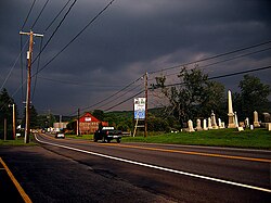
Sanatoga is a community and census-designated place (CDP) that is located in Lower Pottsgrove Township, Montgomery County, Pennsylvania, United States. It is situated immediately east of the borough of Pottstown on U.S. Route 422.

<span class="mw-page-title-main">Spring House, Pennsylvania</span> Census-designated place in Pennsylvania, United States

Spring House is a census-designated place (CDP) in Lower Gwynedd Township, Montgomery County, Pennsylvania, United States. The population was 3,978 at the 2020 census.

<span class="mw-page-title-main">Spring Mount, Pennsylvania</span> Census-designated place in Pennsylvania, United States

Spring Mount is a census-designated place (CDP) in Montgomery County, Pennsylvania, United States. The population was 2,259 at the 2010 census.

<span class="mw-page-title-main">Stowe, Pennsylvania</span> Census-designated place in Pennsylvania, United States

Stowe is a census-designated place (CDP) in West Pottsgrove Township, Montgomery County, Pennsylvania, United States. The population was 3,695 at the 2010 census. It uses the Pottstown ZIP code of 19464.

<span class="mw-page-title-main">Trooper, Pennsylvania</span> Census-designated place in Pennsylvania, United States

Trooper is a census-designated place (CDP) in Lower Providence Township, Montgomery County, Pennsylvania, United States. The population was 5,744 at the 2010 census.

<span class="mw-page-title-main">Old Orchard, Pennsylvania</span> Place in Pennsylvania, United States

Old Orchard is a census-designated place (CDP) in Palmer Township in Northampton County, Pennsylvania. As of the 2010 census, Old Orchard had a total population of 2,434. Old Orchard is part of the Lehigh Valley, which had a population of 861,899 and was the 68th-most populous metropolitan area in the U.S. as of the 2020 census.

<span class="mw-page-title-main">Lake Wynonah, Pennsylvania</span> CDP in Pennsylvania, United States

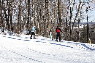
Lake Wynonah is a census-designated place (CDP) in Schuylkill County, Pennsylvania, United States. The population was 1,961 at the 2000 census, and 2,640 at the 2010 census. Lake Wynonah is a gated community with two lakes, Fawn Lake and Lake Wynonah, and as of July 2008, there are over 1200 homes and 1500 members. It is in South Manheim and Wayne Townships.

<span class="mw-page-title-main">Abram-Perezville, Texas</span> Former census-designated place in Texas

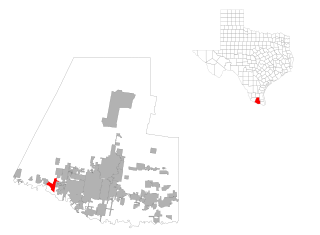
Abram-Perezville is a former census-designated place (CDP) in Hidalgo County, Texas. The population was 5,376 at the 2010 United States Census. It is part of the McAllen–Edinburg–Mission Metropolitan Statistical Area. For the 2010 census, the CDP was split into Abram and Perezville.

References

  1. "ArcGIS REST Services Directory". United States Census Bureau. Retrieved October 12, 2022.
  2. 1 2 "Census Population API". United States Census Bureau. Retrieved October 12, 2022.
  3. "US Gazetteer files: 2010, 2000, and 1990". United States Census Bureau. February 12, 2011. Retrieved April 23, 2011.
  4. "Census of Population and Housing". Census.gov. Retrieved June 4, 2016.
  5. "U.S. Census website". United States Census Bureau . Retrieved January 31, 2008.