Hampton, Connecticut

Last updated

Hampton, Connecticut
Town of Hampton
CT Route 97, Hampton CT.jpg
Route 97 in Hampton
Hampton, CT Logo.png
Windham County Connecticut incorporated and unincorporated areas Hampton highlighted.svg
Hampton, Connecticut
Coordinates: 41°47′N72°4′W / 41.783°N 72.067°W / 41.783; -72.067
CountryFlag of the United States.svg  United States
U.S. state Flag of Connecticut.svg  Connecticut
County Windham
Region Northeastern CT
Incorporated1786
Government
  Type Selectman-town meeting
  First selectmanAllan Cahill
Area
  Total25.5 sq mi (66.0 km2)
  Land25.0 sq mi (64.8 km2)
  Water0.5 sq mi (1.3 km2)
Elevation
696 ft (212 m)
Population
 (2020) [1]
  Total1,728
  Density68/sq mi (26/km2)
Time zone UTC-5 (Eastern)
  Summer (DST) UTC-4 (Eastern)
ZIP code
06247
Area code(s) 860/959
FIPS code 09-36000
GNIS feature ID0213441
Website hamptonct.org

Hampton is a town in Windham County, Connecticut, United States. The town is part of the Northeastern Connecticut Planning Region. The population was 1,728 at the 2020 census. [2]

Contents

Geography

According to the United States Census Bureau, the town has a total area of 25.5 square miles (66 km2), of which, 25.0 square miles (65 km2) is land and 0.5 square miles (1.3 km2) (1.96%) is water.


Climate

The climate of Hampton is a humid continental climate(Dfc) according to the Koppen climate classification. There are four main seasons in Hampton: winter, spring, summer and fall. There is some form of spring warmth starting from mid April, although nights still border freezing, but get progressively warmer till June, where it plateaus for 3 months, then it descends to fall, which is characterized by warmer days and nights than spring. The first fall freeze is in October, but cold-hardy crops like peas, kale, and carrots still strive on untill November, when the fall warmth stops.

Climate data for Hampton, Connecticut(1991-2020 normals)
MonthJanFebMarAprMayJunJulAugSepOctNovDecYear
Mean daily maximum °F (°C)36.2
(2.3)
38.3
(3.5)
46.1
(7.8)
57.6
(14.2)
67.6
(19.8)
75.4
(24.1)
80.4
(26.9)
78.9
(26.1)
72.5
(22.5)
61.8
(16.6)
51.2
(10.7)
41.1
(5.1)
58.9
(15.0)
Daily mean °F (°C)26.8
(−2.9)
28.1
(−2.2)
35.6
(2.0)
46.1
(7.8)
56.3
(13.5)
64.9
(18.3)
70.2
(21.2)
68.5
(20.3)
62.0
(16.7)
51.0
(10.6)
41.1
(5.1)
32.0
(0.0)
48.5
(9.2)
Mean daily minimum °F (°C)17.4
(−8.1)
18.0
(−7.8)
25.2
(−3.8)
34.6
(1.4)
45.1
(7.3)
54.4
(12.4)
60.0
(15.6)
58.0
(14.4)
51.4
(10.8)
40.2
(4.6)
31.0
(−0.6)
23.0
(−5.0)
38.2
(3.4)
Average precipitation inches (mm)4.05
(103)
3.37
(86)
4.44
(113)
4.67
(119)
3.74
(95)
4.32
(110)
3.91
(99)
4.21
(107)
4.31
(109)
4.73
(120)
4.11
(104)
4.78
(121)
50.64
(1,286)
Source: https://www.weather.gov/wrh/Climate?wfo=box

History

Hampton is made up of lands originally shared by the towns of Pomfret and Windham. It was incorporated from the towns of Pomfret, Brooklyn, Canterbury, Mansfield, and Windham in 1786.

The Congregational Church is the second oldest church in the state still in use, with portions of the structure dating from 1754. Also preserved is "The House the Women Built," a two-story building built in 1776 by Sally Bowers and other young women of the town while the men fought in the Continental Army. At Clark's Corner there is a liberty pole dating from 1849. Erected by a resident named Jonathan Clark, it records the distance to Hartford and other towns. [3]

Notable locations

Notable people

A painting (c. 1795-1800) by John Brewster Jr. of his stepmother and his father, a leader in the Hampton church and member of the Connecticut General Assembly BrewsterDrMrs.jpg
A painting (c.1795–1800) by John Brewster Jr. of his stepmother and his father, a leader in the Hampton church and member of the Connecticut General Assembly

Demographics

Historical population
CensusPop.Note
1820 1,313
1850 946
1860 936−1.1%
1870 891−4.8%
1880 827−7.2%
1890 632−23.6%
1900 629−0.5%
1910 583−7.3%
1920 475−18.5%
1930 5117.6%
1940 5354.7%
1950 67225.6%
1960 93439.0%
1970 1,12920.9%
1980 1,32217.1%
1990 1,57819.4%
2000 1,75811.4%
2010 1,8636.0%
2020 1,728−7.2%
U.S. Decennial Census [5]
Voter registration and party enrollment as of April 20, 2007 [6]
PartyActive votersInactive votersTotal votersPercentage
Democratic 368036830.49%
Republican 333033327.59%
Unaffiliated 501050141.51%
Minor Parties 5050.41%
Total1,20701,207100%

At the 2000 census there were 1,758 people, 674 households, and 494 families living in the town. The population density was 70.3 inhabitants per square mile (27.1/km2). There were 695 housing units at an average density of 27.8 per square mile (10.7/km2). The racial makeup of the town was 96.64% White, 0.23% African American, 0.46% Native American, 0.85% Asian, 0.23% from other races, and 1.59% from two or more races. Hispanic or Latino people of any race were 1.76%. [7]

Of the 674 households 33.8% had children under the age of 18 living with them, 62.6% were married couples living together, 7.6% had a female householder with no husband present, and 26.7% were non-families. 19.7% of households were one person and 7.7% were one person aged 65 or older. The average household size was 2.61 and the average family size was 3.04.

The age distribution was 25.8% under the age of 18, 4.9% from 18 to 24, 29.5% from 25 to 44, 28.2% from 45 to 64, and 11.6% 65 or older. The median age was 40 years. For every 100 females, there were 100.0 males. For every 100 females age 18 and over, there were 97.0 males.

The median household income was $54,464 and the median family income was $66,339. Males had a median income of $44,688 versus $32,337 for females. The per capita income for the town was $25,344. About 2.7% of families and 3.5% of the population were below the poverty line, including 1.4% of those under age 18 and 6.0% of those age 65 or over.

Related Research Articles

<span class="mw-page-title-main">Windham County, Connecticut</span> County in Connecticut, United States

Windham County is one of the eight historical counties in the U.S. state of Connecticut, located in its northeastern corner. As of the 2020 census, the population was 116,418, making it the least populous county in Connecticut. It forms the core of the region known as the Quiet Corner. Windham County is included in the Worcester, MA-CT Metropolitan Statistical Area, which is also included in the Boston-Worcester-Providence, MA-RI-NH-CT Combined Statistical Area. The entire county is within the Quinebaug and Shetucket Rivers Valley National Heritage Corridor, as designated by the National Park Service.

<span class="mw-page-title-main">Voluntown, Connecticut</span> Town in Connecticut, United States

Voluntown is a town in New London County, Connecticut, United States. The town is part of the Northeastern Connecticut Planning Region. The population was 2,570 at the 2020 census. Voluntown was part of Windham County from 1726 to 1881, after which it became part of New London County.

<span class="mw-page-title-main">Andover, Connecticut</span> Town in Connecticut, United States

Andover is a rural town in the Capitol Planning Region, Connecticut, United States, roughly 10 miles east of Hartford. The population was 3,151 at the 2020 census.

<span class="mw-page-title-main">Columbia, Connecticut</span> Town in Connecticut, United States

Columbia is a town in the Capitol Planning Region, Connecticut, United States. The population was 5,272 at the 2020 census. Originally a part of Lebanon, known as the North Society or Lebanon's Crank, Columbia was incorporated in May 1804. The town was named for patriotic reasons after the national symbol "Columbia". Columbia offers pre-kindergarten through 8th grade education in town at Horace W. Porter School, while high school students have a choice of attending four nearby high schools; E. O. Smith High School, Bolton High School (Connecticut), Coventry High School, and Windham Technical High School, part of the Connecticut Technical High School System).

<span class="mw-page-title-main">Hebron, Connecticut</span> Town in Connecticut, United States

Hebron is a town in Tolland County, Connecticut, United States. The town is part of the Capitol Planning Region. The population was 9,098 at the 2020 census. Hebron was incorporated May 26, 1708. In 2010, Hebron was rated #6 in Top Towns in Connecticut with population between 6,500 and 10,000, according to Connecticut Magazine.

<span class="mw-page-title-main">Ashford, Connecticut</span> Town in Connecticut, United States

Ashford is a town in Windham County, Connecticut, United States. The town is part of the Northeastern Connecticut Planning Region. The population was 4,191 at the 2020 census. It was founded in 1714. Eastford was a part of Ashford until 1847, when the former split off to organize its own town. For this reason North Ashford is located in northeast Eastford.

<span class="mw-page-title-main">Brooklyn, Connecticut</span> Town in Connecticut, United States

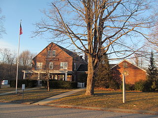
Brooklyn is a town in Windham County, Connecticut, United States. The town is part of the Northeastern Connecticut Planning Region. The population was 8,450 at the 2020 census. The town center village is listed by the U.S. Census Bureau as a census-designated place. The district of East Brooklyn is listed as a separate census-designated place.

<span class="mw-page-title-main">Chaplin, Connecticut</span> Town in Connecticut, United States

Chaplin is a town in Windham County, Connecticut, United States. The town is part of the Northeastern Connecticut Planning Region. The town was named for Deacon Benjamin Chaplin, an early settler. The population was 2,151 at the 2020 census.

<span class="mw-page-title-main">East Brooklyn, Connecticut</span> Census-designated place in Connecticut, United States

East Brooklyn is a census-designated place (CDP) located within the town of Brooklyn in Windham County, Connecticut. It is the portion of the Danielson urban cluster within the town of Brooklyn. The population was 2,205 at the 2020 census. US 6 runs through the town and severs the town.

<span class="mw-page-title-main">Eastford, Connecticut</span> Town in Connecticut, United States

Eastford is a town in Windham County, Connecticut, United States. The town is part of the Northeastern Connecticut Planning Region. The population was 1,649 at the 2020 census.

<span class="mw-page-title-main">Plainfield, Connecticut</span> Town in Connecticut, United States

Plainfield is a town in Windham County, Connecticut, United States. The town is part of the Northeastern Connecticut Planning Region. The population was 14,973 at the 2020 census. The town comprises four villages: Plainfield, Moosup, Wauregan, and Central Village. Each village has their own respective United States Post Office and fire department. The entire town is serviced by the 860 area code.

<span class="mw-page-title-main">Pomfret, Connecticut</span> Town in Connecticut, United States

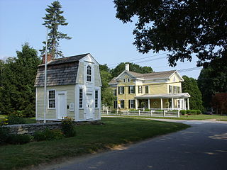
Pomfret is a town located in Windham County, Connecticut with a population of 4,266 according to the 2020 United States Census. The town is part of the Northeastern Connecticut Planning Region. The town was incorporated in 1713 and was named after Pontefract in West Yorkshire, England. The land on which Pomfret stands today was purchased from Native Americans in 1686 in a deal known as the "Mashmuket Purchase" or "Mashamoquet Purchase".

<span class="mw-page-title-main">Putnam, Connecticut</span> Town in Connecticut, United States

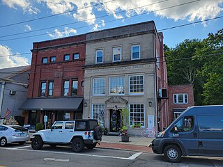
Putnam is a town in Windham County, Connecticut, United States. The town is part of the Northeastern Connecticut Planning Region. The population was 10,214 at the 2020 census.

<span class="mw-page-title-main">Scotland, Connecticut</span> Town in Connecticut, United States

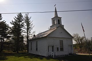
Scotland is a town in Windham County, Connecticut. The town is part of the Northeastern Connecticut Planning Region. As of the 2020 census, the town population was 1,576. Scotland is a predominantly rural town with agriculture as the principal industry. Scotland is the least populated town in Windham County.

<span class="mw-page-title-main">Sterling, Connecticut</span> Town in Connecticut, United States

Sterling is a town in Windham County, Connecticut, United States. The town is part of the Northeastern Connecticut Planning Region. The population was 3,578 at the 2020 census. The rural town is home to two villages: Oneco and Sterling village. Each contains a post office, a church, and a fire station. The town hall and public library are located in Oneco, and the town's one public school is in Sterling village.

<span class="mw-page-title-main">Windham, Connecticut</span> Town in Connecticut, United States

Windham is a town in Windham County, Connecticut, United States. It contains the former city of Willimantic as well as the communities of Windham Center, North Windham, and South Windham. Willimantic, an incorporated city since 1893, was consolidated with the town in 1983. The town is part of the Southeastern Connecticut Planning Region. The population was 24,428 at the 2020 census.

<span class="mw-page-title-main">Putnam (CDP), Connecticut</span> Census-designated place in Connecticut, United States

Putnam District is a village and census-designated place (CDP) in Windham County, Connecticut, United States. The CDP was formed when the former city of Putnam disincorporated, and it consists of the main town center of the town of Putnam along the Quinebaug River. The village is part of the Northeastern Connecticut Planning Region. The population was 7,214 at the 2010 census.

<span class="mw-page-title-main">Halifax, Vermont</span> Town in Vermont, United States

Halifax is a town in Windham County, Vermont, in the United States. As of the 2020 census, the town population was 771.

<span class="mw-page-title-main">Vernon, Vermont</span> Town in Vermont, United States

Vernon is a town in Windham County, Vermont, in the United States. The population was 2,192 at the 2020 census. Vernon is the site of the now-defunct Vermont Yankee, the state of Vermont's only nuclear power plant, which closed in December 2014.

<span class="mw-page-title-main">East Hampton, Connecticut</span> Town in Connecticut, United States

East Hampton is a town in Middlesex County, Connecticut, United States. The town is part of the Lower Connecticut River Valley Planning Region. The population was 12,717 at the 2020 census. The town center village is listed as a census-designated place (CDP). East Hampton includes the communities of Cobalt, Middle Haddam, and Lake Pocotopaug.

References

  1. "U.S. Census Bureau Population Estimates". Archived from the original on June 29, 2011. Retrieved December 5, 2017.
  2. "Census - Geography Profile: Hampton town, Windham County, Connecticut" . Retrieved December 16, 2021.
  3. from home page for "Hampton, Connecticut" Web site, accessed October 9, 2006
  4. Connecticut Audubon Society, Center At Trail Wood, url= "Connecticut Audubon Society". Archived from the original on March 13, 2008. Retrieved March 3, 2008., Retrieved February 3, 2008
  5. "Census of Population and Housing". Census.gov. Retrieved June 4, 2015.
  6. "Registration and Party Enrollment Statistics as of October 25, 2005" (PDF). Connecticut Secretary of State. Archived from the original (PDF) on September 23, 2006. Retrieved October 2, 2006.
  7. "U.S. Census website". United States Census Bureau . Retrieved January 31, 2008.