East Brooklyn, Connecticut

Last updated

East Brooklyn, Connecticut
Tiffany Apartments, East Brooklyn CT.jpg
Tiffany Apartments
Windham County Connecticut incorporated and unincorporated areas East Brooklyn highlighted.svg
Location in Windham County and the state of Connecticut.
Coordinates: 41°47′44″N71°53′54″W / 41.79556°N 71.89833°W / 41.79556; -71.89833
CountryUnited States
State Connecticut
County Windham County
Region Northeastern CT
Town Brooklyn
Area
[1]
  Total2.570 sq mi (6.66 km2)
  Land2.541 sq mi (6.58 km2)
  Water0.029 sq mi (0.08 km2)
Elevation
276 ft (84 m)
Population
 (2020) [2]
  Total2,205
  Density868/sq mi (335/km2)
Time zone UTC-5 (Eastern (EST))
  Summer (DST) UTC-4 (EDT)
ZIP code
06239
Area code 860
FIPS code 09-21160
GNIS feature ID0206799

East Brooklyn is a census-designated place (CDP) located within the town of Brooklyn in Windham County, Connecticut. It is the portion of the Danielson urban cluster within the town of Brooklyn. The population was 2,205 at the 2020 census. [2] US 6 runs through the town and severs the town.

Contents

The portion of the CDP near the Quinebaug River is known as the Quinebaug Mill-Quebec Square Historic District.

Geography

According to the United States Census Bureau, the CDP has a total area of 2.57 square miles (6.7 km2). 2.54 square miles (6.6 km2) of it is land and 0.03 square miles (0.078 km2) of it (1.1%) is water. [1]

Demographics

As of the census [3] of 2000, there were 1,473 people, 668 households, and 378 families residing in the CDP. The population density was 348.9/km2 (903.8/mi2). There were 690 housing units at an average density of 163.4/km2 (423.4/mi2). The racial makeup of the CDP was 94.30% White, 2.04% African American, 0.81% Native American, 0.75% Asian, 0.41% from other races, and 1.70% from two or more races. Hispanic or Latino of any race were 1.83% of the population.

There were 668 households, out of which 28.1% had children under the age of 18 living with them, 35.8% were married couples living together, 15.9% had a female householder with no husband present, and 43.4% were non-families. 37.7% of all households were made up of individuals, and 20.4% had someone living alone who was 65 years of age or older. The average household size was 2.21 and the average family size was 2.87.

In the CDP, the population was spread out, with 25.2% under the age of 18, 7.9% from 18 to 24, 28.4% from 25 to 44, 19.3% from 45 to 64, and 19.2% who were 65 years of age or older. The median age was 38 years. For every 100 females, there were 85.8 males. For every 100 females age 18 and over, there were 77.5 males.

The median income for a household in the CDP was $25,813, and the median income for a family was $34,265. Males had a median income of $27,500 versus $23,182 for females. The per capita income for the CDP was $15,093. About 11.3% of families and 15.5% of the population were below the poverty line, including 18.0% of those under age 18 and 6.5% of those age 65 or over.

Related Research Articles

<span class="mw-page-title-main">Higganum, Connecticut</span> Census-designated place in Connecticut, United States

Higganum is a village and census-designated place (CDP) in the town of Haddam, a part of Middlesex County, Connecticut, United States. The population was 2,089 at the 2020 census.

<span class="mw-page-title-main">South Coventry (CDP), Connecticut</span> CDP in Connecticut, United States

South Coventry is a census-designated place and part of the town of Coventry, Connecticut in Tolland County, Connecticut, United States. The population was 1,483 at the 2010 census.

<span class="mw-page-title-main">Quinebaug, Connecticut</span> Census-designated place in Connecticut, United States

Quinebaug is a village and census-designated place (CDP) in Thompson, a town in Windham County, Connecticut, United States. The population was 1,133 at the 2010 census.

<span class="mw-page-title-main">South Windham, Connecticut</span> Village in Connecticut, United States

South Windham is a village and census-designated place (CDP) in Windham County, Connecticut, United States. It is located within the town of Windham, Connecticut. The population was 1,421 at the 2010 census.

<span class="mw-page-title-main">East Harwich, Massachusetts</span> Census-designated place in Massachusetts, United States

East Harwich is a census-designated place (CDP) and village in the town of Harwich in Barnstable County, Massachusetts, United States. The population was 4,872 at the 2010 census.

<span class="mw-page-title-main">Harwich Port, Massachusetts</span> Census-designated place in Massachusetts, United States

Harwich Port is a small affluent seaside community and census-designated place (CDP) situated along the Nantucket Sound in the town of Harwich in Barnstable County, Massachusetts, United States. It is named after the port of Harwich in Essex, England. As of the 2010 census, the CDP had a population of 1,644. It is a popular vacation spot on Cape Cod and is home to the Wychmere Beach Club and the Allen Harbor Yacht Club. Also, one of its popular mottos is "Three Harbors, One Port," referencing to Saquatucket, Wychmere, and Allen Harbor, which are all located in Harwich Port. Well known residents include Bill O'Brien, former head coach and general manager of the Houston Texans.

<span class="mw-page-title-main">North Attleborough Center, Massachusetts</span> Former Census-designated place in Massachusetts, United States

North Attleborough Center is the central developed area in the town of North Attleborough in Bristol County, Massachusetts, United States. It was a census-designated place at the 2000 census, at which time its population was 16,796. It was not delineated as a census-designated place in 2010.

<span class="mw-page-title-main">North Seekonk, Massachusetts</span> Census-designated place in Massachusetts, United States

North Seekonk is a census-designated place (CDP) in the town of Seekonk in Bristol County, Massachusetts, United States. The population was 2,643 at the 2010 census.

<span class="mw-page-title-main">North Westport, Massachusetts</span> Census-designated place in Massachusetts, United States

North Westport is a census-designated place (CDP) in the town of Westport in Bristol County, Massachusetts, United States. The population was 4,571 at the 2010 census.

<span class="mw-page-title-main">Raynham Center, Massachusetts</span> Census-designated place in Massachusetts, United States

Raynham Center is a census-designated place (CDP) in the town of Raynham in Bristol County, Massachusetts, United States. The population was 4,100 at the 2010 census.

<span class="mw-page-title-main">Putnam (CDP), Connecticut</span> Census-designated place in Connecticut, United States

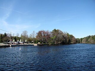
Putnam District is a village and census-designated place (CDP) in Windham County, Connecticut, United States. The CDP was formed when the former city of Putnam disincorporated, and it consists of the main town center of the town of Putnam along the Quinebaug River. The population was 7,214 at the 2010 census.

<span class="mw-page-title-main">Cumberland Hill, Rhode Island</span> Census-designated place in Rhode Island, United States

Cumberland Hill is a census-designated place (CDP) in the town of Cumberland, in Providence County, Rhode Island, United States. The population was 7,934 at the 2010 census.

<span class="mw-page-title-main">Harrisville, Rhode Island</span> Census-designated place in Rhode Island, United States

Harrisville is a census-designated place (CDP) and village in the town of Burrillville in Providence County, Rhode Island, United States. The population was 1,605 at the 2010 census. Much of the community composes a historic district listed on the National Register of Historic Places. The village was named after nineteenth century manufacturer Andrew Harris. Previously, the village was named Rhodesville, after Captain William Rhodes, an eighteenth century privateer.

<span class="mw-page-title-main">Valley Falls, Rhode Island</span> Village and census-designated place in Rhode Island, US

Valley Falls is a village and census-designated place (CDP) in the town of Cumberland, Providence County, Rhode Island, United States. The population was 12,094 at the 2020 census.

<span class="mw-page-title-main">Wakefield-Peacedale, Rhode Island</span> CDP in Rhode Island, United States

Wakefield-Peacedale is a census-designated place (CDP) in the town of South Kingstown in Washington County, Rhode Island, United States that includes the villages of Peace Dale and Wakefield. The population was 8,487 at the 2010 census.

<span class="mw-page-title-main">Great Barrington (CDP), Massachusetts</span> Census-designated place in Massachusetts, United States

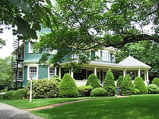
Great Barrington is a census-designated place (CDP) located in the town of Great Barrington in Berkshire County, Massachusetts, United States. The population was 2,231 at the 2010 census, out of 7,104 in the entire town of Great Barrington.

<span class="mw-page-title-main">Holland (CDP), Massachusetts</span> Census-designated place in Massachusetts, United States

Holland is a census-designated place (CDP) in the town of Holland in Hampden County, Massachusetts, United States, comprising the town center and other populated areas in the eastern part of the town. The population was 1,464 at the 2010 census, out of a total 2,481 people in the town. It is part of the Springfield, Massachusetts Metropolitan Statistical Area.

<span class="mw-page-title-main">Sharon (CDP), Massachusetts</span> CDP in Massachusetts, United States

Sharon is a census-designated place (CDP) in the town of Sharon in Norfolk County, Massachusetts, United States. The population was 6,184 at the 2020 census.

<span class="mw-page-title-main">Walpole (CDP), Massachusetts</span> Census-designated place in Massachusetts, United States

Walpole is a small census-designated place (CDP) located within the much larger town of Walpole in Norfolk County, Massachusetts, United States. Walpole Town as it is called by the US Census Bureau, also includes a much larger population. The population of the Census Designated Place was 5,918 at the 2010 census.

<span class="mw-page-title-main">Groton (CDP), Massachusetts</span> Census-designated place in Massachusetts, United States

Groton is a census-designated place (CDP) comprising the main village in the town of Groton in Middlesex County, Massachusetts, United States. The population of the CDP was 1,353 at the 2020 census, out of 11,315 in the entire town of Groton.

References

  1. 1 2 "2020 Gazetteer (Connecticut)". United States Census Bureau . Retrieved August 7, 2023.
  2. 1 2 "Census - Geography Profile: East Brooklyn CDP, Connecticut" . Retrieved August 7, 2023.
  3. "U.S. Census website". United States Census Bureau . Retrieved January 31, 2008.

41°47′48″N71°53′50″W / 41.79667°N 71.89722°W / 41.79667; -71.89722