
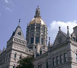
Hartford is the capital city of the U.S. state of Connecticut. The city, located in Hartford County, had a population of 121,054 as of the 2020 census. Hartford is the most populous city in the Capitol Planning Region and the core city of the Greater Hartford metropolitan area.

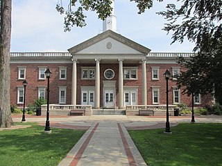
Farmington is a town in Hartford County in the Farmington Valley area of central Connecticut in the United States. The town is part of the Capitol Planning Region. The population was 26,712 at the 2020 census. It sits 10 miles west of Hartford at the hub of major I-84 interchanges, 20 miles south of Bradley International Airport and two hours by car from New York City and Boston. It has been home to the world headquarters of several large corporations including Otis Elevator Company, United Technologies, and Carvel. The northwestern section of Farmington is a suburban neighborhood called Unionville.
Windsor is a town in Hartford County, Connecticut, United States, and was the first English settlement in the state. It lies on the northern border of Connecticut's capital, Hartford. The town is part of the Capitol Planning Region. The population of Windsor was 29,492 at the 2020 census.

Hamden is a town in New Haven County, Connecticut, United States. The town's nickname is "The Land of the Sleeping Giant". The town is part of the South Central Connecticut Planning Region. The population was 61,169 at the 2020 census.

East Hartford is a town in the Capitol Planning Region, Connecticut, United States. The population was 51,045 at the 2020 census. The town is located on the east bank of the Connecticut River, directly across from Hartford, Connecticut. It is home to aerospace manufacturer Pratt & Whitney. It is also home to Pratt & Whitney Stadium at Rentschler Field, a stadium used mainly for soccer and football with a capacity of 40,000 people.
West Hartford is a town in Hartford County, Connecticut, United States, 5 miles (8.0 km) west of downtown Hartford. The town is part of the Capitol Planning Region. The population was 64,083 at the 2020 census.

Frederick Brant Rentschler was an American aircraft engine designer, aviation engineer, industrialist, and the founder of Pratt & Whitney Aircraft. Rentschler created and manufactured many revolutionary aircraft engines, including those used in the aircraft of Charles Lindbergh, Amelia Earhart and James Doolittle. He is also a co-founder of United Aircraft and Transport Corporation, the predecessor of United Technologies Corporation.

Pratt & Whitney Stadium at Rentschler Field is a stadium in East Hartford, Connecticut. It is primarily used for football and soccer, and is the home field of the University of Connecticut (UConn) Huskies. In 2010, it was home to the Hartford Colonials of the United Football League. The stadium, which opened in 2003, was the first stadium used primarily by an NCAA Division I-A team to open in the 21st century. The permanent stadium capacity is 40,000, consisting of 38,066 permanent seats with a standing-room area in the scoreboard plaza that can accommodate up to 1,934 people. It also has a game day capability to add approximately 3,000 temporary seats as it did for UConn football vs. Michigan in 2013. Connecticut played on campus at Memorial Stadium in Storrs, before 2003.

The Connecticut Trolley Museum, also known as the Warehouse Point Trolley Museum, is the oldest incorporated museum dedicated to electric railroading in the United States. Founded in October 1940, the museum is located in East Windsor, Connecticut and is open to the public April through December. The museum features static and moving displays, and self-guided tours of the state's trolley history.

The Hockanum River is a river in Connecticut. Hockanum is derived from the Native American Podunk people Algonquin language word meaning "hook-shaped", so named because of the course of the river. The Hockanum neighborhood in East Hartford is named after it.
Hockanum can refer to some places in the United States:

The Connecticut Company was the primary electric street railway company in the U.S. state of Connecticut, operating both city and rural trolleys and freight service. It was controlled by the New York, New Haven and Hartford Railroad, which also controlled most steam railroads in the state. After 1936, when one of its major leases was dissolved, it continued operating streetcars and, increasingly, buses in certain Connecticut cities until 1976, when its assets were purchased by the state government.
The neighborhoods of Hartford, Connecticut in the United States are varied and historic.
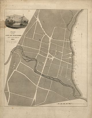
The Park River is a tributary of the Connecticut River in Hartford, Connecticut. It was officially named the Park River in 1892 after Bushnell Park, through which it flowed in downtown Hartford. A local newspaper had advocated for that name rather than the “’Hog River’” name which was then in use. Between 1940 and the 1980s, the 2.3-mile (3.7 km) river was buried by the Army Corps of Engineers to prevent the spring floods regularly caused by increased surface runoff from urban development.
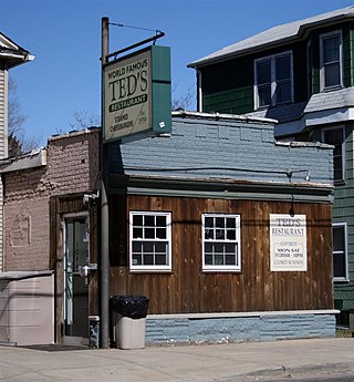
Ted's Restaurant is a hamburger restaurant established in 1959 that is known for its steamed cheeseburger. Its original location is in Meriden, Connecticut, in the United States. It also operates a food truck and a concession stand.

Whitneyville is a neighborhood in the southeastern portion of the town of Hamden, Connecticut. It started in the early nineteenth century as a factory town for workers in Eli Whitney's gun factory. Around the turn of the twentieth century, it evolved into a trolley suburb of New Haven. Today it is primarily residential, with a mixture of single-family homes and small apartment and condominium buildings. There is some commercial development centered around the intersection of Whitney and Putnam avenues.

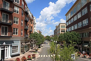
Downtown Hartford, Connecticut is the primary business district of the city, and the center of Connecticut's state government. Because of the large number of insurance companies headquartered there, Hartford is known as the "Insurance Capital of the World".
Timothy D. Larson is an American politician from Connecticut.
The Podunk River is a stream in Hartford County, Connecticut. It is a tributary to the Connecticut River.

