Terramuggus, Connecticut

Last updated
Terramuggus, Connecticut
The Old Country Store, Terramuggus CT.jpg
The Old Country Store
USA Connecticut location map.svg
Red pog.svg
Terramuggus
Usa edcp location map.svg
Red pog.svg
Terramuggus
Coordinates: 41°38′6″N72°28′13″W / 41.63500°N 72.47028°W / 41.63500; -72.47028 Coordinates: 41°38′6″N72°28′13″W / 41.63500°N 72.47028°W / 41.63500; -72.47028
CountryUnited States
State Connecticut
County Hartford
Town Marlborough
Area
  Total1.28 sq mi (3.31 km2)
  Land1.15 sq mi (2.98 km2)
  Water0.13 sq mi (0.33 km2)
Elevation
463 ft (141 m)
Population
 (2010)
  Total1,025
  Density891/sq mi (344.0/km2)
Time zone UTC-5 (Eastern)
  Summer (DST) UTC-4 (Eastern)
ZIP code
06447 (Marlborough)
Area code 860
FIPS code 09-75200
GNIS feature ID2377871

Terramuggus is a census-designated place (CDP) in the town of Marlborough, Hartford County, Connecticut, United States. It contains the town center village and surrounding areas. The population was 1,025 at the 2010 census. [1]

Contents

Geography

According to the United States Census Bureau, the CDP has a total area of 1.3 square miles (3.3 km2), of which 1.2 square miles (3.0 km2) is land and 0.12 square miles (0.3 km2), or 9.94%, is water. [1] It is centered on Lake Terramuggus and includes part of the town center of Marlborough along its southeastern edge. Connecticut Route 2 forms the northeastern edge of the CDP, with access at Exit 13 to Connecticut Route 66, which forms the southeastern edge of the CDP.

Demographics

As of the census [2] of 2000, there were 1,048 people, 389 households, and 299 families residing in the CDP. The population density was 890.5 inhabitants per square mile (343.8/km2). There were 407 housing units at an average density of 345.8 per square mile (133.5/km2). The racial makeup of the CDP was 98.00% White, 0.19% African American, 0.95% Asian, and 0.86% from two or more races. Hispanic or Latino of any race were 0.48% of the population.

There were 389 households, out of which 39.1% had children under the age of 18 living with them, 66.3% were married couples living together, 7.5% had a female householder with no husband present, and 23.1% were non-families. 17.7% of all households were made up of individuals, and 3.6% had someone living alone who was 65 years of age or older. The average household size was 2.69 and the average family size was 3.09.

In the CDP, the population was spread out, with 27.4% under the age of 18, 4.9% from 18 to 24, 32.5% from 25 to 44, 28.4% from 45 to 64, and 6.8% who were 65 years of age or older. The median age was 38 years. For every 100 females, there were 106.3 males. For every 100 females age 18 and over, there were 98.7 males.

The median income for a household in the CDP was $64,844, and the median income for a family was $73,125. Males had a median income of $50,903 versus $39,297 for females. The per capita income for the CDP was $26,127. None of the families and 0.8% of the population were living below the poverty line, including no under eighteens and none of those over 64.

Related Research Articles

Kaibab is an unincorporated community and census-designated place (CDP) in Mohave County, Arizona, United States. It is within the Kaibab Indian Reservation. The population of the CDP was 140 at the 2020 census.

<span class="mw-page-title-main">Strawberry, Arizona</span> CDP in Gila County, Arizona

Strawberry is an unincorporated community and census-designated place (CDP) in Gila County, Arizona, United States. The population was 961 at the 2010 census.

<span class="mw-page-title-main">North Granby, Connecticut</span> Census-designated place in Connecticut, United States

North Granby is a village and census-designated place (CDP) in Hartford County, Connecticut, United States. It is part of the town of Granby. The population was 1,944 at the 2010 census.

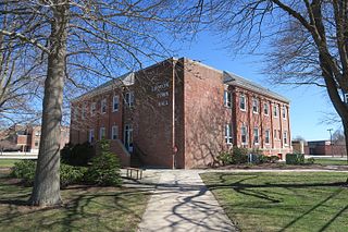
Sherwood Manor is a census-designated place (CDP) within the town of Enfield in Hartford County, Connecticut, United States. The population was 5,410 at the 2010 census.

<span class="mw-page-title-main">Northwest Harwinton, Connecticut</span> Census-designated place in Connecticut, United States

Northwest Harwinton is a census-designated place (CDP) in the town of Harwinton in Litchfield County, Connecticut, United States. The population was 3,252 at the 2010 census, out of 5,642 in the entire town. The CDP contains the town center.

<span class="mw-page-title-main">Oakville, Connecticut</span> Census-designated place in Connecticut, United States

Oakville is a census-designated place (CDP) and neighborhood section of Watertown, in Litchfield County, Connecticut, United States. The population was 9,047 as of the 2010 census. It is the most populous community in Watertown, with more than twice as many people as the center village of Watertown. The ZIP code for Oakville is 06779.

Old Saybrook Center is a community and census-designated place (CDP) in Old Saybrook, a town in Middlesex County, Connecticut, United States. The population was 1,962 at the 2000 census. The CDP includes the traditional town center and the peninsula known as Saybrook Point.

<span class="mw-page-title-main">Long Hill, Groton, Connecticut</span> Census-designated place in Connecticut, United States

Long Hill is a census-designated place (CDP) in the town of Groton in New London County, Connecticut, United States. The population was 4,205 at the 2010 census.

<span class="mw-page-title-main">Old Mystic, Connecticut</span> Census-designated place in Connecticut, United States

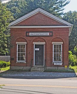
Old Mystic is a village and census-designated place (CDP) located in the town of Stonington in New London County, Connecticut, United States. The population was 3,554 at the 2010 census.

<span class="mw-page-title-main">Poquonock Bridge, Connecticut</span> Census-designated place in Connecticut, United States

Poquonnock Bridge is a village and census-designated place (CDP) in the town of Groton in New London County, Connecticut, United States. The population was 1,727 at the 2010 census.

<span class="mw-page-title-main">Oak Ridge, Florida</span> Census-designated place in Florida, United States

Oak Ridge is a census-designated place and unincorporated area in Orange County, Florida, United States. The population was 22,685 at the 2010 census. It is part of the Orlando–Kissimmee–Sanford, Florida Metropolitan Statistical Area.

<span class="mw-page-title-main">Southwood Acres, Connecticut</span> Census-designated place in Connecticut, United States

Southwood Acres is a suburban neighborhood within the town of Enfield in northern Hartford County, Connecticut, United States. The neighborhood is listed as a census-designated place (CDP) by the U.S. Census Bureau and had a population of 7,657 at the 2010 census.

<span class="mw-page-title-main">South Woodstock, Connecticut</span> Census-designated place in Connecticut, United States

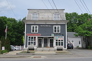
South Woodstock is a village and census-designated place (CDP) in Woodstock, Windham County, Connecticut, United States. The population was 1,291 at the 2010 census.

<span class="mw-page-title-main">New Milford (CDP), Connecticut</span> Census-designated place in Connecticut, United States

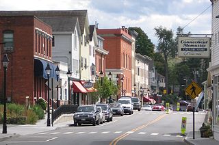
New Milford is a census-designated place (CDP) in Litchfield County, Connecticut, United States. It comprises the main population center within the town of New Milford. As of the 2010 census, the population of New Milford was 6,523, out of 28,142 in the entire town of New Milford.

<span class="mw-page-title-main">Williamstown (CDP), Massachusetts</span> Census-designated place in Massachusetts, United States

Williamstown is a census-designated place (CDP) in the town of Williamstown in Berkshire County, Massachusetts, United States. The population of the CDP was 4,325 at the 2010 census, out of 7,754 in the entire town.

<span class="mw-page-title-main">Marlborough (CDP), New Hampshire</span> Census-designated place in New Hampshire, United States

Marlborough is a census-designated place (CDP) and the main village in the town of Marlborough in Cheshire County, New Hampshire, United States. The population of the CDP was 1,066 at the 2020 census, out of 2,096 in the entire town.

<span class="mw-page-title-main">Glastonbury Center, Connecticut</span> Census-designated place in Connecticut, United States

Glastonbury Center is a census-designated place (CDP) that constitutes the densely populated center of the town of Glastonbury in Hartford County, Connecticut, United States. The population was 7,387 at the 2010 census, out of a total town population of 34,427.

<span class="mw-page-title-main">New Hartford Center, Connecticut</span> Census-designated place in Connecticut, United States

New Hartford Center is a census-designated place (CDP) in Litchfield County, Connecticut, United States. It comprises the village of New Hartford, the adjacent Pine Meadow Historic District, and some surrounding forest land, all within the town of New Hartford. As of the 2010 census, the population of New Hartford Center was 1,385, out of 6,970 in the entire town of New Hartford.

Manchester is a census-designated place (CDP) in Hartford County, Connecticut, United States, comprising the urban center of the town of Manchester. As of the 2010 census, the population of the CDP was 30,577, out of 58,241 in the entire town.

<span class="mw-page-title-main">Norfolk (CDP), Connecticut</span> Census-designated place in Connecticut, United States

Norfolk is a census-designated place (CDP) in Litchfield County, Connecticut, United States. It is the central village within the town of Norfolk. As of the 2010 census, the population of the CDP was 553, out of 1,709 in the entire town.

References

  1. 1 2 "Geographic Identifiers: 2010 Demographic Profile Data (G001): Terramuggus CDP, Connecticut". U.S. Census Bureau, American Factfinder. Archived from the original on February 12, 2020. Retrieved November 30, 2012.
  2. "U.S. Census website". United States Census Bureau . Retrieved 2008-01-31.