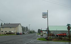
Rhododendron is an unincorporated community in Clackamas County, Oregon, United States. It is located within the Mount Hood Corridor, between Government Camp and Zigzag on U.S. Route 26. It is one of the communities that make up the Villages at Mount Hood.
Oregon Geographic Names is a compilation of the origin and meaning of place names in the U.S. state of Oregon, published by the Oregon Historical Society. The book was originally published in 1928. It was compiled and edited by Lewis A. McArthur. As of 2011, the book is in its seventh edition, which was compiled and edited by Lewis L. McArthur.

Shepperd's Dell is a small canyon in the Columbia River Gorge in Oregon, located at 45.54833°N 122.195°W which is less than one-third mile southeast of Rooster Rock State Park. The Shepperd's Dell Bridge is listed on the National Register of Historic Places.

Redland is an unincorporated community located in Clackamas County, Oregon, United States. It is located six miles (9.7 km) east of Oregon City and four miles (6.4 km) south of Carver.

Vida is an unincorporated community in Lane County, Oregon, United States. It is located on Oregon Route 126 and the McKenzie River.

Lewis Ankeny McArthur, known as "Tam" McArthur, was an executive for Pacific Power and Light Company. He was also the secretary for the Oregon Geographic Board for many years and the author of Oregon Geographic Names. His book, now in its seventh edition, is a comprehensive source of information on the origins and history of Oregon place names. It is a standard reference book in libraries throughout Oregon and the Pacific Northwest. Tam McArthur Rim in the Cascade Mountains is named in his honor.

Barton is an unincorporated community in Clackamas County, Oregon, United States, on Oregon Route 224 near the Clackamas River.

Rainbow is an unincorporated community in Lane County, Oregon, United States. It lies off Oregon Route 126, northeast of Eugene. Rainbow's elevation is 1,211 feet (369 m). A post office was established on July 1, 1924, and closed August 31, 1937. The post office got its name from the rainbow trout that swim in the McKenzie River.

Cape Arago State Park is a state park in the U.S. state of Oregon, administered by the Oregon Parks and Recreation Department. Cape Arago is north of Bandon and 15 miles southwest of Coos Bay on Cape Arago Highway in Coos County.

Manhattan Beach State Recreation Site is a state park in the U.S. state of Oregon. Administered by the Oregon Parks and Recreation Department, the park is open to the public and is fee-free. Amenities at the park, which is 2 miles (3 km) north of Rockaway Beach along U.S. Route 101, include picnicking, fishing, and a Pacific Ocean beach.

New Princeton is an unincorporated community in Harney County, in the U.S. state of Oregon. It is along Oregon Route 78 between Burns and Burns Junction at an elevation of 4,111 feet (1,253 m) above sea level. The South Fork Malheur River begins near Round Mountain, southeast of New Princeton.

Mohawk is an unincorporated community in Lane County, Oregon, United States, on the Mohawk River, about seven miles upstream from Springfield.
Kelso is an unincorporated community located about three miles northwest of Sandy in Clackamas County, Oregon, United States. It was named for the town of Kelso, Washington. The post office operated for ten years, from May 31, 1894 to May 26, 1904.
Latham is an unincorporated community in Lane County, Oregon, United States. It is located on Interstate 5 about 2 miles south of downtown Cottage Grove. The community was named after the politician Milton S. Latham. The post office operated for about ten years, from September 16, 1878 to February 14, 1888. James J. Comstock was its first postmaster. Latham is now served by the Cottage Grove post office.
Linslaw is an unincorporated community in Lane County, Oregon, United States. It is located about eight miles west of Walton on Oregon Route 126 next to the Siuslaw River.
Logan is an unincorporated community in Clackamas County, Oregon, United States. It was named after politician and Civil War Major General John A. Logan. Its post office was established on June 13, 1884. Lafayette Hummiston(1840-1916) was its first postmaster. The office closed on October 12, 1903.
New Era is an unincorporated community in Clackamas County, Oregon, United States. Its post office opened in 1876 and closed in 1940.
Flagg, Oregon, began as a railroad station on the Southern Pacific Line from Eugene to Coos Bay and later became an unincorporated community in Lane County, Oregon, United States, on Penn Road approximately 5 miles (8 km) west of Vaughn. Wildcat Creek, a tributary of the Siuslaw River, flows by Flagg.
Chehalem is an unincorporated community in Washington County, Oregon, United States, located southwest of Sherwood along Oregon Route 99W. The word "Chehalem" is a corruption of the Atfalati word "Chahelim," a name given in 1877 to one of the bands of Atfalati.
Penn is an unincorporated community and former railway station in Lane County, in the U.S. state of Oregon. It was named for the Penn Timber Company, which operated in the vicinity.