Lake Balboa, Los Angeles

Last updated
Lake Balboa
Lake Balboa Pond 2023.jpg
Lake Balboa, the namesake of the Lake Balboa neighborhood
Map of Lake Balboa district, Los Angeles, California.jpg
Lake Balboa neighborhood as mapped by the Los Angeles Times. Van Nuys Airport is on the right.
Location map San Fernando Valley.png
Red pog.svg
Lake Balboa
Location within Los Angeles/San Fernando Valley
USA Los Angeles Metropolitan Area location map.svg
Red pog.svg
Lake Balboa
Lake Balboa (the Los Angeles metropolitan area)
Coordinates: 34°12′04″N118°30′04″W / 34.20111°N 118.50111°W / 34.20111; -118.50111
CountryUnited States
State California
County Los Angeles
City Los Angeles

Lake Balboa is a neighborhood in the San Fernando Valley region of Los Angeles, California. The area was previously part of Van Nuys. [1]

Contents

Population

The 2000 U.S. census counted 24,328 residents in the 3.13-square-mile Lake Balboa neighborhood—or 7,754 people per square mile, about an average population density for the city. In 2008, the city estimated that the population had increased to 26,195. In 2000 the median age for residents was 35, considered average for city and county neighborhoods, but the percentage of residents aged 35 to 49 was among the county's highest. [2]

The neighborhood was considered "highly diverse" ethnically within Los Angeles. The breakdown was whites, 49%; Latinos, 34.1%; Asians, 8.8%; blacks, 3.5%; and others, 4.6%. Mexico (26%) and El Salvador (14.8%) were the most common places of birth for the 31.8% of the residents who were born abroad—a high percentage for Los Angeles. [2]

The median yearly household income in 2008 dollars was $65,336, considered average for the city and county. Renters occupied 34.1% of the housing stock and house- or apartment-owners held 65.9%. The percentages of households that earned $40,000 to $125,000 a year were high for the county. [2]

Geography

On November 2, 2007, the Los Angeles City Council approved a motion renaming a large portion of Van Nuys to Lake Balboa. The new boundaries are as follows: [1]

Surroundings

Lake Balboa is flanked on the north by Northridge, on the east by Van Nuys, on the south by the Sepulveda Basin and on the west by Reseda. [3] Its street and other boundaries are Roscoe Boulevard on the north, Balboa Place, the Van Nuys Airport, Hayvenhurst Avenue and Odessa Avenue on the east, Victory Boulevard on the south and White Oak Avenue on the west. [2]

Economy

MGA Entertainment, a toy maker, previously had its headquarters in the Lake Balboa area, before moving to Chatsworth in the NW San Fernando Valley. [4] [5]

Parks and recreation

Lake Balboa pond in Anthony C. Beilenson Park. LakeBalboaLA.JPG
Lake Balboa pond in Anthony C. Beilenson Park.

Government and infrastructure

Local government

The majority of Lake Balboa is located in Los Angeles City Council District 6, with a small portion at the northwest corner of the neighborhood falling into Los Angeles City Council District 12. [13]

The Los Angeles Fire Department Station 100 West Van Nuys/Lake Balboa, [14] located in Lake Balboa, serves Lake Balboa. [15]

The Los Angeles Police Department operates the West Valley Community Police Station in Reseda, California, serving Lake Balboa. [16]

County, state, and federal representation

The United States Postal Service Van Nuys Post Office is located at 15701 Sherman Way in Lake Balboa. [1] [17]

Education

Twenty-five percent of Lake Balboa residents aged 25 and older had earned a four-year degree by 2000, an average figure for both the city and the county. [2]

Schools within the Lake Balboa boundaries are: [18]

Public

Private

See also

Related Research Articles

Northridge is a neighborhood in the San Fernando Valley region of the City of Los Angeles. The community is home to California State University, Northridge, and the Northridge Fashion Center.

<span class="mw-page-title-main">Van Nuys</span> Neighborhood of Los Angeles in California, United States

Van Nuys is a neighborhood in the central San Fernando Valley region of Los Angeles, California. Home to Van Nuys Airport and the Valley Municipal Building, it is the most populous neighborhood in the San Fernando Valley.

<span class="mw-page-title-main">San Fernando Valley</span> Valley in Los Angeles County, California, US

The San Fernando Valley, known locally as the Valley, is an urbanized valley in Los Angeles County, California. Situated to the north of the Los Angeles Basin, it contains a large portion of the City of Los Angeles, as well as unincorporated areas and the incorporated cities of Burbank, Calabasas, Glendale, Hidden Hills, and San Fernando. The valley is well known for its iconic film studios such as Warner Bros. Studios and Walt Disney Studios. In addition, it is home to the Universal Studios Hollywood theme park.

<span class="mw-page-title-main">Reseda, Los Angeles</span> Neighborhood of Los Angeles in California, United States

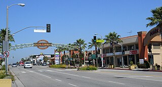
Reseda is a neighborhood in the San Fernando Valley region of Los Angeles, California. It was founded in 1912, and its central business district started developing in 1915. The neighborhood was devoted to agriculture for many years. Earthquakes struck the area in 1971 and 1994.

<span class="mw-page-title-main">Winnetka, Los Angeles</span> Neighborhood of Los Angeles in California, United States

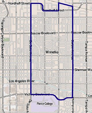
Winnetka is a neighborhood in the west-central San Fernando Valley in the city of Los Angeles. It is a highly ethnically diverse area, both for the city and for Los Angeles County, with a relatively large percentage of Hispanic and Asian people.

<span class="mw-page-title-main">Encino, Los Angeles</span> Neighborhood of Los Angeles in California, United States

Encino is a neighborhood in the San Fernando Valley region of Los Angeles, California.

Panorama City is a neighborhood in the city of Los Angeles, California, in the San Fernando Valley. It has a generally young age range as well as the highest population density in the Valley. More than half of the neighborhood's population was born abroad, the majority being from Mexico. Known as the Valley's first planned community after a transition from agriculture to a post-World War II housing boom, it has been home to several notable residents. It is now a mixture of single-family homes and low-rise apartment buildings.

<span class="mw-page-title-main">Sun Valley, Los Angeles</span> Neighborhood of Los Angeles in California, United States

Sun Valley is a neighborhood in Los Angeles, California in the San Fernando Valley region. The neighborhood is known for its overall youthful population and moderate racial diversity. There are three recreation centers in Sun Valley, one of which is a historic site. The neighborhood has thirteen public schools—including John H. Francis Polytechnic High School and Valley Oaks Center for Enriched Studies (VOCES)—and four private schools.

<span class="mw-page-title-main">West Hills, Los Angeles</span> Neighborhood in Los Angeles, California, United States

West Hills is a suburban/residential community in the western San Fernando Valley region of the City of Los Angeles, California. The percentage of residents aged 35 and older is among the highest in Los Angeles County.

<span class="mw-page-title-main">Sepulveda Dam</span> Dam in San Fernando Valley, California

The Sepulveda Dam is a dry dam constructed by the U.S. Army Corps of Engineers to withhold winter flood waters along the Los Angeles River. Completed in 1941, at a cost of $6,650,561, it is located south of center in the San Fernando Valley, approximately eight miles east of the river's source in the western end of the Valley, in Los Angeles, California.

<span class="mw-page-title-main">Granada Hills, Los Angeles</span> Neighborhood of Los Angeles

Granada Hills is a suburban neighborhood in the San Fernando Valley region of the City of Los Angeles. The community has a sports program and a range of city recreation centers. The neighborhood has fourteen public and ten private schools.

North Hills, known previously as Sepulveda, is a neighborhood in the San Fernando Valley region of Los Angeles, California.

West Los Angeles is an area within the city of Los Angeles, California, United States. The residential and commercial neighborhood is divided by the Interstate 405 freeway, and each side is sometimes treated as a distinct neighborhood, mapped differently by different sources. Each lies within the larger Westside region of Los Angeles County.

<span class="mw-page-title-main">Anthony Beilenson</span> American attorney and politician

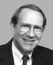
Anthony Charles Beilenson was an American lawyer and politician who served as a Democratic Congressman from Southern California. He served ten terms in the United States House of Representatives from 1977 until 1997.

<span class="mw-page-title-main">Valley Glen, Los Angeles</span> Neighborhood of Los Angeles in California, United States of America

Valley Glen is a neighborhood in southeastern section of the San Fernando Valley in Los Angeles, California. Once part of Van Nuys and North Hollywood, it became a separate neighborhood in 1998. Valley Glen is home to Los Angeles Valley College and the Great Wall of Los Angeles, a half-mile-long California-history mural listed on the National Register of Historic Places.

Victory Boulevard is a major east–west arterial road that runs for 25 miles (40 km) traversing the entire length of the San Fernando Valley in Los Angeles County, Southern California, United States.

Balboa Boulevard is a major north–south street in the city of Los Angeles, and it cuts through many communities and is one of the main thoroughfares in the San Fernando Valley.

<span class="mw-page-title-main">Bull Creek (Los Angeles County)</span> River in the United States

Bull Creek is a 9.6-mile-long (15.4 km) tributary of the Los Angeles River in the San Fernando Valley of Los Angeles County, California.

<span class="mw-page-title-main">Harbor City, Los Angeles</span> Neighborhood of Los Angeles in California, United States

Harbor City is a highly diverse neighborhood in the Harbor region of Los Angeles, California, with a population upward of 36,000 people. Originally part of the Rancho San Pedro Spanish land grant, the 2.58-square-mile (6.7 km2) Harbor City was brought into Los Angeles as a preliminary step in the larger city's consolidation with the port cities of Wilmington and San Pedro.

<span class="mw-page-title-main">Woodley Park (Los Angeles)</span>

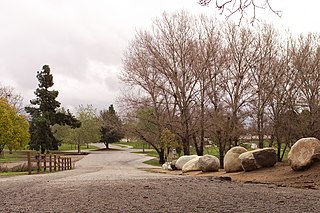
Woodley Park is a recreation area managed by the City of Los Angeles and located along Woodley Avenue between Victory and Burbank Boulevards in the Lake Balboa neighborhood of Los Angeles, California. The area is located within the large Sepulveda Basin Recreation Area in the central San Fernando Valley.

References

  1. 1 2 3 4 5 6 Map Archived 2012-02-18 at the Wayback Machine . Lake Balboa Neighborhood Council. Retrieved on December 6, 2008.
  2. 1 2 3 4 5 "Lake Balboa," Mapping L.A., Los Angeles Times
  3. Colored map, Mapping L.A., Los Angeles Times
  4. "Contact Archived 2009-08-22 at the Wayback Machine ." MGA Entertainment. Retrieved on December 4, 2008.
  5. Home page." Lake Balboa Neighborhood Council. Retrieved on December 26, 2009.
  6. 1 2 "Lake Balboa". City of Los Angeles Department of Recreation and Parks. Archived from the original on September 19, 2012. Retrieved September 27, 2012.
  7. "Lake Balboa/Anthony C. Beilenson Park." City of Los Angeles. Retrieved on March 19, 2010.
  8. "Lake Balboa/Anthony C. Beilenson Park (formerly Balboa Park) Archived 2014-02-16 at the Wayback Machine ." City of Los Angeles. Retrieved on March 19, 2010.
  9. The Japanese Garden (Sepulveda Basin Recreation Area)
  10. "Woodley Park." City of Los Angeles. Retrieved on March 19, 2010.
  11. "Jesse Owens Mini-Park." City of Los Angeles. Retrieved on March 19, 2010.
  12. "Louise Park." City of Los Angeles. Retrieved on March 19, 2010.
  13. "Los Angeles City Council District 6 Map"
  14. "Neighborhood Fire Stations Archived 2010-03-10 at the Wayback Machine ." Los Angeles Fire Department. Retrieved on March 19, 2010.
  15. "Fire Station 100 Archived 2007-08-09 at the Wayback Machine ." City of Los Angeles. Retrieved on March 19, 2010.
  16. "West Valley Community Police Station." Los Angeles Police Department. Retrieved on March 19, 2010.
  17. "Post Office Location - VAN NUYS Archived 2012-07-17 at archive.today ." United States Postal Service . Retrieved on December 6, 2008.
  18. "Lake Balboa: Schools," Mapping L.A., Los Angeles Times