Magnolia Square, Los Angeles

Last updated
Magnolia Square, Los Angeles
MagnoliaSquare.jpg
Magnolia Square Neighborhood Sign
on Century Boulevard and Vermont Avenue
Location map Southern Los Angeles.png
Red pog.svg
Magnolia Square, Los Angeles
United States Los Angeles Southern
Coordinates: 33°57′36″N118°17′45″W / 33.960000°N 118.2959017°W / 33.960000; -118.2959017
Country Flag of the United States.svg United States
State Flag of California.svg  California
County Flag of Los Angeles County, California.svg Los Angeles
Time zone Pacific
Zip Code
90044
Area code 323

Magnolia Square is a neighborhood in Los Angeles, California.

Contents

Geography

By city council action in October 2001 (C.F. #01-1874), "Magnolia Square" was officially named and designated as being bounded by the following streets: Century Boulevard on the north, South Vermont Avenue on the west, the Harbor Freeway (I-110) on the east, and Imperial Highway on the south. [1]

The Department of Transportation was instructed to install signage at the following intersections: Figueroa Street at 109th Place, Figueroa at 99th Street, Century Boulevard at Grand Avenue, and Imperial Highway at Vermont Avenue. [1]

History

Beginning in 2000, the Eighth District Empowerment Congress began working on the "Naming Neighborhoods Project" to identify and name individual communities that had historically been grouped together and regarded as part of South Central Los Angeles. [1]

The first focus group was held at Hebrew Union College in June 2000. Through research, a meeting with an urban historian, and numerous community meetings, the Empowerment Congress ultimately outlined sixteen unique neighborhoods, including the neighborhood of Magnolia Square. The names were submitted to City Council in October 2001 and approved in February 2002. [1]

Government

Magnolia Square lies within Los Angeles City Council District 8. [2]

The neighborhood of Magnolia Square is split between two neighborhood councils: the Empowerment Congress Southeast Area Neighborhood Council serves Magnolia Square residents Century Boulevard and 110th Street [3] [4] and the Harbor Gateway North Neighborhood Council serves the area between 110th Street and Imperial Boulevard. [5] [6]

Parks and recreation

Little Green Acres Park, 2022 LittleGreenAcresPark.jpg
Little Green Acres Park, 2022

Two public parks are located within the boundaries of Magnolia Square:

Education

Two public schools are located within the boundaries of Magnolia Square:

Related Research Articles

<span class="mw-page-title-main">Wilmington, Los Angeles</span> Neighborhood of Los Angeles in Los Angeles, California

Wilmington is a neighborhood in the South Bay and Harbor region of Los Angeles, California, covering 9.14 square miles (23.7 km2).

<span class="mw-page-title-main">Los Feliz, Los Angeles</span> Neighborhood of Los Angeles in California, United States

Los Feliz is a hillside neighborhood in the greater Hollywood area of Los Angeles, California, abutting Hollywood and encompassing part of the Santa Monica Mountains. The neighborhood is named after the Feliz family of Californios who had owned the area since 1795, when José Vicente Féliz was granted Rancho Los Feliz.

<span class="mw-page-title-main">Koreatown, Los Angeles</span> Neighborhood of Los Angeles in California, United States

Koreatown is a neighborhood in central Los Angeles, California, centered near Eighth Street and Irolo Street.

<span class="mw-page-title-main">Pico-Union, Los Angeles</span> Neighborhood of Los Angeles in California, United States of America

Pico-Union is a neighborhood in Central Los Angeles, California. The name "Pico-Union" refers to the neighborhood that surrounds the intersection of Pico Boulevard and Union Avenue. Located immediately west of Downtown Los Angeles, it is home to over 40,000 residents.

<span class="mw-page-title-main">West Adams, Los Angeles</span> Neighborhood of Los Angeles in California, United States

West Adams is a neighborhood in the South Los Angeles region of Los Angeles, California. The area is known for its large number of historic buildings, structures and notable houses and mansions. It contains several Historic Preservation Overlay Zones as well as designated historic districts.

<span class="mw-page-title-main">North University Park, Los Angeles</span> Neighborhood of Los Angeles in California, United States of America

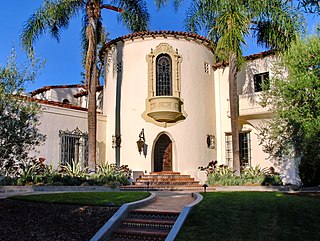
North University Park is a neighborhood in Los Angeles, California. Located just north of the University of Southern California, North University Park contains two historic districts that are both on the National Register of Historic Places: The North University Park Historic District and the Menlo Avenue–West Twenty-ninth Street Historic District.

<span class="mw-page-title-main">South Park, Los Angeles</span> Neighborhood of Los Angeles in California, United States

South Park is a 1.41 square miles (3.65 km2) neighborhood within the South Los Angeles region of Los Angeles, California.

<span class="mw-page-title-main">Harbor Gateway, Los Angeles</span> Neighborhood of Los Angeles in California, United States

The Harbor Gateway is a 5.14-square-mile residential and industrial area (13.3 km2) in the South Bay and Los Angeles Harbor Region, in the southern part of the city. The neighborhood is narrow and long, running along a north-south axis. Its unusual shape has given it the alternative name of "the Shoestring Strip". The northern limit of the neighborhood is Imperial Highway, a city street just north of I-105.

<span class="mw-page-title-main">Vermont Square, Los Angeles</span> Neighborhood of Los Angeles in California, United States

Vermont Square is a neighborhood in Los Angeles, California, within the South Los Angeles region. The Vermont Square Branch library, a designated Historic–Cultural Monument, is located in the community.

<span class="mw-page-title-main">Hyde Park, Los Angeles</span> Neighborhood of Los Angeles in California, United States

Hyde Park is a neighborhood in the South region of Los Angeles, California. Formerly a separate city, it was consolidated with Los Angeles in 1923.

<span class="mw-page-title-main">University Park, Los Angeles</span> Neighborhood of Los Angeles in California, United States

University Park is a 1.17 square miles (3.0 km2) neighborhood in the South Los Angeles region of Los Angeles, California. It is the home of the University of Southern California (USC), Mount St. Mary's College and Hebrew Union College. Additionally, the neighborhood is the home of the historic Shrine Auditorium.

<span class="mw-page-title-main">Historic South Central Los Angeles</span> Neighborhood of Los Angeles in California, United States

Historic South Central Los Angeles is a 2.25-square-mile neighborhood in Los Angeles, California, within the South Los Angeles region. It is the site of the Bob Hope Patriotic Hall.

<span class="mw-page-title-main">Harbor City, Los Angeles</span> Neighborhood of Los Angeles in California, United States

Harbor City is a highly diverse neighborhood in the South Bay and Harbor region of Los Angeles, California, with a population upward of 36,000 people. Originally part of the Rancho San Pedro Spanish land grant, the 2.58-square-mile (6.7 km2) Harbor City was brought into Los Angeles as a preliminary step in the larger city's consolidation with the port cities of Wilmington and San Pedro.

<span class="mw-page-title-main">Manchester Square, Los Angeles</span> Neighborhood of Los Angeles in California, United States

Manchester Square is a neighborhood in Los Angeles, California, within the South Los Angeles region.

<span class="mw-page-title-main">West Park Terrace, Los Angeles</span> Neighborhood of Los Angeles in California, United States

West Park Terrace is a neighborhood in South Los Angeles. The 2009 Mapping L.A. project of the Los Angeles Times gave the same area a different name: Grammercy Park.

<span class="mw-page-title-main">Green Meadows, Los Angeles</span> Neighborhood of Los Angeles in California, United States

Green Meadows is a neighborhood in South Los Angeles, California, with a population of more than thirty thousand people. Green Meadows is within the South Los Angeles Community Plan area and is the home of Locke College Preparatory Academy.

Vermont-Slauson is a 1.44-square-mile neighborhood within the South Los Angeles region of Los Angeles, California.

<span class="mw-page-title-main">Exposition Park, Los Angeles</span> Neighborhood in California, US

Exposition Park is a neighborhood in the south region of Los Angeles, California. It is home to Exposition Park, which includes the Los Angeles Memorial Coliseum, BMO Stadium, Exposition Rose Garden and three museums: the California African American Museum, the California Science Center and the Natural History Museum of Los Angeles County. It is also home to a Science Center Academy.

<span class="mw-page-title-main">Vermont Vista, Los Angeles</span> Neighborhood of Los Angeles in California, United States

Vermont Vista is a neighborhood in Los Angeles, California, within the South Los Angeles area.

<span class="mw-page-title-main">Crenshaw Manor, Los Angeles</span> Neighborhood of Los Angeles in California, United States

Crenshaw Manor is a neighborhood in Los Angeles, California.

References

  1. 1 2 3 4 "Council File 01-1874" (PDF). No. 40. City of Los Angeles. October 2001. Retrieved 31 August 2020.
  2. "Council District 8 Map" (PDF). Retrieved 3 May 2022.
  3. "South East Area Neighborhood Council" . Retrieved 3 May 2022.
  4. "South East Area Neighborhood Council Boundary Map" . Retrieved 3 May 2022. Area 2 - Magnolia Square
  5. "Harbor Gateway North Neighborhood Council" . Retrieved 3 May 2022.
  6. "Harbor Gateway North Neighborhood Council Boundary Map" . Retrieved 3 May 2022.
  7. Los Angeles Department of Recreation and Parks: Little Green Acres
  8. Los Angeles Department of Recreation and Parks: 105th Street Pocket Park
  9. "Figueroa Street Elementary School". Figueroa-elem.com. Retrieved 3 May 2022. Figueroa Street Elementary School, 510 W 111th St, Los Angeles, CA 90044
  10. "Washington Primary Center". LAUSD. Retrieved 3 May 2022. Washington Primary Center-Washington primary dual language center, 860 W. 112th Street Los Angeles, California 90044
  11. Oji, Qevin (April 23, 2006). "Follow Your Nose". Los Angeles Times . Retrieved 13 May 2022. Heading east on Century Boulevard, I passed a city sign: "Magnolia Square." I wondered whose dream it was to line this street with magnolias, wondered when the first one was chopped down and replaced by a sidewalk-busting ficus.