Mars Hill, Maine

Last updated

Mars Hill, Maine
Marshillmountain.jpg
Aroostook County Maine incorporated and unincorporated areas Mars Hill highlighted.svg
Location of Mars Hill, Maine
Coordinates: 46°33′35″N67°51′07″W / 46.55972°N 67.85194°W / 46.55972; -67.85194
Country United States
State Maine
County Aroostook
Incorporated1867
Village Mars Hill
Area
[1]
  Total35.20 sq mi (91.17 km2)
  Land35.13 sq mi (90.99 km2)
  Water0.07 sq mi (0.18 km2)
Elevation
607 ft (185 m)
Population
 (2020)
  Total1,360
  Density39/sq mi (14.9/km2)
Time zone UTC-5 (Eastern)
  Summer (DST) UTC-4 (Eastern)
ZIP code
04758
Area code 207
FIPS code 23-43710
GNIS feature ID0582582
Website www.marshillmaine.org

Mars Hill is a town in Aroostook County, Maine, United States, nestled at the foot of Mars Hill Mountain. The town borders Wicklow Parish, New Brunswick, Canada. The region is mainly agricultural. The population was 1,360 at the time of the 2020 census. [2]

Contents

History

Town view c. 1915 General View of Mars Hill, ME.jpg
Town view c.1915

Timeline of events

The town of Mars Hill is named for Hezekiah Mars, who camped for three years at the base of Mars Hill Mountain. In 1834, the first industry was cutting timber, particularly trees for masts. Farming later became important. [3] Following the end of the Aroostook War in 1839, a boundary line between Maine and New Brunswick was cleared and iron markers were put in place three years later. The first mill opened at Rocky Brook in 1856. In 1860, the first school was established for the community of Mars Hill. Further development of the community was delayed until after the American Civil War. The Bangor and Aroostook Railroad arrived in 1892, allowing shipment of local produce to distant markets.

In 1906, the White Mountain Telephone Company, later known as the Aroostook Telephone & Telegraph Company, opened a new office in Mars Hill. A six-bed community hospital was established in 1912. In 1922, an intense fire devastated the business district in town. Businesses were promptly rebuilt. In 1937, the Walter T.A. Hansen Memorial Library opened. [4] In the 1960s, Big Rock Ski Area was founded on Mars Hill Mountain.

In 2006, Maine's first wind farm was installed along the top and northern side of Mars Hill Mountain. [5]

Military presence

During and after World War II, Mars Hill and the economies of surrounding towns were dominated by military spending. In 1947, the Limestone Army Air Field was built in Limestone. It opened in 1953 and was renamed the Loring Air Force Base. Aroostook County was chosen due to its strategic location as the closest point in the continental United States to Europe. The 1991 Base Realignment and Closure Commission recommended the closure of the Loring Air Force Base, and it closed in 1994. [6]

Big Rock Ski Area

During the late 1950s, two hundred acres were purchased to develop a local recreation area, and by 1960 the Big Rock Ski Area was opened. Big Rock Ski Center was purchased in 2000 by the Maine Winter Sports Center (MWSC), through grants by the Libra Foundation. [7]

Wind power development

On March 27, 2007, a wind farm project was commissioned to be constructed on Mars Hill Mountain by First Wind, a Massachusetts-based renewable energy company. The Mars Hill Wind Farm was projected to have cost $85 million. A total of 28  General Electric 1.5  megawatt turbines were installed along the ridge and in the northern section of the mountain. The wind farm generates about 130 million kilowatt hours (kW·h) per year (15 MW·yr/yr), [8] with a capacity factor of 35%. Mars Hill Wind Farm was the first utility-scale facility in Maine, with projected capacity to produce enough electricity to power 20,000 homes. Mars Hill Wind Farm exports electricity to New Brunswick Power and has become an important component in the local economy. [9]

Demographics

Historical population
CensusPop.Note
1860 201
1870 39998.5%
1880 71679.4%
1890 83716.9%
1900 1,18341.3%
1910 1,51127.7%
1920 1,78318.0%
1930 1,8373.0%
1940 1,8862.7%
1950 2,0609.2%
1960 2,0620.1%
1970 1,875−9.1%
1980 1,8920.9%
1990 1,760−7.0%
2000 1,480−15.9%
2010 1,4930.9%
2020 1,360−8.9%
U.S. Decennial Census [10]

2010 census

As of the census [11] of 2010, there were 1,493 people, 614 households, and 413 families residing in the town. The population density was 42.5 inhabitants per square mile (16.4/km2). There were 687 housing units at an average density of 19.6 per square mile (7.6/km2). The racial makeup of the town was 97.3% White, 0.2% African American, 0.7% Native American, 0.2% Asian, 0.2% from other races, and 1.3% from two or more races. Hispanic or Latino of any race were 1.0% of the population.

There were 614 households, of which 28.0% had children under the age of 18 living with them, 52.8% were married couples living together, 10.4% had a female householder with no husband present, 4.1% had a male householder with no wife present, and 32.7% were non-families. 27.9% of all households were made up of individuals, and 12.8% had someone living alone who was 65 years of age or older. The average household size was 2.33 and the average family size was 2.82.

The median age in the town was 44 years. 21% of residents were under the age of 18; 8.4% were between the ages of 18 and 24; 21.6% were from 25 to 44; 26.8% were from 45 to 64; and 22.2% were 65 years of age or older. The gender makeup of the town was 47.0% male and 53.0% female.

2000 census

As of the census [12] of 2000, there were 1,480 people, 614 households, and 413 families residing in the town. The population density was 42.1 inhabitants per square mile (16.3/km2). There were 708 housing units at an average density of 20.2 per square mile (7.8/km2). The racial makeup of the town was 97.50% White, 0.14% African American, 1.49% Native American, 0.20% Asian, 0.20% from other races, and 0.47% from two or more races. Hispanic or Latino of any race were 0.41% of the population.

There were 614 households, out of which 26.9% had children under the age of 18 living with them, 55.0% were married couples living together, 8.1% had a female householder with no husband present, and 32.6% were non-families. 30.0% of all households were made up of individuals, and 18.1% had someone living alone who was 65 years of age or older. The average household size was 2.35 and the average family size was 2.87.

In the town, the population was spread out, with 23.0% under the age of 18, 7.9% from 18 to 24, 25.1% from 25 to 44, 20.7% from 45 to 64, and 23.4% who were 65 years of age or older. The median age was 41 years. For every 100 females, there were 89.7 males. For every 100 females age 18 and over, there were 84.2 males.

The median income for a household in the town was $24,083, and the median income for a family was $33,333. Males had a median income of $27,054 versus $19,500 for females. The per capita income for the town was $13,630. About 13.4% of families and 16.6% of the population were below the poverty line, including 19.3% of those under age 18 and 19.9% of those age 65 or over.

Geography and climate

Mars Hill in late winter as seen from US Highway 1 Mars Hill Winter.jpg
Mars Hill in late winter as seen from US Highway 1

According to the United States Census Bureau, the town has a total area of 35.20 square miles (91.17 km2), of which 35.13 square miles (90.99 km2) is land and 0.07 square miles (0.18 km2) is water. [1] Mars Hill is split partly in half by the Prestile Stream, which runs directly between Fort Street and Silver Street, then crosses beneath the Fort Street Bridge. After passing the bridge, it flows between Pleasant Street and U.S. 1.

Mars Hill is located in the humid continental climate (Köppen climate classification Dfb), with warm, humid summers. Winters are cold and snowy. Daytime highs are generally in the 75–80 °F (24–27 °C) range through July, with overnight lows in the high 50s °F (around 15 °C). January temperatures range from highs near 32 °F (0 °C) to overnight lows averaging below 0 °F (−18 °C). [13]

Climate data for Mars Hill, Maine
MonthJanFebMarAprMayJunJulAugSepOctNovDecYear
Record high °F (°C)55
(13)
59
(15)
74
(23)
84
(29)
94
(34)
95
(35)
96
(36)
99
(37)
90
(32)
84
(29)
70
(21)
57
(14)
99
(37)
Mean daily maximum °F (°C)20.7
(−6.3)
25
(−4)
35.6
(2.0)
48.3
(9.1)
64.3
(17.9)
73.2
(22.9)
77.2
(25.1)
75.6
(24.2)
65.9
(18.8)
52.9
(11.6)
38.3
(3.5)
25.9
(−3.4)
50.2
(10.1)
Mean daily minimum °F (°C)1.2
(−17.1)
4.7
(−15.2)
16.2
(−8.8)
29
(−2)
40.6
(4.8)
49.8
(9.9)
55.1
(12.8)
53.1
(11.7)
44.6
(7.0)
34.9
(1.6)
24.7
(−4.1)
9.3
(−12.6)
30.3
(−0.9)
Record low °F (°C)−35
(−37)
−37
(−38)
−30
(−34)
−3
(−19)
16
(−9)
26
(−3)
35
(2)
29
(−2)
21
(−6)
15
(−9)
−15
(−26)
−33
(−36)
−37
(−38)
Average precipitation inches (mm)2.55
(65)
1.68
(43)
2.12
(54)
2.35
(60)
3.44
(87)
3.43
(87)
3.71
(94)
3.94
(100)
3.44
(87)
3.28
(83)
2.77
(70)
2.56
(65)
35.27
(896)
Average snowfall inches (cm)18.9
(48)
17.8
(45)
17.3
(44)
7.3
(19)
0.2
(0.51)
0
(0)
0
(0)
0
(0)
0.1
(0.25)
0.6
(1.5)
8.8
(22)
17.7
(45)
88.7
(225)
Average precipitation days (≥ 0.01 in)11.07.89.710.812.612.212.911.811.412.211.811.3135.5
Average snowy days (≥ 0.1 in)7.65.65.02.30.200000.43.06.430.5
Source: NOAA [14]

Mars Hill Mountain

Mars Hill Wind Turbines Mars Hill Wind Farm 672336669 6d41098ae0 o.jpg
Mars Hill Wind Turbines

Mars Hill Mountain plays an important role in the Mars Hill community, providing a dramatic backdrop for photographs as well as magnificent views from atop its peak. It overlooks the Saint John Valley, in which Mars Hill is located. Maine's tallest mountain, Mount Katahdin is visible from the top of Mars Hill Mountain, over 85 miles (137 km) away.

A wind power project was begun on Mars Hill Mountain in the fall of 2006. A total of 28 GE 1.5 MW wind turbines were installed along the ridge and northern section of the mountain. [15] The windmills are assembled in multiple parts. The towers, which are composed of three sections stacked together have a combined weight of 20,000 pounds, and are 80 meters (260 feet) tall. Each of the turbine's three blades (together, a rotor) are approximately 37 meters (121 feet) long, with a total rotor diameter of approximately 75 meters (246 feet). The rotor diameters of the turbines are comparable to the wingspan of a Boeing 747. [16]

Mars Hill Mountain features a ski area, Big Rock Ski Area. [17]

See also

Related Research Articles

<span class="mw-page-title-main">Aroostook County, Maine</span> County in Maine, United States

Aroostook County is a county in the U.S. state of Maine along the Canada–United States border. As of the 2020 census, the population was 67,105. The county seat is Houlton, with offices in Caribou and Fort Kent.

<span class="mw-page-title-main">Bridgewater, Maine</span> Town in the state of Maine, United States

Bridgewater is a town in Aroostook County, Maine, United States. The population was 532 at the 2020 census.

<span class="mw-page-title-main">Castle Hill, Maine</span> Town in the state of Maine, United States

Castle Hill is a town in Aroostook County, Maine, United States. The population was 373 people at the 2020 census.

<span class="mw-page-title-main">Chapman, Maine</span> Town in the state of Maine, United States

Chapman is a town in Aroostook County, Maine, United States. The population was 491 at the 2020 census.

<span class="mw-page-title-main">Eagle Lake, Maine</span> Town in the state of Maine, United States

Eagle Lake is a town in Aroostook County, Maine, United States. The population was 772 at the 2020 census. The town was named by a body of troops heading from Bangor to the Aroostook War for the many eagles that they saw around the lake. A total of 49.0% of the population speaks French, reflecting a trend in Northeastern Maine.

<span class="mw-page-title-main">Frenchville, Maine</span> Town in the state of Maine, United States

Frenchville is a town in Aroostook County, Maine, United States. The population was 1,052 at the 2020 census.

<span class="mw-page-title-main">Hodgdon, Maine</span> Town in the state of Maine, United States

Hodgdon is a rural town in Aroostook County, Maine, United States. The town borders the province of New Brunswick, Canada to the east and Houlton to the north. Hodgdon's population was 1,290 at the 2020 census.

<span class="mw-page-title-main">Mapleton, Maine</span> Town in the state of Maine, United States

Mapleton is a town in Aroostook County, Maine, United States. The population was 1,886 at the 2020 census.

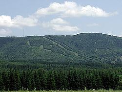
Mars Hill-Blaine was a census-designated place (CDP) occupying parts of the towns of Mars Hill and Blaine in Aroostook County, Maine, United States. The population was 1,428 at the 2000 census. For the 2010 census the area was redelineated as two separate CDPs, Mars Hill and Blaine.

<span class="mw-page-title-main">Monticello, Maine</span> Town in the state of Maine, United States

Monticello is a town in Aroostook County, Maine, United States on the northern branch of the Meduxnekeag River. The population was 737 at the 2020 census. Originally known as Wellington Township, it was settled in 1830 by General Joel Wellington, who owned it, and incorporated in 1846. Some of the earlier migrant workers of Monticello were called the “Amerisee”—a currently disbanded tribe whose members consisted of tribal people from all five Wabanaki Maine tribes, who traveled together as migrant seasonal workers. Many of them had settled in the Monticello and other Aroostook County areas. The word “Amerisee” comes from the Mi’kmaq word “Amase’jijg” which means “some distance” or “quite far” in reference to the distance they traveled for work, which often included all areas of Canada and Aroostook County Maine. The Matthew(s) family shows up in the 1900 Census for Monticello Maine. They had intended to form a sixth tribe—one that accepted members from all five tribes who were originally one tribe, but due to colonization, it had been split up into the five groups known today. The Amerisee wished to reunite the five tribes. The attempt ultimately failed and the Amerisee tribal members, were reabsorbed into their tribes of origin. John Matthew, who is listed on the 1900 Census in Monticello Maine along with his family, writes that he is “Amerisee” however under “Tribe of Father of this Indian” and “Tribe of Mother of this Indian” he says they were both “mi’kmaw” which is the Mi’kmaq word for “Mi’kmaq”. His children were listed as Frank, Lizzie and Annie (Anastasia) Matthew. His parents were Frank and Bertha Matthew(s). He was also a basket maker. According to his death record, he was born in “Restigouche Ind.” territory, which is a testament to how far they would travel to reach farmland in places such as Monticello. John Matthew and other families like his, make up an interesting Native American element to Monticello’s migrant seasonal and farm work history. International shortwave broadcast station WBCQ is located here.

<span class="mw-page-title-main">Oxbow, Maine</span> Township in Maine, United States

Oxbow, officially Oxbow North and Township 9 Range 6, is an unincorporated township in Aroostook County, Maine, United States and part of the state's Unorganized Territory. The population was 66 at the 2010 census. As of 2016, the population was estimated to be 50.

<span class="mw-page-title-main">St. Agatha, Maine</span> Town in the state of Maine, United States

St. Agatha is a town in Aroostook County, Maine, United States. The population was 730 at the 2020 census.

<span class="mw-page-title-main">St. Francis, Maine</span> Town in the state of Maine, United States

St. Francis is a town in Aroostook County, Maine, United States on the Canada–United States border at the junction of the St. Francis River and the Saint John River. The population was 438 at the 2020 census. First settled by English speakers from southern Maine, the original population has been supplanted by French-speaking Acadians.

<span class="mw-page-title-main">Stockholm, Maine</span> Town in the state of Maine, United States

Stockholm is a town in Aroostook County, Maine, United States. The population was 250 at the 2020 census.

<span class="mw-page-title-main">Westmanland, Maine</span> Town in the state of Maine, United States

Westmanland is a town in Aroostook County, Maine, United States. The population was 79 at the 2020 census.

<span class="mw-page-title-main">Brownville, Maine</span> Town in the state of Maine, United States

Brownville is a town in Piscataquis County, Maine, United States. The population was 1,139 at the 2020 census. The town includes the villages of Brownville, Knight's Landing and Brownville Junction, near which passes the 100-Mile Wilderness of the Appalachian Trail.

Moscow is a town in Somerset County, Maine, United States. The population was 475 at the 2020 census.

<span class="mw-page-title-main">Rock Port, Missouri</span> City in Missouri, United States

Rock Port is a city in, and the county seat of, Atchison County, Missouri, United States. The population was 1,278 at the 2020 census.

<span class="mw-page-title-main">Northwest Aroostook, Maine</span> Unorganized territory in Maine, United States

Northwest Aroostook is an unorganized territory in Aroostook County, Maine, United States. The population was 12 at the 2020 census.

<span class="mw-page-title-main">Woodland, Aroostook County, Maine</span> Town in the state of Maine, United States

Woodland is a town in Aroostook County, Maine, United States. The population was 1,217 at the 2020 census. Because the state of Maine has a law stating that no two towns may share the same name, Woodland of Aroostook County and Woodland of Washington County found themselves before the Maine Supreme Judicial Court in the late 1990s. Because it was founded as a township first, Woodland of Aroostook County was allowed to keep its name and Woodland of Washington County was ordered by the court to choose a new name: Baileyville.

References

  1. 1 2 "US Gazetteer files 2010". United States Census Bureau . Retrieved December 16, 2012.
  2. "Census - Geography Profile: Mars Hill town, Aroostook County, Maine" . Retrieved January 20, 2022.
  3. Varney, George J. (1886), Gazetteer of the state of Maine. Mars Hill, Boston: Russell, retrieved February 5, 2009[ dead link ]
  4. Mars Hill Town Office (2014). "History of Mars Hill". Mars Hill Town Office. Mars Hill, Maine. Archived from the original on July 13, 2014. Retrieved May 7, 2014.
  5. Mars Hill Wind Farm Archived May 12, 2011, at the Wayback Machine
  6. Earth Tech, Inc. (1994). "Loring Air Force Base" (PDF). Historic American Buildings Survey . Limestone, Maine: Historic American Engineering Record. Archived from the original (PDF) on June 9, 2013. Retrieved May 11, 2013.
  7. Mars Hill Town Office (2014). "Big Mountain Overview". Big Rock Mountain Ski Resort. Mars Hill, Maine. Archived from the original on May 1, 2014. Retrieved May 7, 2014.
  8. "Mars Hill Wind Farm" . Retrieved January 29, 2009.
  9. Captains of Industry, Inc. (2013). "Welcome to Mars Hill". First Wind Company. Mars Hill, Maine. Archived from the original on December 31, 2013. Retrieved May 7, 2014.
  10. "Census of Population and Housing". Census.gov. Retrieved June 4, 2015.
  11. "U.S. Census website". United States Census Bureau . Retrieved December 16, 2012.
  12. "U.S. Census website". United States Census Bureau . Retrieved January 31, 2008.
  13. Lent, Robert (February 10, 2009). "New All Time Low Temperature Recorded in Maine". U.S. Geological Survey. Retrieved November 6, 2011.
  14. "NCDC: U.S. Climate Normals" (PDF). National Oceanic and Atmospheric Administration. Archived from the original (PDF) on July 20, 2014. Retrieved November 30, 2010.
  15. "Archived copy" (PDF). Archived from the original (PDF) on September 26, 2013. Retrieved November 5, 2012.{{cite web}}: CS1 maint: archived copy as title (link)
  16. "Wind Turbines - GE Wind Turbine Portfolio". Archived from the original on March 27, 2016. Retrieved August 4, 2023.
  17. "BigRock Mountain, Mars Hill, Maine". BigRock Mountain.