Portage Lake, Maine

Last updated

Portage Lake, Maine
Aroostook County Maine incorporated and unincorporated areas Portage Lake highlighted.svg
Location of Portage Lake, Maine
Coordinates: 46°46′41″N68°29′57″W / 46.77806°N 68.49917°W / 46.77806; -68.49917
Country United States
State Maine
County Aroostook
Villages Portage
Buffalo
Area
[1]
  Total34.56 sq mi (89.51 km2)
  Land30.78 sq mi (79.72 km2)
  Water3.78 sq mi (9.79 km2)
Elevation
725 ft (221 m)
Population
 (2020)
  Total359
  Density12/sq mi (4.5/km2)
Time zone UTC-5 (Eastern (EST))
  Summer (DST) UTC-4 (EDT)
ZIP code
04768
Area code 207
FIPS code 23-60300
GNIS feature ID0582681
Website www.townofportage.org

Portage Lake is a town in Aroostook County, Maine, United States. The population was 359 at the 2020 census. [2]

Contents

Geography

According to the United States Census Bureau, the town has a total area of 34.56 square miles (89.51 km2), of which 30.78 square miles (79.72 km2) is land and 3.78 square miles (9.79 km2) is water. [1]

Portage Lake is located along Maine State Route 11, which runs north–south and is the only state road in town. The town is located south of Fort Kent and west of both Caribou and Presque Isle, which are the closest commercial centers.

Demographics

Historical population
CensusPop.Note
1870 124
1880 1326.5%
1890 1406.1%
1900 24172.1%
1910 500107.5%
1920 72144.2%
1930 88622.9%
1940 773−12.8%
1950 542−29.9%
1960 458−15.5%
1970 4774.1%
1980 56217.8%
1990 445−20.8%
2000 390−12.4%
2010 3910.3%
2020 359−8.2%
U.S. Decennial Census [3]

2010 census

As of the census [4] of 2010, there were 391 people, 188 households, and 123 families living in the town. The population density was 12.7 inhabitants per square mile (4.9/km2). There were 511 housing units at an average density of 16.6 per square mile (6.4/km2). The racial makeup of the town was 95.9% White, 0.3% African American, 1.0% Native American, and 2.8% from two or more races.

There were 188 households, of which 17.0% had children under the age of 18 living with them, 57.4% were married couples living together, 5.9% had a female householder with no husband present, 2.1% had a male householder with no wife present, and 34.6% were non-families. 27.7% of all households were made up of individuals, and 12.8% had someone living alone who was 65 years of age or older. The average household size was 2.08 and the average family size was 2.45.

The median age in the town was 56.2 years. 12% of residents were under the age of 18; 3.6% were between the ages of 18 and 24; 15.8% were from 25 to 44; 41.2% were from 45 to 64; and 27.4% were 65 years of age or older. The gender makeup of the town was 50.4% male and 49.6% female.

2000 census

As of the census [5] of 2000, there were 390 people, 183 households, and 116 families living in the town. The population density was 12.7 people per square mile (4.9/km2). There were 485 housing units at an average density of 15.8 per square mile (6.1/km2). The racial makeup of the town was 99.74% White, 0.26% from other races. Hispanic or Latino of any race were 0.26% of the population.

There were 183 households, out of which 17.5% had children under the age of 18 living with them, 58.5% were married couples living together, 3.3% had a female householder with no husband present, and 36.1% were non-families. 26.8% of all households were made up of individuals, and 9.3% had someone living alone who was 65 years of age or older. The average household size was 2.11 and the average family size was 2.53.

In the town, the population was spread out, with 14.4% under the age of 18, 3.6% from 18 to 24, 25.1% from 25 to 44, 38.5% from 45 to 64, and 18.5% who were 65 years of age or older. The median age was 48 years. For every 100 females, there were 109.7 males. For every 100 females age 18 and over, there were 104.9 males.

The median income for a household in the town was $32,232, and the median income for a family was $40,000. Males had a median income of $35,104 versus $18,542 for females. The per capita income for the town was $17,983. About 8.2% of families and 9.8% of the population were below the poverty line, including none of those under age 18 and 22.4% of those age 65 or over.

History

The name of the city was borrowed from the name of the lake that occupies much of the center of town. The word portage comes from French and means "to carry". The town was first settled in 1844 by lumbermen from Canada. In 1872, the settlement was organized as a plantation and in 1909 it was incorporated as a town. The Stevens were the founders of Portage.[ citation needed ]

Notable person

Related Research Articles

<span class="mw-page-title-main">Ashland, Maine</span> Town in Maine, United States

Ashland is a town in Aroostook County, Maine, United States. The population was 1,202 at the 2020 census.

<span class="mw-page-title-main">Bancroft, Maine</span> Unorganized territory in Maine, United States

Bancroft is a township in Aroostook County, Maine, United States. The population was 57 at the 2020 census. On July 1, 2015 the town voted to deorganize and become part of the unorganized territory of South Aroostook.

<span class="mw-page-title-main">Castle Hill, Maine</span> Town in the state of Maine, United States

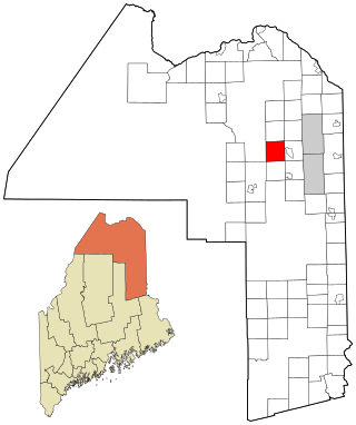
Castle Hill is a town in Aroostook County, Maine, United States. The population was 373 people at the 2020 census.

<span class="mw-page-title-main">Dyer Brook, Maine</span> Town in the state of Maine, United States

Dyer Brook is a town in Aroostook County, Maine, United States. The population was 215 at the 2020 census. Dyer Brook is also host to the local school, Southern Aroostook Community School.

<span class="mw-page-title-main">Eagle Lake, Maine</span> Town in the state of Maine, United States

Eagle Lake is a town in Aroostook County, Maine, United States. The population was 772 at the 2020 census. The town was named by a body of troops heading from Bangor to the Aroostook War for the many eagles that they saw around the lake. A total of 49.0% of the population speaks French, reflecting a trend in Northeastern Maine.

<span class="mw-page-title-main">Frenchville, Maine</span> Town in the state of Maine, United States

Frenchville is a town in Aroostook County, Maine, United States. The population was 1,052 at the 2020 census.

<span class="mw-page-title-main">Hammond, Maine</span> Town in the state of Maine, United States

Hammond is a town in Aroostook County, Maine, United States. The population was 91 at the 2020 census.

<span class="mw-page-title-main">Hersey, Maine</span> Town in the state of Maine, United States

Hersey is a town in Aroostook County, Maine, United States. The population was 73 at the 2020 census.

<span class="mw-page-title-main">Island Falls, Maine</span> Town in the state of Maine, United States

Island Falls is a town in Aroostook County, Maine, United States. The population was 758 at the 2020 census. The primary village of Island Falls in the town is situated at a falls in the West Branch Mattawamkeag River.

<span class="mw-page-title-main">Mapleton, Maine</span> Town in the state of Maine, United States

Mapleton is a town in Aroostook County, Maine, United States. The population was 1,886 at the 2020 census.

<span class="mw-page-title-main">Merrill, Maine</span> Town in the state of Maine, United States

Merrill is a town in Aroostook County, Maine, United States. The population was 208 at the 2020 census.

<span class="mw-page-title-main">Oakfield, Maine</span> Town in the state of Maine, United States

Oakfield is a town in Aroostook County, Maine, United States. The population was 661 at the 2020 census. The village of Oakfield, listed as a census-designated place, is in the northwestern corner of the town.

<span class="mw-page-title-main">Orient, Maine</span> Town in the state of Maine, United States

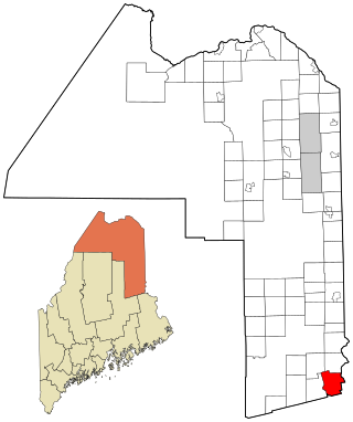
Orient is a town in Aroostook County, Maine, United States. The population was 156 at the 2020 census.

<span class="mw-page-title-main">St. Francis, Maine</span> Town in the state of Maine, United States

St. Francis is a town in Aroostook County, Maine, United States on the Canada–United States border at the junction of the St. Francis River and the Saint John River. The population was 438 at the 2020 census. First settled by English speakers from southern Maine, the original population has been supplanted by French-speaking Acadians.

<span class="mw-page-title-main">Wade, Maine</span> Town in the state of Maine, United States

Wade is a town in Aroostook County, Maine, United States. The population was 229 at the 2020 census.

<span class="mw-page-title-main">Wallagrass, Maine</span> Town in the state of Maine, United States

Wallagrass is a town in Aroostook County, Maine, United States. The population was 519 at the 2020 census.

<span class="mw-page-title-main">Westfield, Maine</span> Town in the state of Maine, United States

Westfield is a town in Aroostook County, Maine, United States. The population was 455 at the 2020 census.

<span class="mw-page-title-main">Weston, Maine</span> Town in the state of Maine, United States

Weston is a town in Aroostook County, Maine, United States. The population was 245 at the 2020 census.

<span class="mw-page-title-main">Square Lake, Maine</span> Unorganized territory in Maine, United States

Square Lake is an unorganized territory in Aroostook County, Maine, United States. The population was 706 at the 2020 census.

<span class="mw-page-title-main">Woodland, Aroostook County, Maine</span> Town in the state of Maine, United States

Woodland is a town in Aroostook County, Maine, United States. The population was 1,217 at the 2020 census. Because the state of Maine has a law stating that no two towns may share the same name, Woodland of Aroostook County and Woodland of Washington County found themselves before the Maine Supreme Judicial Court in the late 1990s. Because it was founded as a township first, Woodland of Aroostook County was allowed to keep its name and Woodland of Washington County was ordered by the court to choose a new name: Baileyville.

References

  1. 1 2 "US Gazetteer files 2010". United States Census Bureau . Retrieved December 16, 2012.
  2. "Census - Geography Profile: Portage Lake town, Aroostook County, Maine" . Retrieved February 27, 2022.
  3. "Census of Population and Housing". Census.gov. Retrieved June 4, 2015.
  4. "U.S. Census website". United States Census Bureau . Retrieved December 16, 2012.
  5. "U.S. Census website". United States Census Bureau . Retrieved January 31, 2008.
  6. Jules Heller; Nancy G. Heller (December 19, 2013). North American Women Artists of the Twentieth Century: A Biographical Dictionary. Routledge. ISBN   978-1-135-63882-5.