National Register of Historic Places listings in Howard County, Arkansas

Last updated

Location of Howard County in Arkansas Map of Arkansas highlighting Howard County.svg
Location of Howard County in Arkansas

This is a list of the National Register of Historic Places listings in Howard County, Arkansas.

Contents

This is intended to be a complete list of the properties on the National Register of Historic Places in Howard County, Arkansas, United States. The locations of National Register properties for which the latitude and longitude coordinates are included below, may be seen in a map. [1]

There are 13 properties listed on the National Register in the county. Six other properties were once listed but have been removed.

Contents: Counties in Arkansas


    This National Park Service list is complete through NPS recent listings posted April 29, 2022. [2]

Map all coordinates using: OpenStreetMap  
Download coordinates as: KML

Current listings

[3] Name on the Register [4] ImageDate listed [5] Location City or townDescription
1 Ebenezer Campground
Ebenezer Campground Ebenezer Campground.jpg
Ebenezer Campground
March 26, 1976
(#76000416)
North of Center Point off Highway 4
34°03′23″N93°57′57″W / 34.056389°N 93.965833°W / 34.056389; -93.965833 (Ebenezer Campground)
Center Point
2 First Presbyterian Church
First Presbyterian Church Restoration project Howard Co. Historical Society, 2014.jpg
First Presbyterian Church
May 4, 1976
(#76000418)
2nd and Hempstead Sts.
33°56′33″N93°50′54″W / 33.9425°N 93.848333°W / 33.9425; -93.848333 (First Presbyterian Church)
Nashville
3 Garrett Whiteside Hall
Garrett Whiteside Hall Garrett Whiteside Hall.jpg
Garrett Whiteside Hall
November 21, 1994
(#94001340)
Southwestern corner of the junction of N. 3rd Ave. and Lockesburg St.
33°57′01″N93°50′59″W / 33.950278°N 93.849722°W / 33.950278; -93.849722 (Garrett Whiteside Hall)
Nashville
4 Elbert W. Holt House
Elbert W. Holt House Elbert W. Holt House.jpg
Elbert W. Holt House
September 20, 1984
(#84000901)
902 N. Main St.
33°57′35″N93°51′11″W / 33.959722°N 93.853056°W / 33.959722; -93.853056 (Elbert W. Holt House)
Nashville
5 Flavius Holt House
Flavius Holt House Flavius Holt House.jpg
Flavius Holt House
December 1, 1978
(#78000593)
Kohler St.
33°57′05″N93°50′39″W / 33.9514°N 93.8443°W / 33.9514; -93.8443 (Flavius Holt House)
Nashville
6 Howard County Courthouse
Howard County Courthouse Howard County Courthouse, 1 of 3.jpg
Howard County Courthouse
June 14, 1990
(#90000902)
Junction of N. Main St. and Bishop St.
33°56′52″N93°50′51″W / 33.947778°N 93.8475°W / 33.947778; -93.8475 (Howard County Courthouse)
Nashville
7 Memphis, Paris, and Gulf Depot
Memphis, Paris, and Gulf Depot Memphis, Paris, and Gulf Depot.jpg
Memphis, Paris, and Gulf Depot
December 4, 1978
(#78000592)
Highway 27
33°52′32″N93°54′40″W / 33.875556°N 93.911111°W / 33.875556; -93.911111 (Memphis, Paris, and Gulf Depot)
Mineral Springs
8 Mineral Springs Waterworks
Mineral Springs Waterworks Mineral Springs Waterworks.jpg
Mineral Springs Waterworks
May 29, 2007
(#07000473)
South of the junction of W. Runnels and S. Hall
33°52′30″N93°55′17″W / 33.875°N 93.921389°W / 33.875; -93.921389 (Mineral Springs Waterworks)
Mineral Springs
9 Nashville American Legion Building
Nashville American Legion Building Nashville American Legion Building.jpg
Nashville American Legion Building
September 13, 1990
(#90001463)
Highway 27, west of Main St.
33°56′01″N93°51′01″W / 33.933611°N 93.850278°W / 33.933611; -93.850278 (Nashville American Legion Building)
Nashville
10 Nashville Commercial Historic District
Nashville Commercial Historic District Nashville Commercial Historic District, 1 of 4.jpg
Nashville Commercial Historic District
September 23, 2010
(#10000784)
Bounded roughly by Shepherd St., Missouri Pacific Railroad, Hempstead St. and Second St.
33°56′38″N93°50′50″W / 33.943889°N 93.847222°W / 33.943889; -93.847222 (Nashville Commercial Historic District)
Nashville
11 Nashville Post Office
Nashville Post Office Nashville Post Office.jpg
Nashville Post Office
August 14, 1998
(#98000913)
220 N. Main St.
33°56′43″N93°50′46″W / 33.945278°N 93.846111°W / 33.945278; -93.846111 (Nashville Post Office)
Nashville
12 Old Corinth Cemetery
Old Corinth Cemetery Old Corinth Cemetery, 1 of 3.jpg
Old Corinth Cemetery
May 11, 2012
(#12000022)
AR 26
34°02′39″N93°50′24″W / 34.044241°N 93.840044°W / 34.044241; -93.840044 (Old Corinth Cemetery)
Center Point vicinity
13 Womack-Parker House
Womack-Parker House Womack-Parker House.jpg
Womack-Parker House
December 1, 1978
(#78000594)
Off Highway 4
33°57′14″N93°50′47″W / 33.953889°N 93.846389°W / 33.953889; -93.846389 (Womack-Parker House)
Nashville

Former listings

[3] Name on the RegisterImageDate listedDate removedLocationCity or townDescription
1 Adam Boyd House May 13, 1976
(#76000415)
September 23, 2011East of Center Point on Highway 26
34°01′33″N93°56′36″W / 34.0258°N 93.9433°W / 34.0258; -93.9433 (Adam Boyd House)
Center Point Destroyed by fire [6]
2 Clardy-Lee House
Clardy-Lee House Clardy-Lee House, State Highway 26, Center Point, Howard County, AR HABS ARK,31-CEPO,1- (sheet 5 of 10).tif
Clardy-Lee House
November 10, 1977
(#77000255)
September 23, 2011 Highway 26
34°01′26″N93°57′38″W / 34.0239°N 93.9606°W / 34.0239; -93.9606 (Clardy-Lee House)
Center Point
3 DeQueen and Eastern Railroad Depot - Dierks June 11, 1992
(#92000607)
March 31, 2000E of Herman Ave.
Dierks
4 First Christian Church November 4, 1982
(#82000831)
September 24, 2010N Main St.
33°56′55″N93°50′47″W / 33.9486°N 93.8464°W / 33.9486; -93.8464 (First Christian Church)
Nashville Delisted due to major alterations [7]
5 Missouri Pacific Railroad Depot June 11, 1992
(#92000618)
September 17, 1999S of E. Hempstead St., between S. Front and S. Ansley Sts.
Nashville
6 Noel Owen Neal House September 27, 2003
(#03000959)
January 26, 2006184 S Blue Bayou Rd.
33°46′42″N93°40′43″W / 33.77844°N 93.67861°W / 33.77844; -93.67861 (Noel Owen Neal House)
Nashville Delisted due to relocation to Washington, Arkansas, and significant remodeling [8]
7 Russey-Murray House May 4, 1976
(#76000417)
September 23, 2011South of Center Point on Highway 4
34°00′12″N93°56′14″W / 34.0033°N 93.9372°W / 34.0033; -93.9372 (Russey-Murray House)
Center Point
8 Tollette Shop Building September 27, 2003
(#03000953)
May 28, 2010Town Hall Dr.
33°48′56″N93°53′56″W / 33.8156°N 93.8989°W / 33.8156; -93.8989 (Tollette Shop Building)
Tollette

See also

Related Research Articles

National Register of Historic Places listings in Carroll County, Arkansas

This is a list of the National Register of Historic Places listings in Carroll County, Arkansas.

National Register of Historic Places listings in Grant County, Arkansas

This is a list of the National Register of Historic Places listings in Grant County, Arkansas.

National Register of Historic Places listings in Ashley County, Arkansas

This is a list of the National Register of Historic Places listings in Ashley County, Arkansas.

National Register of Historic Places listings in Desha County, Arkansas

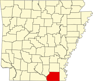
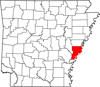
This is a list of the National Register of Historic Places listings in Desha County, Arkansas.

National Register of Historic Places listings in Craighead County, Arkansas

This is a list of the National Register of Historic Places listings in Craighead County, Arkansas.

National Register of Historic Places listings in Garland County, Arkansas

This is a list of the National Register of Historic Places listings in Garland County, Arkansas.

National Register of Historic Places listings in Cleburne County, Arkansas

This is a list of the National Register of Historic Places listings in Cleburne County, Arkansas.

National Register of Historic Places listings in Dallas County, Arkansas

This is a list of the National Register of Historic Places listings in Dallas County, Arkansas.

National Register of Historic Places listings in Independence County, Arkansas

This is a list of the National Register of Historic Places listings in Independence County, Arkansas.

National Register of Historic Places listings in Lee County, Arkansas

This is a list of the National Register of Historic Places listings in Lee County, Arkansas.

National Register of Historic Places listings in Lafayette County, Arkansas

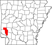
This is a list of the National Register of Historic Places listings in Lafayette County, Arkansas.

National Register of Historic Places listings in Lonoke County, Arkansas

This is a list of the National Register of Historic Places listings in Lonoke County, Arkansas.

National Register of Historic Places listings in Ouachita County, Arkansas

This is a list of the National Register of Historic Places listings in Ouachita County, Arkansas.

National Register of Historic Places listings in Phillips County, Arkansas

This is a list of the National Register of Historic Places listings in Phillips County, Arkansas.

National Register of Historic Places listings in Saline County, Arkansas

This is a list of the National Register of Historic Places listings in Saline County, Arkansas.

National Register of Historic Places listings in Searcy County, Arkansas

This is a list of the National Register of Historic Places listings in Searcy County, Arkansas.

National Register of Historic Places listings in Van Buren County, Arkansas

This is a list of the National Register of Historic Places listings in Van Buren County, Arkansas.

National Register of Historic Places listings in Woodruff County, Arkansas

This is a list of the National Register of Historic Places listings in Woodruff County, Arkansas.

National Register of Historic Places listings in Stone County, Arkansas

This is a list of the National Register of Historic Places listings in Stone County, Arkansas.

National Register of Historic Places listings in White County, Arkansas

This is a list of the National Register of Historic Places listings in White County, Arkansas.

References

  1. The latitude and longitude information provided in this table was derived originally from the National Register Information System, which has been found to be fairly accurate for about 99% of listings. Some locations in this table may have been corrected to current GPS standards.
  2. National Park Service, United States Department of the Interior, "National Register of Historic Places: Weekly List Actions", retrieved April 29, 2022.
  3. 1 2 Numbers represent an alphabetical ordering by significant words. Various colorings, defined here, differentiate National Historic Landmarks and historic districts from other NRHP buildings, structures, sites or objects.
  4. "National Register Information System". National Register of Historic Places . National Park Service. March 13, 2009.
  5. The eight-digit number below each date is the number assigned to each location in the National Register Information System database, which can be viewed by clicking the number.
  6. National Archives
  7. National Archives
  8. Preserve Arkansas