National Register of Historic Places listings in Lyon County, Iowa

Last updated
Location of Lyon County in Iowa Map of Iowa highlighting Lyon County.svg
Location of Lyon County in Iowa

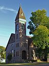
This is a list of the National Register of Historic Places listings in Lyon County, Iowa.

Contents

This is intended to be a complete list of the properties and districts on the National Register of Historic Places in Lyon County, Iowa, United States. Latitude and longitude coordinates are provided for many National Register properties and districts; these locations may be seen together in a map. [1]

National Register of Historic Places federal list of historic sites in the United States

The National Register of Historic Places (NRHP) is the United States federal government's official list of districts, sites, buildings, structures, and objects deemed worthy of preservation for their historical significance. A property listed in the National Register, or located within a National Register Historic District, may qualify for tax incentives derived from the total value of expenses incurred preserving the property.

Lyon County, Iowa County in the United States

Lyon County is the most northwesterly county of the U.S. state of Iowa. As of the 2010 census, the population was 11,581. The county seat is Rock Rapids.

Iowa State of the United States of America

Iowa is a state in the Midwestern United States, bordered by the Mississippi River to the east and the Missouri River and Big Sioux River to the west. It is bordered by six states; Wisconsin to the northeast, Illinois to the east, Missouri to the south, Nebraska to the west, South Dakota to the northwest and Minnesota to the north.

There are 10 properties and districts listed on the National Register in the county, including one National Historic Landmark.

National Historic Landmark formal designation assigned by the United States federal government to historic buildings and sites in the United States

A National Historic Landmark (NHL) is a building, district, object, site, or structure that is officially recognized by the United States government for its outstanding historical significance. Of over 90,000 places listed on the country's National Register of Historic Places, only some 2,500 are recognized as National Historic Landmarks.

This National Park Service list is complete through NPS recent listings posted December 7, 2018. [2]
Map all coordinates using: OpenStreetMap  
Download coordinates as: KML  ·  GPX
[3] Name on the Register [4] ImageDate listed [5] Location City or townDescription
1 Big Sioux Prehistoric Prairie Procurement System Archaeological District January 17, 1989
(#88001169)
Address Restricted
Klondike
2 Blood Run Site
Blood Run Site Blood Run Site, Iowa portion.jpg
Blood Run Site
August 29, 1970
(#70000246)
On the Iowa/South Dakota border along the Big Sioux River [6]
43°30′01″N96°35′49″W / 43.5004°N 96.5969°W / 43.5004; -96.5969 (Blood Run Site)
Granite
3 Broad View Ranch Historic District September 23, 1994
(#94001137)
2572 Log Ave.
43°16′33″N95°54′01″W / 43.275833°N 95.900278°W / 43.275833; -95.900278 (Broad View Ranch Historic District)
Sheldon
4 Burlington, Cedar Rapids, and Northern Railroad-Rock Rapids Station, Railroad Track and Bridge
Burlington, Cedar Rapids, and Northern Railroad-Rock Rapids Station, Railroad Track and Bridge BURLINGTON, CEDAR RAPIDS, AND NORTHERN RAILROAD ROCK RAPIDS STATION, RAILROAD TRACK AND BRIDGE.jpg
Burlington, Cedar Rapids, and Northern Railroad-Rock Rapids Station, Railroad Track and Bridge
November 7, 1976
(#76000783)
N. Story St.
43°26′01″N96°09′59″W / 43.433611°N 96.166389°W / 43.433611; -96.166389 (Burlington, Cedar Rapids, and Northern Railroad-Rock Rapids Station, Railroad Track and Bridge)
Rock Rapids
5 Duncan-Duitsman Farm Historic District September 23, 1994
(#94001138)
4324 180th St.
43°23′33″N95°56′04″W / 43.3925°N 95.934444°W / 43.3925; -95.934444 (Duncan-Duitsman Farm Historic District)
George
6 First Methodist Church
First Methodist Church First Methodist Church Rock Rapids.jpg
First Methodist Church
June 23, 1978
(#78001244)
302 S. Carroll St.
43°25′45″N96°10′19″W / 43.429167°N 96.171944°W / 43.429167; -96.171944 (First Methodist Church)
Rock Rapids
7 Klondike Bridge May 15, 1998
(#98000510)
180th St. over the Big Sioux River
43°23′16″N96°31′18″W / 43.387778°N 96.521667°W / 43.387778; -96.521667 (Klondike Bridge)
Larchwood
8 Lyon County Courthouse
Lyon County Courthouse Lyon County IA Courthouse.jpg
Lyon County Courthouse
October 1, 1979
(#79000913)
3rd and Story Sts.
43°25′48″N96°10′02″W / 43.43°N 96.167222°W / 43.43; -96.167222 (Lyon County Courthouse)
Rock Rapids
9 Melan Bridge
Melan Bridge Melan Arch Bridge.jpg
Melan Bridge
October 18, 1974
(#74000797)
East of Rock Rapids in Emma Sater Park
43°25′49″N96°09′19″W / 43.430278°N 96.155278°W / 43.430278; -96.155278 (Melan Bridge)
Rock Rapids
10 Charles B. Reynolds Round Barn July 7, 1999
(#99000737)
2382 Harrison Ave.
43°18′10″N96°09′21″W / 43.302778°N 96.155833°W / 43.302778; -96.155833 (Charles B. Reynolds Round Barn)
Doon Demolished

Former listings

[3] Name on the RegisterImageDate listedDate removedLocationCity or townSummary
1 Kruger Mill November 3, 1975
(#75000696)
December 15, 2003SW of Larchwood on Sioux River
Larchwood vicinity

See also

National Register of Historic Places listings in Iowa Wikimedia list article

This is a list of properties and historic districts in Iowa that are listed on the National Register of Historic Places. There are listings in all of Iowa's 99 counties, adding up to over 2,300 total.

Related Research Articles

National Register of Historic Places listings in Scott County, Iowa

This is intended to be a complete list of the properties and districts on the National Register of Historic Places in Scott County, Iowa, United States. Latitude and longitude coordinates are provided for many National Register properties and districts; these locations may be seen together in a map.

National Register of Historic Places listings in Allamakee County, Iowa Wikimedia list article

This is a list of the National Register of Historic Places listings in Allamakee County, Iowa.

National Register of Historic Places listings in Black Hawk County, Iowa Wikimedia list article

Here is presented a listing of the National Register of Historic Places in Black Hawk County, Iowa.

National Register of Historic Places listings in Cedar County, Iowa Wikimedia list article

This is a list of the National Register of Historic Places listings in Cedar County, Iowa.

National Register of Historic Places listings in Clinton County, Iowa

This is a list of the National Register of Historic Places listings in Clinton County, Iowa.

National Register of Historic Places listings in Des Moines County, Iowa Wikimedia list article

This is a list of the National Register of Historic Places listings in Des Moines County, Iowa.

National Register of Historic Places listings in Dubuque County, Iowa Wikimedia list article

This is a list of the National Register of Historic Places listings in Dubuque County, Iowa.

National Register of Historic Places listings in Iowa County, Iowa Wikimedia list article

This is a list of the National Register of Historic Places listings in Iowa County, Iowa.

National Register of Historic Places listings in Henry County, Iowa Wikimedia list article

This is a list of the National Register of Historic Places listings in Henry County, Iowa.

National Register of Historic Places listings in Jones County, Iowa Wikimedia list article

This is a list of the National Register of Historic Places listings in Jones County, Iowa.

National Register of Historic Places listings in Lee County, Iowa Wikimedia list article

This is a list of the National Register of Historic Places listings in Lee County, Iowa.

National Register of Historic Places listings in Johnson County, Iowa Wikimedia list article

This is a list of the National Register of Historic Places listings in Johnson County, Iowa.

National Register of Historic Places listings in Linn County, Iowa Wikimedia list article

This is a list of the National Register of Historic Places listings in Linn County, Iowa.

National Register of Historic Places listings in Polk County, Iowa Wikimedia list article

This is a list of the National Register of Historic Places listings in Polk County, Iowa.

National Register of Historic Places listings in Pottawattamie County, Iowa Wikimedia list article

This is a list of the National Register of Historic Places listings in Pottawattamie County, Iowa.

National Register of Historic Places listings in Winneshiek County, Iowa Wikimedia list article

This is a list of the National Register of Historic Places listings in Winneshiek County, Iowa.

National Register of Historic Places listings in Woodbury County, Iowa Wikimedia list article

This is a list of the National Register of Historic Places listings in Woodbury County, Iowa.

National Register of Historic Places listings in Story County, Iowa Wikimedia list article

This is a list of the National Register of Historic Places listings in Story County, Iowa.

National Register of Historic Places listings in Poweshiek County, Iowa Wikimedia list article

This is a list of the National Register of Historic Places listings in Poweshiek County, Iowa.

National Register of Historic Places listings in Davenport, Iowa

This is a list of the National Register of Historic Places listings in Davenport, Iowa. This is intended to be a complete list of the properties and districts on the National Register of Historic Places in Davenport, Iowa, United States. Latitude and longitude coordinates are provided for many National Register properties and districts; these locations may be seen together in an online map.

References

  1. The latitude and longitude information provided in this table was derived originally from the National Register Information System, which has been found to be fairly accurate for about 99% of listings. For about 1% of NRIS original coordinates, experience has shown that one or both coordinates are typos or otherwise extremely far off; some corrections may have been made. A more subtle problem causes many locations to be off by up to 150 yards, depending on location in the country: most NRIS coordinates were derived from tracing out latitude and longitudes from USGS topographical quadrant maps created under the North American Datum of 1927 , which differs from the current, highly accurate WGS84 GPS system used by most on-line maps. Chicago is about right, but NRIS longitudes in Washington are higher by about 4.5 seconds, and are lower by about 2.0 seconds in Maine. Latitudes differ by about 1.0 second in Florida. Some locations in this table may have been corrected to current GPS standards.
  2. "National Register of Historic Places: Weekly List Actions". National Park Service, United States Department of the Interior. Retrieved on December 7, 2018.
  3. 1 2 Numbers represent an ordering by significant words. Various colorings, defined here, differentiate National Historic Landmarks and historic districts from other NRHP buildings, structures, sites or objects.
  4. National Park Service (2008-04-24). "National Register Information System". National Register of Historic Places . National Park Service.
  5. The eight-digit number below each date is the number assigned to each location in the National Register Information System database, which can be viewed by clicking the number.
  6. Location derived from this State Historical Society of Iowa website; the NRIS lists it as "Address Restricted"