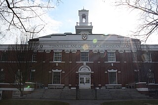
North Stamford is an affluent section of Stamford, Connecticut, United States, north of the Merritt Parkway. Mostly woody and hilly, it is the least densely populated, and highest income section of the city, with a 2021 median household income in excess of $250,000.[1] The two main roadways in North Stamford are High Ridge Road (Connecticut Route 137) and Long Ridge Road (Connecticut Route 104). North Stamford borders Pound Ridge, New York, at the New York line to the north, the "back country" section of Greenwich, Connecticut, to the west, and the Town of New Canaan, Connecticut, to the east. According to the 2010 census, North Stamford has a population of 14,904. The City of Stamford as a whole had a population of 135,470 (per the 2020 Census).
High Ridge Road, in the area just south of the Merrit Parkway, is the largest shopping district near North Stamford. A shopping plaza and some surrounding stores are also nearby on Newfield Avenue, and downtown Springdale also offers nearby stores.
Stamford's population began to grow during and after World War II with 30,000 new residents arrived from 1940 to 1960. "North Stamford developed with one- and two-acre zoning, looking just like Wilton or New Canaan," Janice Green, the manager of the William Pitt Real Estate office, told The New York Times in 1989. "Executives moved up there who had no connection with the factories and ethnic working-class neighborhoods downtown."[2]
Landmarks and institutions
Water reservoirs which provide water service to the City of Stamford are located in North Stamford,[3] as are the Bartlett Arboretum and the Stamford Historical Society headquarters and museum.
Also in the neighborhood is the Stamford Museum and Nature Center, a 118-acre (0.48km2) facility on Scofieldtown Road. The museum works with schools in Stamford, Bridgeport, Norwalk, Darien and Greenwich, and more than 10,000 students visit every year. In 2007 the museum and nature center started working with Aquarion, a water utility serving much of Fairfield County, in a program meant to educate children about water ecology and watershed protection.[4]
Buttonwood Manor, a Colonial-style house on an estate of 8 acres (32,000m2), is in North Stamford. The original main house was built by Jacob Stevens in 1809, then sold it in 1821 to Gould Raymond. For 77 years the Raymond family farmed the land. By 1926 Mary Stella Tisdale Atwood had bought the house from Otto Sarrach and began restoring it. She sold the estate to William E. Stevenson, a Gold Medal winner in the 1924 Summer Olympics in Paris (setting a new world record of 3:16.0 as member of the American 400-meter relay team) and later a president of Oberlin College. While Stevenson and his wife were in England running American Red Cross operations in World War II, they rented the house to Dorothy Fields, a lyricist.[5]
Old Long Ridge Village, the neighborhood surrounding Long Ridge Village Historic District, includes historic churches, a local market, a century old tavern, and the volunteer Long Ridge Fire Company.
Tucker Hill, the former Hunting Ridge Methodist Church built in 1850, is on Hunting Ridge Rd, near Old Long Ridge Village. The former church was converted to a residence in 1968 by the family of renowned sculptor Robert Laurent.
Transportation
The Merritt Parkway allows no commercial vehicles, trucks, buses, and vehicles over 8 feet because of the small lanes, and narrow bridges. The Merritt Parkway is parallel to I-95 5 miles north. The Merritt Parkway starts at the Greenwich border and ends at Milford. The Merritt changes its name to the Hutchinson River Parkway entering New York State with the Exit numbers continuing with a few breaks. The Parkway goes through Westchester County NY into New York City, the Bronx and continues to the Whitestone Bridge into Queens.
North Stamford has two routes: Route 104 and Route 137.[6] Route 104 starts in Ridgeway and ends at Bedford, New York. Route 137 starts in the Downtown and ends at Pound Ridge, New York.
North Stamford is served by the New Canaan Branch of the Metro-North Railroad, with many residents opting to use the stations of New Canaan, Talmadge Hill, and Springdale.[7]
There are also CTTransit Buses that run from the downtown to other parts of the city; North Stamford is served by CTTransit. The bus routes serving North Stamford are 336, 324, 331, and 331S.[8]
Parks
Susan Nabel Park at Chestnut Hill - Chestnut Hill Road and Webbs Hill Road
Dorothy Heroy Park - riding stable trail
Scofieldtown Park - Scofieldtown Road
Woodley Road Bird Sanctuary - off Scofieldtown Road
Mianus River Park - Merribrook Lane
Newman Mills Park - Riverbank Road
Emergency services
Fire service in provided by a combination of volunteer and professional firefighters. Fire stations are Stamford Fire Department Company #8, 268 Turn of River Road (professional), Turn of River Fire Department #2, 50 Roxbury Road (volunteer),[9] Long Ridge Fire Co., 366 Old Long Ridge Road (volunteer), and Long Ridge Fire Co. 2 2619 High Ridge Road (volunteer).
Police service is provided by the Stamford Police Department.[10] The police substation serving North Stamford is at 1137 High Ridge Road.
Emergency medical service is provided by the Stamford Emergency Medical Services.[11] The nearest EMS garage is at 684 Long Ridge Road.
Secession movement of 1990s
The New York Times reported in 1995 that in the 1990s many North Stamford residents were seriously considering a secession movement to form a town separate from the City of Stamford.[12] Many North Stamford residents calculated that creating their own town would significantly reduce property taxes. The Concerned Citizens of North Stamford argued that North Stamford residents pay nearly a third of Stamford's property taxes although they make up less than 15 percent of the city's population and in return receive less city services. North Stamford residents do not receive city garbage collection (as does most of the rest of the city), must provide their own water and sewerage systems, have less police protection and, largely, have their children bused to schools in other parts of town. The New York Times reported that in 1995, that Stamford's then Mayor Esposito strongly opposed the movement. Mayor Esposito cited a plan by the city to permit the conversion of the vacant Riverbank School into a 53-bed residential hospice along with offices for Hospice Care Inc as a strong reason against the movement. Although the Concerned Citizens of North Stamford received about 600 signatures in a petition for the secession movement, it ultimately failed because many North Stamford residents were opposed to the plan and were discouraged by the complex process of secession in the State of Connecticut. Secession would require a revision of the City charter and the approval of the State Legislature. It is unlikely the City of Stamford would allow the lucrative revenue stream of property taxes from North Stamford to cease and for State legislators to approve a major municipality separation without the City of Stamford's support. There is very little to no legitimate discussions on secession in our current day[when?] as North Stamford is seen as an established part of the City of Stamford legally and functionally. Secession movements also took place in 1990s in the Rowayton section of Norwalk, Connecticut, and the East Shore section of New Haven, Connecticut, with those residents citing similar concerns. All of these movements were unsuccessful and their neighborhoods remain within their larger cities jurisdiction.
Historical cemeteries
North Stamford contains numerous old cemeteries from the nineteenth century and before, some quite small and often with gravestones bearing elaborate engravings and even poetry.[13]
The Chambers Brothers, psychedelic soul, recorded Time Has Come Today. with drummer Brian Keenan, were the second black family to integrate North Stamford
Jackie Robinson, the first African-American baseball player in the modern Major Leagues, made North Stamford[14] his home later in his life. One of the several Stamford Little League Baseball leagues is named after him.
Gene Wilder, actor, was a resident before passing away in August 2016.
Travis the Chimp lived in North Stamford before being shot and killed by police after going on a rampage and assaulting a friend of his owner.
Carly Simon's parents owned the estate which is now a private school campus on Newfield Avenue.
Michael Lee Aday aka rockstar Meat Loaf lived on Eagle Drive in the late 1970s and early 1980s. He coached local little league baseball during that period.
Vivian Vance, actress was a resident from 1961 to 1974.
↑ Gosier, Chris, "Environmental immersion: Water company and nature center form watershed education alliance", The Advocate, pp A9, A10, Stamford edition
1 2 3 Nova, Susan, "Manor is rich with history: Offer has been accepted to buy 5,300-square-foot (490m2) home", The Advocate Real Estate section, April 20, 2007, pp. R1, R4
↑ Cavanaugh,Jack "Another Day, Another Secession Movement","Another Day, Another Secession Movement", The New York Times, February 26, 1995
1 2 Majdalayny, Jeanne and Mulkerin, Jean, Poems in Stone in Stamford, Connecticut, published by the Stamford Historical Society, 1980
1 2 3 4 5 6 7 "If You're Thinking of Living In/North Stamford, Conn.; In a Bustling City, a Rural Haven" an article by Eleanor Charles in New York Times Real Estate section, February 1, 1998, accessed September 10, 2006
Fairfield County is a county in the southwestern corner of the U.S. state of Connecticut. It is the most populous county in the state and was also its fastest-growing from 2010 to 2020. As of the 2020 census, the county's population was 957,419, representing 26.6% of Connecticut's overall population. The closest to the center of the New York metropolitan area, the county contains four of the state's top 7 largest cities—Bridgeport (1st), Stamford (2nd), Norwalk (6th), and Danbury (7th)—whose combined population of 433,368 is nearly half the county's total population.
Greenwich is a town in southwestern Fairfield County, Connecticut, United States. At the 2020 census, it had a population of 63,518. Greenwich is a principal community of the Bridgeport–Stamford–Norwalk–Danbury metropolitan statistical area, which comprises all of Fairfield County, and is part of the Western Connecticut Planning Region. The town is the southwesternmost municipality in both the State of Connecticut and the six-state region of New England. The town is named after Greenwich, a royal borough of London in the United Kingdom.
New Canaan is a town in Fairfield County, Connecticut, United States. The population was 20,622 according to the 2020 census. The town is part of the Western Connecticut Planning Region.
Stamford is a city in Fairfield County, Connecticut, 34 miles outside of New York City. It is the sixth-most populous city in New England. Stamford is also the largest city in the Western Connecticut Planning Region, and Connecticut's second-most populous city, behind Bridgeport. With a population of 135,470, Stamford passed Hartford and New Haven in population as of the 2020 census. It is in the Bridgeport-Stamford-Norwalk-Danbury metropolitan statistical area, which is part of the New York City metropolitan area.
The Merritt Parkway is a controlled-access parkway in Fairfield County, Connecticut, with a small section at the northern end in New Haven County. Designed for Connecticut's Gold Coast, the parkway is known for its scenic layout, its uniquely styled signage, and the architecturally elaborate overpasses along the route. As one of the first, oldest parkways in the United States, it is designated as a National Scenic Byway and is also listed in the National Register of Historic Places. Signed as part of Route 15, it runs from the New York state line in Greenwich, where it serves to continue the Hutchinson River Parkway, to Exit 54 in Milford, where the Wilbur Cross Parkway begins. Facing bitter opposition, the project took six years to build in three different sections, with the Connecticut Department of Transportation constantly requiring additional funding due to the area's high property value. The parkway was named for U.S. Congressman Schuyler Merritt. In 2010, the National Trust for Historic Preservation called the Merritt Parkway one of "America's 11 Most Endangered Historic Places".
Shippan Point is the southernmost neighborhood in Stamford, Connecticut, United States, located on a peninsula in Long Island Sound. Street names such as Ocean Drive West and Lighthouse Way reflect the neighborhood's shoreline location. It is one of the wealthiest neighborhoods in the city, with about 1100 homes.
Route 15 is a state highway in the U.S. state of Connecticut that runs 83.53 miles (134.43 km) from a connection with New York's Hutchinson River Parkway in Greenwich, Connecticut, to its northern terminus intersecting with Interstate 84 (I-84) in East Hartford, Connecticut. Route 15 consists of four distinct sections: the Merritt Parkway, the Wilbur Cross Parkway, most of the Berlin Turnpike, and part of the Wilbur Cross Highway. The unified designation was applied to these separate highways in 1948 to provide a continuous through route from New York to Massachusetts. The parkway section of Route 15 is often referred to locally as "The Merritt".
Interstate 95 (I-95) is the main north–south Interstate Highway on the East Coast of the United States, running in a general east–west compass direction for 111.57 miles (179.55 km) in Connecticut, from the New York state line to the Rhode Island state line. I-95 from Greenwich to East Lyme is part of the Connecticut Turnpike, during which it passes through the major cities of Stamford, Bridgeport, and New Haven. After leaving the turnpike in East Lyme, I-95 is known as the Jewish War Veterans Memorial Highway and passes through New London, Groton, and Mystic, before exiting the state through North Stonington at the Rhode Island border.
Route 137 is a main highway running north–south through the city of Stamford, Connecticut. It runs for about 9.3 miles (15.0 km) from Downtown Stamford up to North Stamford and then to New York state line in the town of Pound Ridge, New York.
Glenbrook is a neighborhood of the city of Stamford, Connecticut. Spanning an area of about 1.7 square miles (4.4 km2), about 15,400 people live in Glenbrook as of 2007. Glenbrook is located on the eastern side of the city, east of Downtown, north of the East Side and the Cove sections and south of the Springdale section. To the west is Downtown Stamford and to the northwest is Belltown. To the east is Darien.
The Cove is a neighborhood located in the southeast corner of Stamford, Connecticut. It is an area of mostly modest homes with some very expensive homes along the shoreline.
Stamford, Connecticut was inhabited by Siwanoy Native Americans, prior to European colonization beginning in the mid-17th century. Stamford grew rapidly due to industrialization in the late-19th and early-20th century, and continued to grow rapidly throughout much of the mid-20th century. During the late-20th century, Stamford underwent a period of urban renewal which saw much redevelopment in its downtown. Stamford's population has continued to grow throughout the 21st century, with redevelopments in its downtown and the South End.
Talmadge Hill station is a commuter rail station on the New Canaan Branch of the Metro-North Railroad New Haven Line, located just south of the Merritt Parkway in New Canaan, Connecticut.
Route 123 is a secondary state highway in southwestern Connecticut from Norwalk to the New York state line near the town of Lewisboro.
Route 104 is a Connecticut state highway in the city of Stamford, starting at from the Bulls Head section of the city then through North Stamford, with the highway ending at New York state line.
Route 106 is a state highway in southwestern Connecticut, running from Stamford to Wilton.
U.S. Route 7 (US 7) is a north–south United States Numbered Highway which runs 78 miles (126 km) in the state of Connecticut. The route begins at Interstate 95 (I-95) in Norwalk starting out as a freeway until the Wilton town line. The route then proceeds north as a two-lane surface road through Redding and Ridgefield, where it becomes a four-lane surface road until it reaches Danbury. The route becomes an freeway again, eventually merging with I-84 for a brief period before it turns and proceeds north with US 202 in Brookfield. The freeway section terminates at an intersection with US 202 at the Fairfield–Litchfield county line next to Candlewood lake. The route then continues north as a four-lane arterial road to New Milford, where it becomes a two-lane surface road, running north to the Massachusetts border in North Canaan. US 7 was aligned to its current route around 1930, and, since then, three sections totaling around 12 miles (19 km) have been upgraded to freeway standards.
The transportation system of Connecticut is a cooperation of complex systems of infrastructure. Trains and highways are the central pieces of the system.
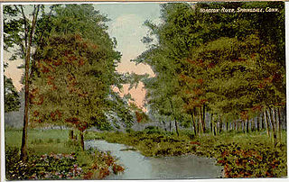
The Noroton River is a 9.4-mile-long (15.1 km) stream which forms most of the border between Stamford and Darien, Connecticut, United States. The river's headwaters are in New Canaan, Connecticut and flow into Holly Pond. It is the largest flowing body of water between the Mill River/Rippowam River to the west and the Fivemile River to the east, although Stony Brook and the Goodwives River in Darien are not much smaller.
Westover is an affluent section of Stamford, Connecticut, United States. With a median household income of $186,607, it is one of the wealthiest neighborhoods in the city, along with Shippan Point and North Stamford. The neighborhood is bordered by Mianus River State Park to the west, the Merritt Parkway to the north, Stillwater Road to the east, and Palmer Hill Road to the south.
This page is based on this Wikipedia article Text is available under the CC BY-SA 4.0 license; additional terms may apply. Images, videos and audio are available under their respective licenses.