North Woodstock, New Hampshire

Last updated

North Woodstock, New Hampshire
Main Street North Woodstock NH.jpg
Main Street in North Woodstock
USA New Hampshire location map.svg
Red pog.svg
North Woodstock
Usa edcp location map.svg
Red pog.svg
North Woodstock
Coordinates: 44°1′49″N71°41′9″W / 44.03028°N 71.68583°W / 44.03028; -71.68583
Country United States
State New Hampshire
County Grafton
Town Woodstock
Area
[1]
  Total1.65 sq mi (4.28 km2)
  Land1.62 sq mi (4.18 km2)
  Water0.04 sq mi (0.09 km2)
Elevation
738 ft (225 m)
Population
 (2020)
  Total739
  Density457.30/sq mi (176.60/km2)
Time zone UTC-5 (Eastern (EST))
  Summer (DST) UTC-4 (EDT)
ZIP code
03262
Area code 603
FIPS code 33-57220
GNIS feature ID0872411

North Woodstock is a census-designated place (CDP) and the primary village in the town of Woodstock in Grafton County, New Hampshire, United States. It had a population of 739 at the 2020 census. [2]

Contents

Geography

It is located along the northern boundary of the town of Woodstock, adjacent to the town of Lincoln. The village is centered on the intersection of U.S. Route 3 (Main Street) and New Hampshire Route 112 (Lost River Road/Kancamagus Highway). Interstate 93 passes through the east portion of the village, with access from Exit 32 (NH 112). I-93 leads south 21 miles (34 km) to Plymouth and north through Franconia Notch 23 miles (37 km) to Littleton. NH 112 leads east on the Kancamagus Highway 36 miles (58 km) to Conway and west through Kinsman Notch 24 miles (39 km) to Woodsville. US-3 is a local road that runs parallel to I-93.

The Pemigewasset River flows past the center of North Woodstock, joined by the East Branch of the Pemigewasset and Moosilauke Brook at the southern limits of the village. According to the U.S. Census Bureau, the North Woodstock CDP has a total area of 1.7 square miles (4.3 km2), of which 0.04 square miles (0.1 km2), or 2.17%, is water. [3]

Demographics

Historical population
CensusPop.Note
2010 528
2020 73940.0%
U.S. Decennial Census [4]
North Woodstock
Woodstock Inn Brewery New Hampshire.jpg
Woodstock Inn Brewery
United States Post Office, North Woodstock New Hampshire.jpg
North Woodstock post office

As of the census of 2010, there were 528 people, 256 households, and 131 families residing in the CDP. There were 759 housing units, of which 503, or 66.3%, were vacant on Census Day (April 1). 480 of the vacant units were seasonal or vacation properties. The racial makeup of the CDP was 96.8% white, 0.2% African American, 0.2% Native American, 1.1% Asian, 0.0% Pacific Islander, 0.0% some other race, and 1.7% from two or more races. 0.0% of the population were Hispanic or Latino of any race. [5]

Of the 256 households in the CDP, 20.3% had children under the age of 18 living with them, 39.1% were headed by married couples living together, 7.4% had a female householder with no husband present, and 48.8% were non-families. 36.3% of all households were made up of individuals, and 6.7% were someone living alone who was 65 years of age or older. The average household size was 2.06, and the average family size was 2.72. [5]

17.2% of residents in the CDP were under the age of 18, 7.8% were from age 18 to 24, 26.1% were from 25 to 44, 32.8% were from 45 to 64, and 16.1% were 65 years of age or older. The median age was 44.5 years. For every 100 females, there were 98.5 males. For every 100 females age 18 and over, there were 97.7 males. [5]

For the period 2011-15, the estimated median annual income for a household was $40,083, and the median income for a family was $42,292. The per capita income for the CDP was $32,940. [6]

Related Research Articles

<span class="mw-page-title-main">Lincoln, New Hampshire</span> Town in New Hampshire, United States

Lincoln is a town in Grafton County, New Hampshire, United States. It is the second-largest town by area in New Hampshire. The population was 1,631 at the 2020 census. The town is home to the New Hampshire Highland Games and to a portion of Franconia Notch State Park. Set in the White Mountains, large portions of the town are within the White Mountain National Forest. The Appalachian Trail crosses the western and northeastern parts of the town. Lincoln is the location of Loon Mountain Ski Resort and associated recreation-centered development.

<span class="mw-page-title-main">Albany, New Hampshire</span> Town in New Hampshire, United States

Albany is a town in Carroll County, New Hampshire, United States. The population was 759 at the 2020 census.

<span class="mw-page-title-main">Woodstock, New Hampshire</span> Town in New Hampshire, United States

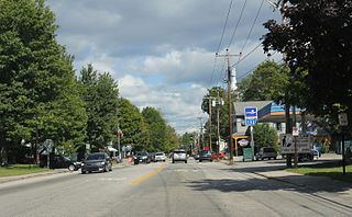
Woodstock is a town in Grafton County, New Hampshire, United States. The population was 1,434 at the 2020 census. Woodstock includes the village of North Woodstock, the commercial center. Its extensive land area is largely forested, and includes the Hubbard Brook Experimental Forest. Parts of the White Mountain National Forest are in the east and west. The Appalachian Trail crosses the town's northwestern corner. Russell Pond Campground is in the east. West of North Woodstock is the Lost River Reservation.

<span class="mw-page-title-main">Contoocook, New Hampshire</span> Census-designated place in New Hampshire, United States

Contoocook is a village and census-designated place (CDP) within the town of Hopkinton in Merrimack County, New Hampshire, United States. The population was 1,427 at the 2020 census. Contoocook is well known for its growth of small businesses, preservation of historical landmarks, community involvement and recreational activities within the village.

<span class="mw-page-title-main">Meredith (CDP), New Hampshire</span> Census-designated place in New Hampshire, United States

Meredith is a census-designated place (CDP) and the main village in the town of Meredith in Belknap County, New Hampshire, United States. The population was 2,527 at the 2020 census, out of 6,662 in the entire town of Meredith.

<span class="mw-page-title-main">Conway (CDP), New Hampshire</span> Census-designated place in New Hampshire, United States

Conway is a census-designated place (CDP) and the primary village in the town of Conway in Carroll County, New Hampshire, United States. The population was 3,576 at the 2020 census. It is the most populous community in the town of Conway, ahead of North Conway.

<span class="mw-page-title-main">Wolfeboro (CDP), New Hampshire</span> Census-designated place in New Hampshire, United States

Wolfeboro is a census-designated place (CDP) in the town of Wolfeboro in Carroll County, New Hampshire, United States. It consists of the main village of Wolfeboro within the town, as well as the smaller village of Wolfeboro Falls. The population of the CDP was 3,300 at the 2020 census, out of 6,416 in the entire town of Wolfeboro.

<span class="mw-page-title-main">Bristol (CDP), New Hampshire</span> Census-designated place in New Hampshire, United States

Bristol is a census-designated place (CDP) and the main village in the town of Bristol in Grafton County, New Hampshire, United States. The population of the CDP was 1,911 at the 2020 census, out of 3,244 in the entire town.

Littleton is a census-designated place (CDP) and the main village in the town of Littleton in Grafton County, New Hampshire, United States. The population of the CDP was 4,467 at the 2020 census, out of 6,005 in the entire town.

<span class="mw-page-title-main">Plymouth (CDP), New Hampshire</span> Census-designated place in New Hampshire, United States

Plymouth is a census-designated place (CDP) and the main village in the town of Plymouth in Grafton County, New Hampshire, United States. Its population was 4,730 at the 2020 census, out of 6,682 in the entire town. The CDP includes the campus of Plymouth State University.

<span class="mw-page-title-main">Hooksett (CDP), New Hampshire</span> Census-designated place in New Hampshire, United States

Hooksett is a census-designated place (CDP) in the town of Hooksett in Merrimack County, New Hampshire, United States. The CDP includes the historic central village of Hooksett as well as suburban and rural land surrounding it. The population of the CDP was 5,283 at the 2020 census, out of 14,871 in the entire town.

<span class="mw-page-title-main">Epping (CDP), New Hampshire</span> Census-designated place in New Hampshire, United States

Epping is a census-designated place (CDP) and the main village in the town of Epping, Rockingham County, New Hampshire, United States. The population of the CDP was 2,693 at the 2020 census, out of 7,125 in the entire town.

<span class="mw-page-title-main">New Hampshire Route 112</span> State highway in northern New Hampshire, US

New Hampshire Route 112 is a 56.39-mile-long (90.75 km) east–west state highway in northern New Hampshire. The highway winds across the state, connecting Bath to Conway through the heart of the scenic and mountainous White Mountain National Forest.

<span class="mw-page-title-main">Bartlett (CDP), New Hampshire</span> Census-designated place in New Hampshire, United States

Bartlett is a census-designated place (CDP) and the main village in the town of Bartlett in Carroll County, New Hampshire, United States. The population was 351 at the 2020 census, out of 3,200 in the entire town of Bartlett.

New Hampton is a census-designated place (CDP) and the main village in the town of New Hampton in Belknap County, New Hampshire, United States. The population was 373 at the 2020 census, out of 2,377 people in the entire town of New Hampton.

<span class="mw-page-title-main">Ashland (CDP), New Hampshire</span> Census-designated place in New Hampshire, United States

Ashland is a census-designated place (CDP) and the main village in the town of Ashland in Grafton County, New Hampshire, United States. The population of the CDP was 1,082 at the 2020 census, out of 1,938 in the entire town.

Bethlehem is a census-designated place (CDP) and the main village in the town of Bethlehem in Grafton County, New Hampshire, United States. The population of the CDP was 826 at the 2020 census, out of 2,484 in the entire town.

<span class="mw-page-title-main">Colebrook (CDP), New Hampshire</span> Census-designated place in New Hampshire, United States

Colebrook is a census-designated place (CDP) and the main village in the town of Colebrook, Coös County, New Hampshire, United States. The population of the CDP was 1,201 at the 2020 census, out of 2,084 in the entire town. The CDP population had dropped from 1,394 at the 2010 census.

Lincoln is a census-designated place (CDP) and the main village in the town of Lincoln in Grafton County, New Hampshire, United States. The population of the CDP was 969 at the 2020 census, out of 1,631 in the entire town.

Mountain Lakes is a census-designated place (CDP) in the towns of Haverhill and Bath in Grafton County, New Hampshire, United States. It had a population of 504 at the 2020 census.

References

  1. "ArcGIS REST Services Directory". United States Census Bureau. Retrieved September 20, 2022.
  2. "North Woodstock CDP, New Hampshire: 2020 DEC Redistricting Data (PL 94-171)". U.S. Census Bureau. Retrieved December 1, 2021.
  3. "2021 U.S. Gazetteer Files – New Hampshire". United States Census Bureau. Retrieved December 1, 2021.
  4. "Decennial Census Official Publications". Census.gov. Retrieved March 4, 2024.
  5. 1 2 3 "Profile of General Population and Housing Characteristics: 2010 Census Summary File 1 (DP-1): North Woodstock CDP, New Hampshire". U.S. Census Bureau, American Factfinder. Archived from the original on February 13, 2020. Retrieved October 13, 2017.
  6. "Selected Economic Characteristics: 2011-2015 American Community Survey 5-Year Estimates (DP03): North Woodstock CDP, New Hampshire". U.S. Census Bureau, American Factfinder. Archived from the original on February 13, 2020. Retrieved October 13, 2017.