Grafton, New Hampshire

Last updated

Grafton, New Hampshire
Town
Grafton Center.jpg
Grafton Center c.1909
Town Seal of Grafton, New Hampshire.jpg
Grafton-Grafton-NH.png
Coordinates: 43°34′24″N71°58′26″W / 43.57333°N 71.97389°W / 43.57333; -71.97389
Country United States
State New Hampshire
County Grafton
Incorporated 1778
Villages
  • Grafton
  • Grafton Center
  • East Grafton
Government
   Board of Selectmen
  • Leif Hogue, Chair
  • Steve Darrow
  • Edward Grinley
[1]
Area
[2]
  Total42.4 sq mi (109.8 km2)
  Land41.5 sq mi (107.4 km2)
  Water0.9 sq mi (2.4 km2)  2.20%
Elevation
870 ft (270 m)
Population
 (2020) [3]
  Total1,385
  Density33/sq mi (12.9/km2)
Time zone UTC-5 (Eastern)
  Summer (DST) UTC-4 (Eastern)
ZIP code
03240
Area code 603
FIPS code 33-30820
GNIS feature ID0873609
Website www.townofgraftonnh.com

Grafton is a town in Grafton County, New Hampshire, United States. The population was 1,385 at the 2020 census. [3]

Contents

History

Originally granted in 1761, and re-granted in 1769, Grafton, like the county it resides in, takes its name from Augustus FitzRoy, 3rd Duke of Grafton, [4] a relative of colonial governor Benning Wentworth. Grafton was incorporated in 1778.

Historically, Grafton's economic base consisted of subsistence farming, small-scale industry, and mining. Several mica mines and granite quarries once dotted the town's landscape, most notably Ruggles Mine.

Geography

The town is in western New Hampshire, on the southern edge of Grafton County. It is bordered to the south by Sullivan County and to the southeast by Merrimack County. U.S. Route 4 is the main road through the town, leading southeast to Andover and Concord and northwest to Canaan and Lebanon. New Hampshire Route 4A crosses the southwest corner of the town.

According to the U.S. Census Bureau, the town has a total area of 42.4 square miles (109.8 km2), of which 41.5 square miles (107.4 km2) are land and 0.93 square miles (2.4 km2) are water, comprising 2.20% of the town. [2] The majority of the town is drained to the east by the Smith River, a tributary of the Pemigewasset River and part of the Merrimack River watershed, while the western side of the town drains by several brooks toward the Mascoma River, a tributary of the Connecticut. [5] The highest point in Grafton is the summit of Melvin Mountain, at 2,177 feet (664 m) above sea level in the northeastern part of town. Grafton Pond is in the western part of town.

Climate

Climate data for Grafton, 1991–2020 normals, 1893-2020 extremes: 830ft (253m)
MonthJanFebMarAprMayJunJulAugSepOctNovDecYear
Record high °F (°C)60
(16)
64
(18)
80
(27)
92
(33)
95
(35)
99
(37)
99
(37)
97
(36)
95
(35)
86
(30)
74
(23)
70
(21)
99
(37)
Mean maximum °F (°C)48.5
(9.2)
51.8
(11.0)
63.5
(17.5)
77.3
(25.2)
84.8
(29.3)
88.8
(31.6)
90.7
(32.6)
88.4
(31.3)
83.8
(28.8)
75.8
(24.3)
66.3
(19.1)
51.5
(10.8)
92.0
(33.3)
Mean daily maximum °F (°C)29.1
(−1.6)
31.9
(−0.1)
40.2
(4.6)
54.3
(12.4)
65.7
(18.7)
75.2
(24.0)
79.5
(26.4)
77.8
(25.4)
70.8
(21.6)
58.0
(14.4)
45.4
(7.4)
34.0
(1.1)
55.2
(12.9)
Daily mean °F (°C)18.2
(−7.7)
19.6
(−6.9)
28.6
(−1.9)
41.3
(5.2)
52.8
(11.6)
62.4
(16.9)
66.8
(19.3)
65.5
(18.6)
57.7
(14.3)
45.4
(7.4)
35.3
(1.8)
24.5
(−4.2)
43.2
(6.2)
Mean daily minimum °F (°C)7.2
(−13.8)
7.2
(−13.8)
17.1
(−8.3)
28.3
(−2.1)
39.9
(4.4)
49.5
(9.7)
54.1
(12.3)
53.2
(11.8)
44.7
(7.1)
32.8
(0.4)
25.3
(−3.7)
15.0
(−9.4)
31.2
(−0.5)
Mean minimum °F (°C)−18.7
(−28.2)
−17.7
(−27.6)
−8.2
(−22.3)
15.2
(−9.3)
24.2
(−4.3)
32.2
(0.1)
39.2
(4.0)
36.1
(2.3)
27.3
(−2.6)
17.2
(−8.2)
7.5
(−13.6)
−8.0
(−22.2)
−20.9
(−29.4)
Record low °F (°C)−40
(−40)
−36
(−38)
−25
(−32)
−6
(−21)
14
(−10)
25
(−4)
30
(−1)
26
(−3)
16
(−9)
9
(−13)
−6
(−21)
−30
(−34)
−40
(−40)
Average precipitation inches (mm)2.93
(74)
2.55
(65)
3.05
(77)
3.20
(81)
3.18
(81)
4.21
(107)
3.89
(99)
3.32
(84)
3.23
(82)
4.51
(115)
3.11
(79)
2.98
(76)
40.16
(1,020)
Average snowfall inches (cm)22.1
(56)
15.3
(39)
15.5
(39)
5.0
(13)
0.0
(0.0)
0.0
(0.0)
0.0
(0.0)
0.0
(0.0)
0.0
(0.0)
0.4
(1.0)
4.8
(12)
15.6
(40)
78.7
(200)
Source 1: NOAA(1981-2010 Snowfall) [6] [7]
Source 2: XMACIS2 (records & 1981-2010 monthly max/mins) [8]

Demographics

Historical population
CensusPop.Note
1790 403
1800 68269.2%
1810 93136.5%
1820 1,09417.5%
1830 1,20710.3%
1840 1,201−0.5%
1850 1,2594.8%
1860 1,150−8.7%
1870 907−21.1%
1880 9343.0%
1890 787−15.7%
1900 748−5.0%
1910 641−14.3%
1920 554−13.6%
1930 539−2.7%
1940 5522.4%
1950 442−19.9%
1960 348−21.3%
1970 3706.3%
1980 73999.7%
1990 92324.9%
2000 1,13823.3%
2010 1,34017.8%
2020 1,3853.4%
U.S. Decennial Census [3] [9]

As of the census of 2010, there were 1,340 people, 564 households, and 372 families residing in the town. The population density was 32.1 inhabitants per square mile (12.4/km2). There were 839 housing units at an average density of 20.1 per square mile (7.8/km2). The racial makeup of the town was 96.7% White, 0.3% African American, 0.2% Native American, 0.4% Asian, 0.1% some other race, and 2.2% from two or more races. Hispanic or Latino of any race were 1.5% of the population. [10]

There were 564 households, out of which 24.1% had children under the age of 18 living with them, 54.4% were headed by married couples living together, 7.1% had a female householder with no husband present, and 34.0% were non-families. 26.4% of all households were made up of individuals, and 7.4% consisted of someone living alone who was 65 years of age or older. The average household size was 2.38, and the average family size was 2.84. [10]

In the town, the population was spread out, with 18.8% under the age of 18, 5.2% from 18 to 24, 23.7% from 25 to 44, 36.5% from 45 to 64, and 14.6% who were 65 years of age or older. The median age was 45.6 years. For every 100 females, there were 108.7 males. For every 100 females age 18 and over, there were 112.1 males. [10]

At the 2000 census, the median income for a household in the town was $38,654, and the median income for a family was $41,875. Males had a median income of $30,074 versus $23,750 for females. The per capita income for the town was $16,944. About 4.2% of families and 7.9% of the population were below the poverty line, including 10.0% of those under age 18 and 4.1% of those age 65 or over.

Government

Grafton is governed by a three-person select board.

Politics

Grafton County, within which the town of Grafton resides, ranks number 100 in terms of highest property taxes levied in the United States. [11] As of 2019, the town of Grafton itself has the 16th highest property tax rate in the state of New Hampshire. [12]

Free Town Project

In 2004, Grafton became the focus for Libertarians as part of the Free Town Project (a single-town version of the Free State Project). One of the goals was to advocate for legal changes. [13] Grafton's appeal as a favorable destination was due to its absence of zoning laws and a then-low property tax rate. [14] [13] John Babiarz, a Grafton resident and prominent member of the Libertarian Party, encouraged libertarian people to move there. [15] [16]

During this time, the town's population grew by about 200 people (about 20%); nearly all of the newcomers were men. [14] Project participants did not find themselves as welcome as they had hoped, but they voted in changes including a 30% reduction in the town's already-small budget. [14] This resulted in eliminating funding to the county's senior-citizens council, town offices going unheated during the winter, poorly maintained roads filled with potholes, and the Grafton Police Department being reduced to one officer (the police chief), who said he was unable to answer calls for service as the town had no money to repair the one police vehicle left. [17] Other issues were inconsistent basic public services, such as trash collection. [15] [14] The libertarian newcomers additionally increased the town's costs by filing lawsuits against it in attempts to set various legal precedents. [14]

Example of a bear-resistant trash container, with an American black bear climbing on top of it. Some libertarian newcomers to Grafton refused to buy bear-resistant containers. Trash hunting Black Bear 31, 06 Aug 2021.jpg
Example of a bear-resistant trash container, with an American black bear climbing on top of it. Some libertarian newcomers to Grafton refused to buy bear-resistant containers.

The project has been associated with an increase in the number and aggressiveness of black bears in town, including entering homes, mauling people, and eating pets. [14] A single, definitive cause for the abnormal behavior of the bears has not been proven, but it may be due to libertarian residents who refuse to buy and use bear-resistant containers, who do not dispose of waste materials (such as feces) safely, or who deliberately put out food to attract the bears to their own yards, without caring how this affected other people. [14]

After a rash of lawsuits from Free Towners, an influx of sex offenders, an increase of crime, problems with bold local bears, and the first murders in the town's history, the Libertarian project ended in 2016. [13] [14] [18]

Notable people

Sites of interest

Related Research Articles

<span class="mw-page-title-main">Lincoln, New Hampshire</span> Town in New Hampshire, United States

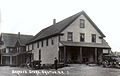
Lincoln is a town in Grafton County, New Hampshire, United States. It is the second-largest town by area in New Hampshire. The population was 1,631 at the 2020 census. The town is home to the New Hampshire Highland Games and to a portion of Franconia Notch State Park. Set in the White Mountains, large portions of the town are within the White Mountain National Forest. The Appalachian Trail crosses the western and northeastern parts of the town. Lincoln is the location of Loon Mountain Ski Resort and associated recreation-centered development.

<span class="mw-page-title-main">Grafton County, New Hampshire</span> County in New Hampshire, United States

Grafton County is a county in the U.S. state of New Hampshire. As of the 2020 census, the population was 91,118. Its county seat is the town of Haverhill. In 1972, the county courthouse and other offices were moved from Woodsville, a larger village within the town of Haverhill, to North Haverhill.

<span class="mw-page-title-main">Alexandria, New Hampshire</span> Town in New Hampshire, United States

Alexandria is a town in Grafton County, New Hampshire, United States. The population was 1,776 at the 2020 census, up from 1,613 at the 2010 census. Newfound Lake is in the northeast corner, with Wellington State Park on the western shore. The town is home to Welton Falls State Forest. Cardigan Mountain State Park, with Mount Cardigan, is in the west. Another attraction is Mowglis Mountain, named for Rudyard Kipling's Jungle Book hero.

<span class="mw-page-title-main">Benton, New Hampshire</span> Town in New Hampshire, United States

Benton is a town in Grafton County, New Hampshire, United States. The population was 374 at the 2020 census. Located in the White Mountains, Benton is largely surrounded by the White Mountain National Forest. The town is crossed by the Appalachian Trail.

<span class="mw-page-title-main">Bridgewater, New Hampshire</span> Town in New Hampshire, United States

Bridgewater is a town in Grafton County, New Hampshire, United States. The population was 1,160 at the 2020 census.

<span class="mw-page-title-main">Campton, New Hampshire</span> Town in New Hampshire, United States

Campton is a town in Grafton County, New Hampshire, United States. The population was 3,343 at the 2020 census. Campton, which includes the villages of Blair, Campton Hollow, Lower Campton and West Campton, is home to Blair State Forest and Livermore Falls State Forest. It is located in the foothills of the White Mountains, and parts of the White Mountain National Forest are in the northeast and northwest.

<span class="mw-page-title-main">Dorchester, New Hampshire</span> Town in New Hampshire, United States

Dorchester is a town in Grafton County, New Hampshire, United States. The population was 339 at the 2020 census.

<span class="mw-page-title-main">Easton, New Hampshire</span> Town in New Hampshire, United States

Easton is a town in Grafton County, New Hampshire, United States. The population was 292 at the 2020 census.

<span class="mw-page-title-main">Ellsworth, New Hampshire</span> Town in New Hampshire, United States

Ellsworth is a town in Grafton County, New Hampshire, United States. The population was 93 at the 2020 census.

<span class="mw-page-title-main">Groton, New Hampshire</span> Town in New Hampshire, United States

Groton is a town in Grafton County, New Hampshire, United States. The population was 569 at the 2020 census.

<span class="mw-page-title-main">Landaff, New Hampshire</span> Town in New Hampshire, United States

Landaff is a town in Grafton County, New Hampshire, United States. As of the 2020 census, the town population was 446.

<span class="mw-page-title-main">Lyman, New Hampshire</span> Town in New Hampshire, United States

Lyman is a town in Grafton County, New Hampshire, United States. The population was 585 at the 2020 census.

<span class="mw-page-title-main">Orange, New Hampshire</span> Town in New Hampshire, United States

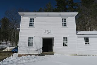
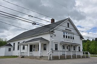
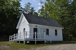
Orange is a town in Grafton County, New Hampshire, United States. The population was 277 at the 2020 census, down from 331 at the 2010 census.

<span class="mw-page-title-main">Piermont, New Hampshire</span> Town in New Hampshire, United States

Piermont is a town in Grafton County, New Hampshire, United States. The population was 769 at the 2020 census. It is home to Camp Walt Whitman and Kingswood Camp for Boys.

<span class="mw-page-title-main">Thornton, New Hampshire</span> Town in New Hampshire, United States

Thornton is a town in Grafton County, New Hampshire, United States. The population was 2,708 at the 2020 census, up from 2,490 at the 2010 census.

<span class="mw-page-title-main">Warren, New Hampshire</span> Town in New Hampshire, United States

Warren is a town in Grafton County, New Hampshire, United States. The population was 825 at the 2020 census, down from 904 at the 2010 census. Warren includes the village of Glencliff. The Appalachian Trail crosses the town in the west.

<span class="mw-page-title-main">Enfield, New Hampshire</span> Town in New Hampshire, United States

Enfield is a town in Grafton County, New Hampshire, United States. The population was 4,465 at the 2020 census. The town includes the villages of Enfield, Enfield Center, Upper Shaker Village, Lower Shaker Village, Lockehaven, and Montcalm.

<span class="mw-page-title-main">Lisbon, New Hampshire</span> Town in New Hampshire, United States

Lisbon is a town in Grafton County, New Hampshire, United States. The population was 1,621 at the 2020 census. Lisbon hosts an annual lilac festival on Memorial Day weekend.

<span class="mw-page-title-main">Littleton, New Hampshire</span> Town in New Hampshire, United States

Littleton is a town in Grafton County, New Hampshire, United States. The population was 6,005 at the 2020 census. Situated at the northern edge of the White Mountains, Littleton is bounded on the northwest by the Connecticut River.

<span class="mw-page-title-main">Plymouth, New Hampshire</span> Town in New Hampshire, United States

Plymouth is a rural town in Grafton County, New Hampshire, United States, in the White Mountains Region. It has a unique role as the economic, medical, commercial, and cultural center for the predominantly rural Plymouth, NH Labor Market Area. Plymouth is located at the confluence of the Pemigewasset and Baker rivers and sits at the foot of the White Mountains. The town's population was 6,682 at the 2020 census. It is home to Plymouth State University, Speare Memorial Hospital, and Plymouth Regional High School.

References

  1. "Board of Selectmen". Town of Grafton, New Hampshire. Retrieved July 18, 2023.
  2. 1 2 "2021 U.S. Gazetteer Files – New Hampshire". United States Census Bureau. Retrieved November 23, 2021.
  3. 1 2 3 "Grafton town, Grafton County, New Hampshire: 2020 DEC Redistricting Data (PL 94-171)". U.S. Census Bureau. Retrieved November 23, 2021.
  4. Gannett, Henry (1905). The Origin of Certain Place Names in the United States. Govt. Print. Off. p. 140.
  5. Foster, Debra H.; Batorfalvy, Tatianna N.; Medalie, Laura (1995). Water Use in New Hampshire: An Activities Guide for Teachers. U.S. Department of the Interior and U.S. Geological Survey.
  6. "Grafton, New Hampshire 1991-2020 Monthly Normals" . Retrieved December 15, 2023.
  7. "Grafton, New Hampshire 1981-2010 Monthly Normals" . Retrieved December 15, 2023.
  8. "xmACIS". National Oceanic and Atmospheric Administration. Retrieved December 15, 2023.
  9. "Census of Population and Housing". Census.gov. Retrieved June 4, 2016.
  10. 1 2 3 "Profile of General Population and Housing Characteristics: 2010 Demographic Profile Data (DP-1): Grafton town, Grafton County, New Hampshire". United States Census Bureau . Retrieved July 10, 2012.
  11. "Grafton County New Hampshire Property Taxes - 2020" . Retrieved October 16, 2020.
  12. "New Hampshire 2019 Property Tax Rates | NH Town Property Taxes". joeshimkus.com. Retrieved October 16, 2020.
  13. 1 2 3 Illing, Sean (December 10, 2020). "How a New Hampshire libertarian utopia was foiled by bears". Vox.
  14. 1 2 3 4 5 6 7 8 Blanchfield, Patrick (October 13, 2020). "The Town That Went Feral: When a group of libertarians set about scrapping their local government, chaos descended. And then the bears moved in". The New Republic . ISSN   0028-6583. Archived from the original on October 13, 2020. Retrieved June 16, 2021.
  15. 1 2 Hongoltz-Hetling, Matthew (May 2018). "Barbearians at the Gate: A journey through a quixotic New Hampshire town teeming with libertarians, fake news, guns, and—possibly—furry invaders". Atavist. No. 79. Archived from the original on June 16, 2018. Retrieved June 16, 2021.
  16. Hongoltz-Hetling, Matthew (2020). A Libertarian Walks Into a Bear: The Utopian Plot to Liberate an American Town (And Some Bears). Public Affairs. ISBN   9781541788510.
  17. https://www.vox.com/policy-and-politics/21534416/free-state-project-new-hampshire-libertarians-matthew-hongoltz-hetling
  18. Austin, Elizabeth (August 30, 2020). "Libertarians Took Control of This Small Town. It Didn't End Well". Washington Monthly . Retrieved July 21, 2023.