Lincoln, New Hampshire

Last updated

Lincoln, New Hampshire
Town
Lincoln NH.JPG
Main Street (NH Route 112)
Lincoln Town Seal.png
Grafton-Lincoln-NH.svg
Coordinates: 44°02′42″N71°40′14″W / 44.04500°N 71.67056°W / 44.04500; -71.67056 Coordinates: 44°02′42″N71°40′14″W / 44.04500°N 71.67056°W / 44.04500; -71.67056
CountryUnited States
State New Hampshire
County Grafton
Incorporated 1764
Government
   Board of Selectmen
  • O.J. Robinson, Chair
  • Tamra Ham
  • Jack Daly
  Town ManagerCarina Park
Area
[1]
  Total131.0 sq mi (339.3 km2)
  Land130.5 sq mi (337.9 km2)
  Water0.5 sq mi (1.4 km2)  0.43%
Elevation
811 ft (247 m)
Population
 (2020) [2]
  Total1,631
  Density12/sq mi (4.8/km2)
Time zone UTC-5 (Eastern)
  Summer (DST) UTC-4 (Eastern)
ZIP Code
03251
Area code 603
FIPS code 33-41860
GNIS feature ID0873646
Website www.lincolnnh.org

Lincoln is a town in Grafton County, New Hampshire, United States. It is the second-largest town by area in New Hampshire. The population was 1,631 at the 2020 census. [2] The town is home to the New Hampshire Highland Games and to a portion of Franconia Notch State Park. Set in the White Mountains, large portions of the town are within the White Mountain National Forest. The Appalachian Trail crosses the western and northeastern parts of the town. Lincoln is the location of Loon Mountain Ski Resort and associated recreation-centered development.

Contents

The primary settlement in town, where 969 people resided at the 2020 census, is defined as the Lincoln census-designated place (CDP) and is located along New Hampshire Route 112 east of Interstate 93. The town also includes the former village sites of Stillwater and Zealand (sometimes known as Pullman) in the town's remote eastern and northern sections respectively, which are now within the White Mountain National Forest.

History

General view c. 1915 General View of Lincoln, NH.jpg
General view c.1915
The Flume c. 1915 The Flume, Franconia Notch, NH.jpg
The Flume c.1915
Hiking trail in Franconia Notch State Park Franconianotchtrail.JPG
Hiking trail in Franconia Notch State Park

In 1764, colonial Governor Benning Wentworth granted 32,456 acres (131.34 km2) to a group of approximately 70 land investors from Connecticut. Lincoln was named after Henry Fiennes Pelham-Clinton, 2nd Duke of Newcastle, 9th Earl of Lincoln – a cousin of the Wentworth governors. He held the position of comptroller of customs for the port of London under King George II and George III, which was important to trade between America and England. [3]

The town was settled about 1782. The 1790 census indicates that it had 22 inhabitants. Rocky soil yielded poor farming, but the area's abundant timber, combined with water power to run sawmills on the Pemigewasset River and its East Branch, helped Lincoln develop into a center for logging. By 1853, the Merrimack River Lumber Company was operating. The railroad transported freight, and increasingly brought tourists to the beautiful mountain region. In 1892, James Everell Henry (1831–1912) bought approximately 100,000 acres (400 km2) of virgin timber and established a logging enterprise at what is today the center of Lincoln. In 1902, he built a pulp and paper mill. He erected the Lincoln House hotel in 1903, although a 1907 fire would nearly raze the community. Until he died in 1912, Henry controlled his company town, installing relatives in positions of civic authority. [4]

In 1917, Henry's heirs sold the business to the Parker Young Company, which in turn sold it to the Marcalus Manufacturing Company in 1946. Franconia Paper took over in 1950, producing 150 tons of paper a day until bankruptcy in 1971, at which time new river classification standards discouraged further papermaking in Lincoln. [4]

Tourism is today the principal business. Nearby Loon Mountain has long drawn skiers, and in recent years has attempted to convert itself into a four-season attraction. The Flume is one of the most visited attractions in the state. Discovered in 1808, it is a natural canyon extending 800 feet (240 m) at the base of Mount Liberty. Walls of Conway granite rise to a height of 70 to 90 feet (21 to 27 m) and are only 12 to 20 feet (3.7 to 6.1 m) apart.

Geography

According to the United States Census Bureau, the town has a total area of 131.0 square miles (339.3 km2), of which 130.5 square miles (337.9 km2) are land and 0.54 square miles (1.4 km2) are water, comprising 0.43% of the town. [1] It is the second-largest town in area in New Hampshire, after Pittsburg.

Lincoln is drained by the Pemigewasset River and its East Branch. Lincoln lies almost fully within the Merrimack River watershed, with the western edge of town in the Connecticut River watershed. [5] Kancamagus Pass, elevation 2,860 feet (870 m), is on the Kancamagus Highway at the eastern boundary. The highest point in Lincoln is the summit of Mount Bond at 4,698 ft (1,432 m) above sea level.

Demographics

Historical population
CensusPop.Note
1790 22
1800 4186.4%
1810 100143.9%
1820 32−68.0%
1830 5056.3%
1840 7652.0%
1850 57−25.0%
1860 7124.6%
1870 710.0%
1880 65−8.5%
1890 11069.2%
1900 541391.8%
1910 1,278136.2%
1920 1,47315.3%
1930 1,5485.1%
1940 1,5600.8%
1950 1,415−9.3%
1960 1,228−13.2%
1970 1,3419.2%
1980 1,313−2.1%
1990 1,229−6.4%
2000 1,2713.4%
2010 1,66230.8%
2020 1,631−1.9%
U.S. Decennial Census [2] [6]

As of the census of 2010, there were 1,662 people, 794 households, and 439 families residing in the town. There were 2,988 housing units, of which 2,194, or 73.4%, were vacant. 2,083 of the vacant units were for seasonal or recreational use. The racial makeup of the town was 96.9% white, 0.3% African American, 0.1% Native American, 1.7% Asian, 0.0% Native Hawaiian or Pacific Islander, 0.3% some other race, and 0.6% from two or more races. 1.7% of the population were Hispanic or Latino of any race. [7]

Of the 794 households, 21.5% had children under the age of 18 living with them, 43.1% were headed by married couples living together, 7.8% had a female householder with no husband present, and 44.7% were non-families. Of all households, 37.0% were made up of individuals, and 13.4% were someone living alone who was 65 years of age or older. The average household size was 2.09, and the average family size was 2.75. [7]

In the town, 18.7% of the population were under the age of 18, 6.8% were from 18 to 24, 19.4% from 25 to 44, 34.8% from 45 to 64, and 20.4% were 65 years of age or older. The median age was 48.5 years. For every 100 females, there were 105.2 males. For every 100 females age 18 and over, there were 103.3 males. [7]

For the period 2011–2015, the estimated median annual income for a household was $37,095, and the median income for a family was $55,326. Male full-time workers had a median income of $31,106 versus $27,381 for females. The per capita income for the town was $24,109. 21.0% of the population and 9.1% of families were below the poverty line. 20.2% of the population under the age of 18 and 8.6% of those 65 or older were living in poverty. [8]

Sites of interest

See also

Related Research Articles

<span class="mw-page-title-main">Albany, New Hampshire</span> Town in New Hampshire, United States

Albany is a town in Carroll County, New Hampshire, United States. The population was 759 at the 2020 census.

<span class="mw-page-title-main">Ashland, New Hampshire</span> Town in New Hampshire, United States

Ashland is a town in Grafton County, New Hampshire, United States. The population was 1,938 at the 2020 census, down from 2,076 at the 2010 census. Located near the geographical center of the state, Ashland is home to Scribner-Fellows State Forest.

<span class="mw-page-title-main">Campton, New Hampshire</span> Town in New Hampshire, United States

Campton is a town in Grafton County, New Hampshire, United States. The population was 3,343 at the 2020 census. Campton, which includes the villages of Blair, Campton Hollow, Lower Campton and West Campton, is home to Blair State Forest and Livermore Falls State Forest. It is located in the foothills of the White Mountains, and parts of the White Mountain National Forest are in the northeast and northwest.

<span class="mw-page-title-main">Ellsworth, New Hampshire</span> Town in New Hampshire, United States

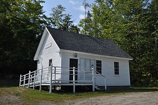
Ellsworth is a town in Grafton County, New Hampshire, United States. The population was 93 at the 2020 census.

<span class="mw-page-title-main">Franconia, New Hampshire</span> Town in New Hampshire, United States

Franconia is a town in Grafton County, New Hampshire, United States. The population was 1,083 at the 2020 census. Set in the White Mountains, Franconia is home to the northern half of Franconia Notch State Park. Parts of the White Mountain National Forest are in the eastern and southern portions of the town. The Appalachian Trail crosses the town.

<span class="mw-page-title-main">Grafton, New Hampshire</span> Town in New Hampshire, United States

Grafton is a town in Grafton County, New Hampshire, United States. The population was 1,385 at the 2020 census.

<span class="mw-page-title-main">Livermore, New Hampshire</span> Township in New Hampshire, United States

Livermore is an unincorporated civil township and ghost town in Grafton County, New Hampshire, United States. It was briefly inhabited as a logging town in the late 19th and early 20th centuries. The site of the former village is about 16 miles (26 km) west of North Conway, about 1.5 miles (2.4 km) off U.S. Route 302 via the U.S. Forest Service Sawyer River Road. The logging operation was established by Daniel Saunders Jr. and Charles W. Saunders, members of the Saunders family. The town was named for Samuel Livermore, a former United States senator who was the grandfather of Daniel Saunders' wife. The population was reported as 2 at the 2020 census.

<span class="mw-page-title-main">Orange, New Hampshire</span> Town in New Hampshire, United States

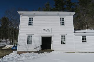
Orange is a town in Grafton County, New Hampshire, United States. The population was 277 at the 2020 census, down from 331 at the 2010 census.

<span class="mw-page-title-main">Thornton, New Hampshire</span> Town in New Hampshire, United States

Thornton is a town in Grafton County, New Hampshire, United States. The population was 2,708 at the 2020 census, up from 2,490 at the 2010 census.

<span class="mw-page-title-main">Warren, New Hampshire</span> Town in New Hampshire, United States

Warren is a town in Grafton County, New Hampshire, United States. The population was 825 at the 2020 census, down from 904 at the 2010 census. Warren includes the village of Glencliff. The Appalachian Trail crosses the town in the west.

<span class="mw-page-title-main">Waterville Valley, New Hampshire</span> Town in New Hampshire, United States

Waterville Valley is a New England town in Grafton County, New Hampshire, United States. The population was 508 at the 2020 census, up from 247 at the 2010 census.

<span class="mw-page-title-main">Woodstock, New Hampshire</span> Town in New Hampshire, United States

Woodstock is a town in Grafton County, New Hampshire, United States. The population was 1,434 at the 2020 census. Woodstock includes the village of North Woodstock, the commercial center. Its extensive land area is largely forested, and includes the Hubbard Brook Experimental Forest. Parts of the White Mountain National Forest are in the east and west. The Appalachian Trail crosses the town's northwest corner. Russell Pond Campground is in the east. West of North Woodstock is the Lost River Reservation.

<span class="mw-page-title-main">Danbury, New Hampshire</span> Town in New Hampshire, United States

Danbury is a town in Merrimack County, New Hampshire, United States. The population was 1,250 at the 2020 census.

<span class="mw-page-title-main">Hill, New Hampshire</span> Town in New Hampshire, United States

Hill is a town in Merrimack County, New Hampshire, United States. The population was 1,017 at the 2020 census. It is home to William Thomas State Forest.

<span class="mw-page-title-main">Wilmot, New Hampshire</span> Town in New Hampshire, United States

Wilmot is a town in Merrimack County, New Hampshire, United States. The population was 1,407 at the 2020 census. The town includes the communities of Wilmot, Wilmot Flat, and North Wilmot.

<span class="mw-page-title-main">Wentworth, New Hampshire</span> Town in New Hampshire, United States

Wentworth is a town in Grafton County, New Hampshire, United States. The population was 845 at the 2020 census, down from 911 at the 2010 census. The town is home to Plummer's Ledge Natural Area, and part of the White Mountain National Forest is in the northeast. The town has a picturesque common, presided over by a Federal-style church and bordered by antique homes.

<span class="mw-page-title-main">Plymouth, New Hampshire</span> Town in New Hampshire, United States

Plymouth is a rural town in Grafton County, New Hampshire, United States, in the White Mountains Region. It has a unique role as the economic, medical, commercial, and cultural center for the predominantly rural Plymouth, NH Labor Market Area. Plymouth is located at the confluence of the Pemigewasset and Baker rivers and sits at the foot of the White Mountains. The town's population was 6,682 at the 2020 census. It is home to Plymouth State University, Speare Memorial Hospital, and Plymouth Regional High School.

<span class="mw-page-title-main">East Branch Pemigewasset River</span> River in New Hampshire, United States

The East Branch of the Pemigewasset River is a 15.8-mile-long (25.4 km) river located in the White Mountains of New Hampshire in the United States. It is a tributary of the Pemigewasset River, part of the Merrimack River watershed.

<span class="mw-page-title-main">North Woodstock, New Hampshire</span> Census-designated place in New Hampshire, United States

North Woodstock is a census-designated place (CDP) and the primary village in the town of Woodstock in Grafton County, New Hampshire, United States. It had a population of 739 at the 2020 census.

Lincoln is a census-designated place (CDP) and the main village in the town of Lincoln in Grafton County, New Hampshire, United States. The population of the CDP was 969 at the 2020 census, out of 1,631 in the entire town.

References

  1. 1 2 "2021 U.S. Gazetteer Files – New Hampshire". United States Census Bureau. Retrieved November 29, 2021.
  2. 1 2 3 "Lincoln town, Grafton County, New Hampshire: 2020 DEC Redistricting Data (PL 94-171)". U.S. Census Bureau. Retrieved November 29, 2021.
  3. Coolidge, Austin J.; John B. Mansfield (1859). A History and Description of New England. Boston, Massachusetts. pp. 553–555.
  4. 1 2 "History of Lincoln, New Hampshire". Archived from the original on May 24, 2006. Retrieved February 6, 2006.
  5. Foster, Debra H.; Batorfalvy, Tatianna N.; Medalie, Laura (1995). Water Use in New Hampshire: An Activities Guide for Teachers. U.S. Department of the Interior and U.S. Geological Survey.
  6. "Census of Population and Housing". Census.gov. Retrieved June 4, 2016.
  7. 1 2 3 "Profile of General Population and Housing Characteristics: 2010 Census Summary File 1 (DP-1): Lincoln town, Grafton County, New Hampshire". U.S. Census Bureau, American Factfinder. Archived from the original on February 13, 2020. Retrieved October 30, 2017.
  8. "Selected Economic Characteristics: 2011-2015 American Community Survey 5-Year Estimates (DP03): Lincoln town, Grafton County, New Hampshire". U.S. Census Bureau, American Factfinder. Archived from the original on February 13, 2020. Retrieved October 30, 2017.