Canterbury, New Hampshire

Last updated

Canterbury, New Hampshire
CanterburyNHCenter2016.jpg
Town center: Canterbury United Community Church (L) & Country Store (R)
Canterbury-NH-Town-Seal.png
Merrimack County New Hampshire incorporated and unincorporated areas Canterbury highlighted.svg
Location in Merrimack County and the state of New Hampshire
Coordinates: 43°20′11″N71°33′53″W / 43.33639°N 71.56472°W / 43.33639; -71.56472
Country United States
State New Hampshire
County Merrimack
Incorporated 1741
Villages
Government
   Board of Selectmen
  • Cheryl Gordon, Chair
  • Kent Ruesswick
  • Scott Doherty
  Town AdministratorKen Folsom
Area
[1]
  Total44.71 sq mi (115.79 km2)
  Land43.88 sq mi (113.64 km2)
  Water0.83 sq mi (2.15 km2)  1.86%
Elevation
599 ft (183 m)
Population
 (2020) [2]
  Total2,389
  Density54/sq mi (21.0/km2)
Time zone UTC-5 (Eastern)
  Summer (DST) UTC-4 (Eastern)
ZIP code
03224
Area code 603
FIPS code 33-09860
GNIS feature ID0873559
Website www.canterbury-nh.org

Canterbury is a town in Merrimack County, New Hampshire, United States. The population was 2,389 at the 2020 census. [2] The Canterbury Shaker Village is in the eastern part of the town.

Contents

History

First granted by Lieutenant Governor John Wentworth in 1727, the town was named for William Wake, Archbishop of Canterbury. [3] It was originally a militia timber fort and trading post of Capt. Jeremiah Clough located on a hill near Canterbury Center, where the Pennacook people came to trade. The town would be incorporated in 1741. [4] There were several garrison houses or stockades in the area as late as 1758. [5]

Geography

According to the United States Census Bureau, the town has a total area of 44.7 square miles (115.8 km2), of which 43.9 square miles (113.6 km2) are land and 0.81 square miles (2.1 km2) are water, comprising 1.86% of the town. [1] The town's highest point is an unnamed summit near Forest Pond and the town's northern border, where the elevation reaches approximately 1,390 feet (420 m) above sea level. Bounded by the Merrimack River on the west, Canterbury is drained on the east by the Soucook River. Canterbury lies fully within the Merrimack River watershed. [6]

Adjacent municipalities

Demographics

Historical population
CensusPop.Note
1790 1,038
1800 1,1147.3%
1810 1,52637.0%
1820 1,69611.1%
1830 1,663−1.9%
1840 1,643−1.2%
1850 1,614−1.8%
1860 1,522−5.7%
1870 1,169−23.2%
1880 1,033−11.6%
1890 964−6.7%
1900 821−14.8%
1910 680−17.2%
1920 655−3.7%
1930 505−22.9%
1940 65930.5%
1950 627−4.9%
1960 6747.5%
1970 89532.8%
1980 1,41057.5%
1990 1,68719.6%
2000 1,97917.3%
2010 2,35218.8%
2020 2,3891.6%
U.S. Decennial Census [2] [7]
Shakers' dwelling c. 1920 Main Dwelling, Canterbury Shaker Village.jpg
Shakers' dwelling c.1920

As of the census [8] of 2000, there were 1,979 people, 749 households, and 590 families residing in the town. The population density was 45.1 inhabitants per square mile (17.4/km2). There were 838 housing units at an average density of 19.1 per square mile (7.4/km2). The racial makeup of the town was 98.59% White, 0.25% African American, 0.25% Asian, 0.05% Pacific Islander, 0.10% from other races, and 0.76% from two or more races. Hispanic or Latino of any race were 0.51% of the population.

There were 749 households, out of which 33.9% had children under the age of 18 living with them, 67.0% were married couples living together, 7.7% had a female householder with no husband present, and 21.2% were non-families. 15.1% of all households were made up of individuals, and 4.9% had someone living alone who was 65 years of age or older. The average household size was 2.64 and the average family size was 2.91.

In the town, the population was spread out, with 24.5% under the age of 18, 4.9% from 18 to 24, 25.6% from 25 to 44, 34.8% from 45 to 64, and 10.4% who were 65 years of age or older. The median age was 42 years. For every 100 females, there were 93.3 males. For every 100 females age 18 and over, there were 93.4 males.

The median income for a household in the town was $58,026, and the median income for a family was $62,583. Males had a median income of $41,302 versus $32,313 for females. The per capita income for the town was $27,374. About 2.0% of families and 2.5% of the population were below the poverty line, including 1.7% of those under age 18 and 2.0% of those age 65 or over.

Arts and culture

Annual cultural events

On the last Saturday in July, the town hosts the annual Canterbury Fair, which includes artisan performances, music performances and a 5K run. [9] [10] [11]

The town hosts a regular Fourth of July parade as well a fireworks show by the town fire department.

Tourism

The biggest attraction in Canterbury is the Shaker Village, established in 1792. At its peak in the 1850s, over 300 people lived, worked and worshiped in 100 buildings on 4,000 acres (16 km2). They made their living by farming, selling seeds, herbs and herbal medicines; and by manufacturing textiles, pails, brooms and other products. The last resident, Sister Ethel Hudson, died in 1992, and the site is now a museum, founded in 1969, to preserve the heritage of the utopian sect. Canterbury Shaker Village is an internationally known, non-profit historic site with 25 original Shaker buildings, four reconstructed Shaker buildings and 694 acres (2.81 km2) of forest, fields, gardens and mill ponds under permanent conservation easement. It has been designated a National Historic Landmark for its architectural integrity and significance. [4] [12] [13]

Canterbury has an active historical society hosting events throughout the year and maintaining the Elizabeth Houser Museum in the old Center Schoolhouse (original one-room school house) as well as an archive of Canterbury-related materials dating to the early 18th century. [14] Among notable works in the archive are the Lunther Cody Collection of Glass Negatives, documenting classic life in New England. [15] [16]

Parks and recreation

Canterbury is home to Ayers State Forest and Shaker State Forest. Ayers State Forest covers 50 acres (20 ha), and Shaker State Forest is 226.5 acres (91.7 ha). [17]

Notable people

Images of Canterbury:

See also

Related Research Articles

<span class="mw-page-title-main">Merrimack County, New Hampshire</span> County in New Hampshire, United States

Merrimack County is a county in the U.S. state of New Hampshire. As of the 2020 Census, the population was 153,808, making it the third most populous county in New Hampshire. Its county seat is Concord, the state capital. The county was organized in 1823 from parts of Hillsborough and Rockingham counties, and is named for the Merrimack River. Merrimack County comprises the Concord, NH Micropolitan Statistical Area, which in turn constitutes a portion of the Boston–Worcester–Providence, MA–RI–NH–CT Combined Statistical Area. In 2010, the center of population of New Hampshire was located in Merrimack County, in the town of Pembroke.

<span class="mw-page-title-main">Belmont, New Hampshire</span> Town in New Hampshire, United States

Belmont is a town in Belknap County, New Hampshire, United States. The population was 7,314 at the 2020 census.

<span class="mw-page-title-main">Gilmanton, New Hampshire</span> Town in New Hampshire, United States

Gilmanton is a town in Belknap County, New Hampshire, United States. The population was 3,945 at the 2020 census. Gilmanton includes the villages of Gilmanton Corners and Gilmanton Ironworks. The town became well known in the 1950s after it was rumored that the popular novel Peyton Place, written by resident Grace Metalious, was based on the town.

<span class="mw-page-title-main">Bridgewater, New Hampshire</span> Town in New Hampshire, United States

Bridgewater is a town in Grafton County, New Hampshire, United States. The population was 1,160 at the 2020 census.

<span class="mw-page-title-main">Ellsworth, New Hampshire</span> Town in New Hampshire, United States

Ellsworth is a town in Grafton County, New Hampshire, United States. The population was 93 at the 2020 census.

<span class="mw-page-title-main">Litchfield, New Hampshire</span> Town in New Hampshire, United States

Litchfield is a town in Hillsborough County, New Hampshire, United States. The population was 8,478 at the 2020 census.

<span class="mw-page-title-main">Allenstown, New Hampshire</span> Town in New Hampshire, United States

Allenstown is a town in Merrimack County, New Hampshire, United States. The population was 4,707 at the 2020 census, up from 4,322 at the 2010 census. Allenstown includes a portion of the village of Suncook. Just over one-half of the town's area is covered by Bear Brook State Park.

<span class="mw-page-title-main">Andover, New Hampshire</span> Town in New Hampshire, United States

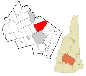
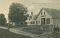
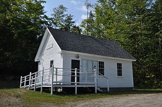
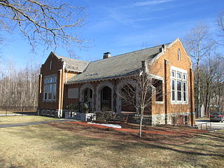
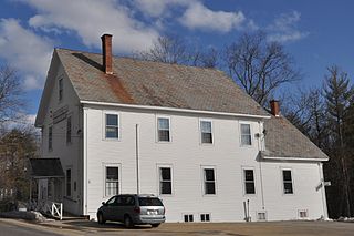
Andover is a town in Merrimack County, New Hampshire, United States. The population was 2,406 at the 2020 census. Andover includes the villages of Cilleyville, Potter Place, East Andover, and West Andover, in addition to the town center. The town is home to Ragged Mountain State Forest and Proctor Academy, a private coeducational preparatory school.

<span class="mw-page-title-main">Bow, New Hampshire</span> Town in New Hampshire, United States

Bow is a town in Merrimack County, New Hampshire, United States. The population was 8,229 at the 2020 census, up from 7,519 at the 2010 census, an increase of 9.4%.

<span class="mw-page-title-main">Bradford, New Hampshire</span> Town in New Hampshire, United States

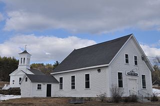
Bradford is a town in Merrimack County, New Hampshire, United States. The population was 1,662 at the 2020 census. The main village of the town, where 372 people resided at the 2020 census, is defined as the Bradford census-designated place (CDP), and is located in the northeast part of the town, west of the junction of New Hampshire routes 103 and 114. The town also includes the village of Bradford Center.

<span class="mw-page-title-main">Chichester, New Hampshire</span> Town in New Hampshire, United States

Chichester is a town in Merrimack County, New Hampshire, United States. The population was 2,665 at the 2020 census.

<span class="mw-page-title-main">Dunbarton, New Hampshire</span> Town in New Hampshire, United States

Dunbarton is a town in Merrimack County, New Hampshire, United States. The population was 3,005 at the 2020 census, up from 2,758 at the 2010 census.

<span class="mw-page-title-main">Epsom, New Hampshire</span> Town in New Hampshire, United States

Epsom is a town in Merrimack County, New Hampshire, United States. The population was 4,834 at the 2020 census.

<span class="mw-page-title-main">Franklin, New Hampshire</span> City in New Hampshire, United States

Franklin is a city in Merrimack County, New Hampshire, United States. At the 2020 census, the population was 8,741, the lowest figure of New Hampshire's 13 cities. Franklin includes the village of West Franklin.

<span class="mw-page-title-main">Hill, New Hampshire</span> Town in New Hampshire, United States

Hill is a town in Merrimack County, New Hampshire, United States. The population was 1,017 at the 2020 census. It is home to William Thomas State Forest.

<span class="mw-page-title-main">Loudon, New Hampshire</span> Town in New Hampshire, United States

Loudon is a town in Merrimack County, New Hampshire, United States. The population was 5,576 at the 2020 census. Loudon is the home of New Hampshire Motor Speedway.

<span class="mw-page-title-main">Northfield, New Hampshire</span> Town in New Hampshire, United States

Northfield is a town in Merrimack County, New Hampshire, United States. The population was 4,872 at the 2020 census.

<span class="mw-page-title-main">Wilmot, New Hampshire</span> Town in New Hampshire, United States

Wilmot is a town in Merrimack County, New Hampshire, United States. The population was 1,407 at the 2020 census. The town includes the communities of Wilmot, Wilmot Flat, and North Wilmot.

<span class="mw-page-title-main">Deerfield, New Hampshire</span> Town in New Hampshire, United States

Deerfield is a town in Rockingham County, New Hampshire, United States. The population was 4,855 at the 2020 census, up from 4,280 in 2010. Deerfield is the location of the annual Deerfield Fair.

<span class="mw-page-title-main">Hooksett, New Hampshire</span> Town in New Hampshire, United States

Hooksett is a town in Merrimack County, New Hampshire, United States. The population was 14,871 at the 2020 census, up from 13,451 at the 2010 census. The town is located between Manchester, the state's largest city, and Concord, the state capital. A prominent landmark is Robie's Country Store, a National Historic Landmark and a frequent stop for presidential candidates during the New Hampshire primary.

References

  1. 1 2 "2021 U.S. Gazetteer Files – New Hampshire". United States Census Bureau. Retrieved December 14, 2021.
  2. 1 2 3 "Canterbury town, Merrimack County, New Hampshire: 2020 DEC Redistricting Data (PL 94-171)". U.S. Census Bureau. Retrieved December 14, 2021.
  3. "Profile for Canterbury, New Hampshire, NH". ePodunk. Retrieved December 13, 2013.
  4. 1 2 "Canterbury, NH" (PDF). Economic & Labor Market Information Bureau. Archived (PDF) from the original on December 14, 2013. Retrieved December 13, 2013.
  5. James Otis Lyford (1912). History of the Town of Canterbury, New Hampshire, 1727-1912: Genealogy and Appendix. Rumford. Retrieved April 10, 2008.
  6. Foster, Debra H.; Batorfalvy, Tatianna N.; Medalie, Laura (1995). Water Use in New Hampshire: An Activities Guide for Teachers. U.S. Department of the Interior and U.S. Geological Survey.
  7. "Census of Population and Housing". Census.gov. Retrieved June 4, 2016.
  8. "U.S. Census website". United States Census Bureau . Retrieved January 31, 2008.
  9. "Canterbury Fair 2013". Canterbury Country Fair. Retrieved December 13, 2013.
  10. "Official Site of the Canterbury Woodchuck Classic 5K Road Race". Canterbury Fair. Retrieved December 13, 2013.
  11. "NH State Fairs". McLean Communications. Retrieved December 13, 2013.
  12. "Shaker Historic Trail". National Park Service. Retrieved December 13, 2013.
  13. "Canterbury Shaker Village". National Historic Landmark Program. Archived from the original on October 9, 2012. Retrieved December 13, 2013.
  14. "History of the town of Canterbury, New Hampshire, 1727-1912". Internet Archive. Retrieved December 13, 2013.
  15. "Historical Society". Town of Canterbury, New Hampshire. Archived from the original on June 15, 2009. Retrieved January 19, 2010.
  16. "The Luther Cody Glass Negative". Find NH History. Retrieved December 13, 2013.
  17. "List of New Hampshire Forests" (PDF). NH Division of Forests and Lands. Archived (PDF) from the original on May 29, 2015. Retrieved March 25, 2014.
  18. "FOSTER, Abiel, (1735 - 1806)". Biographical Directory of the United States Congress. Retrieved December 13, 2013.
  19. "Stephen S. Foster". American Abolitionist. Archived from the original on December 28, 2012. Retrieved December 13, 2013.
  20. "HARPER, Joseph Morrill, (1787 - 1865)". Biographical Directory of the United States Congress. Retrieved December 13, 2013.