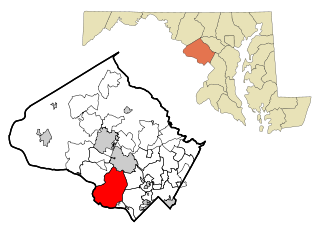
Potomac is a census-designated place (CDP) in Montgomery County, Maryland, United States, named after the nearby Potomac River. Potomac is the seventh most educated small town in America, based on percentage of residents with postsecondary degrees. Bloomberg Businessweek labeled Potomac as the twenty-ninth-richest zip code in the United States in 2011, stating that it had the largest population of any U.S. town with a median income of more than $240,000. In 2012, The Higley Elite 100 published a list of highest-income neighborhoods by mean household income, which included four neighborhoods in Potomac; one of these neighborhoods, "Carderock-The Palisades" was ranked the highest-income neighborhood in the United States, followed by "Beverly Hills-North of Sunset" in Beverly Hills, California and "Swinks Mill-Dominion Reserve" of McLean, Virginia. More recently, two Potomac neighborhoods were ranked among the ten wealthiest neighborhoods in the country by CNBC in 2014. In 2018, data from the American Community Survey revealed that Potomac was the sixth-wealthiest city in the United States. Many Potomac residents work in nearby Washington, D.C. and Northern Virginia.

Indian River is an unincorporated community in Cheboygan County in the U.S. state of Michigan. It is a census-designated place (CDP) for statistical purposes and is not legally recognized as a municipality. The population was 1,959 at the 2010 census.
Fort Hunt is a census-designated place (CDP) in Fairfax County, Virginia, United States. The area is named after Fort Hunt, which was built on the bank of the Potomac River in 1897 to defend Washington, D.C. from naval attack and is now a public park. The area is also notable for its high population of senior citizens and for being one of the first suburbs in wealthy Fairfax County. The population was 16,045 at the 2010 census.

McLean is an unincorporated community and census-designated place (CDP) in Fairfax County in Northern Virginia. McLean is home to many diplomats, military, members of Congress, and high-ranking government officials partially due to its proximity to Washington, D.C., The Pentagon and the Central Intelligence Agency. It is the location of Hickory Hill, the former home of Ethel Kennedy, the widow of Robert F. Kennedy. It is also the location of Salona, the former home of Light-Horse Harry Lee, the Revolutionary War hero.

Tornado, also called Upper Falls, is a census-designated place (CDP) in Kanawha County, West Virginia, United States.

Sterling, Virginia refers most specifically to a census-designated place (CDP) in Loudoun County, Virginia, United States. The population of the CDP as of the 2010 United States Census was 27,822. The CDP boundaries are confined to a relatively small area between Virginia State Route 28 on the west and Virginia State Route 7 on the northeast, excluding areas near SR 606 and the Dulles Town Center.
Countryside is a census-designated place in Loudoun County, Virginia, United States. The population as of the 2010 census was 10,072. It is located about 27 miles (43 km) northwest of Washington and is bounded by the Potomac River to the north, and by Route 7 to the south. Located in eastern Loudoun County, it is about 9 miles (14 km) north of Washington Dulles International Airport. It is bordered by the community of Cascades to the east and by Dulles Town Center to the south, across Route 7.
Monaville is an unincorporated community and census-designated place (CDP) in Logan County, West Virginia, United States. As of the 2010 census, its population was 309.
Valley Head is a census-designated place (CDP) in Randolph County, West Virginia, United States. Valley Head is located on U.S. Route 219, 12 miles (19 km) south-southwest of Huttonsville. Valley Head has a post office with ZIP code 26294. As of the 2010 census, its population was 267.
Hico is a census-designated place (CDP) in Fayette County, West Virginia, United States. Hico is located at the junction of U.S. routes 19 and 60, 7 miles (11 km) northeast of Fayetteville. Hico has a post office with ZIP code 25854. As of the 2010 census, its population was 272.

Mount Carbon is a census-designated place (CDP) in Fayette County, West Virginia, United States. Mount Carbon is located along West Virginia Route 61, 3 miles (4.8 km) southeast of Montgomery, on the south bank of the Kanawha River at the mouth of Armstrong Creek. Mount Carbon has a post office with ZIP code 25139. As of the 2010 census, its population was 428.
Verdunville is an unincorporated community and census-designated place (CDP) in Logan County, West Virginia, United States. It is 3.5 miles (5.6 km) west of Logan, the county seat. Verdunville has a post office with ZIP code 25649. The Verdunville CDP includes the neighboring community of Shegon. As of the 2010 census, the total CDP population was 687.
Stollings is an unincorporated community and census-designated place (CDP) in central Logan County, West Virginia, United States. As of the 2010 census, it had a population of 316.
Henlawson is a census-designated place (CDP) in Logan County, West Virginia, United States. Henlawson has a post office with ZIP code 25624. As of the 2010 census, its population was 442. Henlawson is believed to have been named after a resident, Henry Lawson. Merrill Coal Mines opened Merrill Mines here in 1921 and built homes to house the miners.

Amherstdale is a census-designated place (CDP) in Logan County, West Virginia, United States, situated along Buffalo Creek. The CDP includes the unincorporated communities of Amherstdale, Becco, Fanco, and Braeholm. The CDP population was 350 as of the 2010 census.

Cascades is a census-designated place (CDP) in Loudoun County, Virginia, United States. The population as of the 2010 United States Census was 11,912. Along with nearby Countryside and Lowes Island, it is considered one of the three main components of the Potomac Falls community within Sterling, Virginia.
Lowes Island is a census-designated place (CDP) in Loudoun County, Virginia, United States. The population as of the 2010 United States Census was 10,756. Along with nearby Countryside and Cascades, it is considered one of the three main components of the Potomac Falls community.
Valley Bend is a census-designated place (CDP) in Randolph County, West Virginia, United States. Valley Bend is located on U.S. routes 219 and 250, as well as state routes 55 and 92, 3.5 miles (5.6 km) northwest of Mill Creek. Valley Bend has a post office with ZIP code 26293. As of the 2010 census, its population was 485.
Earling is an unincorporated community and census-designated place (CDP) in Logan County, West Virginia, United States. It was first listed as a CDP prior to the 2020 census. The Earling post office closed on July 1, 1989. The town now shares ZIP Code 25632 with Lyburn and Taplin.
Ferrell is an unincorporated area in Kanawha County, West Virginia, United States.


