
U.S. Route 97 (US 97) is a major north–south route of the United States Numbered Highway System in the Pacific Northwest region. It runs for approximately 670 miles (1,078 km) through the states of California, Oregon, and Washington, primarily serving interior areas on the east side of the Cascade Mountains. The highway terminates to the south at a junction with Interstate 5 (I-5) in Weed, California, and to the north at the Canadian border near Osoyoos, British Columbia, where it becomes British Columbia Highway 97. Major cities on the US 97 corridor include Klamath Falls, Bend, and Redmond in Oregon; and Yakima, Ellensburg, and Wenatchee in Washington. A portion of the highway in California and Oregon is part of the Volcanic Legacy Scenic Byway.
The Little River is a tributary of the North Umpqua River, about 30 miles (48 km) long, in southwestern Oregon in the United States. It drains part of the western side of the Cascade Range east of Roseburg, between the North and South Umpqua.

The McKenzie Pass–Santiam Pass Scenic Byway is an 82-mile-long (132 km) National Scenic Byway in the U.S. state of Oregon. The route is a loop designed to provide a tour of the high Cascade Range northwest of Bend, passing over both McKenzie Pass and Santiam Pass.

The Cascades Lakes Scenic Byway is a National Scenic Byway in central Oregon in the United States. It runs for 66 miles (106 km) in the rugged country of Deschutes and Klamath counties on the east side of the Cascade Range. It offers particularly good views of Mount Bachelor, Broken Top, and the Three Sisters (Oregon) mountains and provides access to many recreational facilities in central Oregon. The route is so named because it weaves past a number of small natural lakes along the Cascades as well as several reservoirs on the upper Deschutes River.

Oregon Route 140 is a state highway in southern Oregon, United States. It is the longest state highway in Oregon, running 237 miles (381 km) from the community of White City, Oregon, through Klamath Falls and on to Lakeview. It then continues east, eventually descending into the state of Nevada.
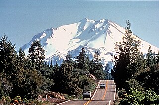
The Volcanic Legacy Scenic Byway is a scenic highway and All-American Road in the U.S. states of California and Oregon. It is roughly 500 mi (804.7 km) long and travels north–south along the Cascade Range past numerous volcanoes. It is composed of two separate National Scenic Byways, the Volcanic Legacy Scenic Byway - Oregon and Volcanic Legacy Scenic Byway - California. The latter also wholly includes the Lassen Scenic Byway.

Oregon Route 31 is a state highway in the U.S. state of Oregon that runs between the Central Oregon cities of La Pine and Lakeview. OR 31 traverses most of the Fremont Highway No. 19 of the Oregon state highway system, named after John C. Frémont. The entire length of OR 31 is part of the Outback Scenic Byway, though the byway extends further south beyond the end of OR 31, to the California border.

Oregon Route 138 is an Oregon state highway that runs between the city of Elkton and a junction with U.S. Route 97 at Diamond Lake Junction. The highway has several distinct stretches, and is the main east–west highway through Roseburg, and provides access to Crater Lake National Park from the north. The highway is signed east–west.

M-65 is a 103.176-mile-long (166.046 km) state trunkline highway in the US state of Michigan. The highway runs between termini on US Highway 23 (US 23) near Omer and Rogers City in the northeastern Lower Peninsula of the state. M-65 runs inland through several small communities in the region, passing through forests and fields along its course. M-65 crosses several watercourses, including the Au Sable River where it runs along the River Road National Scenic Byway. The region also includes the Huron National Forest and the Mackinaw State Forest areas.

Umpqua National Forest, in southern Oregon's Cascade Range, covers an area of 983,129 acres (3,978.58 km2) in Douglas, Lane, and Jackson counties, and borders Crater Lake National Park. The four ranger districts for the forest are the Cottage Grove, Diamond Lake, North Umpqua, and Tiller ranger districts. The forest is managed by the United States Forest Service, headquartered in Roseburg.

State Highway 55 (SH-55) is an Idaho highway from Marsing to New Meadows, connecting with US-95 at both ends.
Hells Canyon Scenic Byway is a designated All-American Road in the U.S. state of Oregon. It is located at the northeast corner of Oregon and comprises Oregon Route 82, Forest Roads 39 and 3365, and most of Oregon Route 86. From the west, the byway begins at the intersection of Oregon Route 82 and Interstate 84 near La Grande and ends near Baker City, at the junction of Interstate 84 and Oregon Route 86. It is 218.4 miles (351.5 km) long.
The Energy Loop: Huntington/Eccles Canyons Scenic Byway is a National Scenic Byway in the state of Utah. It spans approximately 83 miles (134 km) as it travels from Fairview through the Manti-La Sal National Forest southeast to Huntington via Huntington Canyon, and northeast to near Colton via Eccles Canyon.

The Sylamore Scenic Byway is a scenic route in the Arkansas Scenic Byways program. The route runs through the Sylamore Ranger District of the Ozark National Forest in Arkansas for 26.5 miles (42.6 km) in Stone County. It passes through undeveloped forest land as a scenic route to Blanchard Springs Caverns.

State Route 153 (SR-153) is a state highway in the U.S. state of Utah. Just over half of the western portion of the highway has been designated the Beaver Canyon Scenic Byway as part of the Utah Scenic Byways and National Forest Scenic Byways programs.
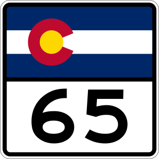
State Highway 65 (SH 65) is a state highway in Colorado that crosses the Grand Mesa. The highway along with a road to Lands End Overlook were designated as the Grand Mesa National Scenic Byway in 1996. SH 65's southern terminus is at SH 92 east of Delta, and its northern terminus is at Interstate 70 (I-70) and U.S. Route 6 (US 6) northeast of Palisade.
The River Road National Scenic Byway is a National Scenic Byway and National Forest Scenic Byway in the US state of Michigan. This 23+1⁄2-mile-long (37.8 km) byway follows M-65 and River Road; it extends eastward into the Huron National Forest and ends in the historic community of Oscoda near Lake Huron. The road parallels the historic Au Sable River which has historically been a major transportation route for floating Michigan's giant white pine from the forest to the saw mill towns on Lake Huron. Along its course, the roadway offers access to several recreational areas as well as the local scenery. The section of the River Road that follows M-65 was added to the State Trunkline Highway System in the 1930s. The River Road was given National Forest Scenic Byway status in 1988, and National Scenic Byway status in 2005.

The Whitefish Bay National Forest Scenic Byway is a National Forest Scenic Byway that runs along Whitefish Bay in the Hiawatha National Forest in the U.S. state of Michigan. The byway mostly follows Federal Forest Highway 42 (FFH 42) through Chippewa County in the Upper Peninsula. As a forest highway, it is maintained jointly by the Chippewa County Road Commission (CCRC) and the U.S. Forest Service (USFS). The route of the byway first existed as an earth road by the 1930s; it was improved into a gravel road in the 1940s and paved between the 1950s and the 1980s. The byway designation was created in 1989.

The Black River National Forest Scenic Byway is a National Forest Scenic Byway that runs along the Black River in the Ottawa National Forest in the U.S. state of Michigan. The byway follows County Road 513 (CR 513) through Gogebic County in the Upper Peninsula. As a county road, it is maintained jointly by the Gogebic County Road Commission (GCRC) with assistance from the U.S. Forest Service (USFS). The byway provides access to several waterfalls and other visitor attractions in the area. The route of the byway first existed as a wagon road in the 1840s and as a county road in the 1920s. The byway designation was instituted on June 20, 1992, and the byway was dedicated later that year.
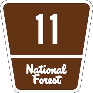
The Superior National Forest Scenic Byway (SNFSB), also known as Forest Highway 11, is a combination of state and county highways in Minnesota that travel between the historic communities of the Iron Range and Lake Superior's North Shore. The byway is 78 miles (126 km) of paved, two-lane roads and is marked by navigational signs with the SNFSB logo. The route was given State Scenic Byway status in 1999.

