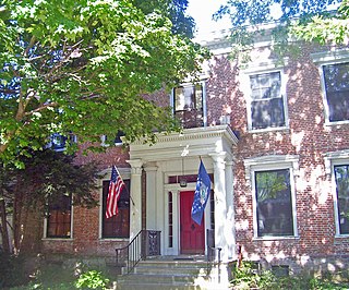
Columbia County is a county located in the U.S. state of New York. As of the 2020 census, the population was 61,570. The county seat is Hudson. The name comes from the Latin feminine form of the name of Christopher Columbus, which was at the time of the formation of the county a popular proposal for the name of the United States.

Copake is a town in Columbia County, New York, United States. The population was 3,346 at the 2020 US census, down from 3,615 at the 2010 census. The town derives its name from a lake, which was known to the natives as Cook-pake, or Ack-kook-peek, meaning "Snake Pond".

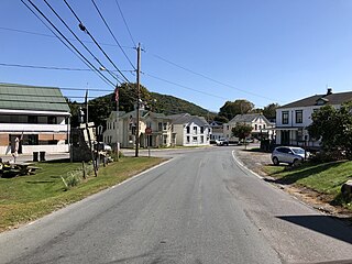
Taghkanic is a town in Columbia County, New York, United States. The town is in the south-central part of the county. The population was 1,231, at the 2020 US census, down from 1,310 at the 2010 census. "Taghkanic" is an older spelling of "Taconic".

Hillside Lake is a hamlet and census-designated place (CDP) in Dutchess County, New York, United States. The population was 1,084 at the 2010 census. It is part of the Poughkeepsie–Newburgh–Middletown, NY Metropolitan Statistical Area as well as the larger New York–Newark–Bridgeport, NY-NJ-CT-PA Combined Statistical Area.

Milan is a town in Dutchess County, New York, United States. The town is in the northern part of the county and is very rural. As of the 2020 census it had a population of 2,245, slightly down from 2,370 in 2010. Milan is located approximately 90 miles (140 km) north of New York City, 60 miles (97 km) south of Albany, and 150 miles (240 km) west of Boston. It is bordered by Rhinebeck and Red Hook to the west, Pine Plains to the east, Stanford to the southeast, Clinton to the south, and Gallatin to the north by Columbia County. The only major route in the town is the historic Taconic State Parkway, though NY 199 serves as the main local thoroughfare.

Town of Kent is a town in Putnam County, New York, United States. The population was 12,900 at the 2020 census. The name is that of an early settler family. The town is in the north-central part of the Putnam County. Many of the lakes are reservoirs for New York City.

Putnam Valley is a town in Putnam County, New York, United States. The population was 11,809 at the 2010 census. Its location is northeast of New York City, in the southwestern part of Putnam County. Putnam Valley calls itself the "Town of Lakes".
Berlin is a town in Rensselaer County, New York, United States. The population was 1,808 at the 2020 census. The town is named after Berlin in Germany, although natives pronounce the name differently, with the accent on the first syllable.
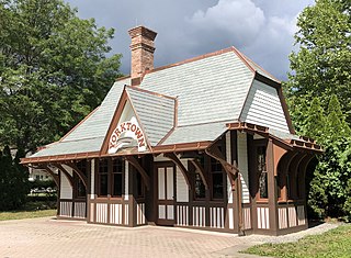
Yorktown Heights is a census-designated place (CDP) in the town of Yorktown in Westchester County, New York, United States. The population was 1,781 at the 2010 census.

The Taconic State Parkway is a 104.12-mile (167.56 km) limited-access parkway between Kensico Dam and Chatham, the longest in the U.S. state of New York. It follows a generally north–south route midway between the Hudson River and the Connecticut and Massachusetts state lines, much of its upper section along the westernmost flank of the Taconic Mountains. It is open only to passenger vehicles, as with other parkways in New York, and maintained by the state Department of Transportation (NYSDOT), the fourth agency to have that responsibility.

The Bear Mountain State Parkway is a parkway located in northern Westchester County, New York, in the United States. It is an incomplete highway, with a 3.85-mile (6.20 km) western section and a 0.73-mile (1.17 km) eastern section; both sections comprise New York State Route 987H, the unsigned reference route assigned to the road by the New York State Department of Transportation (NYSDOT). Crompond Road provides a connection between the two sections. Collectively, the parkway extends from an intersection with US 6, US 9, and US 202 southeast of the Bear Mountain Bridge to an interchange with the Taconic State Parkway in Yorktown.
Taconic Correctional Facility is a medium/minimum security women's prison in Bedford, New York operated by the New York State DOCCS. Although the prison has a maximum 387-person capacity, the incarcerated population was under 170 as of November, 2021.

New York State Route 115 (NY 115) is a 12.45-mile (20.04 km) long state highway located entirely within Dutchess County, New York. The route runs from an intersection with U.S. Route 44 (US 44) and NY 55 in the city of Poughkeepsie along the former Salt Point Turnpike to an interchange with the Taconic State Parkway in Clinton. Throughout its length NY 115 is maintained by the city of Poughkeepsie, Dutchess County, and the New York State Department of Transportation. When NY 115 terminates at the Taconic State Parkway, the Salt Point Turnpike continues as County Route 17 (CR 17) for another four miles to NY 82 in Stanford. NY 115 was designated on April 1, 1980 as part of a maintenance swap by the New York State Department of Transportation, which took over the portion from Smith Street to the Taconic Parkway that was originally CR 75. The portion of the turnpike from the Poughkeepsie city line to Innis Avenue was re-designated New York State Route 984A.

Choate House was built in 1867 by shoe manufacturer Samuel Baker in what is now Pleasantville, New York. It later became the residence of Dr. George C. S. Choate. Choate added a wing as a private sanitarium to accommodate patients being treated for mental and nervous disorders. Horace Greeley was being treated there at the time of his death on November 29, 1872.

East Chatham is a hamlet located partly in the town of Chatham and partly in the town of Canaan, in the state of New York, United States. It is located at the crossroads of a railroad, Interstate 90, and the Taconic State Parkway.
The Taconic Skyline Trail is a 12.1 mi (19.5 km) multi-use trail in the Taconic Mountains of Berkshire County, Massachusetts. The trail extends from U.S. Route 20 in Hancock, Massachusetts, less than 1 mi (1.6 km) east of the New York border, north along the ridgecrest of the Taconic Range within Pittsfield State Forest and officially ending at Brodie Mountain Road on the Hancock/ Lanesborough town line.

Jackson Creek is an 11.0-mile-long (17.7 km) tributary of Sprout Creek in Dutchess County, New York. Via Sprout Creek and Fishkill Creek, water from Jackson Creek flows to the Hudson River. Jackson Creek's subwatershed covers 5,524 acres (22.35 km2) of land.

Jefferson Valley-Yorktown, commonly known as Jefferson Valley, is a census-designated place (CDP) located in the town of Yorktown in Westchester County, New York, United States. The population was 14,142 at the 2010 census. It is a hot spot for local shoppers, due to its Jefferson Valley Mall.

The Pocantico River is a nine-mile-long (14 km) tributary of the Hudson River in western central Westchester County, New York, United States. It rises from Echo Lake, in the town of New Castle south of the hamlet of Millwood, and flows generally southwest past Briarcliff Manor to its outlet at Sleepy Hollow. Portions of the towns of Mount Pleasant and Ossining are within its 16-square-mile (41 km2) watershed.
Griggs Corners is an unincorporated community in Ashtabula County, in the U.S. state of Ohio.
