
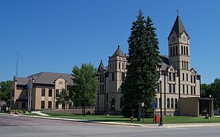
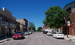
Union County is the southernmost county in the U.S. state of South Dakota. As of the 2020 census, the population was 16,811, making it the 13th most populous county in South Dakota. Its county seat has been Elk Point since April 30, 1865. Originally named Cole County, its name was changed to Union on January 7, 1864, because of Civil War sentiment.

Minnehaha County is a county on the eastern border of the state of South Dakota. As of the 2020 census, the population was 197,214, making it the state's most populous county. It contains over 20% of the state's population. Its county seat is Sioux Falls, South Dakota's most populous city. The county was created in 1862 and organized in 1868. Its name was derived from the Sioux word Mnihaha, meaning "rapid water," or "waterfall".
Lincoln County is a county in the U.S. state of South Dakota. As of the 2020 census, the population was 65,161, making it the third most populous county in South Dakota. Its county seat is Canton. The county was named for Abraham Lincoln, 16th President of the United States.

Yellow Medicine County is a county in the southwestern part of the U.S. state of Minnesota. Its eastern border is formed by the Minnesota River. As of the 2020 census, the population was 9,528. Its county seat is Granite Falls.

Rock County is a county located in the southwestern corner of the U.S. state of Minnesota. According to the 2020 census, its population was 9,704. The county seat is Luverne. It is located within the Sioux Falls MSA.
Redwood Falls is a city in Redwood County, located along the Redwood River near its confluence with the Minnesota River, in the U.S. state of Minnesota. The population was 5,102 at the 2020 census. It is the county seat.

Bismarck–Mandan, colloquially referred to as BisMan, is the metropolitan area composed of Burleigh, Morton, and Oliver counties in the state of North Dakota.

The Sioux City metropolitan statistical area, as defined by the United States Census Bureau, is an area consisting of four counties in three states – Iowa, Nebraska, and South Dakota, anchored by the city of Sioux City, Iowa. As of the 2020 census, the MSA had a population of 145,940. Plymouth County, Iowa, was removed from the definition of the MSA prior to the 2020 census.
The Charleston Metropolitan Statistical Area, as defined by the United States Census Bureau, is an area consisting of three counties in West Virginia, anchored by the city of Charleston. It is the largest metropolitan area entirely within the state of West Virginia. The Huntington Metro Area adds to the Charleston–Huntington, WV-OH-KY CSA and spans three states, while the core county of the Charleston area, Kanawha County, is more populous than the West Virginia portion of the Huntington area.

The Jefferson City metropolitan statistical area, as defined by the United States Census Bureau, is an area consisting of four counties – Cole, Callaway, Moniteau, and Osage – in central Missouri anchored by the city of Jefferson City. As of the 2020 census, the MSA had a population of 150,316. The Jefferson City MSA consists of four counties, and borders the Columbia metropolitan area to the north.

The Asheville metropolitan area is a metropolitan area centered on the principal city of Asheville, North Carolina. The U.S. Office of Management and Budget defines the Asheville, NC Metropolitan Statistical Area, a metropolitan statistical area used by the United States Census Bureau and other entities, as comprising the four counties of Buncombe, Haywood, Henderson, and Madison. The area's population was 424,858 according to the 2010 census, and 469,454 according to the 2020 census.

The Glens Falls Metropolitan Statistical Area, as defined by the United States Census Bureau, is an area consisting of two counties in Upstate New York, anchored by the city of Glens Falls. It is considered to be a part of the greater Capital District. As of the 2010 census, the MSA had a population of 128,942.

The United States Census Bureau defines the Rochester, Minnesota Metropolitan Statistical Area (MSA) as an area consisting of five counties in southeast Minnesota, anchored by the city of Rochester. As of 2018, the US Census Bureau estimates that the Rochester metropolitan statistical area has a population of 221,587. The Rochester–Austin combined statistical area has a population of 259,813 as of 2018.

The Weirton–Steubenville, WV–OH Metropolitan Statistical Area, also known as the Upper Ohio Valley, is a metropolitan statistical area consisting of two counties in the Northern Panhandle of West Virginia and one in Ohio, anchored by the cities of Weirton and Steubenville. As of the 2020 census, the MSA had a population of 116,903. This puts it at 334th largest in the United States. It is also included in the larger Pittsburgh–New Castle–Weirton, PA–OH–WV Combined Statistical Area.

The Rockford Metropolitan Statistical Area, as defined by the United States Census Bureau, is an area consisting of four counties in north-central Illinois, anchored by the city of Rockford. As of the 2010 census, the MSA had a population of 349,431. The Rockford MSA abuts the southern portions of the Janesville-Beloit MSA and the Chicago MSA. It forms the main part of the larger Rockford–Freeport–Rochelle Combined Statistical Area.

The Waterloo–Cedar Falls Metropolitan Statistical Area, as defined by the United States Census Bureau, is an area consisting of three counties in Iowa, anchored by the cities of Waterloo and Cedar Falls. As of the 2000 census, the MSA had a population of 163,706 . As of the 2010 Census, the MSA had a population of 169,484.

The Harrison Micropolitan Statistical Area, as defined by the United States Census Bureau, is an area consisting of two counties in the U.S. state of Arkansas, anchored by the city of Harrison.

The South Bend–Mishawaka Metropolitan Statistical Area, sometimes referred to as Michiana, as defined by the United States Census Bureau, is an area consisting of two counties – one in northern Indiana and one in southwest Michigan (Cass), anchored by the cities of South Bend and Mishawaka in Indiana. As of the 2010 census, the MSA had a population of 319,224.

The St. Cloud Metropolitan Statistical Area, as defined by the United States Census Bureau, consists of two counties in central Minnesota, anchored by the city of St. Cloud. In the 2010 census, the MSA had a population of 201,093; a July 1, 2012, Census Bureau estimate placed the population at 190,014. As of the 2020 census, the population was 199,671.
The Mankato—North Mankato Metropolitan Statistical Area, as defined by the United States Census Bureau, is an area consisting of two counties in south central Minnesota, anchored by the cities of Mankato and North Mankato. It was upgraded from a Micropolitan Statistical Area (μSA) to a Metropolitan Statistical Area (MSA) by the Office of Management and Budget on November 20, 2008. As of the 2020 census, the μSA had a population of 103,566.


