Lampung, officially the Province of Lampung, is a province of Indonesia. It is located on the southern tip of the island of Sumatra. It has a short border with the province of Bengkulu to the northwest, and a longer border with the province of South Sumatra to the north, as well a maritime border with the province of Banten and Jakarta to the east. It is the original home of the Lampung people, who speak their own language, and possess their own written script. Its capital is Bandar Lampung.

The Lingga Regency is a group of islands in Indonesia, located south of Singapore, along both sides of the equator, off the eastern coast of Riau Province on Sumatra island. They are south of the populated Riau Archipelago, known for the industrial island of Batam and the tourist-frequented island of Bintan, although the Lingga Islands themselves are rarely visited due to the infrequent local transportation. The equator goes through the northern tip of Lingga Island, the main island in the archipelago.

Bandar Lampung is the capital and largest city of the Indonesian province of Lampung. Located on the southern tip of Sumatra, Bandar Lampung was originally called Tanjungkarang–Telukbetung, since it was a unification of two major settlements in Lampung, before being renamed in 1983.

Pesisir Selatan Regency is a regency (kabupaten) of West Sumatra Province of Indonesia. It has an area of 6,049.33 km² and a population of 429,246 at the 2010 Census and 504,418 at the 2020 Census; the official estimate as at mid-2023 was 525,355. The regency seat is at the town of Painan, in IV Jurai District.

South Aceh Regency is a regency in the Aceh province of Indonesia. It is located on the west coast of the island of Sumatra. The regency covers an area of 4,173.82 square kilometres and had a population of 202,251 at the 2010 Census, 224,588 in 2015 and 232,414 at the 2020 Census; the official estimate as at mid 2023 was 239,475 . Its population density was thus 48.5 inhabitants/km2 at the 2010 census, 53.8 inhabitants/km2 in 2015, 55.7 inhabitants/km2 at the 2020 census, and 57.4 inhabitants/km2 in mid 2023. The seat of the regency government is at Tapaktuan.

Labuhanbatu Regency, alternatively written in space as Labuhan Batu Regency, is a regency of North Sumatra Province in Indonesia. Its administrative seat is Rantau Prapat. An original regency of the province, it had an area of 9,703 km2 as at early 2008, prior to the separation out of its southern and its north-western districts respectively to create the new South Labuhanbatu and North Labuhanbatu Regencies on 21 July 2008.

Nias Selatan Regency is a regency in North Sumatra province, Indonesia, created on 25 February 2003 by the division of the existing Nias Regency. The regency covers a land area of 2,487.99 square kilometres and according to the 2010 census had a population of 289,708; the 2020 Census showed a population of 360,531, while the official estimate for mid 2023 was 382,539. Its administrative centre is the port of Teluk Dalam. Apart from the southern portion of Nias Island, the regency also includes the smaller Batu Islands to the south, lying between Nias and Siberut; these islands occupy nearly half of the land area of the Regency, but have just 9% of its population.
Yapen Islands Regency is a regency (kabupaten) in Papua Province of eastern Indonesia. It covers an area of 2,432.49 km2 (939.19 sq mi), and had a population of 82,951 at the 2010 Census and 112,676 at the 2020 Census; the official estimate as at mid 2022 was 116,107. It comprises an archipelago which lies in Cenderawasih Bay off the north coast of Western New Guinea.
South Halmahera Regency is a regency of North Maluku Province, Indonesia. It lies partly on Halmahera Island and partly on smaller islands to the west and south of Halmahera. It covers a land area of 8,779.32 km2, and at the 2010 Census it had a population of 198,911 people, while the 2020 Census showed that this had risen to 248,395 and the official estimate in mid 2023 was 255,384 The capital lies at the town of Labuha on Bacan Island.

South Ogan Komering Ulu Regency is an inland regency in the far south of South Sumatra Province, Indonesia. It was created on 18 December 2003 from what had previously been the southernmost districts of Ogan Komering Ulu Regency. It covers an area of 5,493.94 km2, and had a population of 318,428 at the 2010 Census and 408,981 at the 2020 Census; the official estimate as at mid 2022 was 426,687. The administrative centre is the town of Muaradua. It borders Ogan Komering Ulu Regency, East Ogan Komering Ulu Regency and Muara Enim Regency to the north. It also borders Lampung Province to the south and east and Bengkulu Province to the west.
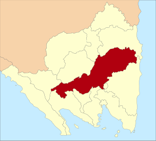
Central Lampung Regency is a regency of the province of Lampung, on Sumatra, Indonesia. On 20 April 1999, two areas were separated from the original regency - the southeastern portion was split off to form a separate East Lampung Regency, while the town of Metro was created as an independent city. The reduced regency has an area of 4,559.57 km2 and had a population of 1,170,048 people at the 2010 census and 1,460,045 at the 2020 census; the official estimate as at mid 2023 was 1,508,331. The regency seat is the town of Gunung Sugih.
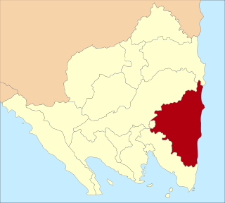
East Lampung Regency is a regency (kabupaten) of Lampung Province, Sumatra, Indonesia. It has an area of 5,325.03 km2 and a population of 951,639 people at the 2010 census and 1,110,340 at the 2020 census. The official estimate as at mid 2023 was 1,114,016 - comprising 566,648 males and 547,368 females. The regency seat is at the town of Sukadana.

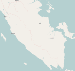
North Lampung Regency is an inland regency (kabupaten) of Lampung Province, Sumatra, in Indonesia. As originally created, it covered a much larger share of the land area of Lampung Province, but on 16 August 1991 its western districts were split off to create a new West Lampung Regency ; on 3 January 1997 its north-eastern districts were split off to create a new Tulang Bawang Regency ; and on 20 April 1999 its north-western districts were split off to create a new Way Kanan Regency.

Pesawaran Regency is a regency (kabupaten) of Lampung Province, Sumatra, Indonesia. It covers an area of 1,278.21 km2, and had a population of 398,848 at the 2010 Census and 477,468 at the 2020 Census; the official estimate as at mid 2022 was 485,671. The regency seat is the town of Gedong Tataan. This regency was formerly part of South Lampung Regency from which it was separated on 17 July 2007.
Pringsewu Regency is a regency of Lampung Province, Sumatra, Indonesia. It has an area of 617.20 km² and had a population of 364,825 people at the 2010 Census and 405,466 at the 2020 Census; the official estimate as at mid 2023 was 437,222. The regency seat is the town of Pringsewu, located 37 kilometres from the provincial capital of Bandar Lampung. The regency was created on 29 October 2008 from the former eastern part of Tanggamus Regency.

Tanggamus Regency is a regency (kabupaten) of Lampung Province, Sumatra, Indonesia. It has an area of 4,654.96 km2 which consists of a land area of 2,855.46 km2 and a sea area of 1,799.5 km2. It had a population of 534,595 at the 2010 Census and 640,275 at the 2020 Census; the official estimate as at mid 2023 was 662,542. The regency seat is the town of Kota Agung Pusat. The regency was created on 21 March 1997 from what were previously the western districts of South Lampung Regency, but districts in its eastern part split away on 29 October 2008 to form the new Pringsewu Regency. It lies in the southwest of the province, and surrounds Semangka Bay on its west, north and east coasts.

Tulang Bawang Regency is a regency (kabupaten) of Lampung Province, Sumatra, Indonesia. The regency was created on 3 January 1997 from the eastern half of North Lampung Regency; when created, it originally covered a much wider area, but on 29 October 2008 the seven northern districts were separated off to form a new Mesuji Regency, and the eight western districts were also separated off to form a new West Tulang Bawang Regency. It now has an area of 3,466.32 square kilometres (1,338.35 sq mi) and had a population of 397,906 at the 2010 Census and 430,021 at the 2020 Census; the official estimate as at mid 2023 was 433,570. The regency seat is the town of Menggala, located about 120 kilometres (75 mi) from the provincial capital of Bandar Lampung. The regency takes its name from the Tulang Bawang River which flows through the province.

Buru Regency is a regency of Maluku province, Indonesia. When it was first created on 4 October 1999, the regency encompassed the entire island ; but on 24 June 2008 the southern 40% of the island was split off to form a separate Buru Selatan Regency. The residual Buru Regency comprises the northern 60% of the island of Buru and covers an area of 7,595.58 km2. The population at the 2010 census was 108,445 and at the 2020 census this had increased to 135,238; the official estimate as at mid 2023 was 139,408. The principal town lies at Namlea.

Southwest Maluku Regency is a regency of Maluku Province, Indonesia. Geographically it forms the most eastern portion of the Lesser Sunda Islands, although it has never been administratively included with them, and politically has always comprised a part of the Maluku Province. It comprises a number of islands and island groups in the south of the province, including Lirang Island, Wetar Island, Kisar Island, Romang Island, the Letti Islands, the Damer Islands, the Sermata Islands and the Babar Islands. The total land area is 4,581.06 km2, and the population was 70,714 at the 2010 Census and 81,928 at the 2020 Census; the official estimate as at mid 2023 was 93,766.

Pesisir Barat Regency is a regency in Lampung Province of Indonesia. It was created on 25 October 2012 from the eight western districts of West Lampung Regency. It covers an area of 2,907.23 km2, and had a population of 141,741 at the 2010 Census and 162,697 at the 2020 Census; the official estimate as of mid-2023 was 174,695. The administrative center is the town of Krui. The majority group in the Pesisir Barat Regency is the Lampung people, while the Bengkulu language is also spoken in some districts.