Special routes of U.S. Route 401 | |
|---|---|
| Location | |
| Country | United States |
| Highway system | |

Several special routes of U.S. Route 401 exist, from South Carolina to North Carolina. In order from south to north, separated by type, they are as follows.
Special routes of U.S. Route 401 | |
|---|---|
| Location | |
| Country | United States |
| Highway system | |
Several special routes of U.S. Route 401 exist, from South Carolina to North Carolina. In order from south to north, separated by type, they are as follows.
U.S. Highway 401 Business | |
|---|---|
| Location | Laurinburg, North Carolina |
| Length | 4.4 mi [1] (7.1 km) |
| Existed | 1960–present |
U.S. Route 401 Business (US 401 Bus) was established in 1960 as a renumbering of US 401A through downtown Laurinburg, it has remained unchanged since. [2]
The entire route is in Laurinburg, Scotland County.
| mi [1] | km | Destinations | Notes | ||
|---|---|---|---|---|---|
| 0.0 | 0.0 | South end of US 15 Business overlap | |||
| 0.5 | 0.80 | ||||
| 1.3 | 2.1 | South end of US 501 Business overlap | |||
| 2.0 | 3.2 | ||||
| 2.9 | 4.7 | North end of US 15/US 501 Business overlap | |||
| 4.4 | 7.1 | ||||
1.000 mi = 1.609 km; 1.000 km = 0.621 mi
| |||||
U.S. Highway 401 Business | |
|---|---|
| Location | Raeford, North Carolina |
| Length | 4.7 mi [3] (7.6 km) |
U.S. Route 401 Business (US 401 Bus) first started unofficially in 1954, US 15A was rerouted onto a bypass around Raeford, the old alignment through downtown was unnumbered until around the early 1960s, when it became US 401 Business. The route follows Harris Avenue, Main Street, and Central Avenue. [2] [4]
The entire route is in Raeford, Hoke County.
| mi [3] | km | Destinations | Notes | ||
|---|---|---|---|---|---|
| 0.0 | 0.0 | ||||
| 0.8 | 1.3 | East end of NC 211 overlap | |||
| 0.9 | 1.4 | West end of NC 20/NC 211 overlap | |||
| 1.2 | 1.9 | East end of NC 20 overlap | |||
| 3.0 | 4.8 | Rockfish Road | |||
| 4.7 | 7.6 | ||||
1.000 mi = 1.609 km; 1.000 km = 0.621 mi
| |||||
U.S. Highway 401 Business | |
|---|---|
| Location | Fayetteville, North Carolina |
| Length | 9.6 mi [5] (15.4 km) |
| Existed | late 1960s–present |
U.S. Route 401 Business (US 401 Bus) was established in late 1960s from a renumbering of US 401, this business loop goes through Fayetteville via Raeford Road, Robeson Street, Martin Luther King Jr Freeway, and Ramsey Street. [2]
The entire route is in Fayetteville, Cumberland County.
| mi [5] | km | Destinations | Notes | ||
|---|---|---|---|---|---|
| 0.0 | 0.0 | ||||
| 2.0 | 3.2 | All American Expressway – Fort Bragg, Pope Army Airfield | |||
| 5.0 | 8.0 | South end of NC 87 overlap | |||
| 6.0 | 9.7 | Hay Street | |||
| 6.3 | 10.1 | North end of NC 87 overlap | |||
| 7.0 | 11.3 | Ramsey Street | |||
| 8.0 | 12.9 | Rosehill Road | |||
| 9.6 | 15.4 | ||||
1.000 mi = 1.609 km; 1.000 km = 0.621 mi
| |||||
U.S. Highway 401 Business | |
|---|---|
| Location | Rolesville, North Carolina |
| Length | 4.67 mi (7.52 km) |
| Existed | 2015–present |
U.S. Route 401 Business (US 401 Bus) is a 4.67-mile (7.52 km) business loop along Main Street, through downtown Rolesville. The Town of Rolesville had been planning this long time, since 1985, but the project never went through. U.S. 401 initially lead in and out of the town until its 2015 opening. Approved by AASHTO on May 29, 2014; its official establishment is dependent on the opening of the Rolesville bypass, which will be signed as U.S. 401. [6] On July 16, 2015, the Rolesville bypass opened. [7]
U.S. Highway 401 Business | |
|---|---|
| Location | Bennettsville, South Carolina |
| Length | 3.4 mi [8] (5.5 km) |
| Existed | 1958[ citation needed ]–1989[ citation needed ] |
U.S. Route 401 Business (US 401 Bus.) was a 3.4-mile (5.5 km) business route of US 401 that traveled through Bennettsville via Main Street and Tyson Avenue. It was established in 1958, when mainline US 401 was bypassed south of Bennettsville; it followed the old alignment. By 1990, the highway was decommissioned with most being replaced by an extension of SC 385.[ citation needed ]
U.S. Highway 401A | |
|---|---|
| Location | Laurinburg, North Carolina |
| Length | 4.4 mi [1] (7.1 km) |
| Existed | 1957–1960 |
U.S. Route 401 Alternate (US 401A) was established in 1957, when US 401 was re-established, it replaced US 15A alignment through downtown Laurinburg, via Main Street. It was renumbered in 1960 into US 401 Business. [2] [4]

U.S. Route 401 (US 401) is a north–south United States highway, a spur of U.S. Route 1, that travels along the Fall Line from Sumter, South Carolina to Interstate 85 near Wise, North Carolina.
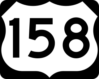
U.S. Route 158 (US 158) is an east–west United States highway that runs for 350 miles (560 km) from Mocksville to Whalebone Junction in Nags Head, entirely in the state of North Carolina. It is also a critical route that connects the cities of Winston-Salem, Summerfield, and Reidsville with one another.

North Carolina Highway 24 (NC 24) is the longest primary state highway in the U.S. state of North Carolina. Traveling east–west between the Charlotte metropolitan area and the Crystal Coast, connecting the cities of Charlotte, Fayetteville, Jacksonville and Morehead City.

North Carolina Highway 211 (NC 211) is a 162.5-mile-long (261.5 km) primary state highway in the U.S. state of North Carolina. It traverses mostly through the Sandhills and Coastal Plain regions of the state; connecting the cities of Candor, Aberdeen, Raeford, Lumberton, Bladenboro, and Southport.

North Carolina Highway 11 (NC 11) is a primary state highway in the U.S. state of North Carolina. Traveling 193.2 miles (310.9 km) in a north–south alignment through Eastern North Carolina, it connects the towns and cities of Wallace, Kenansville, Kinston, Greenville and Murfreesboro.

North Carolina Highway 87 (NC 87) is a primary state highway in the U.S. state of North Carolina. NC 87 begins in the Atlantic coastal town of Southport and crosses into Virginia at the Virginia state line five miles (8 km) north of Eden in Rockingham County. At 240 miles (390 km) in length, NC 87 is the second longest state highway in the U.S. state of North Carolina with only North Carolina Highway 24 being longer. Labeled as a north–south route, NC 87 travels along a relatively straight southeast–northwest path, connecting Cape Fear region with the Piedmont. It is also the main north-south route connecting the cities of Fayetteville, Sanford, Burlington and Reidsville.

North Carolina Highway 98 (NC 98) is a primary state highway in the U.S. state of North Carolina and a semi-urban traffic artery connecting Durham, Wake Forest, and Bunn as well as many small to medium-sized towns in the north portion of The Triangle region of North Carolina. Running from downtown Durham, the route leaves the city to the east, running into a rural area near Falls Lake. As the road approaches Wake Forest, it widens to a four-lane divided highway and runs along the southern side of the city. Once leaving Wake Forest NC 98 becomes a two lane road again, running through rural areas east of Bunn. After a short concurrency with NC 39, NC 98 continues southeast to reach its eastern terminus at US 64 Alternate and NC 231 west of Spring Hope.

A total of at least twenty-three special routes of U.S. Route 17 exist; two in Florida, five in South Carolina, fifteen in North Carolina, and six in Virginia.

North Carolina Highway 59 (NC 59) was an 8.288-mile-long (13.338 km) primary state highway in the U.S. state of North Carolina that ran through Cumberland County from Interstate 95 (I-95) near Hope Mills to U.S. Route 401 Business in Owens, within the city limits of Fayetteville.

A total of at least seven special routes of U.S. Route 301 exist and at least eleven have been deleted.

Several special routes of U.S. Route 70 exist. In order from west to east, these special routes are as follows.

Several special routes of U.S. Route 74 exist. In order from west to east they are as follows.

Several special routes of U.S. Route 64 exist. In order from west to east they are as follows.
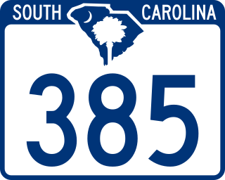
South Carolina Highway 385 (SC 385) is a 11.730-mile (18.878 km) primary state highway in the U.S. state of South Carolina. It connects the city of Bennettsville with northern Marlboro County.

Several special routes of U.S. Route 29 exist. In order from south to north they are as follows.

Several special routes of U.S. Route 421 exist. In order from south to north they are as follows.

A total of at least eight special routes of U.S. Route 501 exist and at least four have been deleted.

Several special routes of U.S. Route 15 exist. In order from south to north they are as follows.

Several special routes of U.S. Route 25 exist. In order from south to north they are as follows.
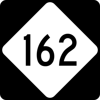
North Carolina Highway 162 (NC 162) is a primary state highway in the U.S. state of North Carolina. The highway serves as an alternate route to NC 59 by bypassing downtown Hope Mills.