
Kootenai County is located in the U.S. state of Idaho. In 2018, the United States Census Bureau estimated the county's population at 161,505, making it the third-most populous county in Idaho. The county seat and largest city is Coeur d'Alene. The county was established in 1864 and named after the Kootenai tribe.

Scouting in Idaho has a long history, from the 1910s to the present day, serving thousands of youth in programs that suit the environment in which they live.

Coeur d'Alene is a city and the county seat of Kootenai County, Idaho, United States. It is the largest city in North Idaho and the principal city of the Coeur d'Alene Metropolitan Statistical Area. In 2019, the United States Census Bureau estimated the city's population at 52,414. Coeur d'Alene is a satellite city of Spokane, which is located about thirty miles (50 km) to the west in the state of Washington. The two cities are the key components of the Spokane–Coeur d'Alene Combined Statistical Area, of which Coeur d'Alene is the third-largest city. The city is situated on the north shore of the 25-mile (40 km) long Lake Coeur d'Alene and to the west of the Coeur d'Alene Mountains. Locally, Coeur d'Alene is known as the "Lake City," or simply called by its initials, "CDA."

Farragut State Park is a public recreation area located at the southern tip of Lake Pend Oreille in the Coeur d'Alene Mountains of the Idaho Panhandle in the northwest United States. The 4,000-acre (1,600 ha) state park is five miles (8 km) east of Athol in Kootenai County, about thirty miles (50 km) northeast of Coeur d'Alene. Activities include camping, picnicking, hiking, mountain biking, cycling, fishing, boating, swimming, water sports, orienteering, disc golf, flying model aircraft, archery, and horseback riding.

The Coeur d'Alene are a Native American nation and one of five federally recognized tribes in the state of Idaho.

Clearwater National Forest with headquarters on the Nez Perce Reservation at Kamiah is located in North Central Idaho in the northwestern United States. The forest is bounded on the east by the state of Montana, on the north by the Idaho Panhandle National Forest, and on the south and west by the Nez Perce National Forest and Palouse Prairie.

The Idaho Panhandle—locally known as North Idaho—is a region in the U.S. state of Idaho encompassing the state's 10 northernmost counties: Benewah, Bonner, Boundary, Clearwater, Idaho, Kootenai, Latah, Lewis, Nez Perce, and Shoshone. The Panhandle is bordered by the state of Washington to the west, Montana to the east, and the Canadian province of British Columbia to the north. The Idaho panhandle, along with Eastern Washington, comprises the region known as the Inland Northwest, headed by its largest city, Spokane, Washington.

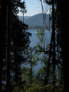
Lake Coeur d'Alene, officially Coeur d'Alene Lake, is a natural dam-controlled lake in North Idaho, located in the Pacific Northwest region of the United States. At its northern end is the city of Coeur d'Alene. It spans 25 miles (40 km) in length and ranges from 1 to 3 miles (5 km) wide with over 109 miles (175 km) of shoreline.

Caribou–Targhee National Forest is located in the states of Idaho and Wyoming, with a small section in Utah in the United States. The forest is broken into several separate sections and extends over 2.63 million acres (10,600 km2). To the east the forest borders Yellowstone National Park, Grand Teton National Park and Bridger–Teton National Forest. Most of the forest is a part of the 20-million-acre (81,000 km2) Greater Yellowstone Ecosystem.

The Kaniksu National Forest is a U.S. National Forest located in northeastern Washington, the Idaho Panhandle, and northwestern Montana. It is one of three forests that are aggregated into the Idaho Panhandle National Forests, along with the Coeur d'Alene National Forest and St. Joe National Forest. Kaniksu National Forest has a total area of 1,627,833 acres (6,587.6 km2). About 55.7% is in Idaho, 27.9% in Montana, and 16.4% in Washington.

The Coeur d'Alene is a U.S. National Forest located in the Idaho panhandle and is one of three forests that are aggregated into the Idaho Panhandle National Forests. Coeur d'Alene National Forest is located in Shoshone, Kootenai, and Bonner counties in northern Idaho. It has a total area of 726,362 acres.
The Idaho Panhandle National Forests are a jointly administered set of three national forests located mostly in the U.S. state of Idaho. In 1973, major portions of the Kaniksu, Coeur d'Alene, and St. Joe National Forests were combined to be administratively managed as the Idaho Panhandle National Forests (IPNF). The IPNF consists of more than 2.5 million acres (10,000 km2) of public lands in the panhandle of north Idaho, with small areas extending into eastern Washington (4.7%) and western Montana (1.2%). The northernmost portion of the IPNF share a boundary with Canada. The Forest Supervisor's office is located in Coeur d'Alene, Idaho with district office's in Bonners Ferry, Sandpoint, Priest River, Fernan and Smelterville, and St. Maries and Avery.

The Silver Valley is a region in the northwest United States, in the Coeur d'Alene Mountains in northern Idaho. It is noted for its mining heritage, dating back to the 1880s.

Lookout Pass Ski and Recreation Area is a ski area in the western United States. It is at Lookout Pass on Interstate 90, on the border of Idaho and Montana, five miles (8 km) east of Mullan, Idaho. It has a summit elevation of 5,650 ft (1,720 m) on Runt Mountain with a vertical drop of 1,150 ft (350 m) on the northeast-facing slopes. Lookout Pass operates seven days per week from the beginning of the ski season until late March then six days a week until closing, which is usually mid-April.

Hobo Cedar Grove Botanical Area is located near Clarkia in the St. Joe National Forest of Idaho in the northwestern United States. The grove is a 240-acre (97 ha) area containing old growth Western Red Cedar estimated to be 500 years old. The upper area contains Western Red Cedar surrounded by Oregon boxwood. The lower portion of the area contain the giant cedars surrounded by Lady-fern. The forest was designated a National Natural Landmark in 1980.
The Coeur d'Alene salamander is a species of woodland salamander (Plethodon) in the family of lungless salamanders (Plethodontidae) found in northern Idaho, western Montana, and southeastern British Columbia. This species was discovered in 1939 by James R. Slater and John W. Slipp on the south shore of Lake Coeur d'Alene in northern Idaho. It was once considered to be a subspecies of Van Dyke's salamander, as P. vandykei idahoensis, but appears to be a distinct and separate species as originally suggested by Slater and Slipp (1940).

The Saint Joe River is a 140-mile (225 km) long tributary of Coeur d'Alene Lake in northern Idaho. Beginning at an elevation of 6,487 feet (1,977 m) in the Northern Bitterroot Range of eastern Shoshone County, it flows generally west through the Saint Joe River Valley and the communities of Avery and Calder. Past Calder, it flows into Benewah County and through the town of St. Maries, where it receives its largest tributary, the Saint Maries River. It then turns northwest, passing through Heyburn State Park before reaching its mouth just north of the Kootenai County line. Much of the river's route through Heyburn State Park is partially flooded due to raised water levels from the Washington Water Power dam at Post Falls on the Spokane River below Coeur d'Alene Lake. With a mouth elevation of 2,129 feet (648.9 m), it is claimed to be the highest navigable river in the world. Multiple rivers in Canada are both higher and navigable, including the Babine, and Middle Rivers.
The Palouse Forest Reserve and after March 4, 1907, the Palouse National Forest was established by Presidential Proclamation on March 2, 1907 and was one of President Theodore Roosevelt's Midnight forests, created before the federal law banning new forest reserves in six western states, including Idaho, became effective.
Heyburn State Park is a public recreation area in the U.S. state of Idaho. It is located almost entirely in Benewah County, with a small portion extending into southern Kootenai County. The park was founded in 1908 and is the oldest state or provincial park in the Pacific Northwest. The park has 5,744 acres (23.2 km2) of land and 2,332 acres (9.4 km2) of water on three lakes: Benewah, Chatcolet, and Hidden. A dam constructed on the Spokane River in Post Falls in 1906 raised the level of Lake Coeur d'Alene, connecting it to the park's three lakes. The surface elevation of the lakes is 2,125 feet (648 m) above sea level. The park's year-round recreational opportunities include camping, boating, hiking, horseback riding, fishing, and picnicking.
Idaho v. United States, 533 U.S. 262 (2001), was a United States Supreme Court case in which the Court held that the United States, not the state of Idaho, held title to lands submerged under Lake Coeur d'Alene and the St. Joe River, and that the land was held in trust for the Coeur d'Alene Tribe as part of its reservation, and in recognition of the importance of traditional tribal uses of these areas for basic food and other needs.

