
Hertford is the county town of Hertfordshire, England, and is also a civil parish in the East Hertfordshire district of the county. The parish had a population of 26,783 at the 2011 census.
Much Hadham, formerly known as Great Hadham, is a village and civil parish in the district of East Hertfordshire, Hertfordshire, England. The parish of Much Hadham contains the hamlets of Perry Green and Green Tye, as well as the village of Much Hadham itself and Hadham Cross. It covers 4,490 acres (1,820 ha). The village of Much Hadham is situated midway between Ware and Bishop's Stortford. The population of the parish was recorded as 2,087 in the 2011 census, an increase from 1,994 in 2001.

Cheshunt is a town in the Borough of Broxbourne in Hertfordshire, England, 13 miles (21 km) north of London on the River Lea and Lee Navigation and directly south of Broxbourne. It contains a section of the Lee Valley Park, including much of the River Lee Country Park. To the north lies Broxbourne and Wormley, Waltham Abbey to the east, Waltham Cross and Enfield to the south, and Cuffley to the west.

Ware is a town and civil parish in the East Hertfordshire district, in the county of Hertfordshire, England. It is close to the county town of Hertford. In 2011 the parish had a population of 18,799.

St Margarets railway station is on the Hertford East branch line off the West Anglia Main Line in the east of England, serving the villages of Stanstead St Margarets and Stanstead Abbotts, Hertfordshire. It is 20 miles 25 chains (32.7 km) down the line from London Liverpool Street and is situated between Rye House and Ware. Its three-letter station code is SMT. It is in the civil parish of Great Amwell.
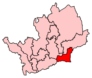
Broxbourne is a constituency in Hertfordshire represented in the House of Commons of the UK Parliament since 2005 by Charles Walker of the Conservative Party.
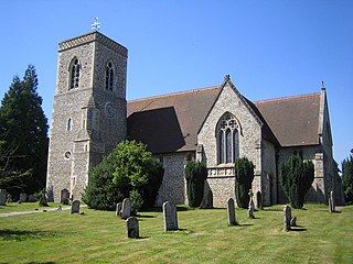
Lilley is a small village and civil parish situated between Hitchin and Luton in Hertfordshire, England. Lilley stands on high ground: nearby Telegraph Hill is just over 600 feet above sea level.

Aspenden is a village and civil parish in the East Hertfordshire district of Hertfordshire, England. It is just to the south of Buntingford. The Prime Meridian passes just to the east of it. Its name, which means 'valley of aspen trees', was first attested in 1212.

Barkway is a long-established village and civil parish in the North Hertfordshire district of Hertfordshire, England, about five miles south-east of Royston, 35 miles from London and 15 miles from the centre of Cambridge. The Prime Meridian passes a mile or so to the west of Barkway.

Barley is a village and civil parish in the district of North Hertfordshire, England. According to the 2001 census, it has a population of 659, increasing to 662 at the 2011 Census. The place-name refers to a lea or meadow and not to the grain-producing plant. Coincidentally to the southwest lies the village of Reed. The Prime Meridian passes to the west of Barley, which is located on the Royston to Saffron Walden road, as well as the medieval London to Cambridge road.

St. Margaretsbury Football Club is a football club based in Stanstead Abbotts, near Ware, Hertfordshire, England. They are currently members of the Eastern Counties League Division One South and play at the Recreation Ground.

Westmill is an English village and civil parish in the East Hertfordshire district of Hertfordshire, with an area of 1036 hectares. A population of 264 was recorded in the 2001 National Census. It lies just to the south of Buntingford, beside the River Rib.

Hertford Heath is a village and civil parish near the county town of Hertford in Hertfordshire, England. The population at the 2011 Census was 2,672.
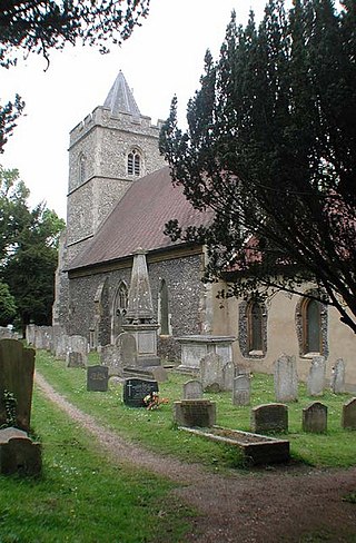
Great Amwell is a village and civil parish in the East Hertfordshire district, in the county of Hertfordshire, England. It is 1+1⁄2 miles (2.4 km) southeast of Ware and about 20 miles (32 km) north of London. In 2011 the parish had a population of 2353.
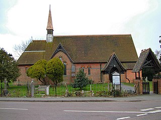
Little Amwell was a village and civil parish in Hertfordshire, England, lying 1.6 miles (2.6 km) south-east of the county town of Hertford. The old village of Little Amwell forms the northern part of the modern village of Hertford Heath. The civil parish of Little Amwell was abolished in 1990, merging with parts of the neighbouring parishes of Great Amwell, Stanstead St Margarets, and Ware to form the new parish of Hertford Heath. Little Amwell remains the name of the ecclesiastical parish which covers Hertford Heath. In 1961 the parish had a population of 982.

Stanstead Abbotts is a village and civil parish in the district of East Hertfordshire, Hertfordshire, England; it lies on the county boundary with Essex. At the 2001 census, the parish had a population of 1,983.
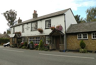
Brickendon is a village in the civil parish of Brickendon Liberty in the district of East Hertfordshire about 3 miles (4.8 km) south of the county town Hertford, and is served by Bayford railway station.
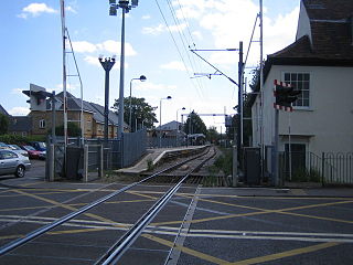
The Hertford East branch line is a railway line in Hertfordshire, England running between Hertford East and Broxbourne. The line follows the route of the Lea Valley, serving intermediate towns and villages. It branches off the West Anglia Main Line north of Broxbourne, and could be seen as part of the Lea Valley lines—a collection of commuter routes into London. It is 5 miles 64 chains (9.33 km) in length.

Hertingfordbury is a small village in Hertfordshire, England, close to the county town of Hertford. It was mentioned in the Domesday Book of 1086. Hertingfordbury is also the name of a neighbouring civil parish, which does not contain the village. Hertingfordbury Village is located within the Castle ward of local government Hertford Town Council. The population of the civil parish as of the 2021 census was 689.

Wormley is a village and former civil parish, lying between Hoddesdon and Cheshunt in the Broxbourne district, in the county of Hertfordshire, England. The village is part of the ward of Wormley and Turnford, which had a population of 8,146 at the 2001 census. In 1931 the parish had a population of 930. The parish was abolished in 1935 and absorbed into Hoddesdon.


