Wolverine Lake, Michigan

Last updated

Wolverine Lake, Michigan
Village of Wolverine Lake
Wolverine Lake Village Offices.jpg
Wolverine Lake Village Offices
Wolverine Lake, MI location.png
Location within Oakland County
USA Michigan location map.svg
Red pog.svg
Wolverine Lake
Location within the state of Michigan
Usa edcp location map.svg
Red pog.svg
Wolverine Lake
Location within the United States
Coordinates: 42°33′09″N83°29′25″W / 42.55250°N 83.49028°W / 42.55250; -83.49028
CountryUnited States
State Michigan
County Oakland
Township Commerce
Incorporated1954
Government
  Type Village council
  PresidentBrian Nedrow
   Clerk David Gillam
Area
[1]
   Village 1.68 sq mi (4.34 km2)
  Land1.26 sq mi (3.26 km2)
  Water0.42 sq mi (1.09 km2)
Elevation
932 ft (284 m)
Population
 (2020)
   Village 4,544
  Density3,612.08/sq mi (1,394.82/km2)
   Metro
4,285,832 (Metro Detroit)
Time zone UTC-5 (Eastern (EST))
  Summer (DST) UTC-4 (EDT)
ZIP code(s)
48390
Area code(s) 248 and 947
FIPS code 26-88260 [2]
GNIS feature ID1616717 [3]
Website Official website

Wolverine Lake is a village in Oakland County in the U.S. state of Michigan. The population was 4,312 at the 2010 census. The village is located within Commerce Township. [4]

Contents

History

Before 1918, Howard Stuart and L. A. Green proposed the idea of damming several small streams in order to create a larger lake. The project was completed in March 1923, and the growing community was petitioned to be named Wolverine Lake by the end of the year. The name was chosen after the wolverine, which is the state animal. Wolverine Lake incorporated as a village in 1954. [5]

Geography

According to the U.S. Census Bureau, the village has a total area of 1.68 square miles (4.35 km2), of which 1.26 square miles (3.26 km2) is land and 0.42 square miles (1.09 km2) (25.0%) is water. [6]

Demographics

Historical population
CensusPop.Note
1960 2,404
1970 4,30178.9%
1980 4,96815.5%
1990 4,727−4.9%
2000 4,415−6.6%
2010 4,312−2.3%
2020 4,5445.4%
U.S. Decennial Census [7]

2010 census

As of the census [8] of 2010, there were 4,312 people, 1,733 households, and 1,214 families living in the village. The population density was 3,395.3 inhabitants per square mile (1,310.9/km2). There were 1,840 housing units at an average density of 1,448.8 per square mile (559.4/km2). The racial makeup of the village was 95.9% White, 0.7% African American, 0.4% Native American, 1.2% Asian, 0.4% from other races, and 1.4% from two or more races. Hispanic or Latino of any race were 2.4% of the population.

There were 1,733 households, of which 31.4% had children under the age of 18 living with them, 55.7% were married couples living together, 9.2% had a female householder with no husband present, 5.1% had a male householder with no wife present, and 29.9% were non-families. 24.1% of all households were made up of individuals, and 5.6% had someone living alone who was 65 years of age or older. The average household size was 2.49 and the average family size was 2.95.

The median age in the village was 42.7 years. 21.6% of residents were under the age of 18; 7.3% were between the ages of 18 and 24; 25.2% were from 25 to 44; 34.3% were from 45 to 64; and 11.6% were 65 years of age or older. The gender makeup of the village was 51.6% male and 48.4% female.

2000 census

As of the census [2] of 2000, there were 4,415 people, 1,671 households, and 1,253 families living in the village. The population density was 3,391.9 inhabitants per square mile (1,309.6/km2). There were 1,733 housing units at an average density of 1,331.4 per square mile (514.1/km2). The racial makeup of the village was 97.76% White, 0.41% African American, 0.11% Native American, 0.59% Asian, 0.07% Pacific Islander, 0.25% from other races, and 0.82% from two or more races. Hispanic or Latino of any race were 1.04% of the population.

There were 1,671 households, out of which 35.8% had children under the age of 18 living with them, 63.9% were married couples living together, 7.5% had a female householder with no husband present, and 25.0% were non-families. 20.0% of all households were made up of individuals, and 5.2% had someone living alone who was 65 years of age or older. The average household size was 2.64 and the average family size was 3.06.

In the village, the population was spread out, with 25.5% under the age of 18, 6.0% from 18 to 24, 33.2% from 25 to 44, 27.8% from 45 to 64, and 7.5% who were 65 years of age or older. The median age was 38 years. For every 100 females, there were 103.1 males. For every 100 females age 18 and over, there were 102.2 males.

The median income for a household in the village was $65,682, and the median income for a family was $70,893. Males had a median income of $50,054 versus $32,342 for females. The per capita income for the village was $30,026. About 2.2% of families and 2.7% of the population were below the poverty line, including 3.0% of those under age 18 and 4.1% of those age 65 or over.

Education

It is within the Walled Lake Consolidated Schools. [9] Guest Elementary School and Loon Lake Elementary School serve portions of Wolverine Lake. [10] [11] Portions are zoned to James R. Geisler Middle School, [12] and portions are zoned to Sarah Banks Middle School. [13] All of Wolverine Lake is zoned to Walled Lake Central High School. [14]

Related Research Articles

<span class="mw-page-title-main">Wolverine, Michigan</span> Village in Michigan, United States

Wolverine is a village in Cheboygan County in the U.S. state of Michigan. The population was 244 at the 2010 census.

<span class="mw-page-title-main">Dimondale, Michigan</span> Village in Michigan, United States

Dimondale is a village in Eaton County in the U.S. state of Michigan. The population was 1,234 at the 2010 census. The village is located within Windsor Charter Township. Dimondale is a suburb of Lansing, which is northeast of the village in Ingham County.

<span class="mw-page-title-main">Iron River, Michigan</span> City in Michigan, United States

Iron River is a city in Iron County in the U.S. state of Michigan. As of the 2020 census, the city population was 3,007. The city is situated at the southeast corner of Iron River Township, but is administratively autonomous.

<span class="mw-page-title-main">Augusta, Michigan</span> Village in Michigan, United States

Augusta is a village in Kalamazoo County in the U.S. state of Michigan. The population was 885 at the 2010 census. The village is mostly within Ross Township, though a small portion extends south into Charleston Township.

<span class="mw-page-title-main">Sand Lake, Michigan</span> Village in Michigan, United States

Sand Lake is a village in Kent County in the U.S. state of Michigan. The population was 522 at the 2020 census.

<span class="mw-page-title-main">Clinton, Lenawee County, Michigan</span> Village in Michigan, United States

Clinton is a village in Lenawee County in the Irish Hills area of the U.S. state of Michigan. The population was 2,336 at the 2010 census. The village is located within Clinton Township.

<span class="mw-page-title-main">Green Oak Township, Michigan</span> Charter township in Michigan, United States

Green Oak Charter Township is a charter township of Livingston County in the U.S. state of Michigan. As of the 2020 census, the township population was 19,539. In September 2005, the township board voted to incorporate as a charter township, becoming the second charter township in Livingston County.
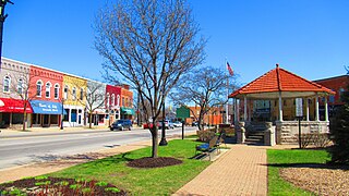
<span class="mw-page-title-main">Dundee, Michigan</span> Village in Michigan, United States

Dundee is a village in Monroe County in the U.S. state of Michigan. The population was 5,323 at the 2020 census, up from 3,957 in 2010. The village is within Dundee Township and is served by Dundee Community Schools.

<span class="mw-page-title-main">Petersburg, Michigan</span> City in Michigan, United States

Petersburg is a city in Monroe County in the U.S. state of Michigan. The population was 1,171 at the 2020 census.
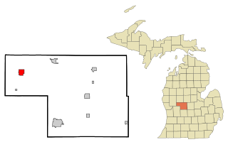
<span class="mw-page-title-main">Howard City, Michigan</span> Village in Michigan, United States

Howard City is a village in Montcalm County in the U.S. state of Michigan. The population was 1,835 at the 2020 census. The village is within Reynolds Township.

<span class="mw-page-title-main">Fruitport, Michigan</span> Village in Michigan, United States

Fruitport is a village in Muskegon County in the U.S. state of Michigan. The population was 1,103 at the 2020 census. The community is located within Fruitport Charter Township.
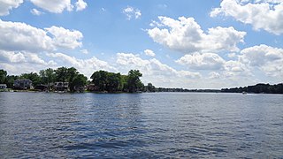
<span class="mw-page-title-main">Commerce Township, Michigan</span> Charter township in Michigan, United States

Commerce Township, officially the Charter Township of Commerce, is a charter township of Oakland County in the U.S. state of Michigan. The population was 43,058 at the 2020 census.

<span class="mw-page-title-main">Keego Harbor, Michigan</span> City in Michigan, United States

Keego Harbor is a city in Oakland County in the U.S. state of Michigan. A northern suburb of Detroit, Keego Harbor is located roughly 27 miles (43.5 km) from downtown Detroit, and about 3 miles (4.8 km) southwest of Pontiac. As of the 2010 census, the city had a population of 2,970. With a land area of 0.50 square miles (1.29 km2), Keego Harbor is the third-smallest city by land area in the state of Michigan, after Petersburg and Clarkston.

<span class="mw-page-title-main">Orchard Lake Village, Michigan</span> City in Michigan, United States

The City of Orchard Lake Village is a city in Oakland County in the U.S. state of Michigan. A northern suburb of Detroit, Orchard Lake Village is located roughly 27 miles (43.5 km) from downtown Detroit, and about 3 miles (4.8 km) southwest of Pontiac. The city is mostly surrounded by West Bloomfield Township, with a small northeast border with Keego Harbor. As of the 2010 census, the city had a population of 2,375.

<span class="mw-page-title-main">Walled Lake, Michigan</span> City in Michigan, United States

Walled Lake is a city in Oakland County in the U.S. state of Michigan. The population was 6,999 at the 2010 census. The city is bordered by Commerce Township on the north and the city of Novi on the south. As a western suburb of Metro Detroit, Walled Lake is about 20 miles (32.2 km) northwest of Detroit.

<span class="mw-page-title-main">Wixom, Michigan</span> City in Michigan, United States

Wixom is a city in Oakland County in the U.S. state of Michigan. A northwestern suburb of Detroit, Wixom is located roughly 30 miles (48.3 km) from downtown Detroit. As of the 2020 census, the city's population was 17,193.

<span class="mw-page-title-main">Centreville, Michigan</span> Village in Michigan, United States

Centreville is a village in the U.S. state of Michigan and the county seat of St. Joseph County. The population was 1,425 at the 2010 census.
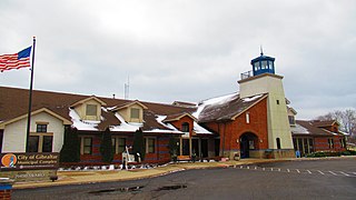
<span class="mw-page-title-main">Gibraltar, Michigan</span> City in Michigan, United States

Gibraltar is a city in Wayne County in the U.S. state of Michigan. The population was 4,656 at the 2010 census.

<span class="mw-page-title-main">Russells Point, Ohio</span> Village in Ohio, United States

Russells Point is a village located in northwest Logan County, Ohio, United States. The population was 1,320 at the 2020 census. It is situated on Indian Lake, which had long been a popular summer resort destination.

<span class="mw-page-title-main">Otter Lake, Michigan</span> Village in Michigan, United States

Otter Lake is a village in the U.S. state of Michigan. The village is split between Marathon Township in Lapeer County to the east and Forest Township in Genesee County to the west. The population was 426 at the 2020 census.

References

  1. "2020 U.S. Gazetteer Files". United States Census Bureau. Retrieved May 21, 2022.
  2. 1 2 "U.S. Census website". United States Census Bureau . Retrieved January 31, 2008.
  3. U.S. Geological Survey Geographic Names Information System: Wolverine Lake, Michigan
  4. "Michigan: 2010 Population and Housing Unit Counts 2010 Census of Population and Housing" (PDF). 2010 United States census . United States Census Bureau. September 2012. p. 36 Michigan. Archived (PDF) from the original on October 19, 2012. Retrieved January 30, 2022.
  5. Romig, Walter (October 1, 1986) [1973]. Michigan Place Names: The History of the Founding and the Naming of More Than Five Thousand Past and Present Michigan Communities (Paperback). Detroit, Michigan: Wayne State University Press. pp. 610–611. ISBN   978-0-8143-1838-6.{{cite book}}: |work= ignored (help)
  6. "2019 U.S. Gazetteer Files". United States Census Bureau. Retrieved July 25, 2020.
  7. "Census of Population and Housing". Census.gov. Retrieved June 4, 2015.
  8. "U.S. Census website". United States Census Bureau . Retrieved November 25, 2012.
  9. "Map of Entire District." (Archive) Walled Lake Consolidated Schools. Retrieved on November 8, 2012.
  10. "Loon Lake Elem." (Archive) Walled Lake Consolidated Schools. Retrieved on November 8, 2012.
  11. "Guest Elem." (Archive) Walled Lake Consolidated Schools. Retrieved on November 8, 2012.
  12. "James R. Geisler M.S. Archived 2014-07-03 at the Wayback Machine " (Archive) Walled Lake Consolidated Schools. Retrieved on November 8, 2012.
  13. "Sarah Banks M.S." (Archive) Walled Lake Consolidated Schools. Retrieved on November 8, 2012.
  14. "Central H.S." (Archive) Walled Lake Consolidated Schools. Retrieved on November 8, 2012.