Brandon Township, Michigan

Last updated
Brandon Township, Michigan
Charter Township of Brandon
BrandonTownshipHall.JPG
Brandon Township Hall
Brandon Charter Township, MI location.png
Location within Oakland County (red) and the administered village of Ortonville (pink)
USA Michigan location map.svg
Red pog.svg
Brandon Township
Location within the state of Michigan
Coordinates: 42°51′08″N83°26′35″W / 42.85222°N 83.44306°W / 42.85222; -83.44306 Coordinates: 42°51′08″N83°26′35″W / 42.85222°N 83.44306°W / 42.85222; -83.44306
Country United States
State Michigan
County Oakland
Established1837
Government
  SupervisorJayson Rumble
   Clerk Roselyn Blair
Area
   Charter township 35.98 sq mi (93.2 km2)
  Land35.11 sq mi (90.9 km2)
  Water0.87 sq mi (2.3 km2)
Elevation
1,037 ft (316 m)
Population
 (2010)
   Charter township 15,175
  Density432.2/sq mi (166.9/km2)
   Metro
4,296,250 (Metro Detroit)
Time zone UTC-5 (EST)
  Summer (DST) UTC-4 (EDT)
ZIP code(s)
48348 (Clarkston)
48371 (Oxford)
48462 (Ortonville)
Area code(s) 248 and 810
FIPS code 26-10040 [1]
GNIS feature ID1625971 [2]
Website Official website

Brandon Charter Township is a charter township of Oakland County in the U.S. state of Michigan. The population was 15,175 at the 2010 census. [3]

Contents

As a northern suburb of Metro Detroit, Brandon Township is about 30 miles (48.3 km) north of the city of Detroit and about 20 miles (32.2 km) southeast of Flint. The village of Ortonville is located within the township.

History

The Township of Brandon was created in 1837, named in honor of the settlers of the Town of Brandon, Vermont, whose descendants had migrated to this area of Michigan. The Charter Township of Brandon was formed in the 20th century. [4]

Communities

Geography

According to the United States Census Bureau, the township has a total area of 35.98 square miles (93.19 km2). 35.11 square miles (90.93 km2) of it is land and 0.87 square miles (2.25 km2) (2.42%) is water. [9]

Demographics

As of the census [1] of 2000, there were 14,765 people, 5,012 households, and 4,039 families residing in the township. The population density was 421.1 inhabitants per square mile (162.6/km2). There were 5,290 housing units at an average density of 150.9 per square mile (58.3/km2). The racial makeup of the township was 97.58% White, 0.40% African American, 0.24% Native American, 0.36% Asian, 0.01% Pacific Islander, 0.39% from other races, and 1.02% from two or more races. Hispanic or Latino of any race were 1.59% of the population.

There were 5,012 households, out of which 45.0% had children under the age of 18 living with them, 67.8% were married couples living together, 8.8% had a female householder with no husband present, and 19.4% were non-families. 15.0% of all households were made up of individuals, and 3.9% had someone living alone who was 65 years of age or older. The average household size was 2.92 and the average family size was 3.25.

In the township the population was spread out, with 30.6% under the age of 18, 6.6% from 18 to 24, 35.2% from 25 to 44, 22.0% from 45 to 64, and 5.5% who were 65 years of age or older. The median age was 35 years. For every 100 females, there were 100.3 males. For every 100 females age 18 and over, there were 99.4 males.

The median income for a household in the township was $66,458, and the median income for a family was $70,359. Males had a median income of $52,419 versus $32,068 for females. The per capita income for the township was $25,011. About 3.0% of families and 4.4% of the population were below the poverty line, including 4.8% of those under age 18 and 8.7% of those age 65 or over.

Education

Most of Brandon Township is in Brandon School District, while a portion to the east is in Oxford Community Schools. [10] The respective zoned high schools are Brandon High School, [11] and Oxford High School.

Related Research Articles

<span class="mw-page-title-main">Shiawassee County, Michigan</span> County in Michigan, United States

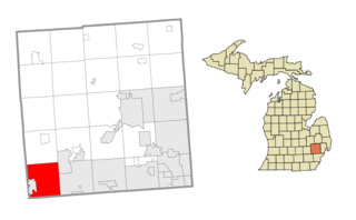
Shiawassee County is a county located in the U.S. state of Michigan. As of the 2020 United States Census, the population was 68,094. The county seat is Corunna, and the largest city in the county is Owosso. In 2010, the center of population of Michigan was located in Shiawassee County, in Bennington Township.

<span class="mw-page-title-main">Oakland County, Michigan</span> County in Michigan, United States

Oakland County is a county in the U.S. state of Michigan. It is part of the metropolitan Detroit area, located northwest of the city. As of the 2020 Census, its population was 1,274,395, making it the second-most populous county in Michigan, behind neighboring Wayne County. It is the largest county in the United States without a city of 100,000 residents. The county seat is Pontiac. The county was founded in 1819 and organized in 1820.

<span class="mw-page-title-main">Livingston County, Michigan</span> County in Michigan, United States

Livingston County is a county in the U.S. state of Michigan. As of the 2020 Census, the population was 193,866. It is part of the Detroit-Warren-Dearborn, MI Metropolitan Statistical Area. The county seat and most populous city is Howell. The county was platted in 1833, but for three years remained assigned to Shiawassee and Washtenaw counties for revenue, taxation and judicial matters. It was formally organized in 1836. As one of Michigan's "Cabinet counties", a group of ten counties whose names honor members of President Andrew Jackson's Cabinet, it is named after former US Secretary of State Edward Livingston. Livingston County's location in Southeast Michigan offers residents relatively convenient access to the metropolitan centers of Detroit, Lansing, Ann Arbor, and Flint. Livingston County residents regularly commute to those centers, using the three major expressways which pass through the county: I-96, US 23, and M-59. Although continuing to be composed largely of bedroom communities, the county is experiencing and maintaining significant growth in both the service and industrial economic sectors. Major employers include Tribar, PepsiCo, Citizens Insurance, and ThaiSummit. The Brighton Recreation Area is in the county.

Hadley Township is a civil township of Lapeer County in the U.S. state of Michigan. The population was 4,528 at the 2010 Census.

Metamora Township is a civil township of Lapeer County in the U.S. state of Michigan. The population was 4,249 at the 2010 Census.

<span class="mw-page-title-main">Shelby Charter Township, Michigan</span> Charter township in Michigan, United States

Shelby Charter Township, officially the Charter Township of Shelby, is a charter township and census-designated place located in Macomb County in the U.S. state of Michigan. The township, a northern suburb of Detroit, is located roughly 15 miles (24 km) north of the city. The 2020 Census places the population at 79,408. Shelby Charter Township is one of the fastest-growing communities in Metro Detroit.

<span class="mw-page-title-main">Monroe Charter Township, Michigan</span> Charter township in Michigan, United States

Monroe Charter Township is a charter township of Monroe County in the U.S. state of Michigan. As of the 2010 census, the township population was 14,568.

<span class="mw-page-title-main">Addison Township, Michigan</span> Civil township in Michigan, United States

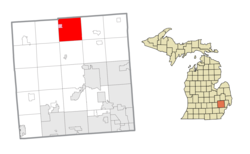
Addison Township is a civil township of northeast Oakland County in the U.S. state of Michigan. As of the 2010 census, the township population was 6,351.

<span class="mw-page-title-main">Commerce Township, Michigan</span> Charter township in Michigan, United States

Commerce Township, officially the Charter Township of Commerce, is a charter township of Oakland County in the U.S. state of Michigan. The population was 40,186 at the 2010 census.

<span class="mw-page-title-main">Groveland Township, Michigan</span> Civil township in Michigan, United States

Groveland Township is a civil township of Oakland County in the U.S. state of Michigan. The population was 5,476 at the 2010 census. Groveland Township was established in 1835.

<span class="mw-page-title-main">Highland Township, Oakland County, Michigan</span> Charter township in Michigan, United States

Highland Township, officially the Charter Township of Highland, is a charter township of west Oakland County, Michigan. The population was 19,202 at the time of the 2010 census.

<span class="mw-page-title-main">Holly Township, Michigan</span> Civil township in Michigan, United States

Holly Township is a civil township of Oakland County in the U.S. state of Michigan. The population was 11,362 at the 2010 census.

<span class="mw-page-title-main">Lyon Township, Oakland County, Michigan</span> Charter township in Michigan, United States

Lyon Charter Township is a charter township of Oakland County in the U.S. state of Michigan. The population was 14,545 at the 2010 census.

<span class="mw-page-title-main">Ortonville, Michigan</span> Village in Michigan, United States

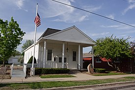
Ortonville is a village in north Oakland County in the U.S. state of Michigan. The village is within Brandon Township, although some development near the village lies within adjacent Oakland County, Groveland township and Lapeer County, Hadley township. The population was 1,442 at the 2010 census. Ortonville lies on the northern edge of Metro Detroit and is approximately 41 miles north of Downtown Detroit.

<span class="mw-page-title-main">Oxford Township, Michigan</span> Charter township in Michigan, United States

Oxford Township, officially the Charter Township of Oxford, is a charter township in Oakland County in the U.S. state of Michigan. The population was 20,526 at the 2010 census.

<span class="mw-page-title-main">Rose Township, Oakland County, Michigan</span> Civil township in Michigan, United States

Rose Township is a civil township of Oakland County in the U.S. state of Michigan. The population was 6,250 at the 2010 census.

<span class="mw-page-title-main">Perry Township, Michigan</span> Civil township in Michigan, United States

Perry Township is a civil township of Shiawassee County in the U.S. state of Michigan. The population was 4,327 at the 2010 census. The township surrounds the city of Perry, but the two are administrated autonomously. Perry Township was organized in 1841.

<span class="mw-page-title-main">Huron Charter Township, Michigan</span> Charter township in Michigan, United States

Huron Charter Township is a charter township of Wayne County in the U.S. state of Michigan. The population was 15,879 at the 2010 census. Huron Charter Township is named after the Huron River, which flows southeast through the township. The township is home to three divisions of the Huron–Clinton Metroparks system: Lower Huron, Oakwoods, and Willow.

<span class="mw-page-title-main">West Bloomfield Township, Michigan</span> Charter township in Michigan, United States

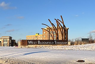
West Bloomfield Township, officially the Charter Township of West Bloomfield, is a charter township in Oakland County in the U.S. state of Michigan, within the Detroit metropolitan area. It is one of the most expensive places to live in Oakland County. As of the 2020 census, the township had a population of 65,888.

<span class="mw-page-title-main">Washington Township, Macomb County, Michigan</span> Charter township in Michigan, United States

Washington Charter Township, located within Metro Detroit, is a charter township of Macomb County in the U.S. state of Michigan. The population was 25,139 at the 2010 census. Washington Township is bordered by the village of Romeo as well as Ray Township, Shelby Township, and Oakland Township in Oakland County and is 18 miles north of Detroit.

References

  1. 1 2 "U.S. Census website". United States Census Bureau . Retrieved 2008-01-31.
  2. U.S. Geological Survey Geographic Names Information System: Brandon Township, Michigan
  3. "Race, Hispanic or Latino, Age, and Housing Occupancy: 2010 Census Redistricting Data (Public Law 94-171) Summary File (QT-PL), Brandon charter township, Oakland County, Michigan". United States Census Bureau . Retrieved August 22, 2011.
  4. Herman, Jennifer. Michigan Encyclopedia. State History Publications. p. 187. ISBN   9781878592941.
  5. U.S. Geological Survey Geographic Names Information System: Brandon Gardens, Michigan & GNIS in Google Map
  6. U.S. Geological Survey Geographic Names Information System: Oakwood, Michigan
  7. 1872 Plat Map of Oakwood, Oakland County, Michigan, accessed via ancestry.com paid subscription site in March 2019.
  8. U.S. Geological Survey Geographic Names Information System: Perry Lake Heights, Michigan & GNIS in Google Map
  9. "Michigan: 2010 Population and Housing Unit Counts 2010 Census of Population and Housing" (PDF). 2010 United States Census . United States Census Bureau. September 2012. p. 36 Michigan. Archived (PDF) from the original on 2012-10-19. Retrieved May 13, 2020.
  10. "2020 CENSUS - SCHOOL DISTRICT REFERENCE MAP: Oakland County, MI" (PDF). U.S. Census Bureau. Archived (PDF) from the original on 2021-12-04. Retrieved 2021-12-03.
  11. "Home". Brandon School District. Retrieved 2021-12-03.