Milford, Michigan

Last updated

Milford
Village of Milford
Milford Michigan central business district.JPG
Downtown Milford along Main Street
Villageofmilfordmiseal.png
Milford, MI location.png
Location within Oakland County
USA Michigan location map.svg
Red pog.svg
Milford
Location within the state of Michigan
Coordinates: 42°35′37″N83°35′58″W / 42.59361°N 83.59944°W / 42.59361; -83.59944
Country United States
State Michigan
County Oakland
Township Milford
Incorporated1869
Government
  Village ManagerChristian Wuerth
Area
[1]
   Village 2.53 sq mi (6.55 km2)
  Land2.45 sq mi (6.35 km2)
  Water0.08 sq mi (0.20 km2)
Elevation
965 ft (288.036 m)
Population
 (2020)
   Village 6,520
  Density2,660.14/sq mi (1,026.90/km2)
   Metro
4,296,250 (Metro Detroit)
Time zone UTC-5 (EST)
  Summer (DST) UTC-4 (EDT)
ZIP code(s)
48380, 48381
Area code(s) 248
FIPS code 26-53960 [2]
GNIS feature ID0632306 [3]
Website Official website

Milford is a village in Oakland County in the U.S. state of Michigan. The population was 6,175 at the time of the 2010 census. [4] The village is located within Milford Township. The village is known for being the home of the Milford General Motors Proving Ground.

Contents

Geography

According to the United States Census Bureau, the village has a total area of 2.52 square miles (6.53 km2), of which 2.43 square miles (6.29 km2) is land and 0.09 square miles (0.23 km2) is water. [5]

Demographics

Historical population
CensusPop.Note
1880 1,251
1890 1,138−9.0%
1900 1,108−2.6%
1910 973−12.2%
1920 1,08811.8%
1930 1,36425.4%
1940 1,63720.0%
1950 1,92417.5%
1960 4,323124.7%
1970 4,6998.7%
1980 5,0417.3%
1990 5,5119.3%
2000 6,27213.8%
2010 6,175−1.5%
2020 6,5205.6%
U.S. Decennial Census [6]

2010 census

As of the census [7] of 2010, there were 6,175 people, 2,589 households, and 1,719 families living in the village. The population density was 2,541.2 inhabitants per square mile (981.2/km2). There were 2,777 housing units at an average density of 1,142.8 per square mile (441.2/km2). The racial makeup of the village was 95.7% White, 0.6% African American, 0.6% Native American, 0.7% Asian, 0.7% from other races, and 1.7% from two or more races. Hispanic or Latino of any race were 2.0% of the population.

There were 2,589 households, of which 31.4% had children under the age of 18 living with them, 49.9% were married couples living together, 13.2% had a female householder with no husband present, 3.2% had a male householder with no wife present, and 33.6% were non-families. 28.4% of all households were made up of individuals, and 10.2% had someone living alone who was 65 years of age or older. The average household size was 2.38 and the average family size was 2.93.

The median age in the village was 40.8 years. 23.5% of residents were under the age of 18; 6.8% were between the ages of 18 and 24; 25.8% were from 25 to 44; 30.9% were from 45 to 64; and 12.9% were 65 years of age or older. The sex makeup of the village was 47.4% male and 52.6% female.

2000 census

As of the census [2] of 2000, there were 6,272 people, 2,427 households, and 1,706 families living in the village. The population density was 2,560.7 inhabitants per square mile (988.7/km2). There were 2,491 housing units at an average density of 1,017.0 per square mile (392.7/km2). The racial makeup of the village was 97.35% White, 0.16% African American, 0.38% Native American, 0.49% Asian, 0.35% from other races, and 1.26% from two or more races. Hispanic or Latino of any race were 1.32% of the population.

There were 2,427 households, out of which 38.3% had children under the age of 18 living with them, 55.0% were married couples living together, 12.7% had a female householder with no husband present, and 29.7% were non-families. 25.8% of all households were made up of individuals, and 8.9% had someone living alone who was 65 years of age or older. The average household size was 2.55 and the average family size was 3.09.

In the village, the population was spread out, with 28.6% under the age of 18, 6.4% from 18 to 24, 33.0% from 25 to 44, 21.6% from 45 to 64, and 10.4% who were 65 years of age or older. The median age was 35 years. For every 100 females, there were 91.2 males. For every 100 females age 18 and over, there were 83.9 males.

The median income for a household in the village was $59,688, and the median income for a family was $71,333. Males had a median income of $53,393 versus $31,935 for females. The per capita income for the village was $26,159. About 6.5% of families and 7.2% of the population were below the poverty line, including 13.0% of those under age 18 and 2.4% of those age 65 or over.

History

The village of Milford began with the building of a sawmill by Elizur and Stanley Ruggles in 1832. [8] Early county records indicate that the mill was erected in the "Township" at that time, and that formal organization would occur in 1834. That same year, the first gristmill was erected by Luman Fuller. In 1835, the first post office was established with Aaron Phelps as postmaster. [9]

The Lower Mill Pond was created in 1836 to provide waterpower for the various types of mills and factories. The Upper Mill Pond followed in 1845. In 1911, the Hubbell Pond was created by a dam built on the Huron River to generate electricity. The village was incorporated in 1869. [9]

Hydropower made it possible for Milford to become one of the first communities to have electric lights, in 1892. A year later, telephone service was available in the Village. [9] As a point of reference, nearby South Lyon did not have electric lights until 1932.

By 1939, Henry Ford built a carburetor plant and two hydroelectric stations intended to allow residents to maintain their agricultural work while working in the factories. The former carburetor plant was demolished in 2002. The Art Deco station still remains on Pettibone Creek in the village, and restoration work began in 2004. [10]

The summer of 2017 was the first year that the village has allowed golf carts on their streets. By November, only 10 carts were registered. [11]

Government

As a village, Milford is provided assessing, counties and school districts tax collecting and elections administration for county, state and national by Milford Township. The Village of Milford is a Michigan home rule village with a council-manager form of government. The village is governed by a local charter adopted by village electors. The village council appoints a Village Manager to serve as the CAO of the government, responsible for the management of the village's daily operations and oversight of all departments. [12]

Milford is a part of the Huron Valley School District.

Notable people

Climate

This climatic region is typified by large seasonal temperature differences, with warm to hot (and often humid) summers and cold (sometimes severely cold) winters. According to the Köppen Climate Classification system, Milford has a humid continental climate, abbreviated "Dfb" on climate maps. [13]

Climate data for Milford, Michigan (Milford GM Proving Ground) 1991–2020 normals, extremes 1928–present
MonthJanFebMarAprMayJunJulAugSepOctNovDecYear
Record high °F (°C)66
(19)
67
(19)
84
(29)
86
(30)
93
(34)
102
(39)
104
(40)
99
(37)
97
(36)
88
(31)
78
(26)
67
(19)
104
(40)
Mean daily maximum °F (°C)30.9
(−0.6)
34.0
(1.1)
44.7
(7.1)
57.6
(14.2)
69.6
(20.9)
78.4
(25.8)
82.3
(27.9)
80.1
(26.7)
73.5
(23.1)
60.7
(15.9)
47.2
(8.4)
35.5
(1.9)
57.9
(14.4)
Daily mean °F (°C)22.8
(−5.1)
24.5
(−4.2)
34.2
(1.2)
46.3
(7.9)
57.8
(14.3)
67.1
(19.5)
71.0
(21.7)
69.3
(20.7)
62.2
(16.8)
50.4
(10.2)
38.3
(3.5)
28.1
(−2.2)
47.7
(8.7)
Mean daily minimum °F (°C)14.7
(−9.6)
15.1
(−9.4)
23.7
(−4.6)
34.9
(1.6)
46.0
(7.8)
55.8
(13.2)
59.6
(15.3)
58.4
(14.7)
51.0
(10.6)
40.0
(4.4)
29.5
(−1.4)
20.8
(−6.2)
37.5
(3.1)
Record low °F (°C)−23
(−31)
−27
(−33)
−14
(−26)
11
(−12)
21
(−6)
33
(1)
39
(4)
38
(3)
26
(−3)
16
(−9)
−2
(−19)
−18
(−28)
−27
(−33)
Average precipitation inches (mm)2.06
(52)
1.91
(49)
2.16
(55)
3.07
(78)
3.66
(93)
3.58
(91)
3.20
(81)
3.32
(84)
3.51
(89)
2.88
(73)
2.64
(67)
2.10
(53)
34.09
(866)
Source: NOAA [14] [15]

Related Research Articles

<span class="mw-page-title-main">Oscoda, Michigan</span> Census-designated place & unincorporated community in Michigan, United States

Oscoda is an unincorporated community and census-designated place (CDP) in Iosco County in the U.S. state of Michigan. The CDP had a population of 916 at the 2020 census. The community is located within Au Sable Township and Oscoda Township at the mouth of the Au Sable River along Lake Huron.

Athens Township is a civil township of southwest Calhoun County in the U.S. state of Michigan, about 15 miles (24 km) south of Battle Creek. It is part of the Battle Creek, Michigan Metropolitan Statistical Area. As of the 2020 census, the township population was 2,444. The Nottawaseppi Huron Band of Potawatomi is based in Athens Township.

<span class="mw-page-title-main">Bad Axe, Michigan</span> City in Michigan, United States

Bad Axe is a city in the U.S. state of Michigan and the county seat of Huron County in the Thumb region of the Lower Peninsula. The population was 3,021 at the 2020 census, making it the largest community in Huron County and second largest in the Upper Thumb, after Caro.

<span class="mw-page-title-main">Elkton, Michigan</span> Village in Michigan, United States

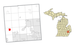
Elkton is a village in Huron County in the U.S. state of Michigan. The population was 796 at the 2020 census. The village is within Oliver Township, along the Pinnebog River. It was incorporated in 1897.

<span class="mw-page-title-main">Pigeon, Michigan</span> Village in Michigan, United States

Pigeon is a village in Huron County in the U.S. state of Michigan. The population was 1,208 at the 2010 census. The village is within Winsor Township.

<span class="mw-page-title-main">Sebewaing, Michigan</span> Village in Michigan, United States

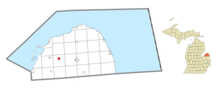
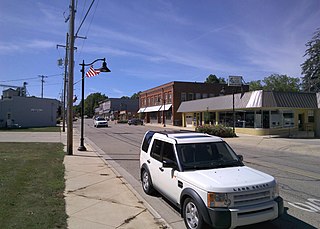
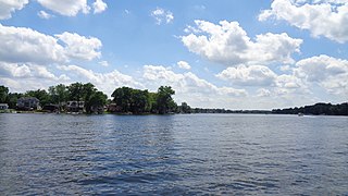
Sebewaing (SEE-bah-wing) is a village in Huron County in the U.S. state of Michigan. The population was 1,721 at the 2020 census. The village is within Sebewaing Township. This community is known as the Sugar Beet Capital, due to the Michigan Sugar slicing mill located within the village and the yearly Michigan Sugar Festival. The Sebewaing area, the Thumb, and the state of Michigan overall are major beet sugar producers, mostly for domestic consumption. Sebewaing is also the first gigabit village in the state of Michigan. In 2014–15, Sebewaing completed its fiber to the home network, offering up to gigabit/second speeds over their fiber optic network.

<span class="mw-page-title-main">Caledonia, Michigan</span> Village in Michigan, United States

Caledonia is a village in Kent County in the U.S. state of Michigan. The population was 1,622 at the 2020 census. The village is located within Caledonia Township about 15 miles (24.1 km) southeast of downtown Grand Rapids.

<span class="mw-page-title-main">Brighton Township, Michigan</span> Charter township in Michigan, United States

Brighton Charter Township is a charter township of Livingston County in the U.S. state of Michigan. As of the 2020 census, the township population was 19,144. The township is bordered on the southwest by the city of Brighton, but the two are administered autonomously.

<span class="mw-page-title-main">Lake City, Michigan</span> City in Michigan, United States

Lake City is a city in the U.S. state of Michigan. It is the county seat of Missaukee County, and is the largest city within the county. The city is located in the Northern Lower Peninsula of Michigan. As of the 2020 census, the population of Lake City was 829. Lake City has been nicknamed "Michigan's Christmas Tree Capital", due to the high number of farms near the city.

<span class="mw-page-title-main">Atlanta, Michigan</span> Census-designated place in Michigan, United States

Atlanta is a census-designated place and unincorporated community in the U.S. state of Michigan. It is the county seat of Montmorency County. The community had a population of 720 at the 2020 census, down from 827 in 2010. Atlanta has been nicknamed the "Elk Capital of Michigan".

Hillman Township is a civil township of Montmorency County in the U.S. state of Michigan. The population was 2,009 at the 2020 census, 604 of whom lived in the village of Hillman within the township.

<span class="mw-page-title-main">Commerce Township, Michigan</span> Charter township in Michigan, United States

Commerce Township, officially the Charter Township of Commerce, is a charter township of Oakland County in the U.S. state of Michigan. The population was 43,058 at the 2020 census.

<span class="mw-page-title-main">Highland Township, Oakland County, Michigan</span> Charter township in Michigan, United States

Highland Township, officially the Charter Township of Highland, is a charter township of west Oakland County, Michigan. The population was 19,172 at the time of the 2020 census.

<span class="mw-page-title-main">Milford Township, Michigan</span> Charter township in Michigan, United States

Milford Township is a charter township of Oakland County in the U.S. state of Michigan. The population was 17,090 at the 2020 census. The village of Milford is located within the township.

<span class="mw-page-title-main">Rose Township, Oakland County, Michigan</span> Civil township in Michigan, United States

Rose Township is a civil township of Oakland County in the U.S. state of Michigan. The population was 6,188 at the 2020 census.

<span class="mw-page-title-main">St. Charles, Michigan</span> Village in Michigan, United States

St. Charles is a village in Saginaw County in the U.S. state of Michigan. The village is located in the northwest corner of St. Charles Township with portions of the village located within Brant and Swan Creek townships. The population was 2,054 at the 2010 census.

<span class="mw-page-title-main">Sandusky, Michigan</span> City in Michigan, United States

Sandusky is the most populous city and county seat of Sanilac County, Michigan. The population was 2,679 at the 2010 census.

<span class="mw-page-title-main">Plymouth, Ohio</span> Village in Ohio, United States

Plymouth is a village in Huron and Richland counties in the U.S. state of Ohio. The population was 1,707 at the 2020 census.

<span class="mw-page-title-main">Meade Township, Huron County, Michigan</span> Civil township in Michigan, United States

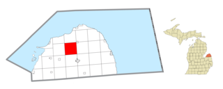
Meade Township is a civil township of Huron County in the U.S. state of Michigan. The population was 698 at the 2020 census.

Milford is a town in Penobscot County, Maine, United States. It is located across the Penobscot River from the city of Old Town. The population of Milford was 3,069 at the 2020 census. The town's slogan is the "Best little town by a dam site," referring to the Milford Dam abutting Milford on the Penobscot River, south of the Penobscot Indian Island Reservation.

References

  1. "2020 U.S. Gazetteer Files". United States Census Bureau. Retrieved May 21, 2022.
  2. 1 2 "U.S. Census website". United States Census Bureau . Retrieved January 31, 2008.
  3. U.S. Geological Survey Geographic Names Information System: Milford, Michigan
  4. "Race, Hispanic or Latino, Age, and Housing Occupancy: 2010 Census Redistricting Data (Public Law 94-171) Summary File (QT-PL), Milford village, Michigan". United States Census Bureau . Retrieved August 19, 2011.
  5. "US Gazetteer files 2010". United States Census Bureau. Archived from the original on July 2, 2012. Retrieved November 25, 2012.
  6. "Census of Population and Housing". Census.gov. Retrieved June 4, 2015.
  7. "U.S. Census website". United States Census Bureau . Retrieved November 25, 2012.
  8. Lowe, S. D., Bourns, M. J., Young, B. B., & Barr, C. L. (1982). Ten minutes ahead of the rest of the world: A history of Milford. Milford, MI: Milford Historical Society.
  9. 1 2 3 "An Account of Oakland County / edited by Lillian Drake Avery". HathiTrust. 1925. pp. 41, 47–48, 67–69, 132, 225, 257. Retrieved January 9, 2024.
  10. "Powerhouse Restoration Project Overview". milfordhistory.org. Retrieved January 9, 2024.
  11. Lawler, Emily (November 1, 2017). "Dozens of Michigan governments have legalized golf carts on roads". MLive.com. MLive Media Group. Retrieved November 1, 2017.
  12. (January 2011). Pages 1,5. Municipal Report: Organization of City and Village Government in Michigan. Updated. Michigan Municipal League. Accessed on February 15, 2016.
  13. Climate Summary for Milford, Michigan
  14. "NowData – NOAA Online Weather Data". National Oceanic and Atmospheric Administration. Retrieved September 4, 2021.
  15. "Station: Milford GM Proving Ground, MI". U.S. Climate Normals 2020: U.S. Monthly Climate Normals (1991–2020). National Oceanic and Atmospheric Administration. Retrieved September 4, 2021.