Baldwin Park, Missouri

Last updated

Baldwin Park, Missouri
Cass County Missouri Incorporated and Unincorporated areas Baldwin Park Highlighted.svg
Location of Baldwin Park, Missouri
Coordinates: 38°47′38″N94°14′48″W / 38.79389°N 94.24667°W / 38.79389; -94.24667
Country United States
State Missouri
County Cass
Area
[1]
  Total0.12 sq mi (0.31 km2)
  Land0.08 sq mi (0.20 km2)
  Water0.04 sq mi (0.11 km2)
Elevation
[2]
879 ft (268 m)
Population
 (2020)
  Total85
  Density1,118.42/sq mi (432.43/km2)
Time zone UTC-6 (Central (CST))
  Summer (DST) UTC-5 (CDT)
FIPS code 29-03124 [3]
GNIS feature ID2398023 [2]

Baldwin Park is a village in Cass County, Missouri, United States. The population was 92 at the 2010 census. It is part of the Kansas City metropolitan area.

Contents

Geography

Baldwin Park surrounds what was once Baldwin Lake until it was drained. It is surrounded by Pleasant Hill. The village pays its taxes to Cass County and receives its funding from county, state and federal taxes. As of the 2010 Census, the Population of Baldwin Park was 92. The village has its own Mayor and Board of Trustees, consisting of four members. As of October 2012, the estimated 2.5 miles of roads were redone. It resides within the Pleasant Hill School District boundaries.

According to the United States Census Bureau, the village has a total area of 0.12 square miles (0.31 km2), of which 0.08 square miles (0.21 km2) is land and 0.04 square miles (0.10 km2) is water. [4]

Demographics

Historical population
CensusPop.Note
1980 126
1990 85−32.5%
2000 11535.3%
2010 92−20.0%
2020 85−7.6%
U.S. Decennial Census [5]

2010 census

As of the census [6] of 2010, there were 92 people, 38 households, and 23 families living in the village. The population density was 1,150.0 inhabitants per square mile (444.0/km2). There were 40 housing units at an average density of 500.0 per square mile (193.1/km2). The racial makeup of the village was 96.7% White, 1.1% Native American, 1.1% Asian, and 1.1% from two or more races.

There were 38 households, of which 34.2% had children under the age of 18 living with them, 36.8% were married couples living together, 7.9% had a female householder with no husband present, 15.8% had a male householder with no wife present, and 39.5% were non-families. 34.2% of all households were made up of individuals, and 15.8% had someone living alone who was 65 years of age or older. The average household size was 2.42 and the average family size was 3.00.

The median age in the village was 38 years. 25% of residents were under the age of 18; 6.5% were between the ages of 18 and 24; 28.3% were from 25 to 44; 32.6% were from 45 to 64; and 7.6% were 65 years of age or older. The gender makeup of the village was 47.8% male and 52.2% female.

2000 census

As of the census [3] of 2000, there were 115 people, 41 households, and 27 families living in the village. The population density was 1,639.7 inhabitants per square mile (633.1/km2). There were 44 housing units at an average density of 627.4 per square mile (242.2/km2). The racial makeup of the village was 99.13% White and 0.87% Native American. Hispanic or Latino of any race were 0.87% of the population.

There were 41 households, out of which 39.0% had children under the age of 18 living with them, 43.9% were married couples living together, 19.5% had a female householder with no husband present, and 34.1% were non-families. 19.5% of all households were made up of individuals, and 9.8% had someone living alone who was 65 years of age or older. The average household size was 2.80 and the average family size was 3.26.

In the village, the population was spread out, with 36.5% under the age of 18, 2.6% from 18 to 24, 36.5% from 25 to 44, 18.3% from 45 to 64, and 6.1% who were 65 years of age or older. The median age was 34 years. For every 100 females, there were 94.9 males. For every 100 females age 18 and over, there were 73.8 males.

The median income for a household in the village was $40,208, and the median income for a family was $38,125. Males had a median income of $35,000 versus $17,292 for females. The per capita income for the village was $22,489. There were no families and 8.8% of the population living below the poverty line, including no under-eighteens and none of those over 64.

Related Research Articles

<span class="mw-page-title-main">Baldwin, Illinois</span> Village in Illinois, United States

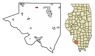
Baldwin is a town in Randolph County, Illinois, United States. The population was 373 at the 2010 census. Baldwin Lake State Fish and Wildlife Area is nearby.

<span class="mw-page-title-main">Baldwin, Iowa</span> City in Iowa, United States

Baldwin is a city in Jackson County, Iowa, United States. The population was 99 at the 2020 census.

<span class="mw-page-title-main">Baldwin, Maine</span> Town in the state of Maine, United States

Baldwin is a town in Cumberland County, Maine, United States. The population was 1,520 at the 2020 census. It is part of the Portland–South Portland–Biddeford, Maine, metropolitan statistical area.

<span class="mw-page-title-main">Wilbur Park, Missouri</span> Village in Missouri, United States

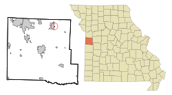
Wilbur Park is a village in St. Louis County, Missouri, United States. The population was 439 at the 2020 census.

<span class="mw-page-title-main">Addyston, Ohio</span> Village in Ohio, United States

Addyston is a village in Miami Township, Hamilton County, Ohio, United States. Located along the Ohio River, it is a western suburb of the neighboring city of Cincinnati. The population was 927 at the 2020 census.

<span class="mw-page-title-main">Elmwood Place, Ohio</span> Village in Hamilton County, Ohio, United States

Elmwood Place is a village in Hamilton County, Ohio, United States. The population was 2,087 at the 2020 census. Except for a small portion which touches neighboring St. Bernard, Elmwood Place is nearly surrounded by the city of Cincinnati.

<span class="mw-page-title-main">Evendale, Ohio</span> Village in Ohio, United States

Evendale is a village in Hamilton County, Ohio, United States, within the Cincinnati metropolitan area. The population was 2,669 at the 2020 census.

<span class="mw-page-title-main">Botkins, Ohio</span> Village in Ohio, United States

Botkins is a village in Shelby County, Ohio, United States. The population was 1,155 at the 2020 census.

<span class="mw-page-title-main">Jackson Center, Ohio</span> Village in Ohio, United States

Jackson Center is a village in Shelby County, Ohio, United States. The population was 1,441 at the 2020 census.

<span class="mw-page-title-main">Kettlersville, Ohio</span> Village in Ohio, United States

Kettlersville is a village in Shelby County, Ohio, United States. The population was 164 at the 2020 census.

<span class="mw-page-title-main">Port Jefferson, Ohio</span> Village in Ohio, United States

Port Jefferson is a village in Salem Township, Shelby County, Ohio, United States. The population was 308 at the 2020 census.

<span class="mw-page-title-main">Burbank, Ohio</span> Village in Ohio, United States

Burbank is a village in Wayne County, Ohio, United States, along Killbuck Creek. The population was 296 at the 2020 census.

<span class="mw-page-title-main">Beech Bottom, West Virginia</span> Village in West Virginia, United States

Beech Bottom is a village in Brooke County, West Virginia, United States, situated along the Ohio River. The population was 523 at the 2010 census. It is part of the Weirton–Steubenville metropolitan area.

<span class="mw-page-title-main">Kekoskee, Wisconsin</span> Village in Wisconsin, United States

Kekoskee is a village in Dodge County, Wisconsin, United States. The population was 161 at the 2010 census.

<span class="mw-page-title-main">Sussex, Wisconsin</span> Village in Wisconsin, United States

Sussex is a village in Waukesha County, Wisconsin, United States, about 19 miles (31 km) northwest of Milwaukee and 9 miles (14 km) north of Waukesha. The village is 7.24 square miles (19 km2) at an elevation of 930 feet. The population was 11,487 at the 2020 census. It is part of the Milwaukee metropolitan area.

<span class="mw-page-title-main">Wilson, Ohio</span> Village in Ohio, United States

Wilson is a village in Belmont and Monroe counties in the U.S. state of Ohio. The population was 129 at the 2020 census. It is part of the Wheeling metropolitan area.

<span class="mw-page-title-main">Verona, Ohio</span> Village in Ohio, United States

Verona is a village in Montgomery and Preble counties in the U.S. state of Ohio. The population was 403 at the 2020 census. It is part of the Dayton Metropolitan Statistical Area.

<span class="mw-page-title-main">Lowell, Wisconsin</span> Village in Wisconsin, United States

Lowell is a village in Dodge County, Wisconsin, United States, along the Beaver Dam River. The population was 340 at the 2010 census. The village is located within the Town of Lowell.

Baldwin is a town in St. Croix County, Wisconsin, United States. The population was 903 at the 2000 census. The Village of Baldwin is located partially within the town. The unincorporated community of Dahl is also located in the town.

<span class="mw-page-title-main">Baldwin, Wisconsin</span> Village in Wisconsin, United States

Baldwin is a village in St. Croix County, Wisconsin, United States. The population was 3,957 at the 2010 census, a growth rate of 48% from 2000. The village is adjacent to the Town of Baldwin.

References

  1. "ArcGIS REST Services Directory". United States Census Bureau. Retrieved August 28, 2022.
  2. 1 2 U.S. Geological Survey Geographic Names Information System: Baldwin Park, Missouri
  3. 1 2 "U.S. Census website". United States Census Bureau . Retrieved January 31, 2008.
  4. "US Gazetteer files 2010". United States Census Bureau. Archived from the original on January 25, 2012. Retrieved July 8, 2012.
  5. "Census of Population and Housing". Census.gov. Retrieved June 4, 2015.
  6. "U.S. Census website". United States Census Bureau . Retrieved July 8, 2012.