Barron County, Wisconsin

Last updated

Barron County
Cumberland Public Library.JPG
Map of Wisconsin highlighting Barron County.svg
Location within the U.S. state of Wisconsin
Wisconsin in United States.svg
Wisconsin's location within the U.S.
Coordinates: 45°25′N91°51′W / 45.42°N 91.85°W / 45.42; -91.85
CountryFlag of the United States.svg United States
StateFlag of Wisconsin.svg  Wisconsin
Founded1874
Named for Henry D. Barron
Seat Barron
Largest city Rice Lake
Area
  Total890 sq mi (2,300 km2)
  Land863 sq mi (2,240 km2)
  Water27 sq mi (70 km2)  3.0%
Population
 (2020)
  Total46,711
  Density54.1/sq mi (20.9/km2)
Time zone UTC−6 (Central)
  Summer (DST) UTC−5 (CDT)
Congressional district 7th
Website www.barroncountywi.gov

Barron County is a county located in the U.S. state of Wisconsin. As of the 2020 census, the population was 46,711. [1] Its county seat is Barron. [2] The county was created in 1859 and later organized in 1874. [3]

Contents

History

The county was created in 1859 [4] as Dallas County (named after Vice President George M. Dallas), with the county seat located at Barron. It was renamed Barron County on March 4, 1869. The county took the name Barron in honor of Wisconsin lawyer and politician Henry D. Barron, who served as circuit judge of the Eleventh Judicial Circuit. [5] [6] Barron County was organized in 1874. [3] In the late 1800s and early 1900s a community of Russian immigrants moved to Barron County. [7]

Geography

According to the U.S. Census Bureau, the county has a total area of 890 square miles (2,300 km2), of which 863 square miles (2,240 km2) is land and 27 square miles (70 km2) (3.0%) is water. [8]

Adjacent counties

Major highways

The county sign for Barron County on County G Barron County WI sign CTH G.jpg
The county sign for Barron County on County G

Railroads

Buses

Airports

Demographics

Historical population
CensusPop.Note
1860 13
1870 5384,038.5%
1880 7,0241,205.6%
1890 15,416119.5%
1900 23,67753.6%
1910 29,11423.0%
1920 34,28117.7%
1930 34,3010.1%
1940 34,2890.0%
1950 34,7031.2%
1960 34,270−1.2%
1970 33,955−0.9%
1980 38,73014.1%
1990 40,7505.2%
2000 44,96310.3%
2010 45,8702.0%
2020 46,7111.8%
U.S. Decennial Census [9]
1790–1960 [10] 1900–1990 [11]
1990–2000 [12] 2010 [13] 2020 [1]

2020 census

As of the census of 2020, [1] the population was 46,711. The population density was 54.1 people per square mile (20.9 people/km2). There were 23,779 housing units at an average density of 27.6 units per square mile (10.7 units/km2). The racial makeup of the county was 91.1% White, 1.8% Black or African American, 1.0% Native American, 0.7% Asian, 1.2% from other races, and 4.2% from two or more races. Ethnically, the population was 2.7% Hispanic or Latino of any race.

2000 census

2000 Census Age Pyramid for Barron County USA Barron County, Wisconsin age pyramid.svg
2000 Census Age Pyramid for Barron County

As of the census [14] of 2000, there were 44,963 people, 17,851 households, and 12,352 families residing in the county. The population density was 52 people per square mile (20 people/km2). There were 20,969 housing units at an average density of 24 units per square mile (9.3 units/km2). The racial makeup of the county was 97.69% White, 0.14% Black or African American, 0.81% Native American, 0.32% Asian, 0.04% Pacific Islander, 0.32% from other races, and 0.69% from two or more races. 0.96% of the population were Hispanic or Latino of any race. 34.4% were of German, 21.8% Norwegian and 5.3% Irish ancestry.

There were 17,851 households, out of which 31.30% had children under the age of 18 living with them, 56.90% were married couples living together, 8.20% had a female householder with no husband present, and 30.80% were non-families. 25.40% of all households were made up of individuals, and 12.20% had someone living alone who was 65 years of age or older. The average household size was 2.48 and the average family size was 2.97.

In the county, the population was spread out, with 25.30% under the age of 18, 8.10% from 18 to 24, 26.80% from 25 to 44, 23.40% from 45 to 64, and 16.40% who were 65 years of age or older. The median age was 39 years. For every 100 females there were 98.20 males. For every 100 females age 18 and over, there were 96.00 males.

In 2017, there were 504 births, giving a general fertility rate of 70.6 births per 1000 women aged 15–44, the 15th highest rate out of all 72 Wisconsin counties. [15] Additionally, there were fewer than five reported induced abortions performed on women of Barron County residence in 2017. [16]

Communities

Cities

Villages

Towns

Census-designated place

Unincorporated communities

Politics

United States presidential election results for Barron County, Wisconsin [17] [18]
Year Republican Democratic Third party
No.%No.%No.%
2020 15,80362.35%9,19436.27%3491.38%
2016 13,61460.05%7,88934.80%1,1685.15%
2012 11,44350.43%10,89047.99%3591.58%
2008 10,45745.69%12,07852.77%3511.53%
2004 12,03050.26%11,69648.86%2110.88%
2000 9,84849.48%8,92844.86%1,1285.67%
1996 6,15835.82%8,02546.68%3,00817.50%
1992 6,57232.49%8,06339.86%5,59527.66%
1988 8,52748.53%8,95150.94%920.52%
1984 9,58753.94%8,06145.36%1240.70%
1980 8,79147.05%8,65446.32%1,2406.64%
1976 7,39345.13%8,67852.97%3111.90%
1972 8,41859.94%5,37638.28%2511.79%
1968 7,52655.38%5,18338.14%8806.48%
1964 5,70140.56%8,33259.28%230.16%
1960 8,64057.05%6,46442.68%410.27%
1956 8,63461.12%5,41938.36%730.52%
1952 10,01366.84%4,90232.72%660.44%
1948 5,51645.91%6,14851.17%3522.93%
1944 7,13755.66%5,58543.55%1010.79%
1940 7,80654.87%6,18343.46%2381.67%
1936 5,06737.94%7,41955.55%8696.51%
1932 3,85232.92%7,41363.35%4363.73%
1928 8,45571.98%3,18527.12%1060.90%
1924 2,70329.44%3774.11%6,10066.45%
1920 6,88784.23%7429.08%5476.69%
1916 2,74654.95%1,86337.28%3887.76%
1912 1,41435.62%1,06526.83%1,49137.56%
1908 3,24766.46%1,26625.91%3737.63%
1904 3,57578.30%62513.69%3668.02%
1900 2,95072.77%94323.26%1613.97%
1896 2,77264.74%1,32430.92%1864.34%
1892 1,81857.37%76724.20%58418.43%

See also

Related Research Articles

<span class="mw-page-title-main">Waushara County, Wisconsin</span> County in Wisconsin, United States

Waushara County is a county located in the U.S. state of Wisconsin. As of the 2020 census, the population was 24,520. Its county seat is Wautoma.

<span class="mw-page-title-main">Washburn County, Wisconsin</span> County in Wisconsin, United States

Washburn County is a county in the U.S. state of Wisconsin. It is named after Governor Cadwallader C. Washburn. As of the 2020 census, the population was 16,623. Its county seat is Shell Lake. The county was created in 1883.

<span class="mw-page-title-main">Walworth County, Wisconsin</span> County in Wisconsin, United States

Walworth County is a county located in the U.S. state of Wisconsin. As of the 2020 census, the population was 106,478. Its county seat is Elkhorn. The county was created in 1836 from Wisconsin Territory and organized in 1839. It is named for Reuben H. Walworth. Walworth County comprises the Whitewater-Elkhorn, WI Micropolitan Statistical Area and is included in the Milwaukee-Racine-Waukesha, WI Combined Statistical Area. Lake Geneva, the University of Wisconsin-Whitewater, and Alpine Valley Resort, and Music Theatre are located in Walworth County.

<span class="mw-page-title-main">St. Croix County, Wisconsin</span> County in Wisconsin, United States

St. Croix County is a county in the U.S. state of Wisconsin. As of the 2020 census, the population was 93,536. Its county seat is Hudson. The county was created in 1840 and organized in 1849. St. Croix County is part of the Minneapolis-St. Paul-Bloomington, MN-WI Metropolitan Statistical Area. Between 2000 and 2010, it was the fastest-growing county in Wisconsin.

<span class="mw-page-title-main">Sawyer County, Wisconsin</span> County in Wisconsin, United States

Sawyer County is a county in the U.S. state of Wisconsin. As of the 2020 census, its population was 18,074. Its county seat is Hayward. The county partly overlaps with the reservation of the Lac Courte Oreilles Band of Lake Superior Chippewa Indians.

<span class="mw-page-title-main">Price County, Wisconsin</span> County in Wisconsin, United States

Price County is a county in the U.S. state of Wisconsin. As of the 2020 census, the population was 14,054. Its county seat is Phillips.

<span class="mw-page-title-main">Pepin County, Wisconsin</span> County in Wisconsin, United States

Pepin County is a county in the U.S. state of Wisconsin. As of the 2020 census, the population was 7,318, making it the fourth-least populous county in Wisconsin; it is also the smallest county in Wisconsin by area. Its county seat is Durand.

<span class="mw-page-title-main">Monroe County, Wisconsin</span> County in Wisconsin, United States

Monroe County is a county in the U.S. state of Wisconsin. As of the 2020 census, the population was 46,274. Its county seat is Sparta.

<span class="mw-page-title-main">Marquette County, Wisconsin</span> County in Wisconsin, United States

Marquette County is a county located in the U.S. state of Wisconsin. As of the 2020 census, the population was 15,592. Its county seat is Montello. The county was created in 1836 from the Wisconsin Territory and organized in 1848.

<span class="mw-page-title-main">Langlade County, Wisconsin</span> County in Wisconsin, United States

Langlade County is a county located in the U.S. state of Wisconsin. As of the 2020 census, the population was 19,491. Its county seat is Antigo.

<span class="mw-page-title-main">Green Lake County, Wisconsin</span> County in Wisconsin, United States

Green Lake County is a county located in the U.S. state of Wisconsin. As of the 2020 census, the population was 19,018. Its county seat is Green Lake. In 2020, the center of population of Wisconsin was located in Green Lake County, near the city of Markesan.

<span class="mw-page-title-main">Calumet County, Wisconsin</span> County in Wisconsin, United States

Calumet County is a county located in the U.S. state of Wisconsin. As of the 2020 census, the population was 52,442. The county seat is Chilton. The county was created in 1836 and organized in 1850.

<span class="mw-page-title-main">Prairie Lake, Wisconsin</span> Town in Wisconsin, United States

Prairie Lake is a town in Barron County in the U.S. state of Wisconsin. The population was 1,532 at the 2010 census. The unincorporated community of Wickware is located partially in the town.

<span class="mw-page-title-main">Almena (town), Wisconsin</span>

The Town of Almena is in Barron County in the U.S. state of Wisconsin. The population was 858 at the 2010 census. The Village of Almena is partially located within the town.

Chetek is a town in Barron County in the U.S. state of Wisconsin. The population was 1,644 at the 2010 census. The City of Chetek is located partially within the town.

<span class="mw-page-title-main">Chetek, Wisconsin</span> City in Wisconsin, United States

Chetek is a city in Barron County, Wisconsin, United States. The population was 2,221 at the 2010 census. The city is located partially within the Town of Chetek.

Cumberland is a town in Barron County in the U.S. state of Wisconsin. The population was 876 at the 2010 census. The City of Cumberland is located partially within the town.

<span class="mw-page-title-main">Cumberland, Wisconsin</span> City in Wisconsin, United States

Cumberland is a city in Barron County in the U.S. state of Wisconsin. The population was 2,170 at the 2010 census. The city is located partially within the Town of Cumberland. It was incorporated in 1885.

<span class="mw-page-title-main">Rice Lake, Wisconsin</span> City in Wisconsin, United States

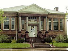
Rice Lake is a city in Barron County in northwest Wisconsin, United States, on the shore of the lake with the same name. The city is a commercial and tourist center for the surrounding rural areas. As of the 2020 census, the city had a total population of 9,040. The city is located mostly within the Town of Rice Lake.

<span class="mw-page-title-main">Turtle Lake, Wisconsin</span> Village in Wisconsin, United States

Turtle Lake is a village in Barron and Polk counties in the U.S. state of Wisconsin. Its population was 1,064 at the 2010 census. Of these, 972 were in Barron County and 93 were in Polk County. The village is located between the towns of Almena, in Barron County, and Beaver, in Polk County.

References

  1. 1 2 3 "2020 Decennial Census: Barron County, Wisconsin". data.census.gov. U.S. Census Bureau. Retrieved July 6, 2022.
  2. "Find a County". National Association of Counties. Archived from the original on July 12, 2012. Retrieved June 7, 2011.
  3. 1 2 "Wisconsin: Individual County Chronologies". Wisconsin Atlas of Historical County Boundaries. The Newberry Library. 2007. Archived from the original on April 14, 2017. Retrieved August 12, 2015.
  4. Wisconsin Legislative Reference Bureau (comp.) State of Wisconsin 1991-1992 Blue Book . Madison: Author, 1991, p. 731.
  5. "Dictionary of Wisconsin History (Wisconsin Historical Society)". Archived from the original on August 24, 2008. Retrieved November 5, 2010.
  6. "Here's How Iron Got Its Name". The Rhinelander Daily News. June 16, 1932. p. 2. Retrieved August 24, 2014 via Newspapers.com. Open Access logo PLoS transparent.svg
  7. "Russians in Wisconsin". August 3, 2012.
  8. "2010 Census Gazetteer Files". United States Census Bureau. August 22, 2012. Retrieved August 2, 2015.
  9. "U.S. Decennial Census". United States Census Bureau. Retrieved August 2, 2015.
  10. "Historical Census Browser". University of Virginia Library. Retrieved August 2, 2015.
  11. Forstall, Richard L., ed. (March 27, 1995). "Population of Counties by Decennial Census: 1900 to 1990". United States Census Bureau. Retrieved August 2, 2015.
  12. "Census 2000 PHC-T-4. Ranking Tables for Counties: 1990 and 2000" (PDF). United States Census Bureau. April 2, 2001. Archived (PDF) from the original on October 9, 2022. Retrieved August 2, 2015.
  13. "2020 Census Population and Housing Map". United States Census Bureau. Archived from the original on December 5, 2021. Retrieved December 5, 2021.
  14. "U.S. Census website". United States Census Bureau . Retrieved May 14, 2011.
  15. "Annual Wisconsin Birth and Infant Mortality Report, 2017 P-01161-19 (June 2019): Detailed Tables". Archived from the original on June 19, 2019. Retrieved June 20, 2019.
  16. Reported Induced Abortions in Wisconsin, Office of Health Informatics, Division of Public Health, Wisconsin Department of Health Services. Section: Trend Information, 2013-2017, Table 18, pages 17-18
  17. Leip, David. "Dave Leip's Atlas of U.S. Presidential Elections". uselectionatlas.org. Retrieved February 8, 2021.
  18. The leading "other" candidate, Progressive Theodore Roosevelt, received 968 votes, while Socialist candidate Eugene Debs received 265 votes, Prohibition candidate Eugene Chafin received 253 votes, and Independent candidate Arthur Reimer received 5 votes.

Further reading

45°25′N91°51′W / 45.42°N 91.85°W / 45.42; -91.85