
Denton is a town in Caroline County, Maryland, United States. The population of Denton was 4,418 as of the 2010 United States Census, and it is the county seat of Caroline County.

Bangor Charter Township is a charter township in Bay County in the U.S. state of Michigan. The township's population was 14,641 as of the 2010 Census and is included in the Bay City Metropolitan Statistical Area.

Chesterfield Charter Township is a charter township of Macomb County in the U.S. state of Michigan. The 2010 census recorded its population to be 43,381.
Harmony is an unincorporated community in Caroline County, Maryland, United States. It is little more than an intersection of state Routes 16 and 578 on Maryland's Eastern Shore. Its original name was Fowling Creek, named after a stream nearby that is a tributary of the Choptank River.

Millersville is an unincorporated community in Anne Arundel County, Maryland, United States. Population was 20,965 in 2015 based on American Community Survey data.
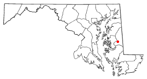
American Corner is a populated place in Caroline County, Maryland, United States. American Corner is home to Colonel Richardson High School and Colonel Richardson Middle School. On older maps, it is sometimes referred to as American Corners. There was formerly a post office, cannery, blacksmith, and a store located there, as seen on the 1875 and 1897 Maps of Caroline County, Maryland.
Andersontown is a populated place on Maryland's Eastern Shore in Caroline County, Maryland, United States. It is situated near the Delaware line, centered on the intersection of Andersontown Road and Maryland Route 404.
Gilpin Point is a cape on Maryland's Eastern Shore in Caroline County, Maryland, United States. It was the home of Revolutionary War soldier William Richardson, who distinguished himself in the Battle of Harlem Heights. There is a tomb dedicated to him next to Gilpin's Point Landing Park. It was placed by the Caroline County Historical Society in the 1950s.
Williston is an unincorporated town and census-designated place on the Eastern Shore of the U.S. state of Maryland, in Caroline County. As of the 2010 census it had a population of 155. It is situated between Maryland Route 16 on its eastern edge and the Choptank River on its west. It was originally known as Potter's Landing for its first resident, Zabdiel Potter. His home, Potter Hall, was listed on the National Register of Historic Places in 1982.

Prospect is an unincorporated community and census-designated place (CDP) in Jackson County, in the U.S. state of Oregon. It lies along Oregon Route 62 on the Rogue River, in the Rogue River – Siskiyou National Forest. As of the 2010 census it had a population of 455.

Norton is an unincorporated community located within Union Township, in Hunterdon County, New Jersey. Norton is located on County Route 635, approximately 1.5 mi (2.4 km) northwest of Interstate 78. The village is included in the Van Syckel Corner District, which was added to the National Register of Historic Places in 1979.

Fairplay is an unincorporated community and census-designated place (CDP) in Washington County, Maryland, United States. Its population was 580 as of the 2010 census. It is sometimes recognized, along with neighboring Tilghmanton, as Fairplay-Tilghmanton; the two communities share a post office as well as a fire company. Fairplay is located between Hagerstown and Sharpsburg, along Maryland Route 65 and is part of the Hagerstown Metropolitan Area. Marsh Mills was listed on the National Register of Historic Places in 1996.
Burrsville is a populated place in Caroline County, Maryland, United States. One of the first references is on the 1875 Map of Caroline County, where the Burrsville Post Office appears. Burrsville is located near the Delaware border.
Reliance is an unincorporated community located on the border of the U.S. states of Maryland and Delaware. The Maryland side of the community has portions in Caroline and Dorchester counties, while the Delaware side is located within Sussex County. Reliance is along Delaware Route 20 and Maryland Route 392 at the junction with Maryland Route 577, west of Seaford. It was previously known as Johnson's Crossroads.
Zionhill is an unincorporated community located in Springfield Township, Bucks County, Pennsylvania, United States. It is located on Old Bethlehem Pike east of the Unami Creek. While the village has its own box post office with the ZIP Code of 18981, surrounding areas use the Coopersburg ZIP Code of 18036 or the Quakertown ZIP Code of 18951.
Hickman is an unincorporated community in Kent County, Delaware, United States. Hickman is located along Delaware Route 16 at the border with Caroline County, Maryland and just north of the Sussex County border, northwest of Greenwood.

Adamsville was a populated place in Pinal County, Arizona. Once a thriving farm town, it became a ghost town by the 1920s. Adamsville is located at an elevation is 1,450 feet, on the south bank of the Gila River, west of Florence, Arizona.
Kasiesville is an unincorporated community in Montgomery Township in Franklin County, Pennsylvania, United States. Kasiesville is located on Pennsylvania Route 75, south of Mercersburg and north of the Maryland border.
Hynson, is an unincorporated community on Maryland's Eastern Shore in Caroline County, Maryland, United States. The earliest record of its existence is from the 1875 Map of Caroline County, where it is referred to as Newhope. In the 1897 Map of Caroline County, it is referred to as Hynson. The Hynson Post Office was located there, which operated from 1881 to 1907.

The historic communities of Alachua County were populated places and/or places with a post office that were established in the 19th century or early 20th century in what is now Alachua County, Florida, but which were abandoned, annexed into an incorporated municipality, or had a much reduced population by the later part of the 20th century.


