Birmingham, Missouri

Last updated

Birmingham, Missouri
Clay County Missouri Incorporated and Unincorporated areas Birmingham Highlighted.svg
Location of Birmingham, Missouri
Coordinates: 39°10′03″N94°27′00″W / 39.16750°N 94.45000°W / 39.16750; -94.45000
Country United States
State Missouri
County Clay
Area
[1]
  Total0.56 sq mi (1.46 km2)
  Land0.56 sq mi (1.46 km2)
  Water0.00 sq mi (0.00 km2)
Elevation
[2]
735 ft (224 m)
Population
 (2020)
  Total189
  Density336.30/sq mi (129.86/km2)
Time zone UTC-6 (Central (CST))
  Summer (DST) UTC-5 (CDT)
ZIP code
64161
Area code 816
FIPS code 29-05824 [3]
GNIS feature ID2398126 [2]
Website villageofbirminghammo.com

Birmingham is a village in Clay County, Missouri, United States. The population was 189 at the 2020 census. [4] It is part of the Kansas City metropolitan area.

Contents

History

Birmingham was founded in 1887. [5] The village was named after Birmingham, England. [6] A post office was established at Birmingham in 1888, and remained in operation until 1956. [7]

Geography

According to the United States Census Bureau, the village has a total area of 0.56 square miles (1.45 km2), all land. [8] Birmingham is entirely surrounded by Kansas City. [9]

Demographics

Historical population
CensusPop.Note
1890 401
1900 217−45.9%
1910 136−37.3%
1920 17528.7%
1930 27356.0%
1940 160−41.4%
1950 23647.5%
1960 201−14.8%
1970 26632.3%
1980 240−9.8%
1990 222−7.5%
2000 214−3.6%
2010 183−14.5%
2020 1893.3%
U.S. Decennial Census [10]

2010 census

As of the census [11] of 2010, there were 183 people, 75 households, and 52 families living in the village. The population density was 326.8 inhabitants per square mile (126.2/km2). There were 85 housing units at an average density of 151.8 per square mile (58.6/km2). The racial makeup of the village was 94.5% White, 0.5% African American, 3.8% Native American, and 1.1% from other races. Hispanic or Latino of any race were 2.7% of the population.

There were 75 households, of which 29.3% had children under the age of 18 living with them, 46.7% were married couples living together, 13.3% had a female householder with no husband present, 9.3% had a male householder with no wife present, and 30.7% were non-families. 24.0% of all households were made up of individuals, and 8% had someone living alone who was 65 years of age or older. The average household size was 2.44 and the average family size was 2.87.

The median age in the village was 36.8 years. 22.4% of residents were under the age of 18; 11.5% were between the ages of 18 and 24; 24.6% were from 25 to 44; 31.8% were from 45 to 64; and 9.8% were 65 years of age or older. The gender makeup of the village was 54.6% male and 45.4% female.

2000 census

As of the census [3] of 2000, there were 214 people, 82 households, and 56 families living in the village. The population density was 419.5 inhabitants per square mile (162.0/km2). There were 89 housing units at an average density of 174.4 per square mile (67.3/km2). The racial makeup of the village was 97.66% White, 0.93% African American, and 1.40% from two or more races.

There were 82 households, out of which 42.7% had children under the age of 18 living with them, 52.4% were married couples living together, 8.5% had a female householder with no husband present, and 31.7% were non-families. 24.4% of all households were made up of individuals, and 7.3% had someone living alone who was 65 years of age or older. The average household size was 2.61 and the average family size was 3.20.

In the village, the population was spread out, with 31.3% under the age of 18, 9.8% from 18 to 24, 26.6% from 25 to 44, 24.8% from 45 to 64, and 7.5% who were 65 years of age or older. The median age was 33 years. For every 100 females, there were 132.6 males. For every 100 females age 18 and over, there were 107.0 males.

The median income for a household in the village was $36,563, and the median income for a family was $45,000. Males had a median income of $38,125 versus $22,857 for females. The per capita income for the village was $16,420. About 8.1% of families and 5.1% of the population were below the poverty line, including 2.6% of those under the age of eighteen and 22.2% of those 65 or over.

Education

North Kansas City School District is the area school district. [12] It is zoned to Topping Elementary School, Maple Park Middle School, and Winnetonka High School. [13]

Related Research Articles

<span class="mw-page-title-main">Birmingham, Iowa</span> City in Iowa, United States

Birmingham is a city in Van Buren County, Iowa, United States. The population was 367 at the 2020 census.

<span class="mw-page-title-main">Amoret, Missouri</span> City in Missouri, United States

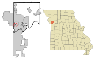
Amoret is a city in western Bates County, Missouri, and is part of the Kansas City metropolitan area within the United States. The population was 133 at the 2020 census.

<span class="mw-page-title-main">Foster, Missouri</span> Village in Missouri, United States

Foster is a village in Bates County, Missouri, and part of the Kansas City metropolitan area within the United States. The population was 76 at the 2020 census.

<span class="mw-page-title-main">Harrisonville, Missouri</span> City in Missouri, United States

Harrisonville is a city in Cass County, Missouri, United States. The population was 10,121 at the 2020 census. It is the county seat of Cass County. It is part of the Kansas City metropolitan area.

<span class="mw-page-title-main">Gladstone, Missouri</span> City in Missouri, United States

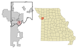
Gladstone is a city in Clay County, Missouri, United States and a suburb of Kansas City. The City of Gladstone is located about 10–20 minutes from downtown Kansas City, and about 10–20 minutes from Kansas City International Airport. As of the 2020 census, the city population was 27,063. It is part of the Kansas City metropolitan area.

<span class="mw-page-title-main">Oaks, Missouri</span> Village in Missouri, United States

Oaks is a village in Clay County, Missouri, United States. The population was 128 at the 2020 census. It is part of the Kansas City metropolitan area.

<span class="mw-page-title-main">Oakview, Missouri</span> Village in Missouri, United States

Oakview is a village in Clay County, Missouri, United States. The population was 366 at the 2020 census. It is part of the Kansas City metropolitan area.

<span class="mw-page-title-main">Oakwood, Missouri</span> Village in Missouri, United States

Oakwood is a village in Clay County, Missouri, United States. The population was 198 at the 2020 census. It is part of the Kansas City metropolitan area.

<span class="mw-page-title-main">Randolph, Missouri</span> City in Missouri, United States

Randolph is a city in Clay County, Missouri, United States. The population was 57 at the 2020 census. It is completely surrounded by Kansas City and is a part of the Kansas City metropolitan area.

<span class="mw-page-title-main">Grain Valley, Missouri</span> City in Missouri, United States

Grain Valley is a city in Jackson County, Missouri, United States. Grain Valley is located in the Kansas City Metropolitan Area and is a suburb of Kansas City. The population was 12,854 at the 2010 census and an estimated 15,627 in 2020. It is 23 miles (37 km) east of downtown Kansas City.

<span class="mw-page-title-main">Unity Village, Missouri</span> Village in Missouri, United States

Unity Village is a village in Jackson County, Missouri, United States, bordering Kansas City and Lee's Summit. It is part of the Kansas City metropolitan area. Its population was 99 at the 2010 census. The founders of the Unity spiritual movement, Charles and Myrtle Fillmore, purchased a 58-acre farm in 1919 as a weekend getaway for employees of their downtown Kansas City headquarters. In March 1920, the land came to be known as Unity Farm, and the following purchase of 12 surrounding farms expanded the land to nearly 1,500 acres.

<span class="mw-page-title-main">Ridgely, Missouri</span> Village in Missouri, United States

Ridgely is a village in Platte County, Missouri within the United States. The population was 104 at the 2010 census. It lies within the Kansas City metropolitan area.

<span class="mw-page-title-main">Riverside, Missouri</span> City in Missouri, United States

Riverside is a city in Platte County, Missouri and is part of the Kansas City metropolitan area within the United States. The population was 4,013 at the 2020 census.

<span class="mw-page-title-main">Elmira, Missouri</span> Village in Missouri, United States

Elmira is a village in northwest Ray County, Missouri, and part of the Kansas City metropolitan area within the United States. The population was 39 at the 2020 census.

<span class="mw-page-title-main">Rayville, Missouri</span> Census-designated place in Missouri, United States

Rayville is a census-designated place and former village in Ray County, Missouri, and part of the Kansas City metropolitan area within the United States. The population was 157 at the 2020 census. It disincorporated in 2012.

<span class="mw-page-title-main">Twin Oaks, Missouri</span> City in Missouri, United States

Twin Oaks is a 4th class city in St. Louis County, Missouri, United States. The former Village of Twin Oaks changed its status to that of a city by public election in November 2016. The population was 392 at the 2010 census.

<span class="mw-page-title-main">Richards, Missouri</span> Village in Missouri, United States

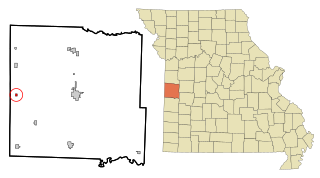
Richards is a village in northwest Vernon County, Missouri, United States. The population was 96 at the 2010 census.

<span class="mw-page-title-main">Baldwin Park, Missouri</span> Village in Missouri, United States

Baldwin Park is a village in Cass County, Missouri, United States. The population was 92 at the 2010 census. It is part of the Kansas City metropolitan area.

<span class="mw-page-title-main">Oakwood Park, Missouri</span> Village in Missouri, United States

Oakwood Park is a village in Clay County, Missouri, United States. The population was 189 at the 2020 census. It is part of the Kansas City metropolitan area.

<span class="mw-page-title-main">Excelsior Estates, Missouri</span> 4th Class City in Missouri in the United States

Excelsior Estates is a village in Clay and Ray counties in the U.S. state of Missouri and part of the Kansas City metropolitan area. The population was 209 at the 2020 census.

References

  1. "ArcGIS REST Services Directory". United States Census Bureau. Retrieved August 28, 2022.
  2. 1 2 U.S. Geological Survey Geographic Names Information System: Birmingham, Missouri
  3. 1 2 "U.S. Census website". United States Census Bureau . Retrieved January 31, 2008.
  4. "Explore Census Data". data.census.gov. Retrieved December 27, 2021.
  5. Ramsay, Robert L. (1952). Our Storehouse of Missouri Place Names. University of Missouri Press. p. 29. ISBN   9780826205865.
  6. "Clay County Place Names, 1928–1945 (archived)". The State Historical Society of Missouri. Archived from the original on June 24, 2016. Retrieved September 19, 2016.{{cite web}}: CS1 maint: bot: original URL status unknown (link)
  7. "Post Offices". Jim Forte Postal History. Archived from the original on March 6, 2016. Retrieved September 19, 2016.
  8. "US Gazetteer files 2010". United States Census Bureau. Archived from the original on January 25, 2012. Retrieved July 8, 2012.
  9. Andriot, John L. Township Atlas of the United States (McLean, Virginia: Andriot Associates, 1979) p. 366
  10. "Census of Population and Housing". Census.gov. Retrieved June 4, 2015.
  11. "U.S. Census website". United States Census Bureau . Retrieved July 8, 2012.
  12. "2020 CENSUS - SCHOOL DISTRICT REFERENCE MAP: Clay County, MO" (PDF). U.S. Census Bureau. Archived (PDF) from the original on September 10, 2022. Retrieved September 9, 2022.
  13. "District Attendance Areas" (PDF). North Kansas City School District. Archived (PDF) from the original on April 22, 2021. Retrieved September 9, 2022.