
Kemp Town Estate, also known as Kemp Town, is a 19th-century Regency architecture residential estate in the east of Brighton in East Sussex, England, UK. It consists of Arundel Terrace, Lewes Crescent, Sussex Square, Chichester Terrace, and the Kemp Town Enclosures. The estate was conceived and financed by Thomas Read Kemp, designed by Charles Busby and Amon Henry Wilds, and constructed by Thomas Cubitt. Work began in 1823 and it was completed in 1855. It has given its name to the larger Kemptown region of Brighton.

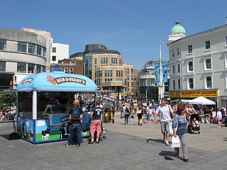
Brighton is a seaside resort and one of the two main areas of the city of Brighton and Hove in the county of East Sussex, England. It is located 47 mi (76 km) south of London. Archaeological evidence of settlement in the area dates back to the Bronze Age, Roman and Anglo-Saxon periods. The ancient settlement of "Brighthelmstone" was documented in the Domesday Book (1086). The town's importance grew in the Middle Ages as the Old Town developed, but it languished in the early modern period, affected by foreign attacks, storms, a suffering economy and a declining population. Brighton began to attract more visitors following improved road transport to London and becoming a boarding point for boats travelling to France. The town also developed in popularity as a health resort for sea bathing as a purported cure for illnesses.

East Sussex is a ceremonial county in South East England. It is bordered by Kent to the north-east, West Sussex to the west, Surrey to the north-west, and the English Channel to the south. The largest settlement is the city of Brighton and Hove, and the county town is Lewes.

Hove is a seaside resort in East Sussex, England. Alongside Brighton, it is one of the two main parts of the city of Brighton and Hove.
Brighton and Hove is a unitary authority with city status in East Sussex, England. There are multiple villages alongside the seaside resorts of Brighton and Hove in the district. It is administered by Brighton and Hove City Council, which is currently under Labour majority control.

Newhaven is a port town in East Sussex in England, lying at the mouth of the River Ouse.

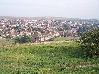
Peacehaven is a town and civil parish in the Lewes district of East Sussex, England. It is located above the chalk cliffs of the South Downs approximately six miles (9.7 km) east of Brighton city centre, on the A259 road. Its site coincides with the point where the Greenwich meridian crosses the English south coast. Peacehaven is next to Telscombe Cliffs, a later western extension to Peacehaven, which lies within a separate parish and has a separate town council.

Kemptown is a small community running along the King's Cliff to Black Rock in the east of Brighton, East Sussex, England.

Volk's Electric Railway (VER) is a narrow gauge heritage railway that runs along a length of the seafront of the English seaside resort of Brighton. It was built by Magnus Volk, the first section being completed in August 1883, and is the oldest operational electric railway in the world, though it was not the first electric railway to be built. It was preceded by electrification of Miller's line in 1875, Werner von Siemens' 1879 demonstration line in Berlin and by the Gross-Lichterfelde Tramway of 1881, although none of these remain in operation.
Whitehawk is a suburb in the east of Brighton, England, south of Bevendean and north of Brighton Marina. The area is a large, modern housing estate built in a downland dry valley historically known as Whitehawk Bottom. The estate was originally developed by the local council between 1933 and 1937 and included nearly 1,200 residences. Subsequently, the Swanborough flats were built in 1967, and in the 1970s and 1980s much of the estate was rebuilt by altering the road layouts and increasing the number of houses. Whitehawk is part of the East Brighton ward of Brighton and Hove City Council.

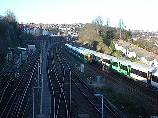
The East Coastway line is a railway line along the south coast of Sussex to the east of Brighton, England. Trains to the west of Brighton operate on the West Coastway line. Together with the West Coastway and the Marshlink line to the east, the line forms part of a continuous route from Havant to Ashford. The Brighton Main Line route to Eastbourne and Hastings, via Plumpton and Cooksbridge, shares the East Coastway line east of Lewes station.

Telscombe is a town and civil parish in the Lewes District of East Sussex, England. It consists of three distinct settlements, separated from each other by an open area of downland called Telscombe Tye.

The history of Brighton is that of an ancient fishing village which emerged as a health resort in the 18th century and grew into one of the largest towns in England by the 20th century.

Brighton Marina is an artificial marina in Brighton, England. It features a working harbour and residential housing alongside a variety of leisure, retail and commercial activities. The construction of the marina itself took place between 1971 and 1979, although developments within it have continued ever since. The marina covers an area of approximately 127 acres (0.51 km2).
Public transport in Brighton and Hove, a city on the south coast of England, dates back to 1840. Brighton and Hove has a major railway station, an extensive bus service, many taxis, coach services, and it has previously had trolley buses, ferries, trams, auto rickshaws and hydrofoils.

Roedean is a village in the city of Brighton and Hove, England, UK, east of the seaside resort of Brighton.

Saltdean is a coastal village in the city of Brighton and Hove, with part outside the city boundary in Lewes district. Saltdean is approximately 5 miles (8 km) east of central Brighton, 5 miles (8 km) west of Newhaven, and 6 miles (9.7 km) south of Lewes. It is bordered by farmland and the South Downs National Park.

Brighton to Newhaven Cliffs is a 165.4-hectare (409-acre) biological and geological Site of Special Scientific Interest and Geological Conservation Review site, which stretches along the coast between Brighton and Newhaven in East Sussex. An area of 16.4 hectares is the Castle Hill, Newhaven Local Nature Reserve

Brighton and Hove, a city and unitary authority in the English county of East Sussex, has a wide range of public services funded by national government, East Sussex County Council, Brighton and Hove City Council and other public-sector bodies. Revenue to fund these services comes partly from Council Tax, which is paid annually by residents: this tax provides the city council with nearly 20% of its income and also helps to fund the local police force, Sussex Police, and the county's fire service, East Sussex Fire and Rescue Service. Some of Brighton and Hove's utilities and infrastructure are provided by outside parties, such as utility companies, rather than by the city council.


