Woodingdean

Last updated

Woodingdean
Woodingdean 01.JPG
Cowley Drive, at the south end of Woodingdean
East Sussex UK location map.svg
Red pog.svg
Woodingdean
Location within East Sussex
Population9,793 (2011.Ward) [1]
Unitary authority
Ceremonial county
Region
Country England
Sovereign state United Kingdom
Post town BRIGHTON
Postcode district BN2
Dialling code 01273
Police Sussex
Fire East Sussex
Ambulance South East Coast
UK Parliament
List of places
UK
England
East Sussex
50°50′10″N0°04′12″W / 50.836°N 0.07°W / 50.836; -0.07

Woodingdean is an eastern suburb of the city of Brighton and Hove, East Sussex, separated from the main part of the city by downland and the Brighton Racecourse. The name Woodingdean came from Woodendean (i.e. wooded valley) Farm which was situated in the south end of what is now Ovingdean. [2]

Contents

History

Woodingdean Water Well Woodingdean water well.jpg
Woodingdean Water Well

The earliest buildings in Woodingdean, apart from scattered farm buildings, were those of the former workhouse school in Warren Road, now the site of the Nuffield Hospital. The grounds contain the capped site of what is claimed to be the deepest hand-dug well in the world, the Woodingdean Water Well, which was created to provide water for the workhouse. It was excavated between 1858 and 1862, and has a depth of 1,285 feet (392 m). [3] [4] [5]

Woodingdean in its present form began to grow up after the First World War in the northern part of the parish of Rottingdean. It consisted of plots of land on the South Downs which had formerly been used for sheep-farming. These were sold by developers (often but not exclusively to returning soldiers) and most were originally smallholdings, e.g. poultry farms.

The junction of Ravenswood Drive and Cowley Drive, showing the proximity of the open countryside of the South Downs. Woodingdean 02.JPG
The junction of Ravenswood Drive and Cowley Drive, showing the proximity of the open countryside of the South Downs.
St Patrick's Roman Catholic Church, Woodingdean St Patrick's RC Church, Woodingdean.JPG
St Patrick's Roman Catholic Church, Woodingdean

The development of the present residential area very much mirrors that of neighbouring Ovingdean. From the 1920s building plots were sold off and first generation shacks and houses began to appear. The area was once locally notorious, like nearby Peacehaven, for the shacks that were put up on these plots, whose architectural styles ranged from Wooden Hut to Railway Carriage Body. Life in these plotlands was satirized in a stage play by H. F. Maltby called What Might Happen (1927). In 1928, both Woodingdean and Ovingdean became part of Brighton County Borough, a move which heralded a substantial increase in residential development.

The area was extensively developed during the 1950s and 1960s when most of the roads in the north-eastern and southern ends of the village were built, including North Woodingdean and South Woodingdean Council estates, which give Woodingdean its distinctive layout - a kidney shaped suburb with private estates in the middle, and a layer of council housing round the edge backing on to the open Downs. There was also a small industrial estate at the north-western end, just off Falmer Road next to the North Woodingdean Estate. The main buildings were the Jaycee Furniture factory and Sunblest Bakery, closed in the 1990s and demolished in 2002.

Notable areas

Woodingdean and Happy Valley seen from Ovingdean Road Woodingdean and Happy Valley seen from Ovingdean Road, Ovingdean (August 2014).JPG
Woodingdean and Happy Valley seen from Ovingdean Road

The most notable thing about Woodingdean is its incredible views to the south over the Downs to the English Channel and the number of pleasant walks there are to do in the area. To the west it is a short walk to Brighton, to the northwest there are downland paths to Bevendean and to north there are walks from Upper Bevendean Farm to Falmer Hill. To the east of the Falmer Road there are walks to Newmarket Hill and into the historic Falmer parish as well as east towards Kingston near Lewes through Newmarket Bottom and the remarkable Castle Hill Local nature reserve.

Downland to the South

Footpath above East Brighton Golf Course leading to Warren Avenue, Woodingdean Footpath above East Brighton Golf Course leading to Warren Avenue, Woodingdean (August 2014) (1).JPG
Footpath above East Brighton Golf Course leading to Warren Avenue, Woodingdean

To the south of Warren Road, past Nuffield Hospital is Wick Bottom ( TQ 35 04 ). The valley is a peaceful valley which takes its name from the medieval farm on the Falmer Road, now long-gone. The name ‘wick’ may denote a far more ancient, perhaps Roman, farmstead. In modern times it has been a place of arable stubbles, but there be a good array of chalk loving plants such as henbit deadnettle, field madder, round-leaved fluellen and common fumitory. [6]

East Brighton Golf Course ( TQ 346 042 ) lies to the valley's west and is unlike many Downland courses in that it has left the scrub thickets and woodland. In winter short-eared owls often reside in the area.

To the east of the valley rises to Mount Pleasant. There is a small triangle of rich chalk grassland. It’s rough and derelict, but special wildlife clings on and there are big swarms of Pride of Sussex rampion, dropwort, horseshoe vetch and hairy violet. European stonechat frequent its thorn and bramble. [6]

To the west of the Falmer Road is Happy Valley, ( TQ 357 047 ), a bushy, cattle-grazed slope with old Down pasture herbs, bits of gorse and thorn. The area includes a recreation park

Downland to the East

Track at The Bostle Track at The Bostle - geograph.org.uk - 2126615.jpg
Track at The Bostle

To the east of Woodingdean is the Bostle barrow field ( TQ 371 054 ), a ‘precious fragment’ of antiquity surrounded by agricultural fields. The field has a cluster of at least twenty-seven small low grassy mounds, which are probably Saxon, and three larger, probably Bronze Age barrows on the top of the hill just south of the bridleway fence line. The Bostle valley slope ( TQ 371 048 ) is an ancient Down pasture slope with the softest sheep’s fescue turf, just south of the barrow field. [6] To the northeast is Bullock Hill with bostal tracks through Standean Bottom to old Balsdean.

Related Research Articles

<span class="mw-page-title-main">Brighton and Hove</span> City and unitary authority in England

Brighton and Hove is a city with unitary authority status in East Sussex, England. There are multiple villages alongside the seaside resorts of Brighton and Hove in the district. It is administered by Brighton and Hove City Council, which is currently in Labour majority control.

<span class="mw-page-title-main">Falmer</span> Village near Brighton, England

Falmer is a small village and civil parish in the Lewes District of East Sussex, England, lying between Brighton and Lewes, approximately five miles (8 km) north-east of the former. It is also the site of Brighton & Hove Albion's Falmer Stadium.

<span class="mw-page-title-main">Bevendean</span> Human settlement in England

Bevendean is a district of the city of Brighton and Hove, in East Sussex, England.

<span class="mw-page-title-main">Iford, East Sussex</span> Village in East Sussex, England

Iford is a village and civil parish in the Lewes District of East Sussex, England. The village is located two miles (3.2 km) south of Lewes. The parish lies on slopes of the South Downs in the valley of the River Ouse.

<span class="mw-page-title-main">Kingston near Lewes</span> Village in East Sussex, England

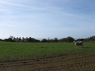
Kingston near Lewes is a village and civil parish in the Lewes District of East Sussex, England. The village is mentioned in the Domesday Book and is located two miles (3.2 km) south of Lewes and is nestled in the South Downs. The parish is par of two Sites of Special Scientific Interest: the Lewes Brooks and Kingston Escarpment and Iford Hill.

<span class="mw-page-title-main">St Ann Without</span> Human settlement in England

St Ann Without is a civil parish in the Lewes District of East Sussex, England. It covers an area to the west of the town of Lewes, including Long Hill.

<span class="mw-page-title-main">Westmeston</span> Village in East Sussex, England

Westmeston is a village and civil parish in the Lewes District of East Sussex, England heavily dependent in amenities on larger Ditchling to the near-immediate northwest. It is four miles (6 km) south-southeast of Burgess Hill and (10 km) west of Lewes, on the northern slopes of the South Downs.

<span class="mw-page-title-main">Fulking</span> Human settlement in England

Fulking is a village and civil parish in the Mid Sussex District of West Sussex, England. The parish lies wholly with the South Downs National Park.

<span class="mw-page-title-main">Newtimber</span> Human settlement in England

Newtimber is a small village and civil parish in the Mid Sussex District of West Sussex, England. It is located north-west of Brighton. The parish also includes the hamlet of Saddlescombe. The parish lies almost wholly with the South Downs National Park, with the exception of a small section of the parish north of the B2117 road. The planning authority for Newtimber is therefore the South Downs National Park Authority (SDNPA), the statutory planning authority for the National Park area. The downland scarp, which includes Newtimber Hill, Newtimber Holt, Saddlescombe chalk quarry and Summer Down, is mostly part of the Beeding Hill to Newtimber Hill, designated Site of Special Scientific Interest.

<span class="mw-page-title-main">Pyecombe</span> Human settlement in England

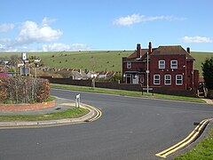
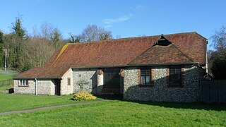
Pyecombe is a village and civil parish in the Mid Sussex District of West Sussex, England. The name 'Pyecombe' may derive from the Saxon "pic" meaning point or pike, in which case it may mean "valley marked by a projecting hill".

<span class="mw-page-title-main">Moulsecoomb</span> Human settlement in England

Moulsecoomb is a suburb of Brighton, Sussex, England, on the northeast side around the A270 Lewes Road, between Coldean and Bevendean, 2+14 miles (3.6 km) north of the seafront. The eastern edge adjoins Falmer Hill on the South Downs. It is often divided into smaller sections on maps: North Moulsecoomb, East Moulsecoomb and South Moulsecoomb.

<span class="mw-page-title-main">Coldean</span> Suburb of Brighton and Hove, England

<span class="mw-page-title-main">Hangleton</span> Suburb of Hove, Sussex, England

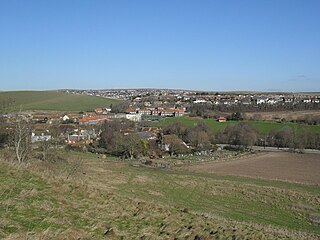
Hangleton is a residential suburb of Hove, in the unparished area of Hove, in the Brighton and Hove district, in the ceremonial county of East Sussex, England. The area was developed in the 1930s after it was incorporated into the borough of Hove, but has ancient origins: its parish church was founded in the 11th century and retains 12th-century fabric, and the medieval manor house is Hove's oldest secular building. The village became depopulated in the medieval era and the church fell into ruins, and the population in the isolated hilltop parish only reached 100 in the early 20th century; but rapid 20th-century development resulted in more than 6,000 people living in Hangleton in 1951 and over 9,000 in 1961. By 2013 the population exceeded 14,000.

<span class="mw-page-title-main">Ovingdean</span> Village in East Sussex, England

Ovingdean is a small, formerly agricultural village and former civil parish, now in the unparished area of Brighton, in the Brighton and Hove district, in the ceremonial county East Sussex, England. In 1921 the parish had a population of 476. On 1 April 1928 the parish was abolished and merged with Brighton.

Younsmere Hundred was an administrative unit in the Rape of Lewes in the eastern division of the county of Sussex, England until the abolition of hundreds in the 19th century. The Rape was a county sub-division peculiar to Sussex. For most of the Younsmere hundred's existence it included the parishes of Rottingdean, Ovingdean and Falmer, i.e. the parishes covering a block of downland east of Brighton.

<span class="mw-page-title-main">Balsdean</span> Abandoned hamlet in East Sussex, England

<span class="mw-page-title-main">Westdene</span> Human settlement in England

Westdene is an area of the city of Brighton and Hove, East Sussex. It is an affluent northern suburb of the city, west of Patcham, the A23 and the London to Brighton railway line, north of Withdean and northeast of West Blatchington. It is on the Brighton side of the historic parish boundary between Brighton and Hove and is served by Preston Park railway station. It is known for its greenery and woodland and is very close to the South Downs, from which it is separated by the Brighton Bypass, and was built on the slopes of two hills.

<span class="mw-page-title-main">Newmarket Hill, Sussex</span> Village in East Sussex, England

Newmarket Hill is situated in the parish of Kingston near Lewes. It is located midway between, and within walking distance of, two of the most important population centres in East Sussex, Brighton and Lewes.

<span class="mw-page-title-main">Bear Road, Brighton</span>

The Bear Road area is a largely residential area in the east of Brighton, part of the English city of Brighton and Hove. Centred on the steep west–east road of that name, it is characterised by terraced houses of the early 20th century, but Brighton's main cemeteries were established here in the 19th century and there is also some industry.

<span class="mw-page-title-main">Bevendean Down</span>

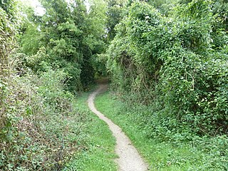
Bevendean Down is a 64.6-hectare (160-acre) Local Nature Reserve in the Bevendean district in Brighton, East Sussex. It is owned by Brighton and Hove Council and managed by tenant farmers and others. It is mainly chalk grassland and there are also areas of woodland and scrub. This site is in five separate blocks.

References

  1. "Brighton and Hove ward population 2011" . Retrieved 13 October 2015.
  2. "History of Woodingdean". My Brighton and Hove. Retrieved 21 October 2021.
  3. "Woodingdean Well". www.mybrightonandhove.org.uk. 2005. Archived from the original on 3 January 2018. Retrieved 16 November 2019.
  4. "Woodingdean in Business". WoodingdeaninBusiness.
  5. "Deepest hand dug well in the world".
  6. 1 2 3 Bangs, Dave (2008). A freedom to roam Guide to the Brighton Downs : from Shoreham to Newhaven and Beeding to Lewes. Brighton: David Bangs. ISBN   978-0-9548638-1-4. OCLC   701098669.

Further reading