Blackhorse Road station

Last updated

Blackhorse Road Underground no-text.svg Overground roundel (no text).svg
Blackhorse Road station MMB 15 172001.jpg
Class 172 Turbostar at the station in 2012
Greater London UK location map 2.svg
Red pog.svg
Blackhorse Road
Location of Blackhorse Road in Greater London
Location Walthamstow
Local authority London Borough of Waltham Forest
Managed by London Underground
Owner London Underground
Network Rail
Station codeBHO
DfT category E
Number of platforms4
AccessibleYes (London Overground only) [1]
Fare zone 3
London Underground annual entry and exit
2018Increase2.svg 9.01 million [2]
2019Increase2.svg 9.74 million [3]
2020Decrease2.svg 6.16 million [4]
2021Decrease2.svg 4.99 million [5]
2022Increase2.svg 8.51 million [6]
National Rail annual entry and exit
2018–19Increase2.svg 2.014 million [7]
2019–20Decrease2.svg 1.838 million [7]
2020–21Decrease2.svg 0.972 million [7]
2021–22Increase2.svg 1.753 million [7]
2022–23Increase2.svg 1.932 million [7]
Key dates
9 July 1894National Rail opened
1 September 1968Victoria line started
14 December 1981BR station resited
Other information
External links
WGS84 51°35′13″N0°02′29″W / 51.586944°N 0.041389°W / 51.586944; -0.041389
Underground sign at Westminster.jpg  London transportportal

Blackhorse Road is an interchange station, located at the junction of Blackhorse Road/Blackhorse Lane with Forest Road in Walthamstow, London for London Underground and London Overground services.

Contents

It is on the Victoria line of the London Underground and is the penultimate station on the eastern end of that line. Above ground, the station is on the Gospel Oak to Barking line of the London Overground, 7  miles 21  chains (11.7 km) from St Pancras (measured via Kentish Town and Mortimer Street Junction). [8]

It is in Travelcard Zone 3 [9] and is the least-used station on the Victoria line, with 6.44 million passengers per year. It is the closest railway station to Walthamstow Wetlands.

Ticket barriers control access to all platforms. Passengers using Oyster cards are required to tap on a yellow Oyster card reader at ticket gates when entering and leaving the station and - to be charged a lower fare - suggested to also tap on a pink Oyster card reader if transferring between the two lines.

History

The station was opened by the Tottenham and Forest Gate Railway on 9 July 1894, [10] and was originally situated east of Blackhorse Road. [11] Its opening changed the local area from a gentrified London suburb to industrial, with several works and units opening around Ferry Lane to the northwest. [12]

The Victoria line station opened on 1 September 1968, across the road from the mainline station. [10] [13] It was planned as a simple two-platform station, and was the only station on the line with any new structures above ground level. [14] The surface line station was re-sited by British Rail on 14 December 1981, to provide better interchange with the Underground station. [15]

The station today

Structure

The station contains two underground platforms for the Victoria line and two for the London Overground. Owing to budget restraints at the time of construction, the Underground station, like many stations on the Victoria line, was never completely finished to the standard of other lines.[ citation needed ] White ceiling panels were never fixed to the ceilings above the platforms; instead the steel tunnel segments were painted black and used to support the fixtures and fittings. This has had a detrimental effect on the lighting levels.[ citation needed ]

Artwork

The black horse tile motif at the tube station. Tile design at Blackhorse Road underground station - geograph.org.uk - 1767778.jpg
The black horse tile motif at the tube station.

There are two distinct works of art at the station, both depicting black horses, in reference to the station's name. One is in the form of a tile motif depicting a black horse on a white cameo against a light blue background, identical to the Victoria line's colour. It was designed by Hans Unger, who also did the tile motif at Seven Sisters tube station. The other is a mural of a black horse outside the station's entrance, by David McFall. [16]

Services

During peak periods, trains run approximately every two minutes on the Victoria line (up to 33 trains per hour) in both directions. [17] [18]

The typical off-peak service for the London Overground Suffragette line in trains per hour (tph) is:

From June 2016 until February 2017, services on the route were suspended whilst it was electrified; this project involved lowering track in several places, rebuilding bridges and lengthening platforms as well as installing overhead wires. [20] A replacement bus service was in operation for the duration of the closure period.

Connections

London Bus routes 123, 158, 230, W11 and night route N73 serve the station. [21]

Related Research Articles

<span class="mw-page-title-main">Kew Gardens station (London)</span> London Underground and London Overground station

Kew Gardens is a Grade II–listed London Underground and London Overground station in Kew, in the London Borough of Richmond upon Thames. It first opened in 1869 and is now managed by London Underground. The station, which is in Travelcard Zones 3 and 4, is served by both the District line on the London Underground and the North London line on the London Overground, and is situated midway between Gunnersbury and Richmond stations.

<span class="mw-page-title-main">Canning Town station</span> London Underground and Docklands Light Railway station

Canning Town is an interchange station located in Canning Town, London for London Underground, Docklands Light Railway (DLR) and London Buses services.

<span class="mw-page-title-main">Queen's Park station (England)</span> London Underground and London Overground station

Queen's Park is an interchange station on the Watford DC line and Bakerloo line served by London Overground and London Underground respectively. It lies at the southern end of Salusbury Road, near the south-east corner of the public park from which the area now known as Queen's Park has taken its modern name. The station is in Travelcard Zone 2.

<span class="mw-page-title-main">Wembley Central station</span> London Underground and railway station

Wembley Central is an interchange station in Wembley, North West London for London Underground and London Overground services on the Watford DC line and National Rail services on the West Coast Main Line.

<span class="mw-page-title-main">Kenton station</span> London Underground and railway station

Kenton is a railway station on the Watford DC line and the Bakerloo line, situated on Kenton Road in Kenton, north-west London. The station is served by London Overground and London Underground services. It has an out of station interchange (OSI) with Northwick Park station on the London Underground's Metropolitan line. On the London Underground’s Bakerloo line, the station is between Harrow & Wealdstone and South Kenton stations.

<span class="mw-page-title-main">Whitechapel station</span> National rail, London Underground and Overground station

Whitechapel is an interchange station in Whitechapel, East London for London Underground, London Overground and Elizabeth line services. The station is located behind a street market of the same name and opposite Tower Hamlets Town Hall. It lies between Aldgate East and Stepney Green stations on the District and Hammersmith & City lines, between Shoreditch High Street and Shadwell stations on the East London Line. To the West of Whitechapel on the Elizabeth Line is Liverpool Street, to the East the line splits with one branch going to Stratford and one to Canary Wharf. It is in Travelcard Zone 2.

<span class="mw-page-title-main">Stepney Green tube station</span> London Underground station

Stepney Green is a London Underground station located on Mile End Road in Stepney, London, United Kingdom. It is between Whitechapel and Mile End on the District line and the Hammersmith & City line, and is in Travelcard Zone 2.

<span class="mw-page-title-main">Bow Road tube station</span> London Underground station

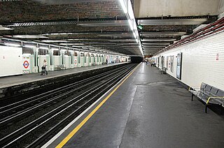
Bow Road is a London Underground station located on Bow Road in Bow, London, England. It is on the District and Hammersmith & City lines. The station is interlinked as an out of station interchange (OSI) with Bow Church station on the Docklands Light Railway which is about 300 m (980 ft) away via Bow Road. The two stations are classed as a single station for ticketing purposes as well as on tube maps but both are managed separately.

<span class="mw-page-title-main">Bromley-by-Bow tube station</span> London Underground station

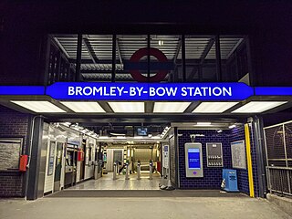
Bromley-by-Bow is a London Underground station located on the Blackwall Tunnel Northern Approach Road in the Bromley-by-Bow area of London, United Kingdom. The station is below the Blackwall Tunnel Northern Approach Road and lies between Bow Road and West Ham stations on the District and Hammersmith & City lines, and is in both Travelcard Zones 2 and 3.

<span class="mw-page-title-main">Gospel Oak to Barking line</span> London Overground line

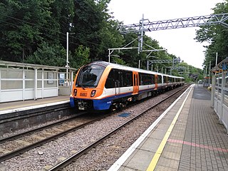
The Gospel Oak to Barking line, sometimes unofficially called the Goblin, is a railway line in London. It is 13 miles 58 chains (22.1 km) in length and carries both through goods trains and London Overground passenger trains, connecting Gospel Oak in north London and Barking Riverside in east London. The line is part of Network Rail Strategic Route 6, and is classified as a London and South East Commuter line. On 15 February 2024 Transport for London announced that the Overground service will be renamed the Suffragette line as part of a strategic rebrand.

<span class="mw-page-title-main">Barking station</span> Interchange railway station in London

Barking is an interchange station serving the town of Barking, east London. It is served by London Underground, London Overground and National Rail main line services. It is located on Station Parade, in the town centre.

<span class="mw-page-title-main">Kensington (Olympia) station</span> London Underground, London Overground and National rail station

Kensington (Olympia) is an interchange station located in Kensington, in West London for London Overground and National Rail services. Limited London Underground services also run here.

<span class="mw-page-title-main">Upminster station</span> London Underground and railway station

Upminster is an interchange station serving the town of Upminster in the London Borough of Havering, Greater London. It is on the London, Tilbury and Southend line (LTSR), 15 miles 20 chains (24.5 km) down the line from London Fenchurch Street; it is the eastern terminus of the District line on the London Underground; and it is the eastern terminus of the Romford to Upminster Line on the London Overground network. Upminster is the easternmost station on the London Underground network as well as the easternmost National Rail station in London.

<span class="mw-page-title-main">Walthamstow Queen's Road railway station</span> Railway station in Walthamstow, London

Walthamstow Queen's Road railway station is a London Overground station between Blackhorse Road and Leyton Midland Road stations on the Gospel Oak to Barking line, 8 miles 7 chains (13.0 km) down the line from Gospel Oak. It is in Zone 3. It opened as "Walthamstow" on 9 July 1894 and was renamed on 6 May 1968 under British Rail. The station stands on Edinburgh Road facing Walthamstow Cemetery. There is step-free access from the street to both platforms.

<span class="mw-page-title-main">Walthamstow Central station</span> London Underground and London Overground station

Walthamstow Central is an interchange station located in Walthamstow in the London Borough of Waltham Forest for London Underground, London Overground and London Buses services.

<span class="mw-page-title-main">Seven Sisters station</span> London Underground and London Overground station

Seven Sisters is an interchange station located in the Seven Sisters area of the London Borough of Haringey, North London for London Underground, London Overground and National Rail services.

<span class="mw-page-title-main">South Tottenham railway station</span> London Overground station

South Tottenham is a railway station on the east–west Gospel Oak to Barking Line of the London Overground. It is located on the eastern side of the north–south A10 High Road in Tottenham, North London, 5 miles 69 chains (9.4 km) from St Pancras and situated between Harringay Green Lanes and Blackhorse Road. It is in Zone 3, in the London Borough of Haringey. South Tottenham to Seven Sisters station is considered an official out-of-station interchange by the National Rail timetable, and involves a short walk. This link will become fixed under the planned route for Crossrail 2, which sees a double-ended underground station built linking together South Tottenham and Seven Sisters stations.

<span class="mw-page-title-main">Tottenham Hale station</span> London Underground and railway station in the London Borough of Haringey

Tottenham Hale is an interchange station located in Tottenham Hale, North London for London Underground and National Rail services.

<span class="mw-page-title-main">West Brompton station</span> London Underground, London Overground and National Rail station

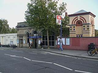
West Brompton is a station located on Old Brompton Road (A3218) in West Brompton, West London for London Underground, London Overground and National Rail services. It is immediately south of the demolished Earls Court Exhibition Centre and west of Brompton Cemetery in the Royal Borough of Kensington and Chelsea.

<span class="mw-page-title-main">Balham station</span> London Underground and railway station

Balham is an interchange station located in central Balham in the London Borough of Wandsworth, South London for London Underground and National Rail services.

References

  1. Standard Tube Map (PDF) (Map). Not to scale. Transport for London. November 2022. Archived (PDF) from the original on 7 November 2022. Retrieved 12 November 2022.
  2. "Station Usage Data" (CSV). Usage Statistics for London Stations, 2018. Transport for London. 23 September 2020. Archived from the original on 14 January 2023. Retrieved 11 October 2023.
  3. "Station Usage Data" (XLSX). Usage Statistics for London Stations, 2019. Transport for London. 23 September 2020. Archived from the original on 9 November 2020. Retrieved 9 November 2020.
  4. "Station Usage Data" (XLSX). Usage Statistics for London Stations, 2020. Transport for London. 16 April 2021. Retrieved 1 January 2022.
  5. "Station Usage Data" (XLSX). Usage Statistics for London Stations, 2021. Transport for London. 12 July 2022. Retrieved 7 September 2022.
  6. "Station Usage Data" (XLSX). Usage Statistics for London Stations, 2022. Transport for London. 4 October 2023. Retrieved 10 October 2023.
  7. 1 2 3 4 5 "Estimates of station usage". Rail statistics. Office of Rail Regulation. Please note: Some methodology may vary year on year.
  8. Padgett, David (October 2016) [1988]. Brailsford, Martyn (ed.). Railway Track Diagrams 2: Eastern (4th ed.). Frome: Trackmaps. map 1B. ISBN   978-0-9549866-8-1.
  9. Standard Tube Map (PDF) (Map). Not to scale. Transport for London. November 2022. Archived (PDF) from the original on 7 November 2022. Retrieved 12 November 2022.
  10. 1 2 Butt 1995, p. 36.
  11. OS London 1:1,056 - Sheet III.39 (Map). 1895. Retrieved 18 June 2019.
  12. 'Walthamstow: Introduction and domestic buildings', in A History of the County of Essex: Volume 6, ed. W R Powell (London, 1973), pp. 240-250. British History Online http://www.british-history.ac.uk/vch/essex/vol6/pp240-250 [Retrieved 18 June 2019].
  13. Horne 1988, p. 24.
  14. ""The Railway in a Bathroom": on the design of London's Victoria line at 50 | CityMetric". www.citymetric.com.
  15. The Forgotten Stations of Greater London by J.Connor and B.Halford ISBN   0 947699 17 1
  16. Porter, Laura. "Blackhorse Road". GoLondon. Archived from the original on 12 July 2014. Retrieved 4 August 2014.
  17. "Victoria line timetable: From Blackhorse Road Underground Station to Walthamstow Central Underground Station". Transport for London . Retrieved 13 March 2015.
  18. "Victoria line timetable: From Blackhorse Road Underground Station to Tottenham Hale Underground Station". Transport for London . Retrieved 13 March 2015.
  19. 1 2 "Gospel Oak to Barking Riverside route" (PDF). 18 July 2022. Archived from the original (PDF) on 16 July 2022. Retrieved 18 July 2022.
  20. "Eight-month closure planned for GOBLIN electrification" Global Rail News article 2 February 2016; retrieved 7 June 2016
  21. "Buses from Blackhorse Road" (PDF). 20 October 2013. Retrieved 13 March 2015.

Sources

Butt, R. V. J. (October 1995). The Directory of Railway Stations: details every public and private passenger station, halt, platform and stopping place, past and present (1st ed.). Sparkford: Patrick Stephens Ltd. ISBN   978-1-85260-508-7. OCLC   60251199. OL   11956311M.

Preceding station Underground no-text.svg London Underground Following station
Tottenham Hale
towards Brixton
Victoria line Walthamstow Central
Terminus
Preceding station Overground notextroundel.svg National Rail logo.svg London Overground Following station
South Tottenham
towards Gospel Oak
Gospel Oak to Barking line Walthamstow Queen's Road