Glencoe is a city in Calhoun and Etowah counties in the U.S. state of Alabama. It is part of the Gadsden Metropolitan Statistical Area. The city incorporated in 1939. The population was 5,160 at the 2010 census.

Harrisburg is a city in Poinsett County, Arkansas, United States. The population was 2,288 at the 2010 census. It is included in the Jonesboro, Arkansas Metropolitan Statistical Area. The city is the county seat of Poinsett County.

Morganton is a city in Fannin County, Georgia, United States. The population was 303 at the 2010 census.
Ridge Farm is a village in Elwood Township, Vermilion County, Illinois, United States. It is part of the Danville, Illinois Metropolitan Statistical Area. The population was 940 at the 2020 census.

Edgewood is a city in Clayton and Delaware counties in the U.S. state of Iowa. Highway 3, which runs through the center of town, is the dividing line between the two counties. The Edgewood post office was established in 1852 on the Clayton side of the town. Edgewood was formally incorporated in 1892, although it had a functioning council for some time before that date. The population was 909 at the time of the 2020 census, down from 923 in 2000.

Nemaha is a city in Sac County, Iowa, United States. The population was 66 at the time of the 2020 census.

Blue Ridge Manor is a home rule-class city in Jefferson County, Kentucky, United States. The city was formally incorporated by the state assembly in 1964. The population was 767 at the 2010 census, up from 623 at the 2000 census.

Sycamore is a home rule-class city in Jefferson County, Kentucky, United States. The population was 160 at the 2010 census.

Sand Ridge is a hamlet in Oswego County, New York, United States. The population was 849 at the 2010 census.

Dougherty is a town in Murray County, Oklahoma, United States. The population was 224 at the 2000 census. American jazz and pop singer Kay Starr was born in Dougherty.

Wysox Township is a township in Bradford County, Pennsylvania. It is part of Northeastern Pennsylvania. The population was 1,721 at the 2010 census.

Elim is an unincorporated community and census-designated place (CDP) in Upper Yoder Township, Cambria County, Pennsylvania, United States. The population was 3,727 at the 2010 census, down from 4,175 at the 2000 census.

Oglala is a census-designated place (CDP) in West Oglala Lakota Unorganized Territory equivalent, Oglala Lakota County, South Dakota, United States. The population was 1,282 at the 2020 census. Its location is in the northwest of the Pine Ridge Indian Reservation.

Lowry Crossing is a city in Collin County, Texas, United States. The population was 1,711 at the 2010 census.

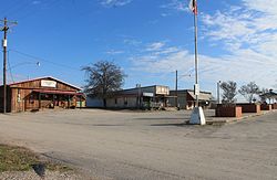
Oak Ridge is a town in Kaufman County, Texas, United States. The population was 495 at the 2010 census, up from 400 at the 2000 census.

La Rosita is a census-designated place (CDP) in Starr County, Texas, United States. The population was 85 at the 2010 census down from 1,729 at the 2000 census. This is because the Census Bureau redefined the CDP.

Los Villareales is a former census-designated place (CDP) in Starr County, Texas, United States. The population was 930 at the 2000 census. The CDP was deleted prior to the 2010 census. Part was annexed to Rio Grande City and parts were taken to form all of La Escondida, La Esperanza, and Santel CDPs and parts of Mi Ranchito Estate and Ranchitos del Norte CDPs.

Morrison is a town in Brown County in the U.S. state of Wisconsin. The population was 1,599 at the 2010 census.
East Koochiching is an unorganized territory in Koochiching County, Minnesota, United States. The population was 383 at the 2000 census.
Northwest St. Louis is an unorganized territory in Saint Louis County, Minnesota, United States. The population was 306 at the 2000 census.