
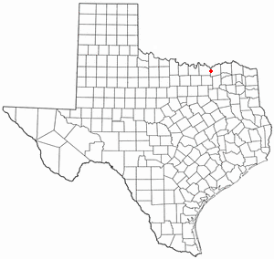
Grayson County is a county in the U.S. state of Texas. As of the 2010 census, its population was 120,877. The county seat is Sherman. The county was founded in 1846 and is named after Peter Wagener Grayson, an attorney general of the Republic of Texas. Grayson County is included in the Sherman-Denison metropolitan statistical area, which is also included in the Dallas-Fort Worth-Arlington, combined statistical area. It is also part of the Texoma region, with proximity to both Lake Texoma and the Red River.

Collin County is located in the U.S. state of Texas. It is part of the Dallas-Fort Worth-Arlington metropolitan statistical area, and a small portion of the city of Dallas is in the county. As of the 2010 United States Census, the county's population was 782,341, making it the seventh-most populous county in Texas and the 45th-largest county by population in the United States. Per the American Community Survey's estimates, its population reached 1,034,730 in 2019. Its county seat is McKinney.

Grayson is a city in Gwinnett County, Georgia, United States. The population was 2,666 at the 2010 census, up from 765 in 2000.

Sedalia is a town in Guilford County, North Carolina, United States. The population was 623 at the 2010 census.
Midway is a village in Range Township, Madison County, Ohio, United States. The population was 322 at the 2010 census.

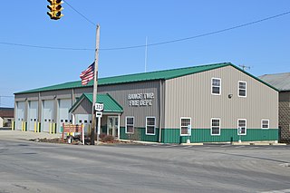
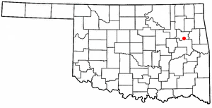
Grayson is a town in Okmulgee County, Oklahoma, United States. The population was 159 at the 2010 census, an increase of 18.7 percent from the figure of 134 recorded in 2000.
Tullahassee is a town in Wagoner County, Oklahoma, United States. The population was 106 in both the 2010 and the 2000 censuses. It was the location of Tullahassee Mission. Tullahassee is considered the oldest of the all-black towns in Oklahoma.

Bartonville is a town in Denton County, Texas, United States. The population was 1,469 at the 2010 census.
Savoy is a city in Fannin County, Texas, United States. The population was 831 at the 2010 census.

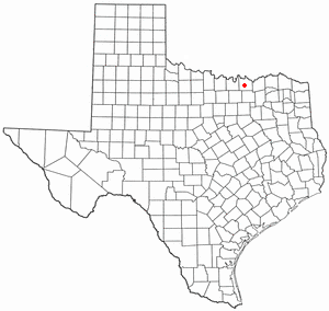
Trenton is a city in Fannin and Grayson counties, Texas, United States. The population was 635 at the 2010 census.

Bells is a city in Grayson County, Texas, United States. The population was 1,392 at the 2010 census, up from 1,190 at the 2000 census. The city lies north of Dallas and is part of the Sherman–Denison Metropolitan Statistical Area.

Collinsville is a town in Grayson County, Texas, United States. Its population was 1,624 at the 2010 census, up from 1,235 at the 2000 census. It is part of the Sherman–Denison metropolitan statistical area. Collinsville is located on U.S. Route 377 south of Whitesboro.
Dorchester is a city in Grayson County, Texas, United States. The population was 148 at the 2010 census, up from 109 at the 2000 census. It is part of the Sherman–Denison Metropolitan Statistical Area.
Gunter is a city in the southwestern corner of Grayson County, Texas, United States. The population was 1,498 at the 2010 census, up from 1,230 at the 2000 census. It is part of the Sherman–Denison Metropolitan Statistical Area.

Knollwood is a city in Grayson County, Texas, United States. The population was 432 at the 2010 census. It is part of the Sherman–Denison metropolitan statistical area.

Sadler is a city in Grayson County, Texas, United States. The population was 343 at the 2010 census, down from 404 at the 2000 census. It is part of the Sherman–Denison Metropolitan Statistical Area.

Southmayd is a city in Grayson County, Texas, United States. The population was 992 at the 2010 census. It is part of the Sherman–Denison Metropolitan Statistical Area.

Tom Bean is a city in Grayson County, Texas, United States. The population was 1,045 at the 2010 census, up from 941 at the 2000 census.

Avery is a town in Red River County, in the U.S. state of Texas. The population was 482 at the 2010 census. From the 1920s through the early 1960s Avery was one of the largest tomato producing and shipping cities in northeastern Texas.
The Sherman–Denison metropolitan statistical area (MSA), as defined by the United States Census Bureau, is an area consisting of one county – Grayson – in North Texas, anchored by the cities of Sherman and Denison. As of the 2010 census, the MSA had a population of 120,877. The Sherman–Denison MSA is a component of the Dallas-Ft. Worth combined statistical area, which covers a 19-county area and had an estimated population of 8,057,796 as of July 1, 2009. It is also a major part of the Texoma region with proximity to both Lake Texoma and the Red River.


