The Loop, one of Chicago's 77 designated community areas, is the central business district of the city and is the main section of Downtown Chicago. Home to Chicago's commercial core, it is the second largest commercial business district in North America and contains the headquarters and regional offices of several global and national businesses, retail establishments, restaurants, hotels, and theaters, as well as many of Chicago's most famous attractions. It is home to Chicago's City Hall, the seat of Cook County, and numerous offices of other levels of government and consulates of foreign nations. The intersection of State Street and Madison Street, located in the area, is the origin of the address system of Chicago's street grid. Most of Grant Park's 319 acres (1.29 km2) are in the eastern section of the community area. The Loop community area is bounded on the north and west by the Chicago River, on the east by Lake Michigan, and on the south by Roosevelt Road.
Berwyn is a suburban city in Cook County, Illinois, coterminous with Berwyn Township, which was formed in 1908 after breaking off from Cicero Township. As of the 2020 census, the city had a total population of 57,250.

Bridgeview is a village in Cook County, Illinois, United States. It is located approximately 15 miles (24 km) southwest of the Chicago Loop. As of the 2020 census, the village population was 17,027.

Elmhurst is a city mostly in DuPage County and overlapping into Cook County in the U.S. state of Illinois, and a western suburb of Chicago. As of 2021, the city has an estimated population of 47,260.
Oak Forest is a city in Cook County, Illinois, United States. The city is out 24 miles (39 km) south-southwest of downtown Chicago in Bremen Township. Per the 2020 census, the population was 27,478.

Riverside is a suburban village in Cook County, Illinois, United States. A significant portion of the village is in the Riverside Landscape Architecture District, designated a National Historic Landmark in 1970. The population of the village was 9,298 at the 2020 census, up from 8,875 at the 2010 census. It is a suburb of Chicago, located roughly 9 miles (14 km) west of downtown Chicago and 2 miles (3 km) outside city limits.

Grayslake is a village in Lake County, Illinois, United States. It is located in the Chicago metropolitan area, about 40 miles (64 km) north of Chicago's downtown, 14 miles (23 km) west of Lake Michigan, and 15 miles (24 km) south of the Wisconsin border. The village's population at the 2020 census was 21,248.

Lakeview, also spelled Lake View, is one of the 77 community areas of Chicago, Illinois. Lakeview is located in the city's North Side. It is bordered by West Diversey Parkway on the south, West Irving Park Road on the north, North Ravenswood Avenue on the west, and the shore of Lake Michigan on the east. The Uptown community area is to Lakeview's north, Lincoln Square to its northwest, North Center to its west, and Lincoln Park to its south. The 2020 population of Lakeview was 103,050 residents, making it the second largest of the Chicago community areas by population.

The Fairfax District is a neighborhood in the Central region of Los Angeles, California.

Irving Park is one of 77 officially designated Chicago community areas located on the Northwest Side. It is bounded by the Chicago River on the east, the Milwaukee Road railroad tracks on the west, Addison Street on the south and Montrose Avenue on the north, west of Pulaski Road stretching to encompass the region between Belmont Avenue on the south and, roughly, Leland Avenue on the north. It is named after the American author Washington Irving.
Ashburn, one of Chicago's 77 community areas, is located on the south side of the city. Greater Ashburn covers nearly five square miles. The approximate boundaries of Ashburn are 72nd Street (north), Western Avenue (east), 87th Street (south) and Cicero Avenue (west).

The Near South Side is a community area of Chicago, Illinois, United States, just south of the downtown central business district, the Loop. The Near South Side's boundaries are as follows: North—Roosevelt Road ; South—26th Street; West—Chicago River between Roosevelt and 18th Street, Clark Street between 18th Street and Cermak Road, Federal between Cermak Road and the Stevenson Expressway just south of 25th Street, and Clark Street again between the Stevenson and 26th Street; and East—Lake Michigan.

West Town, northwest of the Loop on Chicago's West Side, is one of the city's officially designated community areas. Much of this area was historically part of Polish Downtown, along Western Avenue, which was then the city's western boundary. West Town was a collection of several distinct neighborhoods and the most populous community area until it was surpassed by Near West Side in the 1960s. The boundaries of the community area are the Chicago River to the east, the Union Pacific railroad tracks to the south, the former railroad tracks on Bloomingdale Avenue to the North, and an irregular western border to the west that includes the city park called Humboldt Park. Humboldt Park is also the name of the community area to West Town's west, Logan Square is to the north, Near North Side to the east, and Near West Side to the south. The collection of neighborhoods in West Town along with the neighborhoods of Bucktown and the eastern portion of Logan Square have been referred to by media as the Near Northwest Side.

Manhattan Community Board 5 is a New York City community board, part of the local government apparatus of the city, with the responsibility for the neighborhoods of Midtown, Times Square, most of the Theater District, the Diamond District, the Garment District, Herald Square, Koreatown, NoMad, Murray Hill and the Flatiron District, all in the borough of Manhattan. It is bounded by 59th Street on the north, Eighth Avenue, 26th Street, the Avenue of the Americas on the west, 14th Street on the south, and Lexington Avenue on the east, excluding the area from 34th to 40th Streets between Madison and Lexington Avenues, and the area from 20th to 22nd Streets between Park Avenue South and Lexington Avenue/Irving Place.
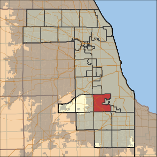
Worth Township is one of 29 townships in Cook County, Illinois. As of the 2010 census, its population was 152,633, with its most populous municipalities including Oak Lawn, Evergreen Park (19,852), Alsip, and Chicago Ridge. It was founded in 1849, when the county voted to subdivide itself into townships.

Lyons Township is one of 29 townships in Cook County, Illinois. As of the 2010 census, its population was 111,688, with its most populous municipalities including La Grange, Justice and Summit. Lyons Township was established in 1850. The village of Lyons, almost all of which lies within the township, is often confused with it.
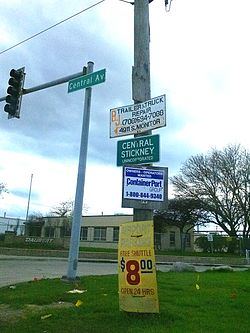
Stickney Township is one of 29 townships in Cook County, Illinois. As of the 2010 census, its population was 40,772, with approximately 71% of that total living in the city of Burbank.

The Gold Coast Historic District is a historic district in Chicago, Illinois. Part of Chicago's Near North Side community area, it is roughly bounded by North Avenue, Lake Shore Drive, Oak Street, and Clark Street.

Harwood is a small neighborhood located in the north-central area of Baltimore, Maryland, USA. It sits east of Charles Village, south of Abell, west of Waverly and north of Barclay. Its boundaries are Guilford and Greenmount Avenues to the east and west, and 25th and 29th streets to the north and south. These streets together encompass about 14 city blocks.
The West Side is one of the three major sections of the city of Chicago in Cook County, Illinois, along with the North Side and the South Side. The West Side consists of communities that are of historical, cultural, and ideological importance to the history and development of Chicago. On the flag of Chicago, the West Side is represented by the central white stripe.