Civil parishes in Cornwall

Last updated

A blank map of mainland Cornwall showing civil parish boundaries Cornwall UK mainland parish map (blank).svg
A blank map of mainland Cornwall showing civil parish boundaries

A civil parish is a country subdivision, forming the lowest unit of local government in England. There are 218 civil parishes in the ceremonial county of Cornwall, which includes the Isles of Scilly. The county is effectively parished in its entirety; only the unpopulated Wolf Rock is unparished. At the 2001 census, there were 501,267 people living in the current parishes, accounting for the whole of the county's population. The final unparished areas of mainland Cornwall, around St Austell, were parished on 1 April 2009 to coincide with the structural changes to local government in England.

Contents

Population sizes within the county vary considerably, Falmouth is the most populous with a population of 26,767, recorded in 2011, and St Michael's Mount the least with 29 residents. The county is governed by two separate unitary authorities; Cornwall Council covers mainland Cornwall, while the Isles of Scilly are administered by their own unitary authority.

History

Parishes arose from Church of England divisions, and were originally purely ecclesiastical. Over time, they acquired civil administration powers. [1]

The Highways Act 1555 made parishes responsible for the upkeep of roads. Every adult inhabitant of the parish was obliged to work four days a year on the roads, providing their own tools, carts and horses; the work was overseen by an unpaid local appointee, the Surveyor of Highways. [2]

The poor were looked after by the monasteries, until their dissolution. In 1572, magistrates were given power to 'survey the poor' and impose taxes for their relief. This system was made more formal by the Poor Law Act 1601, which made parishes responsible for administering the Poor Law; overseers were appointed to charge a rate to support the poor of the parish. [3] The 19th century saw an increase in the responsibility of parishes, although the Poor Law powers were transferred to Poor Law Unions. [4] The Public Health Act 1872 grouped parishes into Rural Sanitary Districts, based on the Poor Law Unions; these subsequently formed the basis for rural districts. [5]

Parishes were run by vestries, meeting annually to appoint officials, and were generally identical to ecclesiastical parishes, [6] although some townships in large parishes administered the Poor Law themselves. Under the Divided Parishes and Poor Law Amendment Act 1882, all extra-parochial areas and townships that levied a separate rate became independent civil parishes. [7]

Civil parishes in their modern sense date from the Local Government Act 1894, which abolished vestries; established elected parish councils in all rural parishes with more than 300 electors; grouped rural parishes into Rural Districts; and aligned parish boundaries with county and borough boundaries. [7] Urban civil parishes continued to exist, and were generally coterminous with the urban district, municipal borough or county borough in which they were situated. Many large towns contained a number of parishes, and these were usually merged into one. Parish councils were not formed in urban areas, and the only function of the parish was to elect guardians to Poor Law Unions. With the abolition of the Poor Law system in 1930 the parishes had only a nominal existence. [8]

The Local Government Act 1972 retained civil parishes in rural areas, and many former urban districts and municipal Boroughs that were being abolished, were replaced by new successor parishes. Urban areas that were considered too large to be single parishes became unparished areas. [9]

Current position

Recent governments have encouraged the formation of town and parish councils in unparished areas. The Local Government and Rating Act 1997 gave local residents the right to demand the creation of a new civil parish. [10]

A parish council can become a town council unilaterally, simply by resolution. A civil parish can also gain city status, but only if that is granted by the Crown. The chairman of a town or city council is called a mayor. [9] The Local Government and Public Involvement in Health Act 2007 introduced alternative names: a parish council can now choose to be called a community; village; or neighbourhood council. [11]

Within Cornwall, the 2007 Act lead to the abolition of the six district councils and Cornwall County Council, establishing in their place the single unitary authority, Cornwall Council. All civil parish councils became the responsibility of this authority. [9] At the same time, four new civil parishes were created in the St Austell area, parishing the last remaining populated part of the county. [12]

List of civil parishes and unparished area

ImageName
Cornish name [13]
StatusPopulationDistrictFormer local council [A] Refs
The Dam at Crowdy Reservoir - geograph.org.uk - 380089.jpg Advent
Sen Adhwynn
Civil parish153 Cornwall
Kernow
Camelford
Rural District
[14]
[15]
Altarnun - The Kings Head, Fivelanes - geograph.org.uk - 511738.jpg Altarnun
Alternonn
Civil parish976 Cornwall
Kernow
Launceston
Rural District
[16]
[15]
The River Lynher at low tide - geograph.org.uk - 1049579.jpg Antony
Trevanta
Civil parish436 Cornwall
Kernow
St Germans
Rural District
[17]
[18]
Blisland, Horse and Riders. - geograph.org.uk - 224948.jpg Blisland
Blyslann
Civil parish565 Cornwall
Kernow
Wadebridge and Padstow
Rural District
[19]
[15]
Brooks - geograph.org.uk - 1006496.jpg Boconnoc
Boskennek
Civil parish121 Cornwall
Kernow
Liskeard
Rural District
[20]
[18]
Fore Street, Bodmin from Turf Street - geograph.org.uk - 846665.jpg Bodmin
Bosvenegh
Town12,881 Cornwall
Kernow
Bodmin
Municipal Borough
[21]
[15]
St Mary's church - Botusfleming - geograph.org.uk - 1599446.jpg Botusfleming
Bosflumyes
Civil parish783 Cornwall
Kernow
St Germans
Rural District
[17]
[18]
Bennacott Methodist Church - geograph.org.uk - 498493.jpg Boyton
Trevoya
Civil parish378 Cornwall
Kernow
Launceston
Rural District
[16]
[15]
Detail, Lesceave Rocks, Hendra - geograph.org.uk - 230971.jpg Breage
Eglosbrek
Civil parish2,955 Cornwall
Kernow
Kerrier
Rural District
[22]
[23]
View to Milldown Wood - geograph.org.uk - 1006505.jpg Braddock
Brodhek
Civil parish124 Cornwall
Kernow
Launceston
Rural District
[16]
[18] [24]
View SW towards Rushy Bay from Samson Hill, Bryher - geograph.org.uk - 15831.jpg Bryher
Breyer
Civil parish92 Isles of Scilly
Enesek Syllan
Isles of Scilly
Rural District
[25]
[26]
Bude Haven - geograph.org.uk - 1487587.jpg Bude–Stratton
Bud–Strasnedh
Town9,242 Cornwall
Kernow
Bude–Stratton
Urban District
[27]
[15]
Argal Reservoir Dam - geograph.org.uk - 162835.jpg Budock
Budhek
Civil parish1,399 Cornwall
Kernow
Kerrier
Rural District
[22]
[23]
The Road to Kelly Bray - geograph.org.uk - 1262813.jpg Callington
Kelliwik
Town4,783 Cornwall
Kernow
St Germans
Rural District
[17]
[18]
Calstock and the Viaduct - geograph.org.uk - 293332.jpg Calstock
Kalstok
Civil parish6,095 Cornwall
Kernow
St Germans
Rural District
[17]
[18]
Two ancient crosses in the grounds of Camborne Parish Church - geograph.org.uk - 1017203.jpg Camborne
Kammbronn
Town20,010 Cornwall
Kernow
Camborne–Redruth
Urban District
[28]
[23]
Manor Farm Camelford - geograph.org.uk - 1808500.jpg Camelford
Ryskammel
Town2,256 Cornwall
Kernow
Camelford
Rural District
[14]
[15]
Cardinham Parish Church - geograph.org.uk - 1046395.jpg Cardinham
Kardhinan
Civil parish588 Cornwall
Kernow
Wadebridge and Padstow
Rural District
[19]
[15]
Mills Hall, Carharrack - geograph.org.uk - 145461.jpg Carharrack
Karardhek
Civil parish1,324 Cornwall
Kernow
Camborne–Redruth
Urban District
[28]
[23]
Magnificent Magnolia at Pine Lodge - geograph.org.uk - 1240162.jpg Carlyon Civil parish1,333 Cornwall
Kernow
St Austell with Fowey
Municipal Borough
[29]
[30]
[12]
Michell's whim - geograph.org.uk - 688695.jpg Carn Brea
Carn Bre
Civil parish7,466 Cornwall
Kernow
Camborne–Redruth
Urban District
[28]
[23]
Chacewater Literary Institute - geograph.org.uk - 148043.jpg Chacewater
Dowr an Chas
Civil parish1,517 Cornwall
Kernow
Truro
Rural District
[31]
[32]
Barn, Bosoughan - geograph.org.uk - 1965647.jpg Colan
Kolan
Civil parish1,766 Cornwall
Kernow
St Austell
Rural District
[33]
[34]
Constantine - cottage near Polwheveral Mill - geograph.org.uk - 981968.jpg Constantine
Lanngostentin
Civil parish1,705 Cornwall
Kernow
Kerrier
Rural District
[22]
[23]
Crantock Beach - geograph.org.uk - 178578.jpg Crantock
Lanngorrow
Civil parish764 Cornwall
Kernow
Newquay
Urban District
[35]
[34]
Clowance Estate - geograph.org.uk - 336982.jpg Crowan
Egloskrowenn
Civil parish2,375 Cornwall
Kernow
Kerrier
Rural District
[22]
[23]
St Cubert's Church, Cubert - geograph.org.uk - 904461.jpg Cubert
Lannowynn
Civil parish1,155 Cornwall
Kernow
Truro
Rural District
[31]
[32]
Two chapels at Cury White Cross - geograph.org.uk - 367242.jpg Cury
Egloskuri
Civil parish388 Cornwall
Kernow
Kerrier
Rural District
[22]
[23]
Davidstow Creamery - geograph.org.uk - 735475.jpg Davidstow
Lanndhewi
Civil parish470 Cornwall
Kernow
Camelford
Rural District
[14]
[15]
Barrett's Zawn - geograph.org.uk - 1946940.jpg Delabole
Delyow Boll
Civil parish Cornwall
Kernow
Camelford
Rural District
[14]
[24]
Sunrise over Whitsand Bay - geograph.org.uk - 342935.jpg Deviock Civil parish1,341 Cornwall
Kernow
St Germans
Rural District
[17]
[18]
Bosent Cross.jpg Dobwalls
Fos an Mogh
Civil parish1,939 (Dobwalls and Trewidland boundaries) Cornwall
Kernow
Liskeard
Rural District
[20]
[18] [24]
Duloe, West Looe River - geograph.org.uk - 138444.jpg Duloe
Dewlogh
Civil parish660 Cornwall
Kernow
Liskeard
Rural District
[20]
[18]
Cattle in the River - geograph.org.uk - 202965.jpg Egloshayle
Eglosheyle
Civil parish371 Cornwall
Kernow
Wadebridge and Padstow
Rural District
[19]
[15]
Egloskerry - geograph.org.uk - 722290.jpg Egloskerry
Egloskeri
Civil parish374 Cornwall
Kernow
Launceston
Rural District
[16]
[15]
The keep at Pendennis Castle - geograph.org.uk - 2017920.jpg Falmouth
Aberfal
Town26,767 Cornwall
Kernow
Falmouth
Municipal Borough
[36]
[32]
Sunset on Carrick Roads - geograph.org.uk - 320991.jpg Feock
Lannfiek
Civil parish3,505 Cornwall
Kernow
Truro
Rural District
[31]
[32]
Sunrise view, Boscastle Harbour - geograph.org.uk - 1577301.jpg Forrabury and Minster Civil parish888 Cornwall
Kernow
Camelford
Rural District
[14]
[15]
Fowey from the water - geograph.org.uk - 1240367.jpg Fowey
Fowydh
Town2,273 Cornwall
Kernow
St Austell with Fowey
Municipal Borough
[29]
[34]
St Germoe's Chair - geograph.org.uk - 985678.jpg Germoe
Germow
Civil parish508 Cornwall
Kernow
Kerrier
Rural District
[22]
[23]
Portscatho - geograph.org.uk - 233819.jpg Gerrans
Gerens
Civil parish933 Cornwall
Kernow
Truro
Rural District
[31]
[32]
Cadgwith Cove - geograph.org.uk - 9871.jpg Grade–Ruan Civil parish1,070 Cornwall
Kernow
Kerrier
Rural District
[22]
[23]
Fore Street Grampound - geograph.org.uk - 1816580.jpg Grampound with Creed
Ponsmeur a'byth Sen Krida
Civil parish638 Cornwall
Kernow
St Austell
Rural District
[33]
[34]
The View from Gunwalloe Cove - geograph.org.uk - 266924.jpg Gunwalloe
Gwynnwalow
Civil parish221 Cornwall
Kernow
Kerrier
Rural District
[22]
[23]
Gweek - Bridge over the creek - geograph.org.uk - 1827530.jpg Gweek
Gwig
Civil parish581 Cornwall
Kernow
Kerrier
Rural District
[22]
[23]
Engine house at Cusvey - geograph.org.uk - 1051186.jpg Gwennap
Lanwenep
Civil parish1,501 Cornwall
Kernow
Truro
Rural District
[31]
[32]
Surfing at Gwithian Sands - geograph.org.uk - 526303.jpg Gwinear–Gwithian
Sen Gwynnyer–
Sen Goedhyan
Civil parish3,032 Cornwall
Kernow
West Penwith
Rural District
[37]
[38]
Hayle viaduct - geograph.org.uk - 1880018.jpg Hayle
Heyl
Town8,317 Cornwall
Kernow
West Penwith
Rural District
[37]
[38]
Helland Church - geograph.org.uk - 1631379.jpg Helland
Hellann
Civil parish205 Cornwall
Kernow
Wadebridge and Padstow
Rural District
[19]
[15]
Coinagehall Street Helston - geograph.org.uk - 1300507.jpg Helston
Hellys
Town9,780 Cornwall
Kernow
Helston
Municipal Borough
[39]
[23]
Samphire Island - geograph.org.uk - 189805.jpg Illogan
Egloshal
Civil parish5,585 Cornwall
Kernow
Camborne–Redruth
Urban District
[28]
[23]
Road into Jacobstow - geograph.org.uk - 713508.jpg Jacobstow
Lannjago
Civil parish421 Cornwall
Kernow
Stratton
Rural District
[40]
[15]
Come To Good Friends' Meeting House, near Feock and Truro, Cornwall - geograph.org.uk - 47198.jpg Kea
Sen Ke
Civil parish1,516 Cornwall
Kernow
Truro
Rural District
[31]
[32]
A Row of Terraced Houses at Green Bottom - geograph.org.uk - 148053.jpg Kenwyn
Keynwynn
Civil parish4,944 Cornwall
Kernow
Truro
Rural District
[31]
[32]
Pasture to the North West of Penstowe (Kilkhampton) Castle - geograph.org.uk - 407228.jpg Kilkhampton
Tregylgh
Civil parish1,193 Cornwall
Kernow
Stratton
Rural District
[40]
[15]
Ladock - geograph.org.uk - 195681.jpg Ladock
Egloslasek
Civil parish1,522 Cornwall
Kernow
Truro
Rural District
[31]
[32]
Lizard RNLI lifeboat station, Kilcobben Cove - geograph.org.uk - 229727.jpg Landewednack
Lanndewynnek
Civil parish886 Cornwall
Kernow
Kerrier
Rural District
[22]
[23]
Circular lawn big.JPG Landrake with
St Erney

Lannergh a'byth
Sen Erney
Civil parish1,001 Cornwall
Kernow
St Germans
Rural District
[17]
[18]
Quay Cottage at Salter Mill - geograph.org.uk - 469698.jpg Landulph
Lanndhelek
Civil parish485 Cornwall
Kernow
St Germans
Rural District
[17]
[18]
Stone cross on Laneast downs - geograph.org.uk - 2002536.jpg Laneast
Lannast
Civil parish164 Cornwall
Kernow
Launceston
Rural District
[16]
[15]
Gatehouse and Garden at Lanhydrock House - geograph.org.uk - 455917.jpg Lanhydrock
Lannhydrek
Civil parish171 Cornwall
Kernow
Wadebridge and Padstow
Rural District
[19]
[15]
Lamorick village - geograph.org.uk - 1816031.jpg Lanivet
Lanneves
Civil parish1,844 Cornwall
Kernow
Wadebridge and Padstow
Rural District
[19]
[15]
Lower Tregantle - geograph.org.uk - 1226543.jpg Lanlivery
Lannlivri
Civil parish492 Cornwall
Kernow
St Austell
Rural District
[33]
[34]
Baronet's Engine House, Pennance Consols - geograph.org.uk - 145190.jpg Lanner
Lannergh
Civil parish2,493 Cornwall
Kernow
Camborne–Redruth
Urban District
[28]
[23]
Cottages in Lanreath - geograph.org.uk - 1139940.jpg Lanreath
Lannreydhow
Civil parish514 Cornwall
Kernow
Liskeard
Rural District
[20]
[18]
Fowey Harbour from Polruan - geograph.org.uk - 535297.jpg Lanteglos
Nanseglos
Civil parish994 Cornwall
Kernow
Liskeard
Rural District
[20]
[18]
The Post Office, Grimscott - geograph.org.uk - 1198120.jpg Launcells
Lannseles
Civil parish563 Cornwall
Kernow
Stratton
Rural District
[40]
[15]
Launceston - the castle - geograph.org.uk - 571477.jpg Launceston
Lannstefan
Town7,135 Cornwall
Kernow
Launceston
Municipal Borough
[41]
[15]
Lawhitton Church - geograph.org.uk - 330652.jpg Lawhitton Rural
Nansgwydhenn
Civil parish270 Cornwall
Kernow
Launceston
Rural District
[16]
[15]
River Valency valley. - geograph.org.uk - 846884.jpg Lesnewth
Lysnowydh
Civil parish68 Cornwall
Kernow
Camelford
Rural District
[14]
[15]
Gravestones, Trevadlock - geograph.org.uk - 638447.jpg Lewannick
Lannwenek
Civil parish884 Cornwall
Kernow
Launceston
Rural District
[16]
[15]
Trekenner Village - geograph.org.uk - 423683.jpg Lezant
Lannsans
Civil parish751 Cornwall
Kernow
Launceston
Rural District
[16]
[15]
Mine engine house, near Minions, 1979 - geograph.org.uk - 66066.jpg Linkinhorne
Lanngynhorn
Civil parish1,471 Cornwall
Kernow
Liskeard
Rural District
[20]
[18]
2007 at Moorswater viaduct - old and new piers.jpg Liskeard
Lyskerrys
Town8,656 Cornwall
Kernow
Liskeard
Municipal Borough
[42]
[18]
East Looe River, Cornwall - geograph.org.uk - 1909483.jpg Looe
Logh
Town5,280 Cornwall
Kernow
Looe
Urban District
[43]
[18]
Lostwithiel - the Stannary Palace - geograph.org.uk - 571361.jpg Lostwithiel
Lostwydhyel
Town2,739 Cornwall
Kernow
St Austell
Rural District
[33]
[34]
Eglos Farm - geograph.org.uk - 539822.jpg Ludgvan
Ludewan
Civil parish3,184 Cornwall
Kernow
West Penwith
Rural District
[37]
[38]
China Clay for export - geograph.org.uk - 1664157.jpg Luxulyan
Lansulien
Civil parish1,371 Cornwall
Kernow
St Austell
Rural District
[33]
[34]
Early Morning Mist over Argal Reservoir - geograph.org.uk - 1277191.jpg Mabe
Lannvab
Civil parish1,276 Cornwall
Kernow
Kerrier
Rural District
[22]
[23]
Anemones in National Trust gardens at Trengwainton - geograph.org.uk - 469854.jpg Madron
Eglosvadern
Civil parish1,533 Cornwall
Kernow
West Penwith
Rural District
[37]
[38]
The Cremyll Ferry on the Tamar - geograph.org.uk - 1184611.jpg Maker-with-Rame
Magor a-berth
Hordh
Civil parish1,071 Cornwall
Kernow
St Germans
Rural District
[17]
[18]
Quay at mouth of Frenchman's Creek - geograph.org.uk - 1371500.jpg Manaccan
Managhan
Civil parish299 Cornwall
Kernow
Kerrier
Rural District
[22]
[23]
St Michael's Mount causeway and the town of Marazion - geograph.org.uk - 1852186.jpg Marazion
Marghasyow
Town1,466 Cornwall
Kernow
West Penwith
Rural District
[37]
[38]
Footpath to Widemouth Bay - geograph.org.uk - 1460008.jpg Marhamchurch
Eglosvarwenn
Civil parish754 Cornwall
Kernow
Stratton
Rural District
[40]
[15]
Mawgan Cross - geograph.org.uk - 418405.jpg Mawgan-in-Meneage
Sen Mowgan
Civil parish1,117 Cornwall
Kernow
Kerrier
Rural District
[22]
[23]
Beacon Cove - geograph.org.uk - 620373.jpg Mawgan-in-Pydar
Lanherne
Civil parish1,176 Cornwall
Kernow
St Austell
Rural District
[33]
[34]
Bream Cove - geograph.org.uk - 236875.jpg Mawnan
Sen Mownan
Civil parish1,454 Cornwall
Kernow
Kerrier
Rural District
[22]
[23]
Bridge and garden - geograph.org.uk - 2025529.jpg Menheniot
Mahunyes
Civil parish1,605 Cornwall
Kernow
Liskeard
Rural District
[20]
[18]
Mevagissey Harbour - geograph.org.uk - 1643196.jpg Mevagissey
Lannvorek
Civil parish2,221 Cornwall
Kernow
St Austell with Fowey
Municipal Borough
[29]
[34]
Duckpond at Tregawn Farm - geograph.org.uk - 379810.jpg Michaelstow
Lannvighal
Civil parish199 Cornwall
Kernow
Camelford
Rural District
[14]
[15]
Anderton and Millbrook Lake - geograph.org.uk - 106806.jpg Millbrook
Govermelin
Civil parish2,033 Cornwall
Kernow
St Germans
Rural District
[17]
[18]
Chun Quoit - geograph.org.uk - 974.jpg Morvah
Morvedh
Civil parish79 Cornwall
Kernow
West Penwith
Rural District
[37]
[38]
Looe train at Terras bridge - geograph.org.uk - 737616.jpg Morval
Morval
Civil parish616 Cornwall
Kernow
Liskeard
Rural District
[20]
[18]
Cattle and Church - geograph.org.uk - 1907364.jpg Morwenstow
Lannvorwenna
Civil parish768 Cornwall
Kernow
Stratton
Rural District
[40]
[15]
The Harbour, Mullion Cove - geograph.org.uk - 1817468.jpg Mullion
Eglosvelyan
Civil parish1,986 Cornwall
Kernow
Kerrier
Rural District
[22]
[23]
Launching pilot gigs, Flushing Beach - geograph.org.uk - 459478.jpg Mylor
Lannwydhek
Civil parish2,533 Cornwall
Kernow
Truro
Rural District
[31]
[32]
Atlantic Hotel, Newquay, and headland from Tolcarne Beach.jpg Newquay
Tewyn Plustry
Town19,423 Cornwall
Kernow
Newquay
Urban District
[35]
[34]
Kilmar Tor - geograph.org.uk - 7112.jpg North Hill
Bre Gledh
Civil parish917 Cornwall
Kernow
Launceston
Rural District
[16]
[15]
Tamar Otter Sanctuary - geograph.org.uk - 147424.jpg North Petherwin
Paderwynn Gledh
Civil parish777 Cornwall
Kernow
Launceston
Rural District
[16]
[15]
Track to Haydon Farm, North Tamerton - geograph.org.uk - 1005051.jpg North Tamerton
Tre war Damer
Civil parish288 Cornwall
Kernow
Stratton
Rural District
[40]
[15]
The St. Tinney Arms - geograph.org.uk - 233019.jpg Otterham
Prasdowrgi
Civil parish228 Cornwall
Kernow
Camelford
Rural District
[14]
[15]
Padstow, inner harbour - geograph.org.uk - 94724.jpg Padstow
Lannwedhenek
Town3,162 Cornwall
Kernow
Wadebridge and Padstow
Rural District
[19]
[15]
Pelynt - geograph.org.uk - 77845.jpg Pelynt
Plunennys
Civil parish1,124 Cornwall
Kernow
Liskeard
Rural District
[20]
[18]
Kings Arms - geograph.org.uk - 2015067.jpg Penryn
Penrynn
Town7,166 Cornwall
Kernow
Penryn
Municipal Borough
[44]
[32]
Pentewan Sands Caravan Site - geograph.org.uk - 31461.jpg Pentewan Valley Civil parish542 Cornwall
Kernow
St Austell with Fowey
Municipal Borough
[29]
[45]
[12]
Pilchards - "Cornish Sardines" - geograph.org.uk - 73778.jpg Penzance
Pensans
Town21,168 Cornwall
Kernow
Penzance
Municipal Borough
[46]
[38]
Cottages on the Valleyside - geograph.org.uk - 147739.jpg Perranarworthal
Pyran ar Woethel
Civil parish1,558 Cornwall
Kernow
Truro
Rural District
[31]
[32]
Vegetable production land by Mounts Bay - geograph.org.uk - 748338.jpg Perranuthnoe
Pyranudhno
Civil parish2,200 Cornwall
Kernow
West Penwith
Rural District
[37]
[38]
Bolingey - geograph.org.uk - 66038.jpg Perranzabuloe
Pyran yn Treth
Civil parish5,382 Cornwall
Kernow
Truro
Rural District
[31]
[32]
The Fal chain ferry at Trelissick - geograph.org.uk - 1660080.jpg Philleigh
Eglosros
Civil parish159 Cornwall
Kernow
Truro
Rural District
[31]
[32]
Cornish fields at Kernock near Pillaton - geograph.org.uk - 1395823.jpg Pillaton
Trebeulyow
Civil parish435 Cornwall
Kernow
St Germans
Rural District
[17]
[18]
Polperro - Harbour - geograph.org.uk - 1691231.jpg Polperro
Porthpyra
Civil parish1,584 Cornwall
Kernow
Liskeard
Rural District
[20]
[18]
Ponsanooth - geograph.org.uk - 166832.jpg Ponsanooth
Pons an Woodh
Civil parish1,271 Cornwall
Kernow
Kerrier
Rural District
[22]
[23] [24]
Sunset 6.jpg Porthleven
Porthleven
Town3,190 Cornwall
Kernow
Helston
Municipal Borough
[39]
[23]
Royal Navy Rescue Helicopter passing Western Hill - geograph.org.uk - 189510.jpg Portreath
Porthtreth
Civil parish1,377 Cornwall
Kernow
Camborne–Redruth
Urban District
[28]
[23]
The Northern Beach on Widemouth Sand - geograph.org.uk - 1494895.jpg Poundstock
Tregorlann
Civil parish805 Cornwall
Kernow
Stratton
Rural District
[40]
[15]
The Old Methodist Church, Probus - geograph.org.uk - 197343.jpg Probus
Lannbroboes
Civil parish2,082 Cornwall
Kernow
Truro
Rural District
[31]
[32]
Maids House - geograph.org.uk - 413969.jpg Quethiock
Gwydhek
Civil parish429 Cornwall
Kernow
St Germans
Rural District
[17]
[18]
Cornish Miner Statue, Redruth - geograph.org.uk - 1903992.jpg Redruth
Resrudh
Town12,352 Cornwall
Kernow
Camborne–Redruth
Urban District
[28]
[23]
Old Hermitage - geograph.org.uk - 1650790.jpg Roche
An Garrek
Civil parish2,876 Cornwall
Kernow
St Austell
Rural District
[33]
[34]
Pond at Ruan Lanihorne - geograph.org.uk - 1260447.jpg Ruanlanihorne
Lannihorn
Civil parish250 Cornwall
Kernow
Truro
Rural District
[31]
[32]
Royal Albert Bridge -Saltash -England-17Dec2009.jpg Saltash
Essa
Town14,964 Cornwall
Kernow
Saltash
Municipal Borough
[47]
[18]
Carn Euny ancient village - geograph.org.uk - 658610.jpg Sancreed
Eglossankres
Civil parish628 Cornwall
Kernow
West Penwith
Rural District
[37]
[38]
Costa Del Cornwall - geograph.org.uk - 498396.jpg Sennen
Sen Senan
Civil parish829 Cornwall
Kernow
West Penwith
Rural District
[37]
[38]
Entrance to the path by Tregantle Fort - geograph.org.uk - 74921.jpg Sheviock
Seviek
Civil parish683 Cornwall
Kernow
St Germans
Rural District
[17]
[18]
Gardens at Trevarno - geograph.org.uk - 32885.jpg Sithney
Sen Sydhni
Civil parish767 Cornwall
Kernow
Kerrier
Rural District
[22]
[23]
Inscribed Stone in South Hill Churchyard - geograph.org.uk - 261575.jpg South Hill
Bre Dheghow
Civil parish474 Cornwall
Kernow
Liskeard
Rural District
[20]
[18]
Farmyard in South Petherwin - geograph.org.uk - 428044.jpg South Petherwin
Paderwynn
Dheghow
Civil parish932 Cornwall
Kernow
Launceston
Rural District
[16]
[15]
Trevaunance Cove - geograph.org.uk - 315674.jpg St Agnes
Breanek
Civil parish7,257 Cornwall
Kernow
Truro
Rural District
[31]
[32]
Lighthouse sunset - geograph.org.uk - 84855.jpg St Agnes
Ragynys
Civil parish73 Isles of Scilly
Enesek Syllan
Isles of Scilly
Rural District
[25]
[26]
St Allen Church - geograph.org.uk - 231696.jpg St Allen
Eglosallen
Civil parish435 Cornwall
Kernow
Truro
Rural District
[31]
[32]
Stepping stones, St Anthony-in-Meneage - geograph.org.uk - 625355.jpg St Anthony-in-Meneage
Lannentenin
Civil parish171 Cornwall
Kernow
Kerrier
Rural District
[22]
[23]
Trenance Road - geograph.org.uk - 1313459.jpg St Austell
Sen Ostell
Town18,378 Cornwall
Kernow
St Austell with Fowey
Municipal Borough
[29]
[48]
[12]
Dock, Charlestown - geograph.org.uk - 225038.jpg St Austell Bay Civil parish857 Cornwall
Kernow
St Austell with Fowey
Municipal Borough
[29]
[49]
[12]
The Hot, Dry Biome, Eden Project - geograph.org.uk - 219410.jpg St Blaise
Lanndreth
Town6,632 Cornwall
Kernow
St Austell with Fowey
Municipal Borough
[29]
[34]
A Grand Day Out, 2006. - geograph.org.uk - 309364.jpg St Breock
Nanssans
Civil parish703 Cornwall
Kernow
Wadebridge and Padstow
Rural District
[19]
[15]
Old Inn, St Breward - geograph.org.uk - 212902.jpg St Breward
Sen Branwalader
Civil parish880 Cornwall
Kernow
Camelford
Rural District
[14]
[15]
Boats and Capstan at Penberth Cove - geograph.org.uk - 319246.jpg St Buryan, Lamorna and Paul
Civil parish1,449 Cornwall
Kernow
West Penwith
Rural District
[37]
[38] [24]
Trethevy Quoit - geograph.org.uk - 651.jpg St Cleer
Sen Kler
Civil parish3,257 Cornwall
Kernow
Liskeard
Rural District
[20]
[18]
St Clement on the Tresillian River at sunset - geograph.org.uk - 711466.jpg St Clement
Sen Klemens
Civil parish1,089 Cornwall
Kernow
Truro
Rural District
[31]
[32]
St Clether, Tregulland - geograph.org.uk - 67236.jpg St Clether
Sen Kleder
Civil parish149 Cornwall
Kernow
Camelford
Rural District
[14]
[15]
West Street - geograph.org.uk - 1591759.jpg St Columb Major
Sen Kolomm Veur
Town3,984 Cornwall
Kernow
St Austell
Rural District
[33]
[34]
Vogue Hill - geograph.org.uk - 836667.jpg St Day
Sen Day
Civil parish1,621 Cornwall
Kernow
Camborne–Redruth
Urban District
[28]
[23]
View over St Dennis Village - geograph.org.uk - 54631.jpg St Dennis
Tredhinas
Civil parish2,696 Cornwall
Kernow
St Austell
Rural District
[33]
[34]
St Dominick Primary School - geograph.org.uk - 291857.jpg St Dominick
Sen Domynek
Civil parish833 Cornwall
Kernow
St Germans
Rural District
[17]
[18]
Harbour Entrance to Port Isaac - geograph.org.uk - 218855.jpg St Endellion
Sen Endelyn
Civil parish1,143 Cornwall
Kernow
Wadebridge and Padstow
Rural District
[19]
[15]
Preaching Pit - geograph.org.uk - 1592671.jpg St Enoder
Eglosenoder
Civil parish3,819 Cornwall
Kernow
St Austell
Rural District
[33]
[34]
Muck Spreading under the Powerlines. - geograph.org.uk - 231635.jpg St Erme
Egloserm
Civil parish1,215 Cornwall
Kernow
Truro
Rural District
[31]
[32]
Chapel Hill, St Erth - geograph.org.uk - 1222206.jpg St Erth
Lannudhno
Civil parish1,384 Cornwall
Kernow
West Penwith
Rural District
[37]
[38]
House by the Crossroads - geograph.org.uk - 206812.jpg St Ervan
Sen Erven
Civil parish408 Cornwall
Kernow
Wadebridge and Padstow
Rural District
[19]
[15]
Former married quarters of St Eval airfield - geograph.org.uk - 50568.jpg St Eval Civil parish963 Cornwall
Kernow
Wadebridge and Padstow
Rural District
[19]
[15]
Spring Heligan Gardens - geograph.org.uk - 735741.jpg St Ewe
Lannewa
Civil parish507 Cornwall
Kernow
St Austell
Rural District
[33]
[34]
Crackington Haven - Pencannow Point reflected - geograph.org.uk - 1466130.jpg St Gennys
Sen Gwynnys
Civil parish810 Cornwall
Kernow
Stratton
Rural District
[40]
[15]
St Germans Viaduct evening train - geograph.org.uk - 738793.jpg St Germans
Lannales
Civil parish1,427 Cornwall
Kernow
St Germans
Rural District
[17]
[18]
Hemmick Beach - geograph.org.uk - 1643378.jpg St Goran Civil parish1,271 Cornwall
Kernow
St Austell
Rural District
[33]
[34]
Wesleyan Methodist Chapel, Relubbus, Cornwall - geograph.org.uk - 21349.jpg St Hilary
Bronnlowena
Civil parish785 Cornwall
Kernow
West Penwith
Rural District
[37]
[38]
Just Shorn, near St Issey - geograph.org.uk - 1416812.jpg St Issey
Egloskrug
Civil parish881 Cornwall
Kernow
Wadebridge and Padstow
Rural District
[19]
[15]
Pensilva Street - geograph.org.uk - 376324.jpg St Ive and Pensilva
Sen Iv ha Pennsilva
Civil parish2,121 Cornwall
Kernow
Liskeard
Rural District
[20]
[18] [24]
Painting St Ives from the Malakoff - geograph.org.uk - 748656.jpg St Ives
Porth Ia
Town11,165 Cornwall
Kernow
St Ives
Municipal Borough
[50]
[38]
Ninney Rocks (2) - geograph.org.uk - 529723.jpg St John
Sen Yowann
Civil parish375 Cornwall
Kernow
St Germans
Rural District
[17]
[18]
Crumbling Rusey Cliff - geograph.org.uk - 437355.jpg St Juliot Civil parish317 Cornwall
Kernow
Camelford
Rural District
[14]
[15]
War memorial - geograph.org.uk - 11265.jpg St Just
Lannyust
Town4,690 Cornwall
Kernow
St Just
Urban District
[51]
[38]
Celtic cross in the churchyard of St Just in Roseland - geograph.org.uk - 966970.jpg St Just in Roseland
Lannsiek
Civil parish1,197 Cornwall
Kernow
Truro
Rural District
[31]
[32]
St Keverne Village Square - geograph.org.uk - 1815453.jpg St Keverne
Lannaghevran
Civil parish2,107 Cornwall
Kernow
Kerrier
Rural District
[22]
[23]
St Kew - St Kew Inn from the highway - geograph.org.uk - 1392757.jpg St Kew
Lanndogho
Civil parish1,026 Cornwall
Kernow
Wadebridge and Padstow
Rural District
[19]
[15]
St Keyne, Lametton Mill - geograph.org.uk - 77456.jpg St Keyne and Trewidland
Sen Keyn ha Trewydhlann
Civil parish486 (St Keyne boundaries) Cornwall
Kernow
Liskeard
Rural District
[20]
[18] [24]
Jesus Christ Superstar at the Minack Theatre - geograph.org.uk - 1903089.jpg St Levan
Sen Selevan
Civil parish487 Cornwall
Kernow
West Penwith
Rural District
[37]
[38]
St Mabyn, St Mabyns church and the St Mabyn Inn - geograph.org.uk - 95338.jpg St Mabyn
Sen Mabon
Civil parish560 Cornwall
Kernow
Wadebridge and Padstow
Rural District
[19]
[15]
Looe Monkey Sanctuary - geograph.org.uk - 54998.jpg St Martin-by-Looe
Penndrumm
Civil parish321 Cornwall
Kernow
Liskeard
Rural District
[20]
[18]
Trelowarren Chapel - geograph.org.uk - 746605.jpg St Martin-in-Meneage
Sen Martyn yn Menaghek
Civil parish343 Cornwall
Kernow
Kerrier
Rural District
[22]
[23]
Scilly Point - geograph.org.uk - 822406.jpg St Martin's
Brechiek
Civil parish142 Isles of Scilly
Enesek Syllan
Isles of Scilly
Rural District
[25]
[26]
Beach in Hugh Town - geograph.org.uk - 694439.jpg St Mary's
Ennor
Civil parish1,666 Isles of Scilly
Enesek Syllan
Isles of Scilly
Rural District
[25]
[26]
Coryton Arms, St Mellion, Cornwall - geograph.org.uk - 178812.jpg St Mellion
Sen Melyan
Civil parish377 Cornwall
Kernow
St Germans
Rural District
[17]
[18]
Solitary surfer at Treyarnon - geograph.org.uk - 1473756.jpg St Merryn Civil parish1,608 Cornwall
Kernow
Wadebridge and Padstow
Rural District
[19]
[15]
Converted chapel at Trelowth - geograph.org.uk - 1675142.jpg St Mewan
Sen Mewen
Civil parish3,071 Cornwall
Kernow
St Austell
Rural District
[33]
[34]
Porthluney cove from the east - geograph.org.uk - 105598.jpg St Michael Caerhays
Lannvighal
Civil parish80 Cornwall
Kernow
St Austell
Rural District
[33]
[34]
Tresillian River - geograph.org.uk - 1451282.jpg St Michael Penkevil
Pennkevyll
Civil parish213 Cornwall
Kernow
Truro
Rural District
[31]
[32]
St. Michael's Mount and Mount's Bay - geograph.org.uk - 862924.jpg St Michael's Mount
Karrek Loos y'n Koos
Civil parish29 Cornwall
Kernow
West Penwith
Rural District
[37]
[38]
Hayle Bay Cornwall - geograph.org.uk - 288998.jpg St Minver Highlands Civil parish1,025 Cornwall
Kernow
Wadebridge and Padstow
Rural District
[19]
[15]
Red ochre sails off The Greenaway, Trebetherick - geograph.org.uk - 1473362.jpg St Minver Lowlands Civil parish1,449 Cornwall
Kernow
Wadebridge and Padstow
Rural District
[19]
[15]
Carnglaze Caverns.jpg St Neot Civil parish867 Cornwall
Kernow
Liskeard
Rural District
[20]
[18]
Metha Road, St Newlyn East - geograph.org.uk - 185129.jpg St Newlyn East
Eglosniwlin
Civil parish1,532 Cornwall
Kernow
Truro
Rural District
[31]
[32]
St. Pinnock church, east end - geograph.org.uk - 492458.jpg St Pinnock
Sen Pynnek
Civil parish621 Cornwall
Kernow
Liskeard
Rural District
[20]
[18]
Clay empties cross Golant harbour - geograph.org.uk - 738713.jpg St Sampson Civil parish223 Cornwall
Kernow
St Austell
Rural District
[33]
[34]
Horses near Carloggas - geograph.org.uk - 81218.jpg St Stephen-in-Brannel
Eglosstefan
Civil parish6,775 Cornwall
Kernow
St Austell
Rural District
[33]
[34]
Steam Engine at Newmills - geograph.org.uk - 1193294.jpg St Stephens by Launceston Rural
Lannstefan Wartha
Civil parish312 Cornwall
Kernow
Launceston
Rural District
[16]
[15]
Barrett's Zawn - geograph.org.uk - 1946940.jpg St Teath
Eglostedha
Civil parish2,343 (including Delabole) Cornwall
Kernow
Camelford
Rural District
[14]
[15]
Eliot Arms, Tregadillett - geograph.org.uk - 587667.jpg St Thomas the Apostle Rural
Sen Tommos Lannstefan
Civil parish815 Cornwall
Kernow
Launceston
Rural District
[16]
[15]
The Manor House at Hengar Manor - geograph.org.uk - 64097.jpg St Tudy
Eglostudi
Civil parish637 Cornwall
Kernow
Wadebridge and Padstow
Rural District
[19]
[15]
Building next to the River, Lerryn, St Veep (Community) - geograph.org.uk - 56436.jpg St Veep
Sen Vip
Civil parish299 Cornwall
Kernow
Liskeard
Rural District
[20]
[18]
Cransworth Common Farm, Rosenannon - geograph.org.uk - 221603.jpg St Wenn
Sen Gwenna
Civil parish335 Cornwall
Kernow
St Austell
Rural District
[33]
[34]
St Winnow snow - geograph.org.uk - 269723.jpg St Winnow
Sen Gwynnow
Civil parish304 Cornwall
Kernow
Liskeard
Rural District
[20]
[18]
A Bulb Field - geograph.org.uk - 159711.jpg Stithians
Sen Stedhyans
Civil parish2,004 Cornwall
Kernow
Kerrier
Rural District
[22]
[23]
Millennium Stone - geograph.org.uk - 409241.jpg Stokeclimsland
Eglosklym
Civil parish1,670 Cornwall
Kernow
Launceston
Rural District
[16]
[15]
The Ruins - geograph.org.uk - 401663.jpg Tintagel
Dintagell
Civil parish1,822 Cornwall
Kernow
Camelford
Rural District
[14]
[15]
Torpoint Chain Ferry - geograph.org.uk - 224097.jpg Torpoint
Penntorr
Town8,457 Cornwall
Kernow
Torpoint
Urban District
[52]
[18]
Trevalgan Hill - geograph.org.uk - 901196.jpg Towednack
Tewynnek
Civil parish370 Cornwall
Kernow
West Penwith
Rural District
[37]
[38]
The Old Town Hall Tregony - geograph.org.uk - 1261047.jpg Tregony with Cuby
Civil parish955 Cornwall
Kernow
Truro
Rural District
[31]
[32] [24]
Church of St Winwallo, Tremaine - geograph.org.uk - 714430.jpg Tremaine Civil parish87 Cornwall
Kernow
Launceston
Rural District
[16]
[15]
Treneglos - towards Treskellow - geograph.org.uk - 556976.jpg Treneglos
Treneglos
Civil parish101 Cornwall
Kernow
Launceston
Rural District
[16]
[15]
The Abbey Garden, Tresco - geograph.org.uk - 15825.jpg Tresco
Ynys Skaw
Civil parish180 Isles of Scilly
Enesek Syllan
Isles of Scilly
Rural District
[25]
[26]
Tresmeer - old station - geograph.org.uk - 556998.jpg Tresmeer
Trewasmeur
Civil parish216 Cornwall
Kernow
Launceston
Rural District
[16]
[15]
Grower Rock - geograph.org.uk - 1378404.jpg Trevalga
Trevelgi
Civil parish83 Cornwall
Kernow
Camelford
Rural District
[14]
[15]
Rescorla, Cornwall - geograph.org.uk - 52065.jpg Treverbyn Civil parish6,159 Cornwall
Kernow
St Austell with Fowey
Municipal Borough
[29]
[34]
Pipers Pool Methodist Chapel - geograph.org.uk - 437310.jpg Trewen
Trewynn
Civil parish124 Cornwall
Kernow
Launceston
Rural District
[16]
[15]
Truro rooftops.jpg Truro
Truru
City17,431 Cornwall
Kernow
Truro
Municipal Borough
[53]
[32]
Par beach in August - geograph.org.uk - 2018638.jpg Tywardreath and Par
Chi war Dreth ha Porth
Civil parish3,161 Cornwall
Kernow
St Austell with Fowey
Municipal Borough
[29]
[34]
Veryan Round Houses - geograph.org.uk - 38223.jpg Veryan
Elerghi
Civil parish982 Cornwall
Kernow
Truro
Rural District
[31]
[32]
Anneka's Bridge - geograph.org.uk - 43657.jpg Wadebridge
Ponsrys
Town6,351 Cornwall
Kernow
Wadebridge and Padstow
Rural District
[19]
[15]
Warbstow Cross houses from Warbstow Bury - geograph.org.uk - 712297.jpg Warbstow
Lannwarburgh
Civil parish439 Cornwall
Kernow
Launceston
Rural District
[16]
[15]
Boulders on Carburrow Tor - geograph.org.uk - 1544495.jpg Warleggan
Gorlegan
Civil parish203 Cornwall
Kernow
Liskeard
Rural District
[20]
[18]
Wooded valley side, on Goscott Farm - geograph.org.uk - 983568.jpg Week St Mary
Gwig Sen Maria
Civil parish550 Cornwall
Kernow
Stratton
Rural District
[40]
[15]
Higher Garlidna Farm - geograph.org.uk - 339031.jpg Wendron
Egloswendron
Civil parish2,476 Cornwall
Kernow
Kerrier
Rural District
[22]
[23]
Werrington - at Yeolmbridge - geograph.org.uk - 457064.jpg Werrington
Trewolvrin
Civil parish453 Cornwall
Kernow
Launceston
Rural District
[16]
[15]
Swannacott Wood - geograph.org.uk - 929479.jpg Whitstone
Mengwynn
Civil parish582 Cornwall
Kernow
Stratton
Rural District
[40]
[15]
Mill houses at Withielgoose - geograph.org.uk - 30930.jpg Withiel
Gwydhyel
Civil parish351 Cornwall
Kernow
Wadebridge and Padstow
Rural District
[19]
[15]
Phare de Wolf Rock - 3.jpg Wolf Rock Unparished area0 Cornwall
Kernow
West Penwith
Rural District
[37]
[38]
The pine, the pub sign and the church - Zennor - geograph.org.uk - 1807780.jpg Zennor
Sen Senar
Civil parish217 Cornwall
Kernow
West Penwith
Rural District
[37]
[38]

See also

Notes

A From 1974 to 2009, mainland Cornwall was divided into districts: Caradon (Cornish : Karadon), formed from Liskeard Municipal Borough, Liskeard Rural District, Looe Urban District, Saltash Municipal Borough, St Germans Rural District and Torpoint Urban District; Carrick (Cornish : Karrek), formed from Falmouth Municipal Borough, Penryn Municipal Borough, Truro Municipal Borough and Truro Rural District; Kerrier (Cornish : Keryer), formed from Camborne–Redruth Urban District, Helston Municipal Borough and Kerrier Rural District; North Cornwall (Cornish : Kernow Gledh), formed from Bodmin Municipal Borough, Bude–Stratton Urban District, Camelford Rural District, Launceston Municipal Borough, Launceston Rural District, Stratton Rural District and Wadebridge and Padstow Rural District; Penwith (Cornish : Pennwydh), formed from Penzance Municipal Borough, St Ives Municipal Borough, St Just Urban District and West Penwith Rural District; and Restormel (Cornish : Rostorrmoel), formed from Newquay Urban District, St Austell Rural District and St Austell with Fowey Municipal Borough

Related Research Articles

<span class="mw-page-title-main">Liskeard</span> Town in Cornwall, England

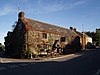
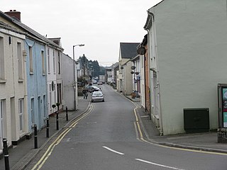
Liskeard is an ancient stannary and market town in south-east Cornwall, England, United Kingdom. It is situated approximately 20 miles (32 km) west of Plymouth, 14 miles (23 km) west of the Devon border, and 12 miles (20 km) east of Bodmin. The Bodmin Moor lies to the north-west of the town. The total population of the town at the 2011 census was 11,366

<span class="mw-page-title-main">Restormel</span> Former local government district of England

Restormel was a borough of Cornwall, England, one of the six administrative divisions that made up the county. Its council was based in St Austell; its other towns included Newquay.

<span class="mw-page-title-main">Caradon</span> Former local government district of Cornwall

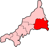
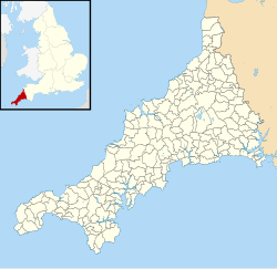
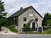
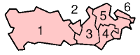
Caradon was a local government district in Cornwall, England, United Kingdom. It contained five towns: Callington, Liskeard, Looe, Saltash and Torpoint, and over 80 villages and hamlets within 41 civil parishes. Its District Council was based in Liskeard 50.453°N 4.465°W.

<span class="mw-page-title-main">Civil parishes in Cumbria</span>

A civil parish in England is the lowest unit of local government. There are 284 civil parishes in the ceremonial county of Cumbria, with most of the county being parished. At the 2001 census, there were 359,692 people living in those 284 parishes, accounting for 73.8 per cent of the county's population.

<span class="mw-page-title-main">Civil parishes in Bedfordshire</span> List of places

A civil parish is a country subdivision, forming the lowest unit of local government in England. There are 125 civil parishes in the ceremonial county of Bedfordshire, most of the county being parished: Luton is completely unparished; Central Bedfordshire is entirely parished. At the 2001 census, there were 312,301 people living in the 125 parishes, which accounted for 55.2 per cent of the county's population.

<span class="mw-page-title-main">Civil parishes in Berkshire</span>

A civil parish is a country subdivision, forming the lowest unit of local government in England. There are 104 civil parishes in the ceremonial county of Berkshire, most of the county being parished; Reading is completely unparished; Bracknell Forest, West Berkshire and Wokingham are entirely parished. At the 2001 census, there were 483,882 people living in the 104 parishes, accounting for 60.5 per cent of the county's population.

<span class="mw-page-title-main">Civil parishes in Cambridgeshire</span>

A civil parish is a country subdivision, forming the lowest unit of local government in England. There are 264 civil parishes in the ceremonial county of Cambridgeshire, most of the county being parished; Cambridge is completely unparished; Fenland, East Cambridgeshire, South Cambridgeshire and Huntingdonshire are entirely parished. At the 2001 census, there were 497,820 people living in the parishes, accounting for 70.2 per cent of the county's population.

<span class="mw-page-title-main">Civil parishes in Cheshire</span>

A civil parish is a country subdivision, forming the lowest unit of local government in England. There are 333 civil parishes in the ceremonial county of Cheshire, most of the county being parished. Cheshire East unitary authority is entirely parished. At the 2001 census, there were 565,259 people living in 332 parishes, accounting for 57.5 per cent of the county's population.

<span class="mw-page-title-main">Civil parishes in Greater Manchester</span>

A civil parish is a country subdivision, forming the lowest unit of local government in England. There are 14 civil parishes in the ceremonial county of Greater Manchester, most of the county being unparished; Bury, Rochdale, Salford and Stockport are completely unparished. At the 2001 census, there were 129,325 people living in the civil parishes, accounting for 5.2% of the county's population.

<span class="mw-page-title-main">Civil parishes in Lancashire</span>

A civil parish is a subnational entity, forming the lowest unit of local government in England. There are 219 civil parishes in the ceremonial county of Lancashire; Blackpool is completely unparished; Pendle and Ribble Valley are entirely parished. At the 2001 census, there were 587,074 people living in the 219 parishes, accounting for 41.5 per cent of the county's population.

<span class="mw-page-title-main">Civil parishes in West Yorkshire</span>

A civil parish is a subnational entity, forming the lowest unit of local government in England. There are 101 civil parishes in the ceremonial county of West Yorkshire, most of the county being unparished. At the 2001 census, there were 557,369 people living in the parishes, accounting for 26.8 per cent of the county's population.

<span class="mw-page-title-main">Civil parishes in Tyne and Wear</span>

There are 10 civil parishes in the ceremonial county of Tyne and Wear, most of the county being unparished; North Tyneside and South Tyneside are completely unparished. It is the county of England with the lowest number of civil parishes. At the 2001 census, there were 41,044 people living in the 10 parishes, accounting for 3.8 per cent of the county's population. A civil parish is the lowest unit of local government in England.

<span class="mw-page-title-main">Civil parishes in South Yorkshire</span>

A civil parish is a country subdivision, forming the lowest unit of local government in England. There are 94 civil parishes in the ceremonial county of South Yorkshire, most of the county being unparished. At the 2001 census, there were 360,191 people living in the parishes, increasing to 369,220 in 2011, accounting for 27.5 per cent of the county's population.

<span class="mw-page-title-main">Civil parishes in the West Midlands (county)</span> Subnational entity

A civil parish is a subnational entity, forming the lowest unit of local government in England. There are 21 civil parishes in the ceremonial county of West Midlands, most of the county being unparished; Dudley, Sandwell, Walsall and Wolverhampton are completely unparished. At the 2001 census, there were 89,621 people living in the parishes, accounting for 3.5 per cent of the county's population.

<span class="mw-page-title-main">Civil parishes in Merseyside</span>

A civil parish is a country subdivision, forming the lowest unit of local government in England. There are 22 civil parishes in the ceremonial county of Merseyside, most of the county being unparished; Liverpool and Wirral are completely unparished. At the 2001 census, there were 177,663 people living in the parishes, accounting for 13.0 per cent of the county's population.

<span class="mw-page-title-main">Grampound</span> Human settlement in England

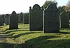
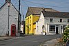
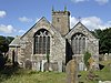
Grampound is a village and former civil parish, now in the parish of Grampound with Creed, in the Cornwall district, in the ceremonial county of Cornwall, England. It is at an ancient crossing point of the River Fal and today is on the A390 road six miles (10 km) west of St Austell and eight miles (13 km) east of Truro. In 1961 the parish had a population of 412.

St Austell with Fowey was a municipal borough in Cornwall, United Kingdom. It was created in 1968 by a merger of the historic borough of Fowey and the much more populous St Austell urban district. 50.338°N 4.794°W

<span class="mw-page-title-main">St Blazey</span> Town in Cornwall, England

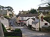
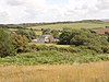
St Blazey is a small town in Cornwall, England, United Kingdom.

St Austell Rural District was a local government division of Cornwall in England, UK, between 1894 and 1974. Established under the Local Government Act 1894, the rural district was reduced to create Fowey Municipal Borough in 1913 and enlarged by the abolition of Bodmin Rural District and St Columb Major Rural District in 1934 and Lostwithiel Municipal Borough in 1968.

References

  1. Angus Winchester, 2000, Discovering Parish Boundaries. Shire Publications. Princes Risborough, 96 pages ISBN   978-0-7478-0470-3
  2. RAC Foundation : What Went Wrong? British Highway Development Before Motorways [ permanent dead link ]. Retrieved 22 August 2009.
  3. The Victorian Web : The Poor Law : Introduction. Retrieved 22 August 2009.
  4. Staffordshire University : Poor Law Unions and Registration Districts Archived 14 September 2012 at archive.today . Retrieved 22 August 2009.
  5. A Vision of Britain Through Time : Status Details for Rural Sanitary District. Retrieved 22 August 2009.
  6. Robert Tittler, The Reformation and the Towns in England, 1998, Oxford University Press, 395 pages, ISBN   978-0-19-820718-4
  7. 1 2 Modern British Surnames : Selected Events in the History of Civil Registration and Boundary Changes 1801-1996 Archived 1 August 2010 at the Wayback Machine . Retrieved 22 August 2009.
  8. Alex MacMorran and T R Colquhoun Dill, The Local Government Act 1894 and the Subsequent Statutes Affecting Parish Councils, 1907, Butterworth and Co, London, 626 pages
  9. 1 2 3 Office of Public Sector Information : Local Government Act 1972 Archived 5 December 2012 at archive.today . Retrieved 22 August 2009.
  10. Office of Public Sector Information : Local Government and Rating Act 1997 Archived 5 August 2012 at archive.today . Retrieved 22 August 2009.
  11. Office of Public Sector Information : Local Government and Public Involvement in Health Act 2007 Archived 5 August 2012 at archive.today . Retrieved 22 August 2009.
  12. 1 2 3 4 5 "Town and parishes to get councils". BBC News Online. 5 December 2008. Retrieved 3 July 2012.
  13. "List of Place-names agreed by the MAGA Signage Panel". Place names in the SWF. Cornish Language Partnership. Archived from the original on 15 May 2013. Retrieved 30 January 2013.
  14. 1 2 3 4 5 6 7 8 9 10 11 12 13 14 A Vision of Britain Through Time : Camelford Rural District. Retrieved 22 September 2010.
  15. 1 2 3 4 5 6 7 8 9 10 11 12 13 14 15 16 17 18 19 20 21 22 23 24 25 26 27 28 29 30 31 32 33 34 35 36 37 38 39 40 41 42 43 44 45 46 47 48 49 50 51 52 53 54 55 56 57 58 59 60 61 62 63 64 65 Office for National Statistics : Census 2001 : Parish Headcounts : North Cornwall Archived 3 March 2016 at the Wayback Machine . Retrieved 22 September 2010.
  16. 1 2 3 4 5 6 7 8 9 10 11 12 13 14 15 16 17 18 19 20 A Vision of Britain Through Time : Launceston Rural District. Retrieved 22 September 2010.
  17. 1 2 3 4 5 6 7 8 9 10 11 12 13 14 15 16 A Vision of Britain Through Time : St Germans Rural District. Retrieved 22 September 2010.
  18. 1 2 3 4 5 6 7 8 9 10 11 12 13 14 15 16 17 18 19 20 21 22 23 24 25 26 27 28 29 30 31 32 33 34 35 36 37 38 39 40 41 Office for National Statistics : Census 2001 : Parish Headcounts : Caradon Archived 23 December 2015 at the Wayback Machine . Retrieved 22 September 2010.
  19. 1 2 3 4 5 6 7 8 9 10 11 12 13 14 15 16 17 18 19 20 A Vision of Britain Through Time : Wadebridge and Padstow Rural District. Retrieved 22 September 2010.
  20. 1 2 3 4 5 6 7 8 9 10 11 12 13 14 15 16 17 18 19 20 A Vision of Britain Through Time : Liskeard Rural District. Retrieved 22 September 2010.
  21. A Vision of Britain Through Time : Bodmin Municipal Borough. Retrieved 22 September 2010.
  22. 1 2 3 4 5 6 7 8 9 10 11 12 13 14 15 16 17 18 19 20 21 22 A Vision of Britain Through Time : Kerrier Rural District. Retrieved 22 September 2010.
  23. 1 2 3 4 5 6 7 8 9 10 11 12 13 14 15 16 17 18 19 20 21 22 23 24 25 26 27 28 29 30 31 32 Office for National Statistics : Census 2001 : Parish Headcounts : Kerrier Archived 3 February 2015 at the Wayback Machine . Retrieved 22 September 2010.
  24. 1 2 3 4 5 6 7 8 "The Cornwall (Reorganisation of Community Governance) No. 1 Order 2020" (PDF). Local Government Boundary Commission for England. Archived from the original (PDF) on 24 June 2021. Retrieved 7 July 2021.
  25. 1 2 3 4 5 A Vision of Britain Through Time : Isles of Scilly Rural District. Retrieved 22 September 2010.
  26. 1 2 3 4 5 Office for National Statistics : Census 2001 : Parish Headcounts : Isle of Scilly Archived 3 March 2016 at the Wayback Machine . Retrieved 22 September 2010.
  27. A Vision of Britain Through Time : Bude–Stratton Urban District. Retrieved 22 September 2010.
  28. 1 2 3 4 5 6 7 8 A Vision of Britain Through Time : Camborne–Redruth Urban District. Retrieved 20 September 2010.
  29. 1 2 3 4 5 6 7 8 9 A Vision of Britain Through Time : St Austell with Fowey Municipal Borough Archived 30 September 2007 at the Wayback Machine . Retrieved 22 September 2010.
  30. Office for National Statistics : Census 2001 : Usual Resident Population Archived 22 April 2015 at the Wayback Machine Crinnis (part) ward. Retrieved 22 September 2010.
  31. 1 2 3 4 5 6 7 8 9 10 11 12 13 14 15 16 17 18 19 20 21 22 23 A Vision of Britain Through Time : Truro Rural District. Retrieved 22 September 2010.
  32. 1 2 3 4 5 6 7 8 9 10 11 12 13 14 15 16 17 18 19 20 21 22 23 24 25 26 Office for National Statistics : Census 2001 : Parish Headcounts : Carrick. Retrieved 22 September 2010.
  33. 1 2 3 4 5 6 7 8 9 10 11 12 13 14 15 16 17 A Vision of Britain Through Time : St Austell Rural District Archived 1 October 2007 at the Wayback Machine . Retrieved 22 September 2010.
  34. 1 2 3 4 5 6 7 8 9 10 11 12 13 14 15 16 17 18 19 20 21 22 23 24 Office for National Statistics : Census 2001 : Parish Headcounts : Restormel Archived 3 March 2016 at the Wayback Machine . Retrieved 22 September 2010.
  35. 1 2 A Vision of Britain Through Time : Newquay Urban District. Retrieved 22 September 2010.
  36. A Vision of Britain Through Time : Falmouth Municipal Borough. Retrieved 22 September 2010.
  37. 1 2 3 4 5 6 7 8 9 10 11 12 13 14 15 16 17 A Vision of Britain Through Time : West Penwith Rural District. Retrieved 22 September 2010.
  38. 1 2 3 4 5 6 7 8 9 10 11 12 13 14 15 16 17 18 19 20 Office for National Statistics : Census 2001 : Parish Headcounts : Penwith Archived 29 August 2012 at the Wayback Machine . Retrieved 22 September 2010.
  39. 1 2 A Vision of Britain Through Time : Helston Municipal Borough. Retrieved 22 September 2010.
  40. 1 2 3 4 5 6 7 8 9 10 A Vision of Britain Through Time : Stratton Rural District. Retrieved 22 September 2010.
  41. A Vision of Britain Through Time : Launceston Municipal Borough. Retrieved 22 September 2010.
  42. A Vision of Britain Through Time : Liskeard Municipal Borough. Retrieved 22 September 2010.
  43. A Vision of Britain Through Time : Looe Urban District. Retrieved 22 September 2010.
  44. A Vision of Britain Through Time : Penryn Municipal Borough. Retrieved 22 September 2010.
  45. Office for National Statistics : Census 2001 : Usual Resident Population Archived 22 April 2015 at the Wayback Machine Mevagissey (part); and St Ewe (part) wards. Retrieved 22 September 2010.
  46. A Vision of Britain Through Time : Penzance Municipal Borough. Retrieved 22 September 2010.
  47. A Vision of Britain Through Time : Saltash Municipal Borough. Retrieved 22 September 2010.
  48. Office for National Statistics : Census 2001 : Usual Resident Population Archived 22 April 2015 at the Wayback Machine Bethel (part); Gover (part); Mount Charles; and Poltair (part) wards. Retrieved 22 September 2010.
  49. Office for National Statistics : Census 2001 : Usual Resident Population Archived 22 April 2015 at the Wayback Machine Crinnis (part); and St Ewe (part) wards. Retrieved 22 September 2010.
  50. A Vision of Britain Through Time : St Ives Municipal Borough. Retrieved 22 September 2010.
  51. A Vision of Britain Through Time : St Just Urban District. Retrieved 22 September 2010.
  52. A Vision of Britain Through Time : Torpoint Urban District. Retrieved 22 September 2010.
  53. A Vision of Britain Through Time : Truro Municipal Borough. Retrieved 22 September 2010.