List of civil parishes in Somerset

Last updated

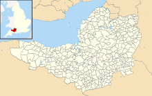
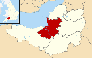
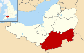
Districts of Somerset
Areas shown in yellow are the unitary authorities and those in pink are districts administered by Somerset County Council
Somerset numbered districts 2019.svg
1 South Somerset
2 Somerset West and Taunton
3 Sedgemoor
4 Mendip
5 Bath and North East Somerset (unitary)
6 North Somerset (unitary)
Map all coordinates using: OpenStreetMap

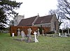
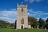
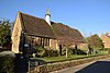
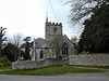
The ceremonial county of Somerset, England is divided into 417 areas known as civil parishes, which are lowest unit of local government in England. Parishes arose from Church of England divisions, and were given their current powers and responsibilities by the Local Government Act 1894. [1] The Local Government Act 1972 retained civil parishes in rural areas. Many former urban districts and municipal boroughs were replaced by new successor parishes; urban areas that were considered too large to be single parishes became unparished areas. [2]

Contents

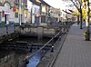
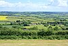
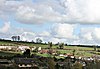
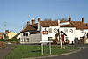
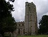
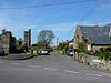
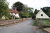
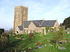
The county of Somerset consists of a non-metropolitan county administered by Somerset County Council, divided into four districts and two unitary authorities. The districts of Somerset are South Somerset, Somerset West and Taunton, Mendip and Sedgemoor. The two administratively independent unitary authorities, which were established on 1 April 1996 following the break-up of the county of Avon, are North Somerset and Bath and North East Somerset. These unitary authorities include areas that were part of Somerset before the creation of Avon in 1974. [3]

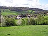
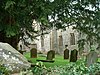
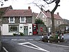
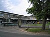
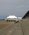
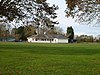
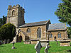
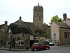
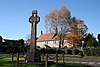
The city of Bath is the largest centre of population in Bath and North East Somerset. Areas of the city that were formerly within the Bath County Borough are now unparished, but the rest of the authority is divided into 49 parishes. All of North Somerset, the other unitary authority, is covered by its 39 parishes ranging from the village Loxton with a population of 192, [4] to the town of Weston-super-Mare with 76,143 inhabitants. [4]

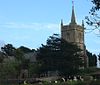
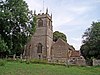
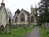
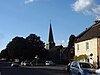
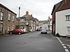
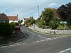
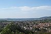
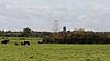
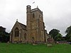
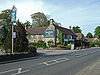
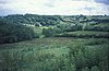
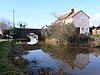
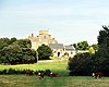
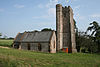
In 2019 the former districts Taunton Deane and West Somerset (a largely rural area, with a population of 35,712) [5] were merged to form the largest district, Somerset West and Taunton. [6] South Somerset covers an area of 958 square kilometres (370 sq mi) from the borders with Devon and Dorset to the edge of the Somerset Levels. [7] It has a population of about 156,100. [7] The largest settlement in the district is Yeovil, with a population of 30,378. [8] Sedgemoor has 54 parishes ranging in population from Greinton with 71 [9] to Bridgwater with 33,698. [9] The Mendip district covers a largely rural area of 738 square kilometres (285 sq mi), [10] ranging from the Mendip Hills through on to the Somerset Levels. It has a population of about 108,300, [10] living in 62 parishes, the largest of which, Frome has 24,510 residents; [11] the smallest, Sharpham has a population of 71. [11]

History

Parishes arose from Church of England divisions, and were originally purely ecclesiastical divisions. Over time they acquired civil administration powers. [12] The Highways Act 1555 made parishes responsible for the upkeep of roads. Every adult inhabitant of the parish was obliged to work four days a year on the roads, providing their own tools, carts and horses; the work was overseen by an unpaid local appointee, the Surveyor of Highways. The poor were looked after by the monasteries, until their dissolution. In 1572, magistrates were given power to 'survey the poor' and impose taxes for their relief. This system was made more formal by the Poor Law Act 1601, which made parishes responsible for administering the Poor Law; overseers were appointed to charge a rate to support the poor of the parish. [13] The 19th century saw an increase in the responsibility of parishes, although the Poor Law powers were transferred to Poor Law Unions. [14] The Public Health Act 1872 grouped parishes into Rural Sanitary Districts, based on the Poor Law Unions; these subsequently formed the basis for Rural Districts. [15] Parishes were run by vestries, meeting annually to appoint officials, and were generally identical to ecclesiastical parishes, [16] although some townships in large parishes administered the Poor Law themselves; under the Parishes Act 1882, all extra-parochial areas and townships that levied a separate rate became independent civil parishes. [17]

Civil parishes in their modern sense date from the Local Government Act 1894, which abolished vestries; established elected parish councils in all rural parishes with more than 300 electors; grouped rural parishes into Rural Districts; and aligned parish boundaries with county and borough boundaries. [17] Urban civil parishes continued to exist, and were generally coterminous with the Urban District, Municipal Borough or County Borough in which they were situated; many large towns contained a number of parishes, and these were usually merged into one. Parish councils were not formed in urban areas, and the only function of the parish was to elect guardians to Poor Law Unions; with the abolition of the Poor Law system in 1930 the parishes had only a nominal existence. [18] The Local Government Act 1972 retained civil parishes in rural areas, and many former Urban Districts and Municipal Boroughs that were being abolished, were replaced by new successor parishes; urban areas that were considered too large to be single parishes became unparished areas. [19]

Current position

Map showing the boundaries of the present-day civil parishes of Somerset Somerset UK parish map (blank).svg
Map showing the boundaries of the present-day civil parishes of Somerset

Recent governments have encouraged the formation of town and parish councils in unparished areas, and the Local Government and Rating Act 1997 gave local residents the right to demand the creation of a new civil parish. [20] A parish council can become a town council unilaterally, simply by resolution; [19] and a civil parish can also gain city status, but only if that is granted by the Crown. [19] The chairman of a town or city council is called a mayor. [19] There are currently 28 civil parishes in the county with the status of a town, and one (Wells) with city status. The Local Government and Public Involvement in Health Act 2007 introduced alternative names: a parish council can now choose to be called a community; village; or neighbourhood council. [21]

Bath and North East Somerset

The area of the city of Bath which was part of Bath County Borough is unparished.

ImageNameStatusPopulationFormer local authorityCoordinatesRefs
St.nicholas.church.at.bathampton.arp.jpg Bathampton Civil parish1,603 Bathavon Rural District 51°23′N2°19′W / 51.39°N 2.32°W / 51.39; -2.32 (Bathampton) [22] [23]
Batheaston.jpg Batheaston Civil parish2,735 Bathavon Rural District 51°25′N2°19′W / 51.41°N 2.31°W / 51.41; -2.31 (Batheaston) [23] [24]
High Street, Bathford - geograph.org.uk - 809104.jpg Bathford Civil parish1,759 Bathavon Rural District 51°23′N2°18′W / 51.39°N 2.30°W / 51.39; -2.30 (Bathford) [23] [25]
Camerton (Somerset) St Peter's Church - geograph.org.uk - 67585.jpg Camerton Civil parish655 Bathavon Rural District 51°19′N2°27′W / 51.32°N 2.45°W / 51.32; -2.45 (Camerton) [23] [26]
Langridge church.jpg Charlcombe Civil parish422 Bathavon Rural District 51°25′N2°22′W / 51.41°N 2.36°W / 51.41; -2.36 (Charlcombe) [23] [27]
Chelwood church.jpg Chelwood Civil parish148 Clutton Rural District 51°21′N2°31′W / 51.35°N 2.52°W / 51.35; -2.52 (Chelwood) [28] [29]
Streetchewmagna.JPG Chew Magna Civil parish1,149 Clutton Rural District 51°22′N2°37′W / 51.37°N 2.61°W / 51.37; -2.61 (Chew Magna) [29] [30]
Chewstokevillagescape.JPG Chew Stoke Civil parish991 Clutton Rural District 51°21′N2°38′W / 51.35°N 2.64°W / 51.35; -2.64 (Chew Stoke) [29] [31]
Claverton Pumping Station Exterior.JPG Claverton Civil parish115 Bathavon Rural District 51°23′N2°19′W / 51.38°N 2.31°W / 51.38; -2.31 (Claverton, Somerset) [23] [32]
Clutton church.JPG Clutton Civil parish1,602 Clutton Rural District 51°20′N2°32′W / 51.33°N 2.54°W / 51.33; -2.54 (Clutton, Somerset) [29] [33]
Combe hay weir.jpg Combe Hay Civil parish147 Bathavon Rural District 51°20′N2°23′W / 51.34°N 2.38°W / 51.34; -2.38 (Combe Hay) [23] [34]
Compton Dando church.JPG Compton Dando Civil parish579 Keynsham Urban District 51°23′N2°31′W / 51.38°N 2.51°W / 51.38; -2.51 (Compton Dando) [35] [36]
Compton martin duck pond.JPG Compton Martin Civil parish508 Clutton Rural District 51°19′N2°39′W / 51.31°N 2.65°W / 51.31; -2.65 (Compton Martin) [29] [37]
Corston (Somerset) All Saints Church - geograph.org.uk - 67722.jpg Corston Civil parish494 Bathavon Rural District 51°23′N2°26′W / 51.39°N 2.44°W / 51.39; -2.44 (Corston, Somerset) [23] [38]
Dunkertonaqueduct.jpg Dunkerton and Tunley Civil parish502 Bathavon Rural District 51°20′N2°25′W / 51.33°N 2.41°W / 51.33; -2.41 (Dunkerton, Somerset) [23] [39]
East harptree church.JPG East Harptree Civil parish644 Clutton Rural District 51°18′N2°37′W / 51.30°N 2.62°W / 51.30; -2.62 (East Harptree) [29] [40]
Englishcombe.jpg Englishcombe Civil parish318 Bathavon Rural District 51°22′N2°25′W / 51.36°N 2.41°W / 51.36; -2.41 (Englishcombe) [23] [41]
Farmborougchurch.jpg Farmborough Civil parish1,035 Clutton Rural District 51°20′N2°29′W / 51.34°N 2.48°W / 51.34; -2.48 (Farmborough) [29] [42]
Farringtongurneychurch.jpg Farrington Gurney Civil parish901 Clutton Rural District 51°17′N2°32′W / 51.29°N 2.53°W / 51.29; -2.53 (Farrington Gurney) [29] [43]
Freshford Mill.jpg Freshford Civil parish551 Bathavon Rural District 51°20′N2°19′W / 51.34°N 2.31°W / 51.34; -2.31 (Freshford) [23] [44]
High Littleton (Somerset) Holy Trinity Church - geograph.org.uk - 67726.jpg High Littleton Civil parish2,104 Clutton Rural District 51°19′N2°31′W / 51.32°N 2.51°W / 51.32; -2.51 (High Littleton) [29] [45]
Hintonblewittpubandchurch.JPG Hinton Blewett Civil parish308 Clutton Rural District 51°19′N2°35′W / 51.31°N 2.58°W / 51.31; -2.58 (Hinton Blewitt) [29] [46]
Hinton Charterhouse church.jpg Hinton Charterhouse Civil parish515 Bathavon Rural District 51°20′N2°19′W / 51.33°N 2.32°W / 51.33; -2.32 (Hinton Charterhouse) [23] [47]
Kelston church.jpg Kelston Civil Parish248 Bathavon Rural District 51°24′N2°26′W / 51.40°N 2.43°W / 51.40; -2.43 (Kelston) [23] [48]
Keyneshamhighstreet.jpg Keynsham Town15,641 Keynsham Urban District 51°25′N2°29′W / 51.41°N 2.49°W / 51.41; -2.49 (Keynsham) [36] [49]
Marksbury church.JPG Marksbury Civil parish397 Bathavon Rural District 51°22′N2°29′W / 51.36°N 2.48°W / 51.36; -2.48 (Marksbury) [23] [50]
Somer2.JPG Midsomer Norton Town
10,997
Norton Radstock 51°17′N2°29′W / 51.28°N 2.48°W / 51.28; -2.48 (Midsomer Norton) [51] [52]
Monkton.combe.from.afar.arp.jpg Monkton Combe Civil parish554 Bathavon Rural District 51°22′N2°20′W / 51.36°N 2.33°W / 51.36; -2.33 (Monkton Combe) [23] [53]
Nempnett church.JPG Nempnett Thrubwell Civil parish177 Clutton Rural District 51°20′N2°41′W / 51.34°N 2.68°W / 51.34; -2.68 (Nempnett Thrubwell) [29] [54]
Newtonstloechurch.jpg Newton St Loe Civil parish681 Bathavon Rural District 51°23′N2°26′W / 51.38°N 2.43°W / 51.38; -2.43 (Newton Saint Loe) [23] [55]
Norton Malreward.jpg Norton Malreward Civil parish246 Clutton Rural District 51°23′N2°34′W / 51.39°N 2.57°W / 51.39; -2.57 (Norton Malreward) [29] [56]
PaultonBatch.jpg Paulton Civil parish5,302 Clutton Rural District 51°19′N2°30′W / 51.31°N 2.50°W / 51.31; -2.50 (Paulton) [29] [57]
Peasedownstjohn.jpg Peasedown St John Civil parish6,446 Bathavon Rural District 51°19′N2°26′W / 51.32°N 2.44°W / 51.32; -2.44 (Peasedown St John) [23] [58]
St Luke and St Andrew's Church, Priston, Somerset.jpg Priston Civil parish232 Bathavon Rural District 51°20′N2°26′W / 51.34°N 2.44°W / 51.34; -2.44 (Priston) [23] [59]
Publow bridge.JPG Publow Civil parish1,119 Clutton Rural District 51°22′N2°33′W / 51.37°N 2.55°W / 51.37; -2.55 (Publow) [29] [60]
RadstockMineWheel.jpg Radstock Town
5,620
Norton Radstock Town Council 51°17′24″N2°26′52″W / 51.29°N 2.4477°W / 51.29; -2.4477 (Westfield) [52] [61]
Saltford St Marys church.jpg Saltford Civil parish4,073 Keynsham Urban District 51°24′N2°28′W / 51.40°N 2.46°W / 51.40; -2.46 (Saltford) [36] [62]
Shoscombe.jpg Shoscombe Civil parish443 Bathavon Rural District 51°18′N2°25′W / 51.30°N 2.41°W / 51.30; -2.41 (Shoscombe) [23] [63]
Southstokechurch.JPG Southstoke Civil parish460 Bathavon Rural District 51°21′N2°22′W / 51.35°N 2.36°W / 51.35; -2.36 (Southstoke) [23] [64]
Stanton drew church.JPG Stanton Drew Civil parish787 Clutton Rural District 51°22′N2°35′W / 51.37°N 2.58°W / 51.37; -2.58 (Stanton Drew) [29] [65]
Bishop Sutton.JPG Stowey-Sutton Civil parish1,361 Clutton Rural District 51°20′N2°35′W / 51.34°N 2.59°W / 51.34; -2.59 (Stowey-Sutton) [29] [66]
Upper Swainswick.jpg Swainswick Civil parish265 Bathavon Rural District 51°25′N2°21′W / 51.41°N 2.35°W / 51.41; -2.35 (Swainswick) [23] [67]
Cameley church 2.JPG Temple Cloud with Cameley Civil parish1,292 Clutton Rural District 51°19′N2°34′W / 51.32°N 2.56°W / 51.32; -2.56 (Cameley) [29] [68]
Timsbury (Somerset) St Mary's Church - geograph.org.uk - 67849.jpg Timsbury Civil parish2,624 Clutton Rural District 51°20′N2°29′W / 51.33°N 2.48°W / 51.33; -2.48 (Timsbury, Somerset) [29] [69]
Ubleychurch.JPG Ubley Civil parish331 Clutton Rural District 51°19′N2°41′W / 51.32°N 2.68°W / 51.32; -2.68 (Ubley) [29] [70]
Wellowsomerset.JPG Wellow Civil parish529 Bathavon Rural District 51°19′N2°22′W / 51.32°N 2.37°W / 51.32; -2.37 (Wellow, Somerset) [23] [71]
Westfield Shops, Wells Road, Radstock - geograph.org.uk - 431126.jpg Westfield Civil parish
5,854
Norton Radstock Town Council 51°17′24″N2°26′53″W / 51.29°N 2.448°W / 51.29; -2.448 (Westfield) [52] [72]
West Harptree.jpg West Harptree Civil parish439 Clutton Rural District 51°19′N2°38′W / 51.31°N 2.63°W / 51.31; -2.63 (West Harptree) [29] [73]
Whitchurchchurch.JPG Whitchurch Civil parish1,354 Bathavon Rural District 51°25′N2°34′W / 51.41°N 2.56°W / 51.41; -2.56 (Whitchurch) [23] [74]

Mendip

The whole of the district is parished.

ImageNameStatusPopulation [11] Former local authorityCoordinatesRefs
Ashwickchurch.jpg Ashwick Civil parish1,352 Shepton Mallet Rural District 51°14′N2°31′W / 51.23°N 2.52°W / 51.23; -2.52 (Ashwick) [75] [76]
Baltonsborough chuch.jpg Baltonsborough Civil parish864 Wells Rural District 51°07′N2°38′W / 51.11°N 2.64°W / 51.11; -2.64 (Baltonsborough) [77] [78]
Batcombe cottages.jpg Batcombe Civil parish439 Shepton Mallet Rural District 51°09′N2°26′W / 51.15°N 2.44°W / 51.15; -2.44 (Batcombe, Somerset) [76] [79]
Bath Rd Beckington.jpg Beckington Civil parish983 Frome Rural District 51°16′N2°17′W / 51.26°N 2.28°W / 51.26; -2.28 (Beckington) [80] [81]
Berkley Somerset church.jpg Berkley Civil parish344 Frome Rural District 51°14′N2°16′W / 51.24°N 2.27°W / 51.24; -2.27 (Berkley, Somerset) [81] [82]
Binegar Church - geograph.org.uk - 185560.jpg Binegar Civil parish313 Shepton Mallet Rural District 51°14′N2°33′W / 51.24°N 2.55°W / 51.24; -2.55 (Binegar) [76] [83]
Buckland Dinham - geograph.org.uk - 747663.jpg Buckland Dinham Civil parish381 Frome Rural District 51°16′N2°21′W / 51.26°N 2.35°W / 51.26; -2.35 (Buckland Dinham) [81] [84]
Butleigh Village Green - geograph.org.uk - 167880.jpg Butleigh Civil parish823 Wells Rural District 51°05′N2°41′W / 51.09°N 2.68°W / 51.09; -2.68 (Butleigh) [78] [85]
Chewton mendip church.jpg Chewton Mendip Civil parish585 Wells Rural District 51°17′N2°35′W / 51.28°N 2.58°W / 51.28; -2.58 (Chewton Mendip) [78] [86]
Chilcompton St Aldhelm's Church - geograph.org.uk - 137562.jpg Chilcompton Civil parish2,062 Clutton Rural District 51°16′N2°30′W / 51.27°N 2.50°W / 51.27; -2.50 (Chilcompton) [29] [87]
Colefordchurch.jpg Coleford Civil parish2,313 Frome Rural District 51°14′N2°27′W / 51.24°N 2.45°W / 51.24; -2.45 (Coleford, Somerset) [81] [88]
Cranmore church.jpg Cranmore Civil parish667 Shepton Mallet Rural District 51°11′N2°29′W / 51.19°N 2.48°W / 51.19; -2.48 (Cranmore, Somerset) [76] [89]
River Sheppey in Croscombe.jpg Croscombe Civil parish603 Shepton Mallet Rural District 51°12′N2°35′W / 51.20°N 2.58°W / 51.20; -2.58 (Croscombe) [76] [90]
Ditcheat church.jpg Ditcheat Civil parish725 Shepton Mallet Rural District 51°08′N2°32′W / 51.13°N 2.54°W / 51.13; -2.54 (Ditcheat) [76] [91]
Downhead parish church - geograph.org.uk - 231205.jpg Downhead Civil parish88 Shepton Mallet Rural District 51°12′40″N2°26′35″W / 51.211°N 2.443°W / 51.211; -2.443 (Downhead) [76]
Doulting - Abbey Barn - geograph.org.uk - 915399.jpg Doulting Civil parish618 Shepton Mallet Rural District 51°11′N2°31′W / 51.19°N 2.51°W / 51.19; -2.51 (Doulting) [76] [92]
All Saints church, East Pennard - geograph.org.uk - 1025320.jpg East Pennard Civil parish348 Shepton Mallet Rural District 51°08′N2°37′W / 51.14°N 2.62°W / 51.14; -2.62 (East Pennard) [76] [93]
Emboroughchurch.jpg Emborough Civil parish148 Shepton Mallet Rural District 51°16′N2°33′W / 51.26°N 2.55°W / 51.26; -2.55 (Emborough) [76] [94]
Evercreech Market Cross.jpg Evercreech Civil parish2,334 Shepton Mallet Rural District 51°08′N2°31′W / 51.14°N 2.51°W / 51.14; -2.51 (Evercreech) [76] [95]
Cheap Street, Frome - geograph.org.uk - 737335.jpg Frome Town26,203 Frome Rural District
Frome Urban District
51°14′N2°19′W / 51.23°N 2.32°W / 51.23; -2.32 (Frome) [81] [96]
Glastonbury from the Tor.JPG Glastonbury Town8,932 Glastonbury Municipal Borough 51°09′N2°43′W / 51.15°N 2.71°W / 51.15; -2.71 (Glastonbury) [97] [98]
Godney Church - geograph.org.uk - 675568.jpg Godney Civil parish237 Wells Rural District 51°11′N2°44′W / 51.18°N 2.74°W / 51.18; -2.74 (Godney) [78] [99]
Bridge over Mells River, Great Elm - geograph.org.uk - 836663.jpg Great Elm Civil parish171 Frome Rural District 51°14′N2°22′W / 51.24°N 2.36°W / 51.24; -2.36 (Great Elm) [81] [100]
Hemington church.jpg Hemington Civil parish640 Frome Rural District 51°17′N2°23′W / 51.28°N 2.39°W / 51.28; -2.39 (Hemington, Somerset) [81] [101]
Holcombe crossroads.jpg Holcombe Civil parish947 Shepton Mallet Rural District 51°14′N2°28′W / 51.24°N 2.46°W / 51.24; -2.46 (Holcombe, Somerset) [76] [102]
Kilmersdon post office.jpg Kilmersdon Civil parish541 Frome Rural District 51°16′N2°26′W / 51.27°N 2.44°W / 51.27; -2.44 (Kilmersdon) [81] [103]
Lamyatt church.jpg Lamyatt Civil parish183 Shepton Mallet Rural District 51°07′N2°29′W / 51.12°N 2.49°W / 51.12; -2.49 (Lamyat) [76] [104]
Leigh on Mendip.jpg Leigh-on-Mendip Civil parish514 Frome Rural District 51°14′N2°26′W / 51.23°N 2.44°W / 51.23; -2.44 (Leigh-on-Mendip) [81] [105]
Litton church.jpg Litton Civil parish240 Clutton Rural District 51°17′N2°35′W / 51.29°N 2.58°W / 51.29; -2.58 (Litton, Somerset) [29] [106]
Lullington pump.jpg Lullington Civil parish162 Frome Rural District 51°16′N2°19′W / 51.26°N 2.31°W / 51.26; -2.31 (Lullington, Somerset) [81] [107]
Lydford stores.jpg Lydford-on-Fosse Civil parish511 Shepton Mallet Rural District 51°04′N2°37′W / 51.07°N 2.62°W / 51.07; -2.62 (Lydford-on-Fosse) [76] [108]
Meare Fish House.jpg Meare Civil parish1,304 Wells Rural District 51°10′N2°46′W / 51.17°N 2.77°W / 51.17; -2.77 (Meare) [78] [109]
StAndrews Mells4.JPG Mells Civil parish638 Frome Rural District 51°14′N2°23′W / 51.24°N 2.39°W / 51.24; -2.39 (Mells, Somerset) [81] [110]
North Wootton church.jpg North Wootton Civil parish317 Wells Rural District 51°10′N2°37′W / 51.17°N 2.62°W / 51.17; -2.62 (North Wootton, Somerset) [78] [111]
NortonStPhilipTheGeorge.jpg Norton St Philip Civil Parish858 Frome Rural District 51°17′N2°19′W / 51.29°N 2.32°W / 51.29; -2.32 (Norton St Philip) [81] [112]
Nunneycastle.JPG Nunney Civil parish844 Frome Rural District 51°13′N2°23′W / 51.21°N 2.38°W / 51.21; -2.38 (Nunney) [81] [113]
Tithe Barn Pilton.jpg Pilton Civil parish998 Shepton Mallet Rural District 51°10′N2°35′W / 51.17°N 2.59°W / 51.17; -2.59 (Pilton, Somerset) [76] [114]
Priddy.jpg Priddy Civil parish624 Wells Rural District 51°15′N2°41′W / 51.25°N 2.68°W / 51.25; -2.68 (Priddy) [78] [115]
Pylle church.jpg Pylle Civil parish160 Shepton Mallet Rural District 51°08′N2°34′W / 51.14°N 2.56°W / 51.14; -2.56 (Pylle) [76] [116]
Rode centre.jpg Rode Civil parish1,025 Frome Rural District 51°17′N2°12′W / 51.28°N 2.2°W / 51.28; -2.2 (Rode, Somerset) [81] [117]
Rodney Stoke church.jpg Rodney Stoke Civil parish1,326 Wells Rural District 51°15′N2°44′W / 51.25°N 2.74°W / 51.25; -2.74 (Rodney Stoke) [78] [118]
Selwood Civil parish798 Frome Rural District 51°14′N2°19′W / 51.24°N 2.31°W / 51.24; -2.31 (Selwood, Somerset) [81] [119]
Sharpham.jpg Sharpham Civil parish130 Wells Rural District 51°08′N2°46′W / 51.14°N 2.77°W / 51.14; -2.77 (Sharpham) [78] [120]
Shepton Mallet marketplace08.jpg Shepton Mallet Town10,369 Shepton Mallet Urban District 51°11′N2°33′W / 51.19°N 2.55°W / 51.19; -2.55 (Shepton Mallet) [121] [122]
Dinder church.jpg St Cuthbert Out Civil parish3,749 Wells Rural District 51°11′N2°41′W / 51.18°N 2.69°W / 51.18; -2.69 (St Cuthbert Out) [78] [123]
Stoke St Michael church.jpg Stoke St Michael Civil parish926 Shepton Mallet Rural District 51°13′N2°29′W / 51.22°N 2.48°W / 51.22; -2.48 (Stoke St Michael) [76] [124]
Ston Easton church.jpg Ston Easton Civil parish550 Clutton Rural District 51°17′N2°32′W / 51.28°N 2.54°W / 51.28; -2.54 (Ston Easton) [29] [125]
St Vigors church, Stratton-on-the-Fosse.jpg Stratton on the Fosse Civil parish1,108 Shepton Mallet Rural District 51°15′N2°29′W / 51.25°N 2.49°W / 51.25; -2.49 (Stratton-on-the-Fosse) [76] [126]
ClarksVillage.jpg Street Civil parish11,805 Street Urban District 51°07′N2°44′W / 51.12°N 2.74°W / 51.12; -2.74 (Street, Somerset) [127] [128]
Tellisford bridge.jpg Tellisford Civil parish182 Frome Rural District 51°17′N2°17′W / 51.29°N 2.28°W / 51.29; -2.28 (Tellisford) [81] [129]
Trudoxhill.jpg Trudoxhill Civil parish423 Frome Rural District 51°11′N2°22′W / 51.19°N 2.37°W / 51.19; -2.37 (Trudoxhill) [81] [130]
Upton Noble church.jpg Upton Noble Civil parish128 Frome Rural District 51°09′N2°25′W / 51.15°N 2.41°W / 51.15; -2.41 (Upton Noble) [81] [131]
Walton windmill.jpg Walton Civil parish1,106 Wells Rural District 51°08′N2°46′W / 51.14°N 2.77°W / 51.14; -2.77 (Walton, Somerset) [78] [132]
Wanstrow.jpg Wanstrow Civil parish489 Frome Rural District 51°10′N2°25′W / 51.17°N 2.41°W / 51.17; -2.41 (Wanstrow) [81] [133]
Wells Cathedral and market square.jpg Wells City10,536 Wells Municipal Borough 51°13′N2°39′W / 51.21°N 2.65°W / 51.21; -2.65 (Wells) [78] [134]
Hornblotton church.jpg West Bradley Civil parish277 Shepton Mallet Rural District 51°08′N2°38′W / 51.13°N 2.64°W / 51.13; -2.64 (West Bradley) [76] [135]
West Pennard church.jpg West Pennard Civil parish670 Wells Rural District 51°08′N2°39′W / 51.14°N 2.65°W / 51.14; -2.65 (West Pennard) [78] [136]
Westbury-sub-Mendip Church.jpg Westbury Civil parish801 Wells Rural District 51°14′N2°43′W / 51.24°N 2.71°W / 51.24; -2.71 (Westbury-sub-Mendip) [78] [137]
Manor Farmhouse Gatehouse, Whatley (Somerset, 2007).jpg Whatley Civil parish245 Frome Rural District 51°14′N2°23′W / 51.23°N 2.38°W / 51.23; -2.38 (Whatley, Mendip) [81] [138]
Witham Friary church and cottages.jpg Witham Friary Civil parish399 Frome Rural District 51°10′N2°22′W / 51.17°N 2.37°W / 51.17; -2.37 (Witham Friary) [81] [139]
Wookey church.jpg Wookey Civil parish1,311 Wells Rural District 51°13′N2°41′W / 51.21°N 2.69°W / 51.21; -2.69 (Wookey) [78] [140]

North Somerset

The whole of the district is parished.

ImageNameStatusPopulationFormer local authorityCoordinatesRefs
Holy Trinity Church, Abbots Leigh - geograph.org.uk - 1051693.jpg Abbots Leigh Civil parish799 Long Ashton Rural District 51°28′N2°39′W / 51.46°N 2.65°W / 51.46; -2.65 (Abbots Leigh) [4] [141]
Backwell sign.jpg Backwell Civil parish4,589 Long Ashton Rural District 51°25′N2°44′W / 51.41°N 2.73°W / 51.41; -2.73 (Backwell) [4] [141]
Banwellcastle.jpg Banwell Civil parish2,919 Axbridge Rural District 51°19′N2°52′W / 51.32°N 2.86°W / 51.32; -2.86 (Banwell) [4] [142]
Barrow Gurney - millpond at Lower Barrow Mill - geograph.org.uk - 94265.jpg Barrow Gurney Civil parish349 Long Ashton Rural District 51°24′N2°40′W / 51.40°N 2.67°W / 51.40; -2.67 (Barrow Gurney) [4] [141]
Blagdon church and lake.jpg Blagdon Civil parish1,116 Axbridge Rural District 51°20′N2°43′W / 51.33°N 2.72°W / 51.33; -2.72 (Blagdon) [4] [142]
Bleadonchurch.jpg Bleadon Civil parish1,079 Axbridge Rural District 51°19′N2°56′W / 51.31°N 2.94°W / 51.31; -2.94 (Bleadon) [4] [142]
Brockley ploughing match in 1991.jpg Brockley Civil parish277 Long Ashton Rural District 51°23′N2°46′W / 51.39°N 2.76°W / 51.39; -2.76 (Brockley, Somerset) [4] [141]
Burrignton church.jpg Burrington Civil parish464 Axbridge Rural District 51°20′N2°44′W / 51.33°N 2.74°W / 51.33; -2.74 (Burrington, Somerset) [4] [142]
Butcombechurch.jpg Butcombe Civil parish218 Axbridge Rural District 51°21′N2°41′W / 51.35°N 2.69°W / 51.35; -2.69 (Butcombe) [4] [142]
Churchillsomerset.JPG Churchill Civil parish2,235 Axbridge Rural District 51°20′N2°47′W / 51.33°N 2.79°W / 51.33; -2.79 (Churchill, Somerset) [4] [142]
Clapton Court - geograph.org.uk - 697226.jpg Clapton in Gordano Civil parish348 Long Ashton Rural District 51°28′N2°45′W / 51.46°N 2.75°W / 51.46; -2.75 (Clapton in Gordano) [4] [141]
Holy Trinity Church Cleeve.jpg Cleeve Civil parish902 Long Ashton Rural District 51°23′N2°46′W / 51.39°N 2.77°W / 51.39; -2.77 (Cleeve, Somerset) [4] [141]
ClevedonPier.jpg Clevedon Town21,281 Clevedon Urban District 51°26′N2°51′W / 51.43°N 2.85°W / 51.43; -2.85 (Clevedon) [4] [143]
Congresbury.jpg Congresbury Civil parish3,497 Axbridge Rural District 51°22′N2°49′W / 51.37°N 2.81°W / 51.37; -2.81 (Congresbury) [4] [142]
Dundry-fairlawns.JPG Dundry Civil parish829 Long Ashton Rural District 51°23′N2°38′W / 51.39°N 2.64°W / 51.39; -2.64 (Dundry) [4] [141]
Flax Bourton church in 2004.jpg Flax Bourton Civil parish715 Long Ashton Rural District 51°25′N2°43′W / 51.42°N 2.71°W / 51.42; -2.71 (Flax Bourton) [4] [141]
Hutton War Memorial.jpg Hutton Civil parish2,582 Axbridge Rural District 51°19′N2°56′W / 51.32°N 2.93°W / 51.32; -2.93 (Hutton, Somerset) [4] [142]
Kenn church.jpg Kenn Civil parish431 Long Ashton Rural District 51°25′N2°50′W / 51.42°N 2.84°W / 51.42; -2.84 (Kenn, Somerset) [4] [141]
Woodspringpriory.jpg Kewstoke Civil parish1,690 Axbridge Rural District 51°22′N2°58′W / 51.37°N 2.96°W / 51.37; -2.96 (Kewstoke) [4] [142]
The Triangle Kingston Seymour.jpg Kingston Seymour Civil parish388 Long Ashton Rural District 51°23′N2°52′W / 51.39°N 2.86°W / 51.39; -2.86 (Kingston Seymour) [4] [141]
Locking village hall.jpg Locking Civil parish2,756 Axbridge Rural District 51°20′N2°55′W / 51.33°N 2.91°W / 51.33; -2.91 (Locking, North Somerset) [4] [142]
Long Ashton Church and Angel.jpg Long Ashton Civil parish6,044 Long Ashton Rural District 51°26′N2°39′W / 51.43°N 2.65°W / 51.43; -2.65 (Long Ashton) [4] [141]
Loxton.jpg Loxton Civil parish192 Axbridge Rural District 51°17′N2°53′W / 51.29°N 2.89°W / 51.29; -2.89 (Loxton, North Somerset) [4] [142]
Nailsea and Backwell.JPG Nailsea Town15,630 Long Ashton Rural District 51°26′N2°46′W / 51.43°N 2.76°W / 51.43; -2.76 (Nailsea) [4] [141]
Eig sign.png Pill and Easton-in-Gordano (until 2011 Easton in Gordano)Civil parish4,828 Long Ashton Rural District 51°29′N2°41′W / 51.48°N 2.69°W / 51.48; -2.69 (Easton in Gordano) [4] [141]
Portbury church.jpg Portbury Civil parish827 Long Ashton Rural District 51°28′N2°43′W / 51.47°N 2.72°W / 51.47; -2.72 (Portbury) [4] [141]
Portishead xNaishHill 2.jpg Portishead Town23,699 Long Ashton Rural District
Portishead Urban District
51°29′N2°46′W / 51.48°N 2.77°W / 51.48; -2.77 (Portishead and North Weston) [4] [141] [144]
Puxton church.jpg Puxton Civil parish359 Axbridge Rural District 51°22′N2°51′W / 51.37°N 2.85°W / 51.37; -2.85 (Puxton) [4] [142]
WSM St Georges News.jpg St Georges Civil parish3,379 Axbridge Rural District 51°22′N2°54′W / 51.36°N 2.90°W / 51.36; -2.90 (St. Georges, North Somerset) [4] [142]
Tickenham church.jpg Tickenham Civil parish910 Long Ashton Rural District 51°26′N2°48′W / 51.44°N 2.80°W / 51.44; -2.80 (Tickenham) [4] [142]
Walton in Gordano junction.jpg Walton in Gordano Civil parish273 Axbridge Rural District 51°27′N2°50′W / 51.45°N 2.83°W / 51.45; -2.83 (Walton in Gordano) [4] [142]
Weston in Gordano church.jpg Weston in Gordano Civil parish301 Axbridge Rural District 51°28′N2°47′W / 51.46°N 2.79°W / 51.46; -2.79 (Weston in Gordano) [4] [142]
Weston-Super-Mare view.jpg Weston super Mare Town76,143 Axbridge Rural District
Weston super Mare Municipal Borough
51°21′N2°58′W / 51.35°N 2.97°W / 51.35; -2.97 (Weston-super-Mare) [4] [142]
Wick St Lawrence.jpg Wick St Lawrence Civil parish1,331 Axbridge Rural District 51°23′N2°55′W / 51.38°N 2.91°W / 51.38; -2.91 (Wick St. Lawrence) [4] [142]
Prince of Waterloo Winford.jpg Winford Civil parish2,153 Long Ashton Rural District 51°23′N2°40′W / 51.38°N 2.66°W / 51.38; -2.66 (Winford) [4] [141]
Winscombe Woodborough Road.jpg Winscombe and Sandford Civil parish4,546 Axbridge Rural District 51°19′N2°50′W / 51.31°N 2.83°W / 51.31; -2.83 (Winscombe and Sandford) [4] [142]
WraxallAllSaintsChurch.jpg Wraxall and Failand Civil parish2,302 Long Ashton Rural District 51°26′N2°44′W / 51.44°N 2.73°W / 51.44; -2.73 (Wraxall and Failand) [4] [141]
Wringtonhighstreet.jpg Wrington Civil parish2,633 Axbridge Rural District 51°22′N2°46′W / 51.36°N 2.76°W / 51.36; -2.76 (Wrington) [4] [142]
YattonPrecinct.jpg Yatton Civil parish7,552 Long Ashton Rural District 51°23′N2°50′W / 51.39°N 2.83°W / 51.39; -2.83 (Yatton) [4] [141]

Sedgemoor

The whole of the district is parished.

ImageNameStatusPopulation [9] Former local authorityCoordinatesRefs
Ashcott.jpg Ashcott Civil parish1,186 Bridgwater Rural District 51°07′N2°49′W / 51.12°N 2.81°W / 51.12; -2.81 (Ashcott) [8] [145]
AxbridgeSquare.jpg Axbridge Town2,057 Axbridge Rural District 51°17′N2°49′W / 51.29°N 2.82°W / 51.29; -2.82 (Axbridge) [8] [142]
Badgworth Church.jpg Badgworth Civil parish525 Axbridge Rural District 51°16′N2°52′W / 51.27°N 2.87°W / 51.27; -2.87 (Badgworth) [8] [142]
St Michael and All Angels Church, Bawdrip - geograph.org.uk - 85565.jpg Bawdrip Civil parish506 Bridgwater Rural District 51°09′N2°56′W / 51.15°N 2.94°W / 51.15; -2.94 (Bawdrip) [8] [145]
SS Nornen wreck.jpg Berrow Civil parish1,534 Axbridge Rural District 51°16′N3°01′W / 51.27°N 3.01°W / 51.27; -3.01 (Berrow, Somerset) [8] [142]
Stbridgetschurchbrean.JPG Brean Civil parish635 Axbridge Rural District 51°18′N3°01′W / 51.30°N 3.01°W / 51.30; -3.01 (Brean) [8] [142]
Brent Knoll vicarage.jpg Brent Knoll Civil parish1,271 Axbridge Rural District 51°15′N2°57′W / 51.25°N 2.95°W / 51.25; -2.95 (Brent Knoll) [8] [142]
Bridgwater cornexchange staute and church.jpg Bridgwater Town35,886 Bridgwater Municipal Borough 51°08′N2°59′W / 51.13°N 2.99°W / 51.13; -2.99 (Bridgwater) [8] [145]
Horsey A39.jpg Bridgwater Without Civil parish428 Bridgwater Rural District 51°08′N2°58′W / 51.14°N 2.97°W / 51.14; -2.97 (Bridgwater Without) [8] [145]
Broomfield church.jpg Broomfield Civil parish249 Bridgwater Rural District 51°05′N3°07′W / 51.08°N 3.11°W / 51.08; -3.11 (Broomfield, Somerset) [8] [145]
Pier Burnham-on-Sea.jpg Burnham on Sea and Highbridge Town19,576 Burnham on Sea Urban District 51°14′N2°59′W / 51.24°N 2.99°W / 51.24; -2.99 (Burnham-on-Sea and Highbridge) [8] [146]
Edithmead church.jpg Burnham Without Civil Parish1,636 Axbridge Rural District 51°14′N2°58′W / 51.23°N 2.96°W / 51.23; -2.96 (Burnham Without) [8] [142]
St Philips & St James Church. Burtle - geograph.org.uk - 117490.jpg Burtle Civil parish388 Bridgwater Rural District 51°10′N2°52′W / 51.17°N 2.87°W / 51.17; -2.87 (Burtle) [8] [145]
Cannington church.jpg Cannington Civil parish2,271 Bridgwater Rural District 51°09′N3°04′W / 51.15°N 3.07°W / 51.15; -3.07 (Cannington, Somerset) [8] [145]
Village of Catcott and part of church yard. From tower of St Peter's Church - geograph.org.uk - 124508.jpg Catcott Civil parish531 Bridgwater Rural District 51°09′N2°52′W / 51.15°N 2.87°W / 51.15; -2.87 (Catcott) [8] [145]
Chapel Allerton - Ashton Windmill - geograph.org.uk - 83605.jpg Chapel Allerton Civil parish401 Axbridge Rural District 51°15′N2°51′W / 51.25°N 2.85°W / 51.25; -2.85 (Chapel Allerton, Somerset) [8] [142]
Cheddar 09-06 9.jpg Cheddar Civil parish5,755 Axbridge Rural District 51°17′N2°47′W / 51.28°N 2.78°W / 51.28; -2.78 (Cheddar) [8] [142]
Chedzoy Church - geograph.org.uk - 153750.jpg Chedzoy Civil parish404 Bridgwater Rural District 51°08′N2°57′W / 51.13°N 2.95°W / 51.13; -2.95 (Chedzoy) [8] [145]
Chilton Priory.jpg Chilton Polden Civil parish698 Bridgwater Rural District 51°09′N2°54′W / 51.15°N 2.90°W / 51.15; -2.90 (Chilton Polden) [8] [145]
Chilton Trinity Church - geograph.org.uk - 1001082.jpg Chilton Trinity Civil parish260 Bridgwater Rural District 51°09′N3°01′W / 51.15°N 3.01°W / 51.15; -3.01 (Chilton Trinity) [8] [145]
Compton Bishop.jpg Compton Bishop Civil parish620 Axbridge Rural District 51°18′N2°52′W / 51.30°N 2.87°W / 51.30; -2.87 (Compton Bishop) [8] [142]
Cossington church.jpg Cossington Civil parish564 Bridgwater Rural District 51°10′N2°55′W / 51.16°N 2.92°W / 51.16; -2.92 (Cossington, Somerset) [8] [145]
West Bower Manor.jpg Durleigh Civil parish548 Bridgwater Rural District 51°07′N3°02′W / 51.12°N 3.04°W / 51.12; -3.04 (Durleigh) [8] [145]
East Brent - Crook Peak and East Brent Church - geograph.org.uk - 43849.jpg East Brent Civil parish1,302 Axbridge Rural District 51°16′N2°56′W / 51.26°N 2.94°W / 51.26; -2.94 (East Brent, Somerset) [8] [142]
East Huntspill.jpg East Huntspill Civil parish1,146 Bridgwater Rural District 51°12′N2°59′W / 51.20°N 2.98°W / 51.20; -2.98 (Huntspill) [8] [145]
Edington Holy Well - geograph.org.uk - 542761.jpg Edington Civil parish372 Bridgwater Rural District 51°09′N2°53′W / 51.15°N 2.88°W / 51.15; -2.88 (Edington, Somerset) [8] [145]
Enmore church.jpg Enmore Civil parish247 Bridgwater Rural District 51°07′N3°05′W / 51.11°N 3.09°W / 51.11; -3.09 (Enmore, Somerset) [8] [145]
Fiddington Church - geograph.org.uk - 1175231.jpg Fiddington Civil parish298 Bridgwater Rural District 51°10′N3°07′W / 51.16°N 3.12°W / 51.16; -3.12 (Fiddington) [8] [145]
Temple of Harmony, Goathurst, Somerset - geograph.org.uk - 920680.jpg Goathurst Civil parish193 Bridgwater Rural District 51°06′N3°04′W / 51.10°N 3.06°W / 51.10; -3.06 (Goathurst) [8] [145]
Greintonchurch.JPG Greinton Civil Parish71 Bridgwater Rural District 51°07′N2°50′W / 51.12°N 2.84°W / 51.12; -2.84 (Greinton) [145]
Cricket Pavilion - geograph.org.uk - 84650.jpg Lympsham Civil parish960 Axbridge Rural District 51°17′N2°57′W / 51.29°N 2.95°W / 51.29; -2.95 (Lympsham) [8] [142]
Cattle grazing in East Lyng, Somerset.jpg Lyng Civil parish338 Bridgwater Rural District 51°03′N2°58′W / 51.05°N 2.96°W / 51.05; -2.96 (Lyng, Somerset) [8] [145]
MARK, Somerset - geograph.org.uk - 66003.jpg Mark Civil parish1,478 Axbridge Rural District 51°14′N2°53′W / 51.23°N 2.89°W / 51.23; -2.89 (Mark, Somerset) [8] [142]
Middlezoychurch.JPG Middlezoy Civil parish725 Bridgwater Rural District 51°05′N2°53′W / 51.09°N 2.89°W / 51.09; -2.89 (Middlezoy) [8] [145]
St. Mary's Church, Moorlinch - geograph.org.uk - 253048.jpg Moorlinch Civil parish408 Bridgwater Rural District 51°08′N2°52′W / 51.13°N 2.86°W / 51.13; -2.86 (Moorlinch) [8] [145]
Netherstoweychurch.jpg Nether Stowey Civil parish1,373 Bridgwater Rural District 51°09′N3°09′W / 51.15°N 3.15°W / 51.15; -3.15 (Nether Stowey) [8] [145]
North Petherton church.jpg North Petherton Town6,730 Bridgwater Rural District 51°05′N3°01′W / 51.09°N 3.01°W / 51.09; -3.01 (North Petherton) [8] [145]
Otherychurch.JPG Othery Civil parish642 Bridgwater Rural District 51°05′N2°53′W / 51.08°N 2.88°W / 51.08; -2.88 (Othery) [8] [145]
Otterhampton church - geograph.org.uk - 95683.jpg Otterhampton Civil parish831 Bridgwater Rural District 51°11′N3°05′W / 51.18°N 3.08°W / 51.18; -3.08 (Otterhampton) [8] [145]
Church at Over Stowey.jpg Over Stowey Civil parish352 Bridgwater Rural District 51°09′N3°09′W / 51.15°N 3.15°W / 51.15; -3.15 (Over Stowey) [8] [145]
Pawlett village shop.jpg Pawlett Civil Parish1,038 Bridgwater Rural District 51°11′N3°00′W / 51.18°N 3.00°W / 51.18; -3.00 (Pawlett, Somerset) [8] [145]
Puriton-Church.jpg Puriton Civil parish1,068 Bridgwater Rural District 51°10′N2°58′W / 51.17°N 2.97°W / 51.17; -2.97 (Puriton) [8] [145]
Shapwick church.jpg Shapwick Civil parish536 Bridgwater Rural District 51°08′N2°50′W / 51.14°N 2.83°W / 51.14; -2.83 (Shapwick, Somerset) [8] [145]
Shipham.jpg Shipham Civil parish1,087 Axbridge Rural District 51°19′N2°48′W / 51.31°N 2.80°W / 51.31; -2.80 (Shipham) [8] [142]
The Lamb Inn Spaxton - geograph.org.uk - 160227.jpg Spaxton Civil parish1,012 Bridgwater Rural District 51°08′N3°07′W / 51.13°N 3.11°W / 51.13; -3.11 (Spaxton) [8] [145]
Stawell church.jpg Stawell Civil parish386 Bridgwater Rural District 51°08′N2°55′W / 51.14°N 2.91°W / 51.14; -2.91 (Stawell, Somerset) [8] [145]
Stockland Bristol from the east - geograph.org.uk - 95684.jpg Stockland Bristol Civil parish165 Bridgwater Rural District 51°11′N3°05′W / 51.19°N 3.08°W / 51.19; -3.08 (Stockland Bristol) [8] [145]
Maypole Inn, Thurloxton - geograph.org.uk - 91201.jpg Thurloxton Civil parish153 Bridgwater Rural District 51°04′N3°02′W / 51.07°N 3.04°W / 51.07; -3.04 (Thurloxton) [8] [145]
St Gregory's church Weare.jpg Weare Civil parish658 Axbridge Rural District 51°16′N2°50′W / 51.27°N 2.84°W / 51.27; -2.84 (Weare, Somerset) [8] [142]
Wedmore church.jpg Wedmore Civil Parish3,318 Axbridge Rural District 51°14′N2°49′W / 51.23°N 2.81°W / 51.23; -2.81 (Wedmore) [8] [142]
Wembdon church.jpg Wembdon Civil parish3,613 Bridgwater Rural District 51°08′N3°01′W / 51.13°N 3.02°W / 51.13; -3.02 (Wembdon) [8] [145]
West Huntspill church.jpg West Huntspill Civil parish1,414 Bridgwater Rural District 51°12′N2°59′W / 51.20°N 2.98°W / 51.20; -2.98 (Huntspill) [8] [145]
Westonzoylandchurch.JPG Westonzoyland Civil parish1,801 Bridgwater Rural District 51°07′N2°55′W / 51.11°N 2.92°W / 51.11; -2.92 (Westonzoyland) [8] [145]
Woolavington church.jpg Woolavington Civil parish2,115 Bridgwater Rural District 51°10′N2°56′W / 51.17°N 2.93°W / 51.17; -2.93 (Woolavington) [8] [145]

South Somerset

The whole of the district is parished.

ImageNameStatusPopulationFormer local authorityCoordinatesRefs
Templecombe in 2008.jpg Abbas and Templecombe Civil parish1,560 Wincanton Rural District 50°59′N2°25′W / 50.99°N 2.41°W / 50.99; -2.41 (Templecombe) [8] [147]
Alford church.jpg Alford Civil parish63 Wincanton Rural District 51°05′N2°34′W / 51.08°N 2.57°W / 51.08; -2.57 (Alford, Somerset) [147]
Old Pound Inn, Aller, Somerset.jpg Aller Civil parish410 Langport Rural District 51°03′N2°51′W / 51.05°N 2.85°W / 51.05; -2.85 (Aller, Somerset) [8] [148]
Ansford from Ditcheat Hill - geograph.org.uk - 454856.jpg Ansford Civil parish1,085 Wincanton Rural District 51°05′N2°31′W / 51.09°N 2.51°W / 51.09; -2.51 (Ansford) [8] [147]
Ash, Holy Trinity Church.jpg Ash Civil parish626 Yeovil Rural District 50°59′N2°45′W / 50.98°N 2.75°W / 50.98; -2.75 (Ash, South Somerset) [8] [149]
Ashill church.jpg Ashill Civil parish529 Chard Rural District 50°56′N2°58′W / 50.94°N 2.96°W / 50.94; -2.96 (Ashill, Somerset) [8] [150]
Babcary Church.jpg Babcary Civil parish248 Langport Rural District 51°03′N2°37′W / 51.05°N 2.62°W / 51.05; -2.62 (Babcary) [8] [148]
Barrington Ct.jpg Barrington Civil parish438 Langport Rural District 50°58′N2°52′W / 50.96°N 2.87°W / 50.96; -2.87 (Barrington, Somerset) [8] [148]
Barton St David.jpg Barton St David Civil parish561 Langport Rural District 51°05′N2°39′W / 51.08°N 2.65°W / 51.08; -2.65 (Barton St David) [8] [148]
RoyalOakStoford.jpg Barwick Civil parish1,221 Yeovil Rural District 50°55′N2°37′W / 50.92°N 2.62°W / 50.92; -2.62 (Barwick, Somerset) [8] [149]
Beercrocombe - the green - geograph.org.uk - 1132709.jpg Beercrocombe Civil parish134 Langport Rural District 50°59′N2°58′W / 50.98°N 2.97°W / 50.98; -2.97 (Beercrocombe) [8] [148]
Blackford church.jpg Compton Pauncefoot Civil parish130 Wincanton Rural District 51°02′N2°30′W / 51.03°N 2.50°W / 51.03; -2.50 (Compton Pauncefoot) [147]
St. Nicholas Bratton St. Maur - geograph.org.uk - 520316.jpg Bratton Seymour Civil parish104 Wincanton Rural District 51°04′N2°28′W / 51.07°N 2.47°W / 51.07; -2.47 (Bratton Seymour) [8] [147]
Duckpond at South Brewham - geograph.org.uk - 402415.jpg Brewham Civil parish441 Wincanton Rural District 51°08′N2°24′W / 51.13°N 2.40°W / 51.13; -2.40 (Brewham) [8] [147]
Porch House, Broadway - geograph.org.uk - 157055.jpg Broadway Civil parish740 Chard Rural District 50°56′N2°58′W / 50.93°N 2.97°W / 50.93; -2.97 (Broadway, Somerset) [8] [150]
Bruton.jpg Bruton Town2,907 Wincanton Rural District 51°07′N2°27′W / 51.11°N 2.45°W / 51.11; -2.45 (Bruton) [8] [147]
Brympton DEvercy House (geograph 3084630).jpg Brympton Civil parish7,308 Yeovil Rural District 50°56′N2°41′W / 50.94°N 2.68°W / 50.94; -2.68 (Brympton) [8] [149]
Buckland St Mary old rectory.jpg Buckland St Mary Civil parish521 Chard Rural District 50°55′N3°02′W / 50.91°N 3.04°W / 50.91; -3.04 (Buckland St Mary) [8] [150]
Castle Cary church.jpg Castle Cary Town2,276 Wincanton Rural District 51°05′N2°31′W / 51.09°N 2.51°W / 51.09; -2.51 (Castle Cary) [8] [147]
Church of St Michael and All Angels, Chaffcombe - geograph.org.uk - 245016.jpg Chaffcombe Civil parish229 Chard Rural District 50°53′N2°55′W / 50.89°N 2.92°W / 50.89; -2.92 (Chaffcombe) [8] [150]
Fore Street, Chard - geograph.org.uk - 755770.jpg Chard Town Town13,074 Chard Municipal Borough 50°52′N2°58′W / 50.87°N 2.96°W / 50.87; -2.96 (Chard, Somerset) [8] [150]
Parish Church of St Peter and St Paul - Charlton Horethorne - geograph.org.uk - 890899.jpg Charlton Horethorne Civil parish591 Wincanton Rural District 51°01′N2°29′W / 51.01°N 2.48°W / 51.01; -2.48 (Charlton Horethorne) [8]
St. Johns, Charlton Musgrove - geograph.org.uk - 488263.jpg Charlton Musgrove Civil parish398 Wincanton Rural District 51°05′N2°23′W / 51.08°N 2.39°W / 51.08; -2.39 (Charlton Musgrove) [8] [147]
St. James Church, Chillington - geograph.org.uk - 508076.jpg Chillington Civil parish164 Chard Rural District 50°53′N2°52′W / 50.89°N 2.87°W / 50.89; -2.87 (Chillington, Somerset) [8] [150]
Church of the Blessed Virgin Mary - Chilthorne Domer - geograph.org.uk - 443998.jpg Chilthorne Domer Civil parish574 Yeovil Rural District 50°58′N2°41′W / 50.97°N 2.68°W / 50.97; -2.68 (Chilthorne Domer) [8] [149]
The Parish Church of St James - Chilton Cantelo - geograph.org.uk - 409126.jpg Chilton Cantelo Civil parish445 Yeovil Rural District 51°00′N2°36′W / 51.00°N 2.60°W / 51.00; -2.60 (Chilton Cantelo) [8] [149]
Chiselborough Church Exterior 01.JPG Chiselborough Civil parish275 Yeovil Rural District 50°56′N2°46′W / 50.93°N 2.76°W / 50.93; -2.76 (Chiselborough) [8] [149]
Closworth church.jpg Closworth Civil parish220 Yeovil Rural District 50°53′N2°37′W / 50.89°N 2.62°W / 50.89; -2.62 (Closworth) [8] [149]
Combe St Nicholas - the village - geograph.org.uk - 223385.jpg Combe St Nicholas Civil parish1,373 Chard Rural District 50°53′N2°59′W / 50.89°N 2.99°W / 50.89; -2.99 (Combe St Nicholas) [8] [150]
View towards Compton Dundon - geograph.org.uk - 892230.jpg Compton Dundon Civil parish705 Langport Rural District 51°05′N2°44′W / 51.09°N 2.73°W / 51.09; -2.73 (Compton Dundon) [8] [148]
Corton Denham Church - geograph.org.uk - 306403.jpg Corton Denham Civil parish189 Wincanton Rural District 51°00′N2°31′W / 51.00°N 2.52°W / 51.00; -2.52 (Corton Denham) [8] [147]
St Bartholomew Crewkerne.jpg Crewkerne Town7,000 Crewkerne Urban District 50°53′N2°47′W / 50.88°N 2.79°W / 50.88; -2.79 (Crewkerne) [8] [151]
Cricket saint thomas manor house arp.jpg Cricket St Thomas Civil parish50 Chard Rural District 50°52′N2°53′W / 50.87°N 2.89°W / 50.87; -2.89 (Cricket St Thomas) [150]
Cucklington - geograph.org.uk - 498012.jpg Cucklington Civil parish173 Wincanton Rural District 51°03′N2°21′W / 51.05°N 2.35°W / 51.05; -2.35 (Cucklington) [8] [147]
Cudworth church.jpg Cudworth Civil parish69 Chard Rural District 50°53′N2°53′W / 50.89°N 2.89°W / 50.89; -2.89 (Cudworth, Somerset) [150]
Pope's Cross Curry Mallet.jpg Curry Mallet Civil parish306 Langport Rural District 50°59′N2°58′W / 50.99°N 2.96°W / 50.99; -2.96 (Curry Mallet) [8] [148]
Curry Rivel - Manor Farmhouse and church - geograph.org.uk - 438592.jpg Curry Rivel Civil parish2,148 Langport Rural District 51°02′N2°52′W / 51.03°N 2.86°W / 51.03; -2.86 (Curry Rivel) [8] [148]
St Nicholas' Church, Dinnington - geograph.org.uk - 546314.jpg Dinnington Civil parish65 Chard Rural District 50°55′N2°51′W / 50.91°N 2.85°W / 50.91; -2.85 (Dinnington, Somerse) [150]
The Blessed Virgin Mary Church Donyatt.JPG Donyatt Civil parish347 Chard Rural District 50°56′N2°57′W / 50.93°N 2.95°W / 50.93; -2.95 (Donyatt) [8] [150]
Dowlish Wake packhorse bridge.jpg Dowlish Wake Civil parish277 Chard Rural District 50°55′N2°53′W / 50.91°N 2.89°W / 50.91; -2.89 (Dowlish Wake) [8] [150]
Stcatherinesdrayton.jpg Drayton Civil parish379 Langport Rural District 51°01′08″N2°51′00″W / 51.019°N 2.85°W / 51.019; -2.85 (Drayton, Somerset) [8] [148]
East Chinnock church.jpg East Chinnock Civil parish479 Yeovil Rural District 50°55′N2°43′W / 50.92°N 2.72°W / 50.92; -2.72 (The Chinnocks) [8] [149]
East Coker Church - geograph.org.uk - 542241.jpg East Coker Civil parish1,667 Yeovil Rural District 50°55′N2°39′W / 50.91°N 2.65°W / 50.91; -2.65 (East Coker) [8] [149]
Fivehead church.jpg Fivehead Civil parish609 Langport Rural District 50°59′N2°55′W / 50.99°N 2.92°W / 50.99; -2.92 (Fivehead) [8] [148]
Hambridge Mill House - geograph.org.uk - 558787.jpg Hambridge and Westport Civil parish514 Langport Rural District 50°59′N2°52′W / 50.99°N 2.86°W / 50.99; -2.86 (Hambridge and Westport) [8] [148]
Hardington Moor - geograph.org.uk - 962169.jpg Hardington Mandeville Civil parish585 Yeovil Rural District 50°54′N2°41′W / 50.90°N 2.69°W / 50.90; -2.69 (Hardington Mandeville) [8] [149]
St Michael's Church - Haselbury Plucknett - geograph.org.uk - 457453.jpg Haselbury Plucknett Civil parish744 Yeovil Rural District 50°53′N2°45′W / 50.89°N 2.75°W / 50.89; -2.75 (Haselbury Plucknett) [8] [149]
Henstridge church.jpg Henstridge Civil parish1,814 Wincanton Rural District 50°58′N2°23′W / 50.97°N 2.39°W / 50.97; -2.39 (Henstridge) [8]
High Ham church.jpg High Ham Civil parish909 Langport Rural District 51°05′N2°49′W / 51.08°N 2.82°W / 51.08; -2.82 (High Ham) [8] [148]
Hintonstgchurch.jpg Hinton St George Civil parish442 Chard Rural District 50°55′N2°49′W / 50.91°N 2.82°W / 50.91; -2.82 (Hinton St George) [8] [150]
Holton church.jpg Holton Civil parish238 Wincanton Rural District 51°02′N2°27′W / 51.04°N 2.45°W / 51.04; -2.45 (Holton, Somerset) [8] [147]
Horsington church.jpg Horsington Civil parish571 Wincanton Rural District 51°01′N2°26′W / 51.01°N 2.43°W / 51.01; -2.43 (Horsington, Somerset) [8] [147]
Thatched cottage Horton.jpg Horton Civil parish812 Chard Rural District 50°56′N2°58′W / 50.93°N 2.97°W / 50.93; -2.97 (Horton, Somerset) [8] [150]
Stmaryshuish.jpg Huish Episcopi Civil parish2,095 Langport Rural District 51°02′N2°49′W / 51.04°N 2.81°W / 51.04; -2.81 (Huish Episcopi) [8] [148]
Ilchester.jpg Ilchester Civil parish2,153 Yeovil Rural District 51°00′N2°41′W / 51.00°N 2.68°W / 51.00; -2.68 (Ilchester) [8] [149]
Minster Church Ilminster Apr 2002.JPG Ilminster Town5,808 Chard Rural District
Ilminster Urban District
50°56′N2°55′W / 50.93°N 2.91°W / 50.93; -2.91 (Ilminster) [8] [150]
Thatched house Ilton.jpg Ilton Civil parish854 Chard Rural District 50°57′N2°55′W / 50.95°N 2.92°W / 50.95; -2.92 (Ilton) [8] [150]
St Mary the Virgin's Church, Isle Abbotts, Somerset 01.jpg Isle Abbots Civil parish205 Langport Rural District 50°59′N2°55′W / 50.98°N 2.92°W / 50.98; -2.92 (Isle Abbots) [8] [148]
Isle Brewers church, All Saints - geograph.org.uk - 443496.jpg Isle Brewers Civil parish150 Langport Rural District 50°59′N2°54′W / 50.99°N 2.90°W / 50.99; -2.90 (Isle Brewers) [8]
Keinton Mandeville church.jpg Keinton Mandeville Civil parish1,068 Langport Rural District 51°04′N2°39′W / 51.07°N 2.65°W / 51.07; -2.65 (Keinton Mandeville) [8] [148]
Kingsburyepiscopi.jpg Kingsbury Episcopi Civil parish1,307 Langport Rural District 50°59′N2°49′W / 50.99°N 2.81°W / 50.99; -2.81 (Kingsbury Episcopi) [8] [148]
Kingsdonchurch.jpg Kingsdon Civil parish303 Langport Rural District 51°02′N2°41′W / 51.04°N 2.69°W / 51.04; -2.69 (Kingsdon, Somerset) [8] [148]
Church of St John the Evangelist and All Saints, Kingstone.jpg Kingstone Civil parish83 Chard Rural District 50°55′N2°53′W / 50.92°N 2.89°W / 50.92; -2.89 (Kingstone, Somerset) [150]
The Approach to Kingweston Church - geograph.org.uk - 444041.jpg Kingweston Civil parish128 Langport Rural District 51°05′N2°41′W / 51.08°N 2.68°W / 51.08; -2.68 (Kingweston) [148]
Malherbie Court Knowle St Giles.jpg Knowle St Giles Civil parish244 Chard Rural District 50°54′N2°56′W / 50.90°N 2.93°W / 50.90; -2.93 (Knowle St Giles) [8] [150]
Langport Parrett.jpg Langport Town1,081 Langport Rural District 51°02′N2°50′W / 51.04°N 2.83°W / 51.04; -2.83 (Langport) [8] [148]
Long Load bridge.JPG Long Load Civil parish332 Yeovil Rural District 51°01′N2°46′W / 51.01°N 2.76°W / 51.01; -2.76 (Long Load) [8] [149]
Long Load bridge.JPG Long Sutton Civil parish833 Langport Rural District [8] [148]
Church St Lopen.jpg Lopen Civil parish260 Chard Rural District 50°56′N2°49′W / 50.93°N 2.82°W / 50.93; -2.82 (Lopen) [8] [150]
Lovington church.jpg Lovington Civil parish141 Wincanton Rural District 51°04′N2°35′W / 51.07°N 2.58°W / 51.07; -2.58 (Lovington, Somerset) [8] [147]
Maperton church.jpg Maperton Civil parish140 Wincanton Rural District 51°02′N2°28′W / 51.04°N 2.46°W / 51.04; -2.46 (Maperton) [8] [147]
Marston Magna church.jpg Marston Magna Civil parish523 Yeovil Rural District 51°00′N2°35′W / 51.00°N 2.58°W / 51.00; -2.58 (Marston Magna) [8] [149]
Martockchurch.jpg Martock Civil parish4,766 Yeovil Rural District 50°58′N2°46′W / 50.97°N 2.77°W / 50.97; -2.77 (Martock) [8] [149]
All Saints Merriot.jpg Merriott Civil parish1,979 Chard Rural District 50°55′N2°47′W / 50.91°N 2.79°W / 50.91; -2.79 (Merriott) [8] [150]
Milborne Port Church1.jpg Milborne Port Civil parish2,802 Wincanton Rural District 50°58′N2°28′W / 50.97°N 2.46°W / 50.97; -2.46 (Milborne Port) [8] [147]
Misterton church.jpg Misterton Civil parish826 Chard Rural District 50°52′N2°47′W / 50.87°N 2.78°W / 50.87; -2.78 (Misterton, Somerset) [8] [150]
Montacute.jpg Montacute Civil parish831 Yeovil Rural District 50°57′N2°43′W / 50.95°N 2.72°W / 50.95; -2.72 (Montacute) [8] [149]
Priesthouse.jpg Muchelney Civil parish195 Langport Rural District 51°01′16″N2°49′12″W / 51.021°N 2.82°W / 51.021; -2.82 (Muchelney) [8] [148]
Mudford church.jpg Mudford Civil parish696 Yeovil Rural District 50°58′N2°37′W / 50.97°N 2.61°W / 50.97; -2.61 (Mudford) [8] [149]
North Barrow church.jpg North Barrow Civil parish233 Wincanton Rural District 51°04′N2°34′W / 51.06°N 2.57°W / 51.06; -2.57 (North Barrow) [8] [147]
Ncadburycourt.jpg North Cadbury Civil parish950 Wincanton Rural District 51°03′N2°31′W / 51.05°N 2.52°W / 51.05; -2.52 (North Cadbury) [8] [147]
North Chriton chapel.jpg North Cheriton Civil parish208 Wincanton Rural District 51°02′N2°26′W / 51.03°N 2.44°W / 51.03; -2.44 (North Cheriton) [8] [147]
North Perrott church.jpg North Perrott Civil parish246 Yeovil Rural District 50°53′N2°45′W / 50.88°N 2.75°W / 50.88; -2.75 (North Perrott) [8] [149]
Nortonsubchurch.jpg Norton sub Hamdon Civil parish743 Yeovil Rural District 50°56′N2°46′W / 50.94°N 2.76°W / 50.94; -2.76 (Norton Sub Hamdon) [8] [149]
Odcombe church.jpg Odcombe Civil parish759 Yeovil Rural District 50°56′N2°42′W / 50.94°N 2.70°W / 50.94; -2.70 (Odcombe) [8] [149]
St. Michaels, Penselwood - geograph.org.uk - 188722.jpg Penselwood Civil parish273 Wincanton Rural District 51°05′N2°21′W / 51.08°N 2.35°W / 51.08; -2.35 (Penselwood) [8] [147]
Railway Viaduct at Pitcombe - geograph.org.uk - 567464.jpg Pitcombe Civil parish532 Wincanton Rural District 51°06′N2°28′W / 51.10°N 2.47°W / 51.10; -2.47 (Pitcombe) [8] [147]
Pitney.jpg Pitney Civil parish374 Langport Rural District 51°03′N2°47′W / 51.05°N 2.79°W / 51.05; -2.79 (Pitney) [8] [148]
St Andrews Church Puckington - geograph.org.uk - 419764.jpg Puckington Civil parish117 Langport Rural District 50°58′N2°53′W / 50.96°N 2.89°W / 50.96; -2.89 (Puckington) [8] [148]
Qcamelchurch.jpg Queen Camel Civil parish908 Wincanton Rural District 51°01′N2°35′W / 51.02°N 2.58°W / 51.02; -2.58 (Queen Camel) [8] [147]
Rimpton church - geograph.org.uk - 38571.jpg Rimpton Civil parish235 Yeovil Rural District 50°59′N2°34′W / 50.99°N 2.56°W / 50.99; -2.56 (Rimpton) [8] [149]
Seavington St Mary church.jpg Seavington St Mary Civil parish384 Chard Rural District 50°56′N2°52′W / 50.93°N 2.86°W / 50.93; -2.86 (Seavington St Mary) [8] [150]
Seavington St Michael.jpg Seavington St Michael Civil parish127 Chard Rural District 50°56′N2°50′W / 50.93°N 2.84°W / 50.93; -2.84 (Seavington St Michael) [8] [150]
Shepton Beauchamp church primary school.jpg Shepton Beauchamp Civil parish728 Chard Rural District 50°57′N2°51′W / 50.95°N 2.85°W / 50.95; -2.85 (Shepton Beauchamp) [8] [150]
Shepton Montague.jpg Shepton Montague Civil parish208 Wincanton Rural District 51°05′N2°28′W / 51.08°N 2.47°W / 51.08; -2.47 (Shepton Montague) [8] [147]
Somerton.jpg Somerton Town4,697 Langport Rural District 51°03′N2°44′W / 51.05°N 2.74°W / 51.05; -2.74 (Somerton) [8] [148]
South Barrow church.jpg South Barrow Civil parish162 Wincanton Rural District 51°03′N2°34′W / 51.05°N 2.56°W / 51.05; -2.56 (South Barrow) [8] [147]
South Cadbury, church - geograph.org.uk - 45566.jpg South Cadbury and Sutton Montis Civil parish284 Wincanton Rural District 51°02′N2°31′W / 51.03°N 2.52°W / 51.03; -2.52 (South Cadbury and Sutton Montis) [8] [147]
South Petherton Church.jpg South Petherton Civil parish3,367 Yeovil Rural District 50°57′N2°49′W / 50.95°N 2.81°W / 50.95; -2.81 (South Petherton) [8] [149]
Sparkford Inn.jpg Sparkford Civil parish617 Wincanton Rural District 51°02′N2°34′W / 51.04°N 2.57°W / 51.04; -2.57 (Sparkford) [8] [147]
Stocklinch Ottersey church - geograph.org.uk - 38503.jpg Stocklinch Civil parish154 Chard Rural District 50°57′N2°53′W / 50.95°N 2.88°W / 50.95; -2.88 (Stocklinch) [8] [150]
Stoke sub Hamdon church.jpg Stoke sub Hamdon Civil parish1,068 Yeovil Rural District 50°57′N2°45′W / 50.95°N 2.75°W / 50.95; -2.75 (Stoke-sub-Hamdon) [8] [149]
Stoke Trister Village Street - geograph.org.uk - 398296.jpg Stoke Trister Civil parish313 Wincanton Rural District 51°04′N2°23′W / 51.06°N 2.38°W / 51.06; -2.38 (Stoke Trister) [8] [147]
Tatworthchurch.jpg Tatworth and Forton Civil parish2,660 Chard Rural District 50°51′N2°58′W / 50.85°N 2.96°W / 50.85; -2.96 (Tatworth) [8] [150]
Charlton Mackrell Church.jpg The Charltons Civil parish1,073 Langport Rural District 51°03′N2°41′W / 51.05°N 2.68°W / 51.05; -2.68 (Charlton Mackrell) [8] [148] [152]
Tintinhull church.jpg Tintinhull Civil parish902 Yeovil Rural District 50°58′N2°43′W / 50.97°N 2.71°W / 50.97; -2.71 (Tintinhull) [8] [149]
Wambrook - geograph.org.uk - 27652.jpg Wambrook Civil parish184 Chard Rural District 50°52′N3°00′W / 50.86°N 3.00°W / 50.86; -3.00 (Wambrook) [8] [150]
Wayford Manor House.jpg Wayford Civil parish114 Chard Rural District 50°51′N2°51′W / 50.85°N 2.85°W / 50.85; -2.85 (Wayford) [150]
West Camel church.jpg West Camel Civil parish459 Yeovil Rural District 51°01′N2°36′W / 51.02°N 2.60°W / 51.02; -2.60 (West Camel) [8] [149]
West Chinnock church.jpg West and Middle Chinnock Civil parish592 Yeovil Rural District 50°55′N2°46′W / 50.92°N 2.76°W / 50.92; -2.76 (West Chinnock) [8] [149]
West Coker.jpg West Coker Civil parish2,018 Yeovil Rural District 50°55′N2°41′W / 50.92°N 2.69°W / 50.92; -2.69 (West Coker) [8] [149]
St Bartholomew Crewkerne.jpg West Crewkerne Civil parish631 Chard Rural District 50°53′N2°47′W / 50.88°N 2.79°W / 50.88; -2.79 (Crewkerne) [8] [150]
Whitelackington church.jpg Whitelackington Civil parish209 Chard Rural District 50°56′N2°53′W / 50.94°N 2.88°W / 50.94; -2.88 (Whitelackington) [8] [150]
Whitestaunton - St Andrews church - geograph.org.uk - 223373.jpg Whitestaunton Civil parish256 Chard Rural District 50°53′N3°01′W / 50.89°N 3.02°W / 50.89; -3.02 (Whitestaunton) [8] [150]
Wincanton high street.jpg Wincanton Town5,272 Wincanton Rural District 51°04′N2°25′W / 51.06°N 2.41°W / 51.06; -2.41 (Wincanton) [8] [147]
Winsham.jpg Winsham Civil parish748 Chard Rural District 50°51′N2°53′W / 50.85°N 2.89°W / 50.85; -2.89 (Winsham) [8] [150]
Yarlington church.jpg Yarlington Civil parish123 Wincanton Rural District 51°04′N2°29′W / 51.06°N 2.49°W / 51.06; -2.49 (Yarlington) [8] [147]
Yeovil County Court.jpg Yeovil Town30,378 Yeovil Municipal Borough 50°57′N2°38′W / 50.95°N 2.64°W / 50.95; -2.64 (Yeovil) [8] [153]
Yeovil shops.jpg Yeovil Without Civil parish6,834 Yeovil Rural District 50°58′N2°39′W / 50.96°N 2.65°W / 50.96; -2.65 (Yeovil Without) [8] [149]
Weir at Yeovilton.jpg Yeovilton and District Civil parish1,425 Yeovil Rural District 51°00′N2°39′W / 51.00°N 2.65°W / 51.00; -2.65 (Yeovilton) [8] [149] [154]

Somerset West and Taunton

The whole of the district is parished.

ImageNameStatusPopulation [155] Former local authorityCoordinatesRefs
Ashbrittle Yew.jpg Ashbrittle Civil parish225 Wellington Rural District

Taunton Deane

50°59′N3°21′W / 50.98°N 3.35°W / 50.98; -3.35 (Ashbrittle) [8] [156]
Holy Trinity Church, Ash Priors - geograph.org.uk - 885498.jpg Ash Priors Civil parish155 Taunton Rural District

Taunton Deane

51°04′N3°13′W / 51.06°N 3.21°W / 51.06; -3.21 (Ash Priors) [8] [157]
Bathealton.jpg Bathealton Civil parish194 Wellington Rural District

Taunton Deane

51°01′N3°19′W / 51.01°N 3.31°W / 51.01; -3.31 (Bathealton) [8] [156]
Bickenhall.jpg Bickenhall Civil parish122 Taunton Rural District

Taunton Deane

50°58′N3°02′W / 50.96°N 3.03°W / 50.96; -3.03 (Bickenhall) [157]
Bicknoller church.jpg Bicknoller Civil parish371 Williton Rural District

West Somerset

51°09′N3°16′W / 51.15°N 3.27°W / 51.15; -3.27 (Bicknoller) [8] [158]
Manor House, Bishop's Hull - geograph.org.uk - 1004769.jpg Bishop's Hull Civil parish2,975 Taunton Rural District

Taunton Deane

51°01′N3°08′W / 51.02°N 3.14°W / 51.02; -3.14 (Bishop's Hull) [8] [157]
Bishopslydeardchurch.jpg Bishops Lydeard Civil parish2,839
(includes Cotford St Luke)
Taunton Rural District

Taunton Deane

51°04′N3°11′W / 51.06°N 3.19°W / 51.06; -3.19 (Bishops Lydeard) [8] [157]
Church Bradford on Tone Somerset.jpg Bradford-on-Tone Civil parish622 Wellington Rural District

Taunton Deane

51°00′N3°11′W / 51.00°N 3.18°W / 51.00; -3.18 (Bradford on Tone) [8] [156]
Brompton Ralph church.jpg Brompton Ralph Civil parish287 Williton Rural District

West Somerset

51°05′N3°19′W / 51.08°N 3.31°W / 51.08; -3.31 (Brompton Ralph) [8] [158]
Brompton Regis - geograph.org.uk - 662427.jpg Brompton Regis Civil parish449 Dulverton Rural District

West Somerset

51°04′N3°29′W / 51.07°N 3.49°W / 51.07; -3.49 (Brompton Regis) [8] [159]
BRUSHFORD, Somerset - geograph.org.uk - 66241.jpg Brushford Civil parish519 Dulverton Rural District

West Somerset

51°01′N3°32′W / 51.02°N 3.53°W / 51.02; -3.53 (Brushford, Somerset) [8] [159]
Burrow Bridge.jpg Burrowbridge Civil parish508 Taunton Rural District

Taunton Deane

51°04′N2°55′W / 51.07°N 2.92°W / 51.07; -2.92 (Burrowbridge) [160] [161]
Carhampton, Somerset - geograph.org.uk - 66205.jpg Carhampton Civil parish865 Williton Rural District

West Somerset

51°10′N3°25′W / 51.17°N 3.42°W / 51.17; -3.42 (Carhampton, Somerset) [8] [158]
Chedonfitzpaine.jpg Cheddon Fitzpaine Civil parish1,929 Taunton Rural District

Taunton Deane

51°02′N3°05′W / 51.04°N 3.08°W / 51.04; -3.08 (Cheddon Fitzpaine) [160] [161]
Chipstable.jpg Chipstable Civil parish309 Wellington Rural District

Taunton Deane

51°02′N3°22′W / 51.04°N 3.37°W / 51.04; -3.37 (Chipstable) [160] [162]
Churchstanton church.jpg Churchstanton Civil parish752 Taunton Rural District

Taunton Deane

50°55′N3°09′W / 50.92°N 3.15°W / 50.92; -3.15 (Churchstanton) [160] [161]
Clatworthychurch.JPG Clatworthy Civil parish101 Williton Rural District

West Somerset

51°04′N3°21′W / 51.07°N 3.35°W / 51.07; -3.35 (Clatworthy) [158]
Combe Florey - village street - geograph.org.uk - 56115.jpg Combe Florey Civil parish261 Taunton Rural District

Taunton Deane

51°05′N3°13′W / 51.08°N 3.21°W / 51.08; -3.21 (Combe Florey) [160] [161]
Corfe war memorial.jpg Corfe Civil parish253 Taunton Rural District

Taunton Deane

50°58′N3°05′W / 50.97°N 3.09°W / 50.97; -3.09 (Corfe) [8] [157]
Bishops Lydeard, Cotford St Luke - geograph.org.uk - 159243.jpg Cotford St Luke Civil parishcreated post-census Taunton Rural District

Taunton Deane

51°02′21″N3°11′19″W / 51.0392°N 3.1886°W / 51.0392; -3.1886 (Corfe) [157]
Vicarage, Cothelstone - geograph.org.uk - 1139920.jpg Cothelstone Civil parish111 Taunton Rural District

Taunton Deane

51°05′N3°10′W / 51.08°N 3.16°W / 51.08; -3.16 (Cothelstone) [8] [157]
Creech St. Michael - bridge over untroubled water - geograph.org.uk - 1132841.jpg Creech St Michael Civil parish2,416 Taunton Rural District

Taunton Deane

51°01′N3°02′W / 51.02°N 3.04°W / 51.02; -3.04 (Creech St Michael) [8] [157]
Crowcombe church and cross.jpg Crowcombe Civil parish489 Williton Rural District

West Somerset

51°07′N3°14′W / 51.12°N 3.23°W / 51.12; -3.23 (Crowcombe) [8] [158]
Curland Methodist Chapel - geograph.org.uk - 157087.jpg Curland Civil parish225 Taunton Rural District

Taunton Deane

50°57′N3°02′W / 50.95°N 3.03°W / 50.95; -3.03 (Curland) [8] [157]
Cutcombe church.jpg Cutcombe Civil parish361 Williton Rural District

West Somerset

51°08′N3°32′W / 51.14°N 3.53°W / 51.14; -3.53 (Cutcombe) [8] [158]
Dulverton church.jpg Dulverton Town1,408 Dulverton Rural District

West Somerset

51°03′N3°33′W / 51.05°N 3.55°W / 51.05; -3.55 (Dulverton) [8] [159]
Dunster.jpg Dunster Civil parish817 Williton Rural District

West Somerset

51°11′N3°27′W / 51.18°N 3.45°W / 51.18; -3.45 (Dunster) [8]
Durston church.jpg Durston Civil parish136 Taunton Rural District

Taunton Deane

51°03′N3°01′W / 51.05°N 3.01°W / 51.05; -3.01 (Durston) [8] [157]
East Quantoxhead Church from the SSW - geograph.org.uk - 22698.jpg East Quantoxhead Civil parish104 Williton Rural District

West Somerset

51°11′N3°14′W / 51.18°N 3.24°W / 51.18; -3.24 (East Quantoxhead) [8]
Elworthy church.jpg Elworthy Civil parish103 Williton Rural District

West Somerset

51°07′N3°19′W / 51.11°N 3.31°W / 51.11; -3.31 (Elworthy) [158]
Exfordchurch.jpg Exford Civil parish405 Dulverton Rural District

West Somerset

51°08′N3°38′W / 51.13°N 3.64°W / 51.13; -3.64 (Exford, Somerset) [8] [159]
Fortescuecairn.jpg Exmoor Civil parish251 Dulverton Rural District

West Somerset

51°08′N3°45′W / 51.14°N 3.75°W / 51.14; -3.75 (Exmoor civil parish) [8] [159]
Exton - Bridgetown Mill - geograph.org.uk - 71109.jpg Exton Civil parish243 Dulverton Rural District

West Somerset

51°05′N3°32′W / 51.09°N 3.54°W / 51.09; -3.54 (Exton, Somerset) [8] [159]
Fitzgead church.jpg Fitzhead Civil parish264 Wellington Rural District

Taunton Deane

51°03′N3°16′W / 51.05°N 3.26°W / 51.05; -3.26 (Fitzhead) [8] [156]
Halse - St James Church - geograph.org.uk - 50055.jpg Halse Civil parish290 Taunton Rural District

Taunton Deane

51°02′N3°14′W / 51.04°N 3.23°W / 51.04; -3.23 (Halse, Somerset) [8] [157]
Hatchbchurch.jpg Hatch Beauchamp Civil parish620 Taunton Rural District

Taunton Deane

50°59′N2°59′W / 50.98°N 2.99°W / 50.98; -2.99 (Hatch Beauchamp) [157]
Holford.jpg Holford Civil parish392 Williton Rural District

West Somerset

51°10′N3°13′W / 51.16°N 3.21°W / 51.16; -3.21 (Holford) [8] [158]
Huishchampflowerchurch.jpg Huish Champflower Civil parish301 Dulverton Rural District

West Somerset

51°04′N3°22′W / 51.06°N 3.36°W / 51.06; -3.36 (Huish Champflower) [8] [159]
Kilvechantry.jpg Kilve Civil parish344 Williton Rural District

West Somerset

51°11′N3°13′W / 51.18°N 3.22°W / 51.18; -3.22 (Kilve) [8] [158]
Kingstmarychurch.jpg Kingston St Mary Civil parish921 Taunton Rural District

Taunton Deane

51°04′N3°07′W / 51.06°N 3.11°W / 51.06; -3.11 (Kingston St Mary) [8] [157]
Langford Budville church.jpg Langford Budville Civil parish535 Wellington Rural District

Taunton Deane

51°00′N3°16′W / 51.00°N 3.27°W / 51.00; -3.27 (Langford Budville) [8] [156]
Luccombe church.jpg Luccombe Civil parish157 Williton Rural District

West Somerset

51°11′N3°34′W / 51.19°N 3.56°W / 51.19; -3.56 (Luccombe, Somerset) [8] [158]
River Washford, Pooltown.jpg Luxborough Civil parish237 Williton Rural District

West Somerset

51°08′N3°28′W / 51.13°N 3.46°W / 51.13; -3.46 (Luxborough) [8] [158]
Lydeard St Lawrence church.jpg Lydeard St Lawrence Civil parish506 Taunton Rural District

Taunton Deane

51°05′N3°15′W / 51.09°N 3.25°W / 51.09; -3.25 (Lydeard St Lawrence) [8] [157]
Milverton church.jpg Milverton Civil parish1,438 Wellington Rural District

Taunton Deane

51°01′N3°15′W / 51.02°N 3.25°W / 51.02; -3.25 (Milverton, Somerset) [8] [156]
View Over Minehead From Hill.jpg Minehead Town11,981 Williton Rural District
Minehead Urban District

West Somerset

51°12′N3°28′W / 51.20°N 3.47°W / 51.20; -3.47 (Minehead) [8] [158] [163]
Bratton Court.jpg Minehead Without Civil parish60 Williton Rural District

West Somerset

51°12′N3°31′W / 51.20°N 3.51°W / 51.20; -3.51 (Minehead Without) [158]
Monksilverchurch.jpg Monksilver Civil parish113 Williton Rural District

West Somerset

51°08′N3°20′W / 51.13°N 3.33°W / 51.13; -3.33 (Monksilver) [8] [158]
NETTLECOMBE, Somerset - geograph.org.uk - 66189.jpg Nettlecombe Civil parish174 Williton Rural District

West Somerset

51°08′N3°21′W / 51.13°N 3.35°W / 51.13; -3.35 (Nettlecombe, Somerset) [8] [158]
Northcurrychurch.jpg North Curry Civil parish1,640 Taunton Rural District

Taunton Deane

51°01′N2°58′W / 51.02°N 2.96°W / 51.02; -2.96 (North Curry) [8] [157]
Norton Fitzwarren church.jpg Norton Fitzwarren Civil parish3,046 Taunton Rural District

Taunton Deane

51°01′N3°09′W / 51.02°N 3.15°W / 51.02; -3.15 (Norton Fitzwarren) [8] [157]
Nyneheadchurch.jpg Nynehead Civil parish415 Wellington Rural District

Taunton Deane

50°59′N3°14′W / 50.99°N 3.23°W / 50.99; -3.23 (Nynehead) [8] [156]
St Bartholomew's Church, Oake, Somerset.jpg Oake Civil parish765 Wellington Rural District

Taunton Deane

51°01′N3°13′W / 51.02°N 3.21°W / 51.02; -3.21 (Oake) [8] [156]
Robber's Bridge, Exmoor, Somerset.jpg Oare Civil parish68 Williton Rural District

West Somerset

51°12′N3°43′W / 51.20°N 3.71°W / 51.20; -3.71 (Oare, Somerset) [158]
Old Cleeve church.jpg Old Cleeve Civil parish1,672 Williton Rural District

West Somerset

51°10′N3°23′W / 51.17°N 3.38°W / 51.17; -3.38 (Old Cleeve) [8] [158]
Thurlbear church.jpg Orchard Portman Civil parish150 Taunton Rural District

Taunton Deane

50°59′N3°05′W / 50.99°N 3.08°W / 50.99; -3.08 (Orchard Portman) [8] [157]
Otterford church.jpg Otterford Civil parish356 Taunton Rural District

Taunton Deane

50°55′N3°06′W / 50.92°N 3.10°W / 50.92; -3.10 (Otterford) [8] [157]
Pitminster, The Blagdon Inn - geograph.org.uk - 195110.jpg Pitminster Civil parish956 Taunton Rural District

Taunton Deane

50°58′N3°07′W / 50.97°N 3.11°W / 50.97; -3.11 (Pitminster) [8] [157]
Porlock church.jpg Porlock Civil parish1,440 Williton Rural District

West Somerset

51°13′N3°36′W / 51.21°N 3.60°W / 51.21; -3.60 (Porlock) [8] [158]
Ruishton church.jpg Ruishton Civil parish1,473 Taunton Rural District

Taunton Deane

51°01′N3°03′W / 51.02°N 3.05°W / 51.02; -3.05 (Ruishton) [8] [157]
Sampford Arundel.jpg Sampford Arundel Civil parish268 Wellington Rural District

Taunton Deane

50°58′N3°17′W / 50.96°N 3.28°W / 50.96; -3.28 (Sampford Arundel) [8] [156]
Sampford Breet church.jpg Sampford Brett Civil parish270 Williton Rural District

West Somerset

51°10′N3°19′W / 51.16°N 3.31°W / 51.16; -3.31 (Sampford Brett) [8] [158]
Selworthytevillage.jpg Selworthy Civil parish477 Williton Rural District

West Somerset

51°13′N3°33′W / 51.21°N 3.55°W / 51.21; -3.55 (Selworthy) [8] [158]
St John the Baptist, Skilgate - geograph.org.uk - 693728.jpg Skilgate Civil parish100 Dulverton Rural District

West Somerset

51°02′N3°27′W / 51.04°N 3.45°W / 51.04; -3.45 (Skilgate) [159]
Staple Fitzpaine manor house - geograph.org.uk - 157100.jpg Staple Fitzpaine Civil parish189 Taunton Rural District

Taunton Deane

50°58′N3°03′W / 50.96°N 3.05°W / 50.96; -3.05 (Staple Fitzpaine) [8] [157]
Stawley from Ham Hill.jpg Stawley Civil parish279 Wellington Rural District

Taunton Deane

51°00′N3°20′W / 51.00°N 3.33°W / 51.00; -3.33 (Stawley) [8] [156]
Crowcombe Heathfield railway station signal box.jpg Stogumber Civil parish702 Williton Rural District

West Somerset

51°08′N3°17′W / 51.13°N 3.29°W / 51.13; -3.29 (Stogumber) [8] [158]
Stogurseychurch.jpg Stogursey Civil parish1,385 Williton Rural District

West Somerset

51°11′N3°08′W / 51.18°N 3.14°W / 51.18; -3.14 (Stogursey) [8] [158]
Parish Church, Stoke St Gregory - geograph.org.uk - 1082878.jpg Stoke St Gregory Civil parish942 Taunton Rural District

Taunton Deane

51°02′N2°56′W / 51.04°N 2.94°W / 51.04; -2.94 (Stoke St Gregory) [8] [157]
Stoke St Mary church.jpg Stoke St Mary Civil parish421 Taunton Rural District

Taunton Deane

50°59′N3°03′W / 50.99°N 3.05°W / 50.99; -3.05 (Stoke St Mary) [8] [157]
St Mary the Virgin's Church, Stringston, Somerset.jpg Stringston Civil parish116 Williton Rural District

West Somerset

51°11′N3°11′W / 51.18°N 3.18°W / 51.18; -3.18 (Stringston) [158]
Tauntonchurch.jpg Taunton Civil parish Taunton Municipal Borough

Taunton Deane

51°01′08″N3°06′00″W / 51.019°N 3.100°W / 51.019; -3.100 (Taunton)
Thornfalcon church.jpg Thornfalcon Civil parish119 Taunton Rural District

Taunton Deane

51°01′N3°01′W / 51.01°N 3.02°W / 51.01; -3.02 (Thornfalcon) [8] [157]
St. Petrock's church, Timberscombe - geograph.org.uk - 679109.jpg Timberscombe Civil parish402 Williton Rural District

West Somerset

51°08′N3°32′W / 51.13°N 3.54°W / 51.13; -3.54 (Timberscombe) [8] [158]
St John the Baptist's Church, Tolland, Somerset.jpg Tolland Civil parish81 Taunton Rural District

Taunton Deane

51°05′N3°17′W / 51.08°N 3.28°W / 51.08; -3.28 (Tolland, Somerset) [157]
Treborough Lime Kilns.jpg Treborough Civil parish51 Williton Rural District

West Somerset

51°07′N3°25′W / 51.12°N 3.41°W / 51.12; -3.41 (Treborough) [158]
Trull church.jpg Trull Civil parish2,288 Taunton Rural District

Taunton Deane

51°00′N3°07′W / 51.00°N 3.12°W / 51.00; -3.12 (Trull) [8] [157]
St James's Church, Upton, Somerset.jpg Upton Civil parish250 Dulverton Rural District

West Somerset

51°06′N3°26′W / 51.10°N 3.44°W / 51.10; -3.44 (Upton, Somerset) [8] [159]
Watchet.jpg Watchet Town3,785 Watchet Urban District

West Somerset

51°11′N3°20′W / 51.18°N 3.33°W / 51.18; -3.33 (Watchet) [8] [164]
Wellington Somerset.jpg Wellington Town13,822 Wellington Urban District

Taunton Deane

50°59′N3°13′W / 50.98°N 3.22°W / 50.98; -3.22 (Wellington, Somerset) [8] [165]
Former chapel, Holywell Lake (geograph 4717204).jpg Wellington Without Civil parish727 Wellington Rural District

Taunton Deane

50°58′N3°14′W / 50.96°N 3.23°W / 50.96; -3.23 (Wellington Without) [8] [156]
Rising Sun, West Bagborough.jpg West Bagborough Civil parish358 Taunton Rural District

Taunton Deane

51°05′N3°11′W / 51.09°N 3.18°W / 51.09; -3.18 (West Bagborough) [8] [157]
West Buckland church.jpg West Buckland Civil parish1,189 Wellington Rural District

Taunton Deane

50°59′N3°11′W / 50.98°N 3.18°W / 50.98; -3.18 (West Buckland) [8] [156]
West hatch church.jpg West Hatch Civil parish306 Taunton Rural District

Taunton Deane

50°59′N3°01′W / 50.98°N 3.02°W / 50.98; -3.02 (West Hatch) [8] [157]
StAugustineWMonkton.jpg West Monkton Civil parish2,787 Taunton Rural District

Taunton Deane

51°03′N3°03′W / 51.05°N 3.05°W / 51.05; -3.05 (West Monkton) [8] [157]
St Audries Waterfall.jpg West Quantoxhead Civil parish343 Williton Rural District

West Somerset

51°10′N3°16′W / 51.17°N 3.27°W / 51.17; -3.27 (West Quantoxhead) [8] [158]
WillitonMethodistChurch.jpg Williton Civil parish2,607 Williton Rural District

West Somerset

51°10′N3°19′W / 51.16°N 3.31°W / 51.16; -3.31 (Williton) [8] [158]
Winsfordchurch.jpg Winsford Civil parish321 Dulverton Rural District

West Somerset

51°06′N3°34′W / 51.10°N 3.57°W / 51.10; -3.57 (Winsford, Somerset) [8] [159]
Withycombe church.jpg Withycombe Civil parish293 Williton Rural District

West Somerset

51°10′N3°25′W / 51.16°N 3.41°W / 51.16; -3.41 (Withycombe) [8] [158]
Withypool bridge.jpg Withypool and Hawkridge Civil parish201 Dulverton Rural District

West Somerset

51°07′N3°39′W / 51.11°N 3.65°W / 51.11; -3.65 (Withypool and Hawkridge) [8] [159]
Wiveliscombe houses.jpg Wiveliscombe Town2,893 Wellington Rural District

Taunton Deane

51°02′N3°19′W / 51.04°N 3.31°W / 51.04; -3.31 (Wiveliscombe) [8] [156]
Wootton Courtenay church.jpg Wootton Courtenay Civil parish264 Williton Rural District

West Somerset

51°11′N3°31′W / 51.18°N 3.52°W / 51.18; -3.52 (Wootton Courtenay) [8] [158]

See also

Related Research Articles

<span class="mw-page-title-main">Sedgemoor</span> Former non-metropolitan district in England

Sedgemoor is a low-lying area of land in Somerset, England. It lies close to sea level south of the Polden Hills, historically largely marsh. The eastern part is known as King's Sedgemoor, and the western part West Sedgemoor. Sedgemoor is part of the area now known as the Somerset Levels and Moors. Historically the area was known as the site of the Battle of Sedgemoor.

<span class="mw-page-title-main">Bath and North East Somerset</span> District in England

Bath and North East Somerset (B&NES) is a unitary authority district in England. Bath and North East Somerset Council was created on 1 April 1996 following the abolition of the county of Avon. It is part of the ceremonial county of Somerset.

<span class="mw-page-title-main">Mendip District</span> Former non-metropolitan district in England

Mendip was a local government district of Somerset in England. The district covered a largely rural area of 285 square miles (738 km2) with a population of approximately 112,500, ranging from the Wiltshire border in the east to part of the Somerset Levels in the west. The district took its name from the Mendip Hills. The administrative centre of the district was Shepton Mallet but the largest town was Frome.

<span class="mw-page-title-main">South Somerset</span> Former non-metropolitan district in England

South Somerset was a local government district in Somerset, England. The district covered an area of 370 square miles (958 km2) ranging from the borders with Devon, Wiltshire and Dorset to the edge of the Somerset Levels. It had a population of approximately 158,000. The administrative centre of the district was Yeovil.

<span class="mw-page-title-main">Pilton, Somerset</span> Human settlement in England

Pilton is a village and civil parish in Somerset, England, situated on the A361 road in the Mendip district, 3 miles (5 km) south-west of Shepton Mallet and 6 miles (10 km) east of Glastonbury. The village has a population of 998. The parish includes the hamlets of West Compton, East Compton, Westholme, Beardly Batch and Cannards Grave.

<span class="mw-page-title-main">Coleford, Somerset</span> Human settlement in England

Coleford is a village and civil parish in Somerset, England, situated on the Mells River in the Mendip Hills five miles west of Frome. The parish has a population of 2,313 in 2011.

<span class="mw-page-title-main">Witham Friary</span> Human settlement in England

Witham Friary is a small English village and civil parish located between the towns of Frome and Bruton in the county of Somerset. It is in the Cranborne Chase and West Wiltshire Downs Area of Outstanding Natural Beauty and the ancient Forest of Selwood.

<span class="mw-page-title-main">West Harptree</span> Human settlement in England

West Harptree is a small village and civil parish in the Chew Valley, Somerset within the unitary district of Bath and North East Somerset. The parish has a population of 439.

<span class="mw-page-title-main">Ubley</span> Human settlement in England

Ubley is a small village and civil parish within the Chew Valley in Bath and North East Somerset about 9 miles (14.5 km) south of Bristol. It is just south-east of Blagdon Lake, just off the A368 between Compton Martin and Blagdon.

<span class="mw-page-title-main">Litton, Somerset</span> Human settlement in England

Litton is a small village and civil parish between Chewton Mendip and West Harptree in the Mendip Hills, Somerset, England. The parish includes the hamlet of Sherborne. Very close to the village are the Litton Reservoirs.

<span class="mw-page-title-main">Westbury-sub-Mendip</span> Human settlement in England

Westbury-sub-Mendip is a village in Somerset, England, on the southern slopes of the Mendip Hills 4 miles (6.4 km) from Wells and Cheddar.

<span class="mw-page-title-main">Priddy</span> Human settlement in England

Priddy is a village in Somerset, England in the Mendip Hills, close to East Harptree and 4 miles (6 km) north-west of Wells. It is in the local government district of Mendip.

<span class="mw-page-title-main">Godney</span> Human settlement in England

Godney is a village and civil parish near Glastonbury on the River Sheppey on the Somerset Levels in the Mendip district of Somerset, England.

<span class="mw-page-title-main">Great Elm</span> Village in Somerset, England

Great Elm is a village and civil parish between Mells and Frome in the Mendip district of Somerset, England. The parish includes the hamlet of Hapsford.

<span class="mw-page-title-main">Meare</span> Human settlement in England

Meare is a village and civil parish 3 miles (4.8 km) north west of Glastonbury on the Somerset Levels, in the Mendip district of Somerset, England. The parish includes the village of Westhay.

<span class="mw-page-title-main">North Wootton, Somerset</span> Human settlement in England

North Wootton is a village and civil parish, on the River Redlake, 2.5 miles (4.0 km) south east of Wells, and 3.5 miles (5.6 km) south west of Shepton Mallet in the Mendip district of Somerset, England.

<span class="mw-page-title-main">Pylle</span> Human settlement in England

Pylle is a village and civil parish 4 miles (6.4 km) south west of Shepton Mallet, and 7 miles (11.3 km) from Wells, in the Mendip district of Somerset, England. It has a population of 160. The parish includes the hamlet of Street on the Fosse.

<span class="mw-page-title-main">Selwood, Somerset</span> Human settlement in England

Selwood used to be a village but is now part of the suburbs of Frome. It is a civil parish in the Mendip district of Somerset, England. The parish includes the villages of East and West Woodlands, Rodden and the hamlets of Alder Row and Blatchbridge.

<span class="mw-page-title-main">Upton Noble</span> Village in England

Upton Noble is a village and civil parish on the River Frome. It is roughly 4.5 miles (7 km) north-east of Bruton, and 7 miles (11 km) from Frome town centre, in the Mendip district of Somerset, England.

<span class="mw-page-title-main">Leigh-on-Mendip</span> Human settlement in England

Leigh-on-Mendip or Leigh upon Mendip is a small village on the Mendip Hills in Somerset, England. It lies roughly equidistant from Frome, Radstock and Shepton Mallet at about 5 miles (8 km) from each town.

References

  1. "The Parish Councils Bill". The Times . 27 March 1893. p. 8.
  2. HMSO. Local Government Act 1972. 1972 c.70
  3. "The Avon (Structural Change) Order 1995". HMSO. Archived from the original on 4 November 2010. Retrieved 9 December 2007.
  4. 1 2 3 4 5 6 7 8 9 10 11 12 13 14 15 16 17 18 19 20 21 22 23 24 25 26 27 28 29 30 31 32 33 34 35 36 37 38 39 40 41 "2011 Census Profile" (Excel). North Somerset Council. Archived (PDF) from the original on 29 January 2017. Retrieved 29 January 2017.
  5. "Community Profile" (PDF). Somerset Intelligence Network. Archived (PDF) from the original on 2 February 2017. Retrieved 29 January 2017.
  6. "Somerset West and Taunton Council". somersetwestandtaunton.gov.uk. Archived from the original on 10 May 2023. Retrieved 31 December 2020.
  7. 1 2 "An introduction to South Somerset" (PDF). South Somerset District Council. Archived (PDF) from the original on 29 November 2014. Retrieved 4 January 2014.
  8. 1 2 3 4 5 6 7 8 9 10 11 12 13 14 15 16 17 18 19 20 21 22 23 24 25 26 27 28 29 30 31 32 33 34 35 36 37 38 39 40 41 42 43 44 45 46 47 48 49 50 51 52 53 54 55 56 57 58 59 60 61 62 63 64 65 66 67 68 69 70 71 72 73 74 75 76 77 78 79 80 81 82 83 84 85 86 87 88 89 90 91 92 93 94 95 96 97 98 99 100 101 102 103 104 105 106 107 108 109 110 111 112 113 114 115 116 117 118 119 120 121 122 123 124 125 126 127 128 129 130 131 132 133 134 135 136 137 138 139 140 141 142 143 144 145 146 147 148 149 150 151 152 153 154 155 156 157 158 159 160 161 162 163 164 165 166 167 168 169 170 171 172 173 174 175 176 177 178 179 180 181 182 183 184 185 186 187 188 189 190 191 192 193 194 195 196 197 198 199 200 201 202 203 204 205 206 207 208 209 210 211 212 213 214 215 216 217 218 219 220 221 222 223 224 225 226 227 228 229 230 231 232 233 234 235 236 237 238 239 240 241 "Statistics for Wards, LSOAs and Parishes — SUMMARY Profiles". Somerset Intelligence. Archived from the original (Excel) on 4 January 2014. Retrieved 4 January 2014.
  9. 1 2 3 "Sedgemoor parish population estimates for 2002" (PDF). Somerset County Council. 2002. Archived from the original (PDF) on 21 November 2009. Retrieved 17 October 2009.
  10. 1 2 "A Portrait of Mendip". Mendip Council. Archived from the original on 4 January 2014. Retrieved 4 January 2014.
  11. 1 2 3 "Mendip Parish Population Statistics" (PDF). ONS Census 2001. Somerset County Council. Archived from the original (PDF) on 21 November 2009. Retrieved 3 July 2008.
  12. Winchester, Angus (2000). Discovering Parish Boundaries. Princes Risborough: Shire Publications. ISBN   978-0-7478-0470-3.
  13. "The Poor Law : Introduction". The Victorian Web. Archived from the original on 11 April 2010. Retrieved 22 August 2009.
  14. "The New Poor Law". The Workhouse. Archived from the original on 12 October 2016. Retrieved 29 January 2017.
  15. "A Vision of Britain Through Time : Status Details for Rural Sanitary District". Great Britain Historical GIS Project 2004/University of Portsmouth. Data Office for National Statistics, for England and Wales. Archived from the original on 14 May 2011. Retrieved 22 August 2009.
  16. Tittler, Robert (1998). The Reformation and the Towns in England: Politics and Political Culture, c.1540–1640. Oxford University Press. ISBN   978-0-19-820718-4.
  17. 1 2 "Modern British Surnames : Selected Events in the History of Civil Registration and Boundary Changes 1801–1996". Archived from the original on 20 August 2008. Retrieved 22 August 2009.
  18. MacMorran, Alexander; Colquhoun Dill, T. R. (1907). The Local Government Act 1894 and the Subsequent Statutes Affecting Parish Councils. London: Butterworth and Co.
  19. 1 2 3 4 "Local Government Act 1972". Office of Public Sector Information. Archived from the original on 5 December 2012. Retrieved 22 August 2009.
  20. "Local Government and Rating Act 1997". Office of Public Sector Information. Archived from the original on 8 May 2016. Retrieved 29 January 2017.
  21. "Local Government and Public Involvement in Health Act 2007". Office of Public Sector Information. Archived from the original on 1 February 2017. Retrieved 29 January 2017.
  22. "Bathampton Parish". Neighbourhood Statistics. Office for National Statistics. Archived from the original on 1 January 2014. Retrieved 31 December 2013.
  23. 1 2 3 4 5 6 7 8 9 10 11 12 13 14 15 16 17 18 19 20 21 22 23 "Bathavon RD". A vision of Britain Through Time. University of Portsmouth. Archived from the original on 13 October 2013. Retrieved 4 January 2014.
  24. "Batheaston Parish". Neighbourhood Statistics. Office for National Statistics. Archived from the original on 1 January 2014. Retrieved 31 December 2013.
  25. "Bathford Parish". Neighbourhood Statistics. Office for National Statistics. Archived from the original on 1 January 2014. Retrieved 31 December 2013.
  26. "Camerton Parish". Neighbourhood Statistics. Office for National Statistics. Archived from the original on 1 January 2014. Retrieved 31 December 2013.
  27. "Charlcombe Parish". Neighbourhood Statistics. Office for National Statistics. Archived from the original on 1 January 2014. Retrieved 31 December 2013.
  28. "Chelwood Parish". Neighbourhood Statistics. Office for National Statistics. Archived from the original on 1 January 2014. Retrieved 31 December 2013.
  29. 1 2 3 4 5 6 7 8 9 10 11 12 13 14 15 16 17 18 19 20 21 22 23 "Clutton RD". A vision of Britain Through Time. University of Portsmouth. Archived from the original on 13 October 2013. Retrieved 4 January 2014.
  30. "Chew Magna Parish". Neighbourhood Statistics. Office for National Statistics. Archived from the original on 1 January 2014. Retrieved 31 December 2013.
  31. "Chew Stoke Parish". Neighbourhood Statistics. Office for National Statistics. Retrieved 31 December 2013.
  32. "Claverton Parish". Neighbourhood Statistics. Office for National Statistics. Archived from the original on 1 January 2014. Retrieved 31 December 2013.
  33. "Clutton Parish". Neighbourhood Statistics. Office for National Statistics. Archived from the original on 1 January 2014. Retrieved 31 December 2013.
  34. "Combe Hay Parish". Neighbourhood Statistics. Office for National Statistics. Retrieved 31 December 2013.
  35. "Compton Dando Parish". Neighbourhood Statistics. Office for National Statistics. Retrieved 31 December 2013.
  36. 1 2 3 "Keynsham UD". A vision of Britain Through Time. University of Portsmouth. Archived from the original on 13 October 2013. Retrieved 4 January 2014.
  37. "Compton Martin Parish". Neighbourhood Statistics. Office for National Statistics. Retrieved 31 December 2013.
  38. "Corston Parish". Neighbourhood Statistics. Office for National Statistics. Archived from the original on 1 January 2014. Retrieved 31 December 2013.
  39. "Dunkerton Parish". Neighbourhood Statistics. Office for National Statistics. Archived from the original on 1 January 2014. Retrieved 31 December 2013.
  40. "East Harptree Parish". Neighbourhood Statistics. Office for National Statistics. Archived from the original on 1 January 2014. Retrieved 31 December 2013.
  41. "Englishcombe Parish". Neighbourhood Statistics. Office for National Statistics. Archived from the original on 1 January 2014. Retrieved 31 December 2013.
  42. "Farmborough Parish". Neighbourhood Statistics. Office for National Statistics. Archived from the original on 1 January 2014. Retrieved 31 December 2013.
  43. "Farrington Gurney Parish". Neighbourhood Statistics. Office for National Statistics. Archived from the original on 1 January 2014. Retrieved 31 December 2013.
  44. "Freshford Parish". Neighbourhood Statistics. Office for National Statistics. Archived from the original on 1 January 2014. Retrieved 31 December 2013.
  45. "High Littleton Parish". Neighbourhood Statistics. Office for National Statistics. Archived from the original on 1 January 2014. Retrieved 31 December 2013.
  46. "Hinton Blewett Parish". Neighbourhood Statistics. Office for National Statistics. Archived from the original on 1 January 2014. Retrieved 31 December 2013.
  47. "Hinton Charterhouse Parish". Neighbourhood Statistics. Office for National Statistics. Archived from the original on 1 January 2014. Retrieved 31 December 2013.
  48. "Kelston Parish". Neighbourhood Statistics. Office for National Statistics. Archived from the original on 1 January 2014. Retrieved 31 December 2013.
  49. "Keynsham Parish". Neighbourhood Statistics. Office for National Statistics. Archived from the original on 1 January 2014. Retrieved 31 December 2013.
  50. "Marksbury Parish". Neighbourhood Statistics. Office for National Statistics. Archived from the original on 1 January 2014. Retrieved 31 December 2013.
  51. "Midsomer Norton Parish". Neighbourhood Statistics. Office for National Statistics. Archived from the original on 1 January 2014. Retrieved 31 December 2013.
  52. 1 2 3 "Norton Radstock UD". A vision of Britain Through Time. University of Portsmouth. Archived from the original on 5 January 2014. Retrieved 4 January 2014.
  53. "Monkton Combe Parish". Neighbourhood Statistics. Office for National Statistics. Archived from the original on 1 January 2014. Retrieved 31 December 2013.
  54. "Nempnett Thrubwell Parish". Neighbourhood Statistics. Office for National Statistics. Archived from the original on 1 January 2014. Retrieved 31 December 2013.
  55. "Newton St Loe Parish". Neighbourhood Statistics. Office for National Statistics. Archived from the original on 1 January 2014. Retrieved 31 December 2013.
  56. "Norton Malreward Parish". Neighbourhood Statistics. Office for National Statistics. Archived from the original on 1 January 2014. Retrieved 31 December 2013.
  57. "Paulton Parish". Neighbourhood Statistics. Office for National Statistics. Archived from the original on 1 January 2014. Retrieved 31 December 2013.
  58. "Peasedown St John Parish". Neighbourhood Statistics. Office for National Statistics. Archived from the original on 1 January 2014. Retrieved 31 December 2013.
  59. "Priston Parish". Neighbourhood Statistics. Office for National Statistics. Archived from the original on 1 January 2014. Retrieved 31 December 2013.
  60. "Publow Parish". Neighbourhood Statistics. Office for National Statistics. Archived from the original on 1 January 2014. Retrieved 31 December 2013.
  61. "Radstock Parish". Neighbourhood Statistics. Office for National Statistics. Archived from the original on 1 January 2014. Retrieved 31 December 2013.
  62. "Saltford Parish". Neighbourhood Statistics. Office for National Statistics. Archived from the original on 1 January 2014. Retrieved 31 December 2013.
  63. "Shoscombe Parish". Neighbourhood Statistics. Office for National Statistics. Archived from the original on 1 January 2014. Retrieved 31 December 2013.
  64. "Southstoke Parish". Neighbourhood Statistics. Office for National Statistics. Archived from the original on 1 January 2014. Retrieved 31 December 2013.
  65. "Stanton Drew Parish". Neighbourhood Statistics. Office for National Statistics. Archived from the original on 1 January 2014. Retrieved 31 December 2013.
  66. "Stowey-Sutton Parish". Neighbourhood Statistics. Office for National Statistics. Archived from the original on 1 January 2014. Retrieved 31 December 2013.
  67. "Swainswick Parish". Neighbourhood Statistics. Office for National Statistics. Archived from the original on 1 January 2014. Retrieved 31 December 2013.
  68. "Cameley Parish". Neighbourhood Statistics. Office for National Statistics. Archived from the original on 1 January 2014. Retrieved 31 December 2013.
  69. "Timsbury Parish". Neighbourhood Statistics. Office for National Statistics. Archived from the original on 1 January 2014. Retrieved 31 December 2013.
  70. "Ubley Parish". Neighbourhood Statistics. Office for National Statistics. Archived from the original on 1 January 2014. Retrieved 31 December 2013.
  71. "Wellow Parish". Neighbourhood Statistics. Office for National Statistics. Archived from the original on 1 January 2014. Retrieved 31 December 2013.
  72. "Westfield Parish". Neighbourhood Statistics. Office for National Statistics. Archived from the original on 1 January 2014. Retrieved 31 December 2013.
  73. "West Harptree Parish". Neighbourhood Statistics. Office for National Statistics. Archived from the original on 1 January 2014. Retrieved 31 December 2013.
  74. "Whitchurch Parish". Neighbourhood Statistics. Office for National Statistics. Archived from the original on 1 January 2014. Retrieved 31 December 2013.
  75. "Ashwick Parish". Neighbourhood Statistics. Office for National Statistics. Archived from the original on 2 January 2014. Retrieved 1 January 2014.
  76. 1 2 3 4 5 6 7 8 9 10 11 12 13 14 15 16 17 18 19 "Shepton Mallet RD". A vision of Britain Through Time. University of Portsmouth. Archived from the original on 5 January 2014. Retrieved 4 January 2014.
  77. "Baltonsborough Parish". Neighbourhood Statistics. Office for National Statistics. Archived from the original on 2 January 2014. Retrieved 1 January 2014.
  78. 1 2 3 4 5 6 7 8 9 10 11 12 13 14 15 "Wells RD". A vision of Britain Through Time. University of Portsmouth. Archived from the original on 5 January 2014. Retrieved 4 January 2014.
  79. "Batcombe Parish". Neighbourhood Statistics. Office for National Statistics. Archived from the original on 2 January 2014. Retrieved 1 January 2014.
  80. "Beckington Parish". Neighbourhood Statistics. Office for National Statistics. Archived from the original on 2 January 2014. Retrieved 1 January 2014.
  81. 1 2 3 4 5 6 7 8 9 10 11 12 13 14 15 16 17 18 19 20 21 "Frome RD". A vision of Britain Through Time. University of Portsmouth. Archived from the original on 16 October 2013. Retrieved 4 January 2014.
  82. "Berkley Parish". Neighbourhood Statistics. Office for National Statistics. Archived from the original on 2 January 2014. Retrieved 1 January 2014.
  83. "Binegar Parish". Neighbourhood Statistics. Office for National Statistics. Archived from the original on 2 January 2014. Retrieved 1 January 2014.
  84. "Buckland Dinham Parish". Neighbourhood Statistics. Office for National Statistics. Retrieved 1 January 2014.
  85. "Butleigh Parish". Neighbourhood Statistics. Office for National Statistics. Archived from the original on 2 January 2014. Retrieved 1 January 2014.
  86. "Chewton Mendip Parish". Neighbourhood Statistics. Office for National Statistics. Archived from the original on 2 January 2014. Retrieved 1 January 2014.
  87. "Chilcompton Parish". Neighbourhood Statistics. Office for National Statistics. Archived from the original on 2 January 2014. Retrieved 1 January 2014.
  88. "Coleford Parish". Neighbourhood Statistics. Office for National Statistics. Archived from the original on 2 January 2014. Retrieved 1 January 2014.
  89. "Cranmore Parish". Neighbourhood Statistics. Office for National Statistics. Archived from the original on 2 January 2014. Retrieved 1 January 2014.
  90. "Croscombe Parish". Neighbourhood Statistics. Office for National Statistics. Archived from the original on 2 January 2014. Retrieved 1 January 2014.
  91. "Ditcheat Parish". Neighbourhood Statistics. Office for National Statistics. Archived from the original on 2 January 2014. Retrieved 1 January 2014.
  92. "Doulting Parish". Neighbourhood Statistics. Office for National Statistics. Archived from the original on 2 January 2014. Retrieved 1 January 2014.
  93. "East Pennard Parish". Neighbourhood Statistics. Office for National Statistics. Retrieved 1 January 2014.
  94. "Emborough Parish". Neighbourhood Statistics. Office for National Statistics. Archived from the original on 2 January 2014. Retrieved 1 January 2014.
  95. "Evercreech Parish". Neighbourhood Statistics. Office for National Statistics. Archived from the original on 2 January 2014. Retrieved 1 January 2014.
  96. "Frome Parish". Neighbourhood Statistics. Office for National Statistics. Archived from the original on 2 January 2014. Retrieved 1 January 2014.
  97. "Glastonbury Parish". Neighbourhood Statistics. Office for National Statistics. Archived from the original on 2 January 2014. Retrieved 1 January 2014.
  98. "Glastonbury MB". A vision of Britain Through Time. University of Portsmouth. Archived from the original on 5 January 2014. Retrieved 4 January 2014.
  99. "Godney Parish". Neighbourhood Statistics. Office for National Statistics. Archived from the original on 6 September 2015. Retrieved 1 January 2014.
  100. "Great Elm Parish". Neighbourhood Statistics. Office for National Statistics. Retrieved 1 January 2014.
  101. "Hemington Parish". Neighbourhood Statistics. Office for National Statistics. Archived from the original on 2 January 2014. Retrieved 1 January 2014.
  102. "Holcombe Parish". Neighbourhood Statistics. Office for National Statistics. Archived from the original on 2 January 2014. Retrieved 1 January 2014.
  103. "Kilmersdon Parish". Neighbourhood Statistics. Office for National Statistics. Archived from the original on 2 January 2014. Retrieved 1 January 2014.
  104. "Lamyat Parish". Neighbourhood Statistics. Office for National Statistics. Archived from the original on 2 January 2014. Retrieved 1 January 2014.
  105. "Leigh-on-Mendip Parish". Neighbourhood Statistics. Office for National Statistics. Archived from the original on 2 January 2014. Retrieved 1 January 2014.
  106. "Litton Parish". Neighbourhood Statistics. Office for National Statistics. Archived from the original on 2 January 2014. Retrieved 1 January 2014.
  107. "Lullington Parish". Neighbourhood Statistics. Office for National Statistics. Archived from the original on 2 January 2014. Retrieved 1 January 2014.
  108. "Lydford-on-Fosse Parish". Neighbourhood Statistics. Office for National Statistics. Archived from the original on 2 January 2014. Retrieved 1 January 2014.
  109. "Meare Parish". Neighbourhood Statistics. Office for National Statistics. Archived from the original on 2 January 2014. Retrieved 1 January 2014.
  110. "Mells Parish". Neighbourhood Statistics. Office for National Statistics. Archived from the original on 2 January 2014. Retrieved 1 January 2014.
  111. "North Wootton Parish". Neighbourhood Statistics. Office for National Statistics. Retrieved 1 January 2014.
  112. "Norton St Philip Parish". Neighbourhood Statistics. Office for National Statistics. Retrieved 1 January 2014.
  113. "Nunney Parish". Neighbourhood Statistics. Office for National Statistics. Archived from the original on 2 January 2014. Retrieved 1 January 2014.
  114. "Pilton Parish". Neighbourhood Statistics. Office for National Statistics. Archived from the original on 2 January 2014. Retrieved 1 January 2014.
  115. "Priddy Parish". Neighbourhood Statistics. Office for National Statistics. Archived from the original on 2 January 2014. Retrieved 1 January 2014.
  116. "Pylle Parish". Neighbourhood Statistics. Office for National Statistics. Archived from the original on 2 January 2014. Retrieved 1 January 2014.
  117. "Rode Parish". Neighbourhood Statistics. Office for National Statistics. Archived from the original on 2 January 2014. Retrieved 1 January 2014.
  118. "Rodney Stoke Parish". Neighbourhood Statistics. Office for National Statistics. Retrieved 1 January 2014.
  119. "Selwood Parish". Neighbourhood Statistics. Office for National Statistics. Archived from the original on 2 January 2014. Retrieved 1 January 2014.
  120. "Sharpham Parish". Neighbourhood Statistics. Office for National Statistics. Archived from the original on 2 January 2014. Retrieved 1 January 2014.
  121. "Shepton Mallet Parish". Neighbourhood Statistics. Office for National Statistics. Retrieved 1 January 2014.
  122. "Shepton Mallet UD". A vision of Britain Through Time. University of Portsmouth. Archived from the original on 13 October 2013. Retrieved 4 January 2014.
  123. "St Cuthbert Out Parish". Neighbourhood Statistics. Office for National Statistics. Retrieved 1 January 2014.
  124. "Stoke St Michael Parish". Neighbourhood Statistics. Office for National Statistics. Retrieved 1 January 2014.
  125. "Ston Easton Parish". Neighbourhood Statistics. Office for National Statistics. Retrieved 1 January 2014.
  126. "Stratton on the Fosse Parish". Neighbourhood Statistics. Office for National Statistics. Retrieved 1 January 2014.
  127. "Street Parish". Neighbourhood Statistics. Office for National Statistics. Archived from the original on 2 January 2014. Retrieved 1 January 2014.
  128. "Street UD". A vision of Britain Through Time. University of Portsmouth. Archived from the original on 5 January 2014. Retrieved 4 January 2014.
  129. "Tellisford Parish". Neighbourhood Statistics. Office for National Statistics. Archived from the original on 2 January 2014. Retrieved 1 January 2014.
  130. "Trudoxhill Parish". Neighbourhood Statistics. Office for National Statistics. Archived from the original on 2 January 2014. Retrieved 1 January 2014.
  131. "Upton Noble Parish". Neighbourhood Statistics. Office for National Statistics. Retrieved 1 January 2014.
  132. "Walton Parish". Neighbourhood Statistics. Office for National Statistics. Archived from the original on 2 January 2014. Retrieved 1 January 2014.
  133. "Wanstrow Parish". Neighbourhood Statistics. Office for National Statistics. Archived from the original on 2 January 2014. Retrieved 1 January 2014.
  134. "Wells Parish". Neighbourhood Statistics. Office for National Statistics. Archived from the original on 2 January 2014. Retrieved 1 January 2014.
  135. "West Bradley Parish". Neighbourhood Statistics. Office for National Statistics. Retrieved 1 January 2014.
  136. "West Pennard Parish". Neighbourhood Statistics. Office for National Statistics. Retrieved 1 January 2014.
  137. "Westbury Parish". Neighbourhood Statistics. Office for National Statistics. Archived from the original on 2 January 2014. Retrieved 1 January 2014.
  138. "Whatley Parish". Neighbourhood Statistics. Office for National Statistics. Archived from the original on 2 January 2014. Retrieved 1 January 2014.
  139. "Witham Friary Parish". Neighbourhood Statistics. Office for National Statistics. Retrieved 1 January 2014.
  140. "Wookey Parish". Neighbourhood Statistics. Office for National Statistics. Archived from the original on 2 January 2014. Retrieved 1 January 2014.
  141. 1 2 3 4 5 6 7 8 9 10 11 12 13 14 15 16 17 18 "Long Ashton RD". A vision of Britain Through Time. University of Portsmouth. Archived from the original on 12 October 2013. Retrieved 4 January 2014.
  142. 1 2 3 4 5 6 7 8 9 10 11 12 13 14 15 16 17 18 19 20 21 22 23 24 25 26 27 28 29 30 31 32 33 34 35 "Axbridge RD". A vision of Britain Through Time. University of Portsmouth. Archived from the original on 13 October 2013. Retrieved 4 January 2014.
  143. "Clevedon UD". A vision of Britain Through Time. University of Portsmouth. Archived from the original on 13 October 2013. Retrieved 4 January 2014.
  144. "Portishead". ONS. Retrieved 15 March 2018.
  145. 1 2 3 4 5 6 7 8 9 10 11 12 13 14 15 16 17 18 19 20 21 22 23 24 25 26 27 28 29 30 31 32 33 34 35 36 37 38 "Brdigwater RD". A vision of Britain Through Time. University of Portsmouth. Archived from the original on 21 October 2013. Retrieved 4 January 2014.
  146. "Burnham UD". A vision of Britain Through Time. University of Portsmouth. Archived from the original on 5 January 2014. Retrieved 4 January 2014.
  147. 1 2 3 4 5 6 7 8 9 10 11 12 13 14 15 16 17 18 19 20 21 22 23 24 25 26 27 28 29 "Wincanton RD". A vision of Britain Through Time. University of Portsmouth. Archived from the original on 5 January 2014. Retrieved 4 January 2014.
  148. 1 2 3 4 5 6 7 8 9 10 11 12 13 14 15 16 17 18 19 20 21 22 23 24 25 "Langport RD". A vision of Britain Through Time. University of Portsmouth. Archived from the original on 5 January 2014. Retrieved 4 January 2014.
  149. 1 2 3 4 5 6 7 8 9 10 11 12 13 14 15 16 17 18 19 20 21 22 23 24 25 26 27 28 29 "Yeovil RD". A vision of Britain Through Time. University of Portsmouth. Archived from the original on 8 December 2013. Retrieved 4 January 2014.
  150. 1 2 3 4 5 6 7 8 9 10 11 12 13 14 15 16 17 18 19 20 21 22 23 24 25 26 27 28 29 30 31 32 "Chard RD". A vision of Britain Through Time. University of Portsmouth. Archived from the original on 5 January 2014. Retrieved 4 January 2014.
  151. "Crewkerne UD". A vision of Britain Through Time. University of Portsmouth. Archived from the original on 5 January 2014. Retrieved 4 January 2014.
  152. "Bulletin of change 2014 Final" (PDF). Lgbce. Archived from the original (PDF) on 16 March 2018. Retrieved 15 March 2018.
  153. "Yeovil MB". A vision of Britain Through Time. University of Portsmouth. Archived from the original on 5 January 2014. Retrieved 4 January 2014.
  154. "The South Somerset (Reorganisation of Community Governance) Order 2022" (PDF). Local Government Boundary Commission for England. Archived from the original (PDF) on 20 March 2022. Retrieved 21 May 2022.
  155. "Taunton Deane" (PDF). Population estimates 2002. Somerset County Council. Archived from the original (PDF) on 21 November 2009. Retrieved 14 November 2009.
  156. 1 2 3 4 5 6 7 8 9 10 11 12 13 "Wellington RD". A vision of Britain Through Time. University of Portsmouth. Archived from the original on 30 December 2013. Retrieved 5 January 2014.
  157. 1 2 3 4 5 6 7 8 9 10 11 12 13 14 15 16 17 18 19 20 21 22 23 24 25 26 27 28 29 "Taunton RD". A vision of Britain Through Time. University of Portsmouth. Archived from the original on 6 January 2014. Retrieved 5 January 2014.
  158. 1 2 3 4 5 6 7 8 9 10 11 12 13 14 15 16 17 18 19 20 21 22 23 24 25 26 27 28 29 "Williton RD". A vision of Britain Through Time. University of Portsmouth. Archived from the original on 6 January 2014. Retrieved 5 January 2014.
  159. 1 2 3 4 5 6 7 8 9 10 11 "Dulverton RD". A vision of Britain Through Time. University of Portsmouth. Archived from the original on 13 October 2013. Retrieved 5 January 2014.
  160. 1 2 3 4 5 "Statistics for Wards, LSOAs and Parishes — SUMMARY Profiles". Somerset Intelligence. Archived from the original (Excel) on 4 January 2014. Retrieved 4 January 2014.
  161. 1 2 3 4 "Taunton RD". A vision of Britain Through Time. University of Portsmouth. Archived from the original on 6 January 2014. Retrieved 5 January 2014.
  162. "Wellington RD". A vision of Britain Through Time. University of Portsmouth. Archived from the original on 30 December 2013. Retrieved 5 January 2014.
  163. "Minehead UD". A vision of Britain Through Time. University of Portsmouth. Archived from the original on 6 January 2014. Retrieved 5 January 2014.
  164. "Watchet UD". A vision of Britain Through Time. University of Portsmouth. Archived from the original on 6 January 2014. Retrieved 5 January 2014.
  165. "Wellington UD". A vision of Britain Through Time. University of Portsmouth. Archived from the original on 1 January 2014. Retrieved 5 January 2014.