
The River Parrett flows through the counties of Dorset and Somerset in South West England, from its source in the Thorney Mills springs in the hills around Chedington in Dorset. Flowing northwest through Somerset and the Somerset Levels to its mouth at Burnham-on-Sea, into the Bridgwater Bay nature reserve on the Bristol Channel, the Parrett and its tributaries drain an area of 660 square miles (1,700 km2) – about 50 per cent of Somerset's land area, with a population of 300,000.

The River Avon is a river in the southwest of England. To distinguish it from a number of other rivers of the same name, it is often called the Bristol Avon. The name 'Avon' is a cognate of the Welsh word afon, meaning 'river'.

The Derwent is a river in Yorkshire in the north of England. It flows from Fylingdales Moor in the North York Moors National Park, east then southwards as far as its confluence with the River Hertford then westwards through the Vale of Pickering, south through Kirkham Gorge and the Vale of York, joining the River Ouse at Barmby on the Marsh. The confluence is unusual in that the Derwent converges on the Ouse at a shallow angle in an upstream direction.

The River Itchen in Hampshire, England, rises to the south of New Alresford and flows 26 miles (42 km) to meet Southampton Water below the Itchen Bridge. The Itchen Navigation was constructed in the late 17th and early 18th centuries to enable barges to reach Winchester from Southampton Docks, but ceased to operate in the mid-19th century and is largely abandoned today.

Beverley Brook is a 14.3 km (8.9 mi)-long river in the south-western suburbs of London, England. It rises in Worcester Park and joins the River Thames to the north of the Putney Embankment at Barn Elms, having flowed through the green spaces of Wimbledon Common, Richmond Park, Barnes Common and Putney Lower Common on its course. It is followed for much of its course by the Beverley Brook Walk.

Bickenhall is a hamlet and parish in Somerset, England, situated 5 miles (8.0 km) south east of Taunton in the Somerset West and Taunton district. The parish, which includes the hamlet of Batten's Green, has a population of 122.
Fivehead is a village and civil parish in Somerset, England, situated on the Fivehead River, 8 miles (12.9 km) east of Taunton in the South Somerset district. In 2011 the parish, which includes the hamlet of Swell, had a population of 609.

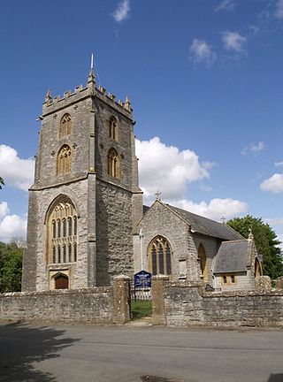
Ilton is a village and civil parish in Somerset, England, situated 8 miles (12.9 km) south-east of Taunton, and 2 miles (3.2 km) north of Ilminster in the South Somerset district. The village has a population of 854. The parish includes the hamlets of Ilford and Cad Green with its 16th-century almshouses.

Isle Abbots is a village and civil parish in Somerset, England, around 7 miles (11.3 km) south-east of Taunton in the South Somerset district. The village had a population of 205 at the 2011 census.

Kingweston is a village and civil parish in Somerset, England, situated on Combe Hill, 3 miles (4.8 km) north east of Somerton in the South Somerset district. The village has a population of 128.

Bishop Sutton is a village on the northern slopes of the Mendip Hills, within the affluent Chew Valley in Somerset. It lies east of Chew Valley Lake and north east of the Mendip Hills, approximately ten miles south of Bristol on the A368, Weston-super-Mare to Bath road between West Harptree and Chelwood. Bishop Sutton and the neighbouring village of Stowey form the civil parish of Stowey Sutton.
The Chew Valley is an affluent area in North Somerset, England, named after the River Chew, which rises at Chewton Mendip, and joins the River Avon at Keynsham. Technically, the area of the valley is bounded by the water catchment area of the Chew and its tributaries; however, the name Chew Valley is often used less formally to cover other nearby areas, for example, Blagdon Lake and its environs, which by a stricter definition are part of the Yeo Valley. The valley is an area of rich arable and dairy farmland, interspersed with a number of villages.
Fivehead Woods and Meadow is a 62.4 hectare biological Site of Special Scientific Interest near the village of Fivehead in Somerset, notified in 1989.
Fivehead Arable Fields is a 10.3 hectare biological Site of Special Scientific Interest near the village of Fivehead in Somerset, notified in 1990.

Stoke St Michael is a village and civil parish on the Mendip Hills 4 miles (6.4 km) north east of Shepton Mallet, and 8 miles (12.9 km) west of Frome, in the Mendip district of Somerset, England.

Gmina Kamionka is a rural gmina in Lubartów County, Lublin Voivodeship, in eastern Poland. Its seat is the village of Kamionka, which lies approximately 10 kilometres (6 mi) west of Lubartów and 26 km (16 mi) north of the regional capital Lublin. It lies on the generally flat Lubartów plain.

Uphill is a village and former civil parish, now in the parish of Weston-super-Mare, in the North Somerset district, in the ceremonial county of Somerset, England, at the southern edge of the town, on the Bristol Channel coast.
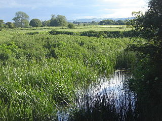
The River Isle flows from its source near Combe St Nicholas, through Somerset, England and discharges into the River Parrett south of Langport near Midelney.

The Mells River flows through the eastern Mendip Hills in Somerset, England. It rises at Gurney Slade and flows east joining the River Frome at Frome.
