Culdrum Township, Morrison County, Minnesota

Last updated

Culdrum Township, Minnesota
USA Minnesota location map.svg
Red pog.svg
Culdrum Township, Minnesota
Location within the state of Minnesota
Usa edcp location map.svg
Red pog.svg
Culdrum Township, Minnesota
Culdrum Township, Minnesota (the United States)
Coordinates: 45°58′1″N94°35′25″W / 45.96694°N 94.59028°W / 45.96694; -94.59028
Country United States
State Minnesota
County Morrison
Area
  Total33.8 sq mi (87.5 km2)
  Land33.5 sq mi (86.9 km2)
  Water0.2 sq mi (0.6 km2)
Elevation
1,227 ft (374 m)
Population
 (2000)
  Total505
  Density15.1/sq mi (5.8/km2)
Time zone UTC-6 (Central (CST))
  Summer (DST) UTC-5 (CDT)
FIPS code 27-14248 [1]
GNIS feature ID0663905 [2]

Culdrum Township is a township in Morrison County, Minnesota, United States. The population was 505 at the 2000 census.

Contents

History

Culdrum Township was organized in 1871. [3] The first settler in the area of the town was J.C. Stebbins who in 1859 located in an area known as Martin place. During the US-Dakota War of 1862 the entire population of township was abandoned. [4] Soon after the war the end of the war John Workman, one of the Little Falls first settlers, selected the name for the township which was named for Culdrum Townland in County Londonderry, his native town in Ireland. [5] [3]

Geography

According to the United States Census Bureau, the township has a total area of 33.8 square miles (88 km2), of which 33.5 square miles (87 km2) is land and 0.2 square miles (0.52 km2) (0.68%) is water.

Demographics

As of the census [1] of 2000, there were 505 people, 165 households, and 130 families residing in the township. The population density was 15.1 inhabitants per square mile (5.8/km2). There were 178 housing units at an average density of 5.3 per square mile (2.0/km2). The racial makeup of the township was 99.60% White, and 0.40% from two or more races. Hispanic or Latino of any race were 0.59% of the population.

There were 165 households, out of which 44.8% had children under the age of 18 living with them, 69.7% were married couples living together, 5.5% had a female householder with no husband present, and 21.2% were non-families. 18.8% of all households were made up of individuals, and 10.3% had someone living alone who was 65 years of age or older. The average household size was 3.06 and the average family size was 3.54.

In the township the population was spread out, with 35.6% under the age of 18, 5.0% from 18 to 24, 26.5% from 25 to 44, 19.8% from 45 to 64, and 13.1% who were 65 years of age or older. The median age was 36 years. For every 100 females, there were 102.0 males. For every 100 females age 18 and over, there were 108.3 males.

The median income for a household in the township was $34,712, and the median income for a family was $46,250. Males had a median income of $26,250 versus $19,375 for females. The per capita income for the township was $14,174. About 3.1% of families and 3.5% of the population were below the poverty line, including 1.3% of those under age 18 and 9.6% of those age 65 or over.

Related Research Articles

<span class="mw-page-title-main">Morrison County, Minnesota</span> County in Minnesota, United States

Morrison County is a county in the U.S. state of Minnesota. As of the 2020 census, the population was 34,010. Its county seat is Little Falls. Camp Ripley Military Reservation occupies a significant area in north-central Morrison County.

Morrison Township is a township in Aitkin County, Minnesota, United States. The population was 200 as of the 2010 census.

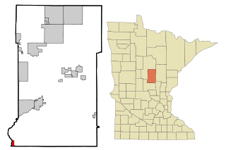
Graham Township is a township in Benton County, Minnesota, United States. The population was 582 as of the 2010 census.

<span class="mw-page-title-main">Fort Ripley, Minnesota</span> City in Minnesota, United States

Fort Ripley is a city in Crow Wing County, Minnesota, United States, near the confluence of the Mississippi and Nokasippi Rivers. The population was 69 at the 2010 census. It is part of the Brainerd Micropolitan Statistical Area.

Agram Township is a township in Morrison County, Minnesota, United States. The population was 534 at the 2000 census.

Elmdale Township is a township in Morrison County, Minnesota, United States. The population was 904 at the 2000 census.

Granite Township is a township in Morrison County, Minnesota, United States. The population was 480 at the 2000 census.

Mount Morris Township is a township in Morrison County, Minnesota, United States. The population was 90 at the 2000 census.

Ripley Township is a township in Morrison County, Minnesota, United States. The population was 692 at the 2000 census.

Swan River Township is a township in Morrison County, Minnesota, United States. The population was 755 at the 2000 census.

<span class="mw-page-title-main">Swanville, Minnesota</span> City in Minnesota, United States

Swanville is a city in Morrison County, Minnesota, United States. A very small portion of the city extends into Todd County. The population was 326 at the 2020 census.

Swanville Township is a township in Morrison County, Minnesota, United States. The population was 534 at the 2000 census.

<span class="mw-page-title-main">Two Rivers Township, Morrison County, Minnesota</span> Township in Minnesota, United States

Two Rivers Township is a township in Morrison County, Minnesota, United States. The population was 780 at the 2020 census.

Angus Township is a township in Polk County, Minnesota, United States. It is part of the Grand Forks-ND-MN Metropolitan Statistical Area. The population was 112 at the 2000 census.

Esther Township is a township in Polk County, Minnesota, United States. It is part of the Grand Forks-ND-MN Metropolitan Statistical Area. The population was 158 at the 2000 census.

Hammond Township is a township in Polk County, Minnesota, United States. It is part of the Grand Forks-ND-MN Metropolitan Statistical Area. The population was 57 at the 2000 census.

Queen Township is a township in Polk County, Minnesota, United States. It is part of the Grand Forks-ND-MN Metropolitan Statistical Area. The population was 198 at the 2000 census.

Lake Township is a township in Roseau County, Minnesota, United States. The population was 2,087 at the 2000 census. This township was originally called Algoma Township, which bears a name of Indian derivation, "formed by Schoolcraft from Algonquin and goma meaning 'Algonquin waters.' It designates a large district in Canada, bordering Lakes Huron and Superior. The name was changed sometime between 1954 and 1965.

Kugler Township is a township in Saint Louis County, Minnesota, United States. The population was 175 at the 2010 census.

<span class="mw-page-title-main">Pike Township, St. Louis County, Minnesota</span> Township in Minnesota, United States

Pike Township is a township in Saint Louis County, Minnesota, United States. The population was 417 at the 2010 census.

References

  1. 1 2 "U.S. Census website". United States Census Bureau . Retrieved January 31, 2008.
  2. "US Board on Geographic Names". United States Geological Survey. October 25, 2007. Retrieved January 31, 2008.
  3. 1 2 Warner, Mary (2006). A Big Hearted Paleface Man: Nathan Richardson and The History of Morrison County, MN. Little Falls, Minnesota: Morrison County Historical Society. pp. 189–192.
  4. "A History of Culdrum Township". The Swanville News. Vol. XXXXVI (38 ed.). Swanville, MN. p. 1.
  5. Upham, Warren (1920). Minnesota Geographic Names: Their Origin and Historic Significance. Minnesota Historical Society. p. 351.