
Morrison County is a county in the U.S. state of Minnesota. As of the 2020 census, the population was 34,010. Its county seat is Little Falls. Camp Ripley Military Reservation occupies a significant area in north-central Morrison County.

Buckman is a city in Morrison County, Minnesota, United States. The population was 307 at the 2020 Census.

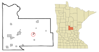
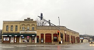
Harding is a city in Morrison County, Minnesota, United States. The population was 123 at the 2020 census.

Lastrup is a city in Morrison County, Minnesota, United States. The population was 120 at the 2020 census.

Little Falls is a city in Morrison County, Minnesota, United States, near the geographic center of the state. Established in 1848, Little Falls is one of the oldest European-American cities in Minnesota. It is the county seat of Morrison County. The population was 9,140 at the 2020 census, up from 8,343 in 2010. Little Falls was the boyhood home of noted aviator Charles Lindbergh. Just across from his former home is Charles A. Lindbergh State Park, named after Lindbergh's father, prominent Minnesota lawyer and U.S. Congressman Charles August Lindbergh.
Platte Township is a township in Morrison County, Minnesota, United States. The population was 329 at the 2000 census.
Genola is a city in Morrison County, Minnesota, United States. The population was 70 at the 2020 census.
Royalton is a city in Morrison and Benton counties in the U.S. state of Minnesota, along the Platte River. The population was 1,281 at the 2020 census. The city is located mainly within Morrison County.

The Platte River is a tributary of the Mississippi River in central Minnesota in the United States. It is 55.1 miles (88.6 km) long. Platte is a name derived from the French meaning "flat".
Cushing is an unincorporated community in Cushing Township, Morrison County, Minnesota, United States. The community is located along U.S. Highway 10 near Morrison County Road 5, Bear Road. Nearby places include Randall, Little Falls, and Motley.
Crane Meadows National Wildlife Refuge was established in 1992 to preserve a large, natural wetland complex. The refuge is located in central Minnesota and serves as an important stop for many species of migrating birds. Located within a large watershed that includes Rice, Skunk and Mud Lakes, Platte and Skunk Rivers, Rice and Buckman Creeks, and sedge meadow wetlands, it harbors one of the largest nesting populations of greater sandhill cranes in Minnesota. Habitats include native tallgrass prairie, oak savanna, and wetlands with stands of wild rice. With a total authorized acquisition boundary of 13,540 acres (54.8 km2) encompassing this important wetland complex and adjacent uplands, Crane Meadows National Wildlife Refuge presently exists as scattered parcels totaling about 2,000 acres (8.1 km2). Existing ownership lies in Little Falls Township and Agram Township in Morrison County.
Little Rock is an unincorporated community in Buckman Township, Morrison County, Minnesota, United States. There are approximately 25 people living in Little Rock. The community is located along State Highway 25 near its junction with Morrison County Road 26, Nature Road. Nearby places include Buckman, Royalton, Rice, and Pierz. Bunker Hill Creek flows through the community.

North Prairie is an unincorporated community in Two Rivers Township, Morrison County, Minnesota, United States. The community is located along Morrison County Road 21 near Gable Road. Nearby places include Bowlus and Royalton. The Mississippi River is nearby.
Vawter is an unincorporated community in Morrison County, Minnesota, United States, near Little Falls and Royalton. The community is located along 103rd Street near Morrison County Road 35, Iris Road. Vawter is located within Bellevue Township and Little Falls Township. The Crane Meadows National Wildlife Refuge and the Rice–Skunk Lake Wildlife Management Area are both nearby.
Ramey is an unincorporated community in Morrill Township, Morrison County, Minnesota, United States. The community is located along 345th Avenue near its junction with Morrison County Road 26, Nature Road. Nearby places include Pierz, Hillman, and Foley.
Morrill is an unincorporated community in Morrill Township, Morrison County, Minnesota, United States. The community is located near the junction of 330th Avenue and Morrison County Road 26, Nature Road. Nearby places include Pierz, Hillman, Little Rock, Ramey, and Foley.
Lincoln is an unincorporated community in Scandia Valley Township, Morrison County, Minnesota, United States. The community is located along U.S. Highway 10 near Holt Road. 320th Street and Azure Road are also in the immediate area. Nearby places include Motley, Cushing, and Little Falls.
Gregory is an unincorporated community in Little Falls Township, Morrison County, Minnesota, United States, near Little Falls. The community is located near the intersection of 123rd Street and Haven Road, Morrison County Road 76.
Freedhem is an unincorporated community in Belle Prairie Township, Morrison County, Minnesota, United States. The community is located near the junction of 203rd Street and Morrison County Road 45, Jewel Road. Nearby places include Little Falls, Pierz, and Camp Ripley.
Mae is an unincorporated community in Beulah Township, Cass County, Minnesota, United States, near Outing and Emily. It is located along Cass County Road 58, near Morrison Lake Road NE.


