
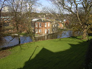
The River Sheaf in Sheffield, South Yorkshire, England, flows northwards, past Dore, through Abbeydale and north of Heeley. It then passes into a culvert, through which it flows under the centre of Sheffield before joining the River Don. This lower section of the River Sheaf, together with the River Don between the Blonk Street and Lady's Bridges, formed two sides of the boundary of Sheffield Castle.
The Porter Brook is a river which flows through the City of Sheffield, England, descending over 1,000 feet (300 m) from its source on Burbage Moor to the west of the city to its mouth where it joins the River Sheaf in a culvert beneath Sheffield railway station. Like the other rivers in Sheffield, its steep gradient made it ideal for powering water mills and works associated with the metalworking and cutlery industries, and around 20 dams were constructed over the centuries to facilitate this. At its lower end, it is extensively culverted, but parts of it are gradually being restored to open channels, as part of a daylighting scheme for the city.

Sheffield station, formerly Pond Street and later Sheffield Midland, is a combined railway station and tram stop in Sheffield, England; it is the busiest station in South Yorkshire. Adjacent is Sheffield station/Sheffield Hallam University Sheffield Supertram stop. In 2017–18, the station was the 43rd-busiest in the UK and the 15th-busiest outside London.

Weston Park Museum is a museum in Sheffield, South Yorkshire, England. It is one mile west of Sheffield city centre within Weston Park. It is Sheffield's largest museum and is housed in a Grade II* listed building and managed by Museums Sheffield. Until 2006 it was called Sheffield City Museum and Mappin Art Gallery.

Sheffield Winter Garden is a large temperate glasshouse located in the city of Sheffield in South Yorkshire, England. It is one of the largest temperate glasshouses to be built in the UK during the last hundred years, and the largest urban glasshouse anywhere in Europe. It is home to more than 2,000 plants from all around the world. It was officially opened by Queen Elizabeth II on 22 May 2003.

Sheffield is a geographically diverse city in England. It nestles in the eastern foothills of the Pennines and the confluence of five rivers: Don, Sheaf, Rivelin, Loxley and Porter. As such, much of the city is built on hillsides, with views into the city centre or out to the countryside. The city is roughly one third urban, one third rural and one third in the Peak District. At its lowest point the city stands just 29 metres above sea level at Blackburn Meadows on the Rotherham border, rising up to over 500 m in some parts of the city to a peak of 548m at High Stones on the Derbyshire border; however, 89% of the housing in the city is between 100 and 200 metres above sea level. Over 95% of the population resides in the main urban area.

Sheaf House was a nine-storey tower building by Sheaf Square, next to Sheffield railway station, in the centre of Sheffield, in South Yorkshire, England. The building was formerly the Sheffield area headquarters of British Rail.

Chesterfield Road is a shopping street in Sheffield, England. It leads south from the suburb of Meersbrook to Woodseats, before becoming Meadowhead at the Abbey Lane junction, next to the Abbey pub. The road starts at Toll Bar bridge on the Meers Brook, the former boundary between Yorkshire and Derbyshire. There the road changes name from London Road to Chesterfield Road.

The Meers Brook is a stream in Sheffield, England and one of the main tributaries of the River Sheaf. The Meers Brook originates in Gleadless and flows downhill through Gleadless Valley and Meersbrook then, culverted, continues underneath Heeley to pour into the River Sheaf near Saxon Road and Clyde Road in Lowfield.

Sheaf Square is a municipal square lying immediately east of the city centre of Sheffield, England.
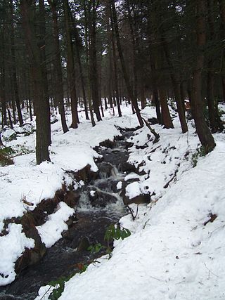
The Totley Brook is a stream in Sheffield, South Yorkshire, England. It rises on a millstone grit ridge some 7 miles (11 km) to the south-west of the centre of Sheffield. Over its course it drops from 740 feet (230 m) to 430 feet (130 m) near its junction with the Old Hay Brook close to Baslow Road. The streams form the River Sheaf once they have joined.
Sheffield City Centre is a district of the City of Sheffield and is covered partly by the City ward of the City of Sheffield. It includes the area that is within a radius of roughly 0.75 miles (1.2 km) of Sheffield Cathedral and is encircled by the Inner Ring Road, a circular route started in the late 1960s and completed in 2007. As well as the cathedral, buildings in the city centre include the Grade I listed Town Hall, the City Hall and the Winter Gardens. Several areas of the city centre have been designated as quarters. It is home to the city's major business, transport, leisure and cultural attractions.

Leopold Square is a mixed-use development in Sheffield's West End, England, located at the corner of Leopold Street and West Street. The development, by Ask Developments and Gleeson's in collaboration with local architects AXIS Architecture, comprises the refurbishment of the former Central Technical School buildings, built between 1870 and 1894, into apartments, bars, restaurants and a hotel. The development also has a new angular building to house a bar and a restaurant, and the creation of a brand new public square. The redevelopment of the old buildings began in 2004, following years of use as council offices after the closure of the Schools.

The Castlegate Quarter is one of the eleven quarters of Sheffield city centre. It is named after Castlegate, the quarter's main thoroughfare. The boundaries of the Castlegate Quarter are formed by Castlegate and the River Don to the north, Exchange Place to the east, Commercial Street and part of the High Street to the south, and Angel Street and Snig Hill to the west. For the latter part of the 20th century, the Castlegate Quarter was dominated by Castle Market, a large indoor market building. Following the demolition of Castle Market in 2015, the quarter is now undergoing regeneration as of 2020.

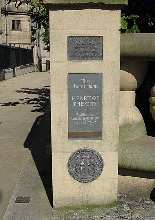
Millennium Square is a modern city square in Sheffield, England. It was created as part of the Heart of the City project that began in 1998 and has become a central feature in Sheffield's redeveloped city centre. It contains fountains in the shape of steel spheres, recalling Sheffield's past as a centre of the steel making industry, whilst linking with the fountains of the Peace Gardens, as well as Sheaf Square, Hallam Square and Barkers Pool. The square forms part of the 'Gold Route', designed by Sheffield City Council to guide visitors through the city centre from Sheffield Station to Devonshire Green.

The Sheffield Digital Campus is a new development in Sheffield City Centre close to the railway station and bus station.
