Related Research Articles

Essex County is a county in the northeastern part of the U.S. state of Massachusetts. At the 2020 census, the total population was 809,829, making it the third-most populous county in the state, and the seventy-eighth-most populous in the country. It is part of the Greater Boston area. The largest city in Essex County is Lynn. The county was named after the English county of Essex. It has two traditional county seats: Salem and Lawrence. Prior to the dissolution of the county government in 1999, Salem had jurisdiction over the Southern Essex District, and Lawrence had jurisdiction over the Northern Essex District, but currently these cities do not function as seats of government. However, the county and the districts remain as administrative regions recognized by various governmental agencies, which gathered vital statistics or disposed of judicial case loads under these geographic subdivisions, and are required to keep the records based on them. The county has been designated the Essex National Heritage Area by the National Park Service.

Hampden County is a non-governmental county located in the Pioneer Valley of the U.S. state of Massachusetts, in the United States. As of the 2020 census, Hampden County's population was 465,825. Its traditional county seat is Springfield, the Connecticut River Valley's largest city, and economic and cultural capital; with an estimated population of 154,758, approximately one-third of Hampden County residents live in Springfield.

Worcester County is a county in the U.S. state of Massachusetts. At the 2020 census, the population was 862,111, making it the second-most populous county in Massachusetts. It is also the largest county in Massachusetts by geographic area. The largest city and traditional shire town is Worcester. Worcester County is part of the Worcester, MA–CT metropolitan statistical area and the Boston-Worcester-Providence combined statistical area.

In the United Kingdom, a scheduled monument is a nationally important archaeological site or historic building, given protection against unauthorised change.

The city of Northampton is the county seat of Hampshire County, Massachusetts, United States. As of the 2020 census, the population of Northampton was 29,571.

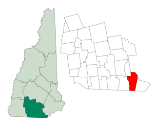
North Conway is a census-designated place (CDP) and village in eastern Carroll County, New Hampshire, United States. The population was 2,116 at the 2020 census. A year-round resort area, North Conway is the second-largest village within the town of Conway, after the village of Conway proper. North Conway maintains its own fire station, post office and public library, sharing its other services with Conway. The White Mountain National Forest is to the west and north. The area is home to Cathedral Ledge, Echo Lake State Park, and Cranmore Mountain Resort. North Conway is known for its large number of outlet shops.

The River Avon is in the south of England, rising in Wiltshire, flowing through that county's city of Salisbury and then west Hampshire, before reaching the English Channel through Christchurch Harbour in the Bournemouth, Christchurch and Poole conurbation of Dorset.

The Pioneer Valley is the colloquial and promotional name for the portion of the Connecticut River Valley that is in Massachusetts in the United States. It is generally taken to comprise the three counties of Hampden, Hampshire, and Franklin. The lower Pioneer Valley corresponds to the Springfield, Massachusetts metropolitan area, the region's urban center, and the seat of Hampden County. The upper Pioneer Valley region includes the smaller cities of Northampton and Greenfield, the county seats of Hampshire and Franklin counties, respectively.

Lancaster is a town located along the Connecticut River in Coös County, New Hampshire, United States. The town is named after the city of Lancaster in England. As of the 2020 census, the town population was 3,218, the second largest in the county after Berlin. It is the county seat of Coos County and gateway to the Great North Woods Region of the state. Lancaster, which includes the villages of Grange and South Lancaster, is home to Weeks State Park and the Lancaster Fair. Part of the White Mountain National Forest is in the eastern portion. The town is part of the Berlin, NH−VT Micropolitan Statistical Area.
Hudson is a town in Hillsborough County, New Hampshire, United States. It is located along the Massachusetts state line. The population was 25,394 at the 2020 census. It is the tenth-largest municipality in the state, by population.

The New Forest is one of the largest remaining tracts of unenclosed pasture land, heathland and forest in Southern England, covering southwest Hampshire and southeast Wiltshire. It was proclaimed a royal forest by William the Conqueror, featuring in the Domesday Book.
National parks of the United Kingdom are areas of relatively undeveloped and scenic landscape across the country. Despite their name, they are quite different from national parks in many other countries, which are usually owned and managed by governments as protected community resources, and which do not usually include permanent human communities. In the United Kingdom, an area designated as a national park may include substantial settlements and human land uses that are often integral parts of the landscape. Land within national parks remains largely in private ownership. These parks are therefore not "national parks" according to the internationally accepted standard of the IUCN but they are areas of outstanding landscape where planning controls are a little more restrictive than elsewhere.

Greater Boston is the metropolitan region of New England encompassing the municipality of Boston, the capital of the U.S. state of Massachusetts and the most populous city in New England, and its surrounding areas. The most stringent definition of the region consists of most of the eastern third of mainland Massachusetts, excluding the Merrimack Valley and most of Southeastern Massachusetts, though most definitions include much of these areas and portions of southern New Hampshire.

Western Massachusetts, known colloquially as "western Mass," is a region in Massachusetts, one of the six U.S. states that make up the New England region of the United States. Western Massachusetts has diverse topography; 22 colleges and universities including UMass in Amherst, MA, with approximately 100,000 students; and such institutions as Tanglewood, the Springfield Armory, and Jacob's Pillow.
The Crossroads of the American Revolution National Heritage Area (XRDS) is a federally designated National Heritage Area encompassing portions of fourteen counties in New Jersey that were the scene of significant actions in the American Revolutionary War in late 1776 through 1778. The designated area covers the Delaware and Hudson valleys in New Jersey and the central portion of the state between the valleys where the Continental Army fought forces under British command. The National Heritage Area includes Morristown National Historical Park and sites associated with the Battle of Monmouth as well as Princeton, New Jersey, the meeting place of the Continental Congress when peace was declared in 1783.

New England is a region comprising six states in the Northeastern United States: Connecticut, Maine, Massachusetts, New Hampshire, Rhode Island, and Vermont. It is bordered by the state of New York to the west and by the Canadian provinces of New Brunswick to the northeast and Quebec to the north. The Gulf of Maine and Atlantic Ocean are to the east and southeast, and Long Island Sound is to the southwest. Boston is New England's largest city and the capital of Massachusetts. Greater Boston is the largest metropolitan area, with nearly a third of New England's population; this area includes Worcester, Massachusetts, the second-largest city in New England, Manchester, New Hampshire, the largest city in New Hampshire, and Providence, Rhode Island, the capital of and largest city in Rhode Island.

The Trail of the Ancients is a collection of National Scenic Byways located in the U.S. Four Corners states of Utah, Colorado, New Mexico, and Arizona. These byways comprise:

North Stoneham Park, also known as Stoneham Park, was a landscaped parkland and country house of the same name, north of Southampton at North Stoneham, Hampshire. It was the seat of the Fleming family. The park was remodelled by Lancelot Brown in the 18th century. It is listed in the Hampshire Register of Historic Parks and Gardens.
The Journey Through Hallowed Ground National Heritage Area is a federally designated National Heritage Area in portions of Pennsylvania, West Virginia, Maryland and Virginia.

Sangre de Cristo National Heritage Area is a federally designated National Heritage Area in the south central portion of the U.S. state of Colorado. The heritage area includes the San Luis Valley and portions of the Sangre de Cristo Range. The region combines influences of Anglo-American, Hispano-American and Native American influences. It also includes portions of the upper Rio Grande valley.
References
- ↑ "Vision Statement". Freedom's Way National Heritage Area. Archived from the original on 18 June 2012. Retrieved 13 April 2012.
- ↑ "Rediscovering the Native Landscape: Map". Freedom's Way National Heritage Area. Archived from the original on 18 June 2012. Retrieved 16 April 2012.
- ↑ "Legislative Summary". Freedom's Way National Heritage Area. Archived from the original on 18 June 2012. Retrieved 16 April 2012.
- ↑ "Activation" (PDF). National Park Service. Retrieved 16 April 2012.