Related Research Articles

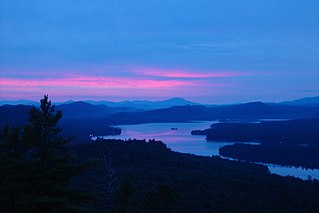
Lake Champlain is a natural freshwater lake in North America mainly within the borders of the United States but also across the Canada–U.S. border into the Canadian province of Quebec.

Vermont is a state in the New England region of the United States. It borders the states of Massachusetts to the south, New Hampshire to the east, and New York to the west, and the Canadian province of Quebec to the north. Vermont is the only state in New England that does not border the Atlantic Ocean. Vermont is the second-least-populated U.S. state after Wyoming and the sixth-smallest by area of the 50 U.S. states with a recorded population of 643,503 according to the 2020 U.S. census. The state capital is Montpelier, the least-populous state capital in the United States. The most-populous city, Burlington, is the least-populous city to be the most-populous city in a state.

Washington County is a county in the U.S. state of New York. As of the 2020 census, the population was 61,302. The county seat is Fort Edward. The county was named for U.S. President George Washington.

Clinton County is a county in the north-easternmost corner of the state of New York, in the United States and bordered by the Canadian province of Quebec. As of the 2020 United States Census, the population was 79,843. Its county seat is the city of Plattsburgh. The county lies just south of the border with the Canadian province of Quebec and to the west of the State of Vermont.

Saratoga County is a county in the U.S. state of New York, and is the fastest-growing county in Upstate New York. As of the 2020 U.S. Census, the county's population was enumerated at 235,509, representing a 7.2% increase from the 2010 population of 219,607, representing one of the fastest growth rates in the northeastern United States. The county seat is Ballston Spa. Saratoga County is included in the Capital District, encompassing the Albany-Schenectady-Troy, New York Metropolitan Statistical Area.

Burlington is the most-populous city in Vermont and the seat of Chittenden County. It is 45 miles (72 km) south of the Canada–United States border and 94 miles (151 km) south of Montreal. The population was 44,743 at the 2020 census. It ranks as the least-populous city to also be the most-populous city in its state.

Crown Point is a town in Essex County, New York, United States, located on the west shore of Lake Champlain. The population was 2,024 at the 2010 census. The name of the town is a direct translation of the original French name, Pointe à la Chevelure.

Port Henry is a hamlet in Essex County, New York, United States. The population was 1,194 at the 2010 census.
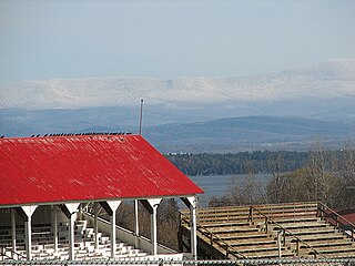
Westport is a town in Essex County, New York, United States overlooking Lake Champlain. The population was 1,312 at the 2010 census.
Upstate New York is a geographic region consisting of the portion of New York State lying north of the New York City metropolitan area. Although the precise boundary is debated, Upstate New York excludes New York City and Long Island, and most definitions of the region exclude all or part of Westchester and Rockland counties. Major cities across Upstate New York from east to west include Albany, Utica, Binghamton, Syracuse, Rochester, and Buffalo.
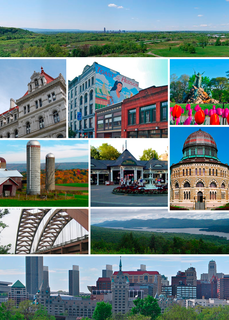
The Capital District, also known as the Capital Region, is the metropolitan area surrounding Albany, the capital of the U.S. state of New York. In the 21st century, the Capital District emerged as a major anchor of Tech Valley, the moniker describing the technologically focused region of eastern New York State. The Capital District was first settled by the Dutch in the early 17th century and came under English control in 1664. Albany has been the permanent capital of the state of New York since 1797. The Capital District is notable for many historical events that predate the independence of the United States, including the Albany Plan of Union and The Battles of Saratoga.

The Champlain Valley is a region of the United States around Lake Champlain in Vermont and New York extending north slightly into Quebec, Canada. It is part of the St. Lawrence River drainage basin, drained northward by the Richelieu River into the St. Lawrence at Sorel-Tracy, Quebec. The Richelieu valley is not generally referred to as part of the Champlain Valley.

The geologic history of Vermont begins more than 450 million years ago during the Cambrian and Devonian periods.
Chimney Point is a peninsula in the town of Addison, Vermont, which juts into Lake Champlain forming a narrows. It is one of the earliest settled and most strategic sites in the Champlain Valley.

Battery Park is a public park overlooking Lake Champlain at the western end of downtown Burlington, Vermont. The park includes a bandshell, a playground, and various monuments, including a bronze statue of Civil War veteran General William W. Wells, and a red oak sculpture of Chief Gray Lock, a veteran of Gray Lock's War. Locally, it is popular for its wide, sweeping views of Lake Champlain.

Otter Creek is the longest river entirely contained within the borders of Vermont. Roughly 112 miles (180 km) long, it is the primary watercourse running through Rutland County and Addison County. The mouth of the river flows into Lake Champlain.

New York is a state in the Northeastern United States. It is sometimes called New York State to distinguish it from its largest city, New York City. With a total area of 54,556 square miles (141,300 km2), New York is the 27th largest state geographically. With 20.2 million residents, it is the fourth most populous state in the United States as of 2021, with approximately 44% living in New York City and 40% on Long Island. The state is bordered by New Jersey and Pennsylvania to the south, and Connecticut, Massachusetts, and Vermont to the east; it has a maritime border with Rhode Island, east of Long Island, as well as an international border with the Canadian provinces of Quebec to the north and Ontario to the northwest.

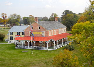
Mount Independence on Lake Champlain in Orwell, Vermont, was the site of extensive fortifications built during the American Revolutionary War by the American army to stop a British invasion. Construction began in July 1776, following the American defeat in Canada, and continued through the winter and spring of 1777. After the American retreat on July 5 and 6, 1777, British and Hessian troops occupied Mount Independence until November 1777.

Whitehall is a town in Washington County, New York, United States. It is part of the Glens Falls Metropolitan Statistical Area. The town population was 4,035 at the 2000 census.
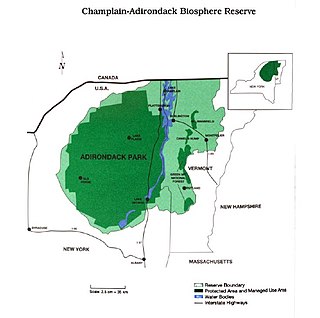
The Champlain-Adirondack Biosphere Network is a UNESCO-designated biosphere reserve. The Champlain-Adirondack Biosphere Network is part of a global network of 727 biosphere reserves in 131 countries and it is one of 28 internationally recognized biosphere regions in the United States.
References
- ↑ "Discover NHAs - National Heritage Areas (U.S. National Park Service)". www.nps.gov. Retrieved 2018-03-29.
- 1 2 3 "Welcome". Champlain Valley National Heritage Area. Champlain Valley National Heritage Partnership. Archived from the original on 25 January 2012. Retrieved 20 March 2012.
- ↑ "Themes". Champlain Valley National Heritage Area. Champlain Valley National Heritage Partnership. Archived from the original on 14 April 2013. Retrieved 20 March 2012.
- ↑ "Congressional Record". www.congress.gov. 2005-02-08. Retrieved 2018-03-29.