Related Research Articles

The Mohican are an Eastern Algonquian Native American tribe that historically spoke an Algonquian language. As part of the Eastern Algonquian family of tribes, they are related to the neighboring Lenape, who occupied territory to the south as far as the Atlantic coast. The Mohican occupied the upper tidal Hudson River Valley, including the confluence of the Mohawk River and into western New England centered on the upper Housatonic River watershed. After 1680, due to conflicts with the powerful Mohawk to the west during the Beaver Wars, many were driven southeastward across the present-day Massachusetts western border and the Taconic Mountains to Berkshire County around Stockbridge, Massachusetts.

Berkshire County is a county on the western edge of the U.S. state of Massachusetts. As of the 2020 census, the population was 129,026. Its largest city and traditional county seat is Pittsfield. The county was founded in 1761.

Kent is a town in Litchfield County, Connecticut, alongside the border with New York. The population was 3,019 according to the 2020 census. The town is home to three boarding schools: Kent School, the Marvelwood School, and South Kent School. The Schaghticoke Indian Reservation is also located within town borders. The town is also home to former U.S. Secretary of State Henry Kissinger.

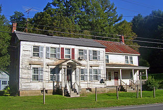
Housatonic is a census-designated place (CDP) in the town of Great Barrington in Berkshire County, Massachusetts. It is part of the Pittsfield, Massachusetts Metropolitan Statistical Area. The population was 1,109 at the 2010 census. It was named after the Housatonic River.
Canaan is a town in Columbia County, New York, United States. The population was 1,710 at the 2010 census. The town is in the northeastern part of the county.

Great Barrington is a town in Berkshire County, Massachusetts, United States. It is part of the Pittsfield, Massachusetts, Metropolitan Statistical Area. The population was 7,172 at the 2020 census. Both a summer resort and home to Ski Butternut, a ski resort, Great Barrington includes the villages of Van Deusenville and Housatonic.

The Berkshires are a highland geologic region located in the western parts of Massachusetts and northwest Connecticut. The term "Berkshires" is normally used by locals in reference to the portion of the Vermont-based Green Mountains that extend south into western Massachusetts; the portion extending further south into northwestern Connecticut is grouped with the Connecticut portion of the Taconic Mountains and referred to as either the Northwest Hills or Litchfield Hills.

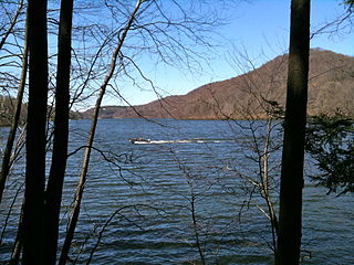
The Housatonic River is a river, approximately 149 miles (240 km) long, in western Massachusetts and western Connecticut in the United States. It flows south to southeast, and drains about 1,950 square miles (5,100 km2) of southwestern Connecticut into Long Island Sound. Its watershed is just to the west of the watershed of the lower Connecticut River.

In the United States, A National Heritage Area (NHA) is a site designated by Act of Congress, intended to encourage historic preservation of the area and an appreciation of the history and heritage of the site. There are currently 55 NHAs, some of which use variations of the title, such as National Heritage Corridor.

The Northwest Hills are a geographic region of the U.S. state of Connecticut located in the northwestern corner of the state. It is roughly coterminous with the boundaries of Litchfield County, for which it is named. The geographic region includes colloquial subregions -rural Northwestern Connecticut and the area associated with the city of Torrington, also known as the Upper Naugatuck River Valley or simply Litchfield Hills- which have also variously corresponded to designated government councils both past and present. Much of the area makes up the lowermost section of the Berkshire region, and is culturally similar to the rest of western New England.

The Ice Glen is a ravine in the southeast area of Stockbridge, Massachusetts. The park is essentially a lush, untended, romantic landscape consisting of piled rocks thick with mosses. Ice Glen derives its name from the fact that ice can persist at the bottom of deep rock crevices there into the summer. Its north-south orientation protects the glen from much direct sunlight. Surrounding the glen is an old growth forest, rare in New England.
The Housatonic Railroad is a Class III railroad operating in southwestern New England. It was chartered in 1983 to operate a short section of ex-New York, New Haven and Hartford Railroad in northwestern Connecticut, and has since expanded north and south, as well as west into New York State.

Mount Frissell, 2,454 feet (748 m), which straddles the border of southwest Massachusetts and northwest Connecticut, is a prominent peak of the Taconic Range.
Connecticut's 5th congressional district is a congressional district in the U.S. state of Connecticut. Located in the western part of the state spanning across parts of Fairfield, Litchfield, New Haven and Hartford counties, the district runs from Meriden and New Britain in central Connecticut, westward to Danbury and the surrounding Housatonic Valley, encompassing the Farmington Valley, Upper Naugatuck River Valley, and the Litchfield Hills. The district also includes most of Waterbury.

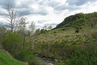
The Housatonic Valley is a geographic region of Connecticut and Massachusetts in the United States, associated with the valley and watershed of the Housatonic River.
The Konkapot River is a 22.1-mile-long (35.6 km) river in southwestern Massachusetts and northern Connecticut. It is a tributary of the Housatonic River, not to be confused with the smaller Konkapot Brook in Stockbridge.

The Berkshire Scenic Railway Museum is a railroad museum located in Lenox, Massachusetts, United States, that offers historical exhibits. The museum was founded in 1984 as a not-for-profit organization. During the 1980s and 2003-2011 it offered tourist train rides between Lenox and Stockbridge on the Housatonic Railroad right-of-way. In 2016 the museum began tourist train service in North Adams, Massachusetts.
The Lillinonah Trail is a 5.9-mile (9.5 km) Blue-Blazed hiking trail "system" in the lower Housatonic River valley in Fairfield County and, today, is entirely in Newtown. Most of the trail is in the upper block of Paugussett State Forest.
The Hop Brook Valley is a valley in southeastern Berkshire County, Massachusetts. The valley lies predominantly in the town of Tyringham, Massachusetts, although a good portion of it is located in the neighboring town of Lee. Because of its rural location, scenic views, and variety of hiking trails, it is considered as a destination for travellers of the region.

Great Barrington station is a former railroad station in Great Barrington, Massachusetts along the Housatonic Railroad Berkshire Line.
References
- 1 2 "Plan A Visit: About Your Visit". Housatonic Heritage. 2012. Retrieved 25 April 2012.