The geology of Cheshire in England consists mainly of Triassic sandstones and mudstones. To the north west of Cheshire, these rocks are heavily faulted and the underlying Carboniferous Coal Measures are thrown up. Around the areas of Poynton and Macclesfield, the coal is close to the surface and was easily mined. Below the Coal Measures is the Millstone Grit, which appears towards the Derbyshire border on the flanks of the Peak District dome. [1]
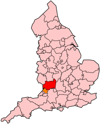
The Cheshire Basin is a major sedimentary basin which comprises the larger part of the county. This fault-bounded half-graben structure is bounded to the east and southeast by a series of faults of which the most significant is the Red Rock Fault. Numerous faults trend north-south through the basin, some of which help to define the series of hills which are known collectively as the Mid Cheshire Ridge. The basin was flooded on several occasions in the Permian and early Triassic periods resulting in the laying down of massive halite (salt) beds. These beds have been mined both by cavern working and hot water brine extraction for over 200 years, mainly in the area around Northwich. The collapse of some of these worked-out halite beds has given rise to some of Cheshire's noted features, the Cheshire Meres. [2]
Rocks originating in the Carboniferous period are largely restricted to that part of the county to the east of the Red Rock Fault. They comprise mudstones, siltstones and sandstones of the Lower Coal Measures and of the Millstone Grit Group. A very small outcrop of Carboniferous Limestone formerly occurred near Astbury though this has largely been removed by quarrying.
Coal Measures strata also occurs in the Neston area though it is obscured by glacial till and estuarine alluvium. It represents the easternmost extent of the Flintshire Coalfield. An inlier of upper Carboniferous rocks occurs to the south of Chester though it too is obscured by superficial deposits.
Carboniferous strata underlies the entire Cheshire basin at depth.
The majority of the solid rocks of Cheshire are sedimentary rocks laid down during the Permian and Triassic periods. Both the east and west Cheshire Plains are immediately underlain by Triassic sandstones, siltstones and mudstones, although outcrops are restricted to those areas that are not covered by thick expanses of glacial till of glacio-fluvial sands and gravels, such as the Mid Cheshire Ridge and Alderley Edge.
Rocks of Permian age occur to the west of Chester and in restricted areas to the southeast and northeast of the city, although again largely obscured by superficial deposits.
Small areas of the extreme south of the county are underlain by rocks of Jurassic age. Outcrops are very scarce as the thick cover of glacial till in this area largely obscures the underlying bedrock. The strata are assigned to the lowermost Jurassic Lias Group comprising mudstones and limestones.
The larger part of the Cheshire Plain is covered by a thick mantle of glacial till and sands and gravels of glacio-fluvial origin. These deposits are the legacy of the over-riding of the area on several occasions by glacial ice during the past 2 million years. The present distribution of deposits and the landforms to which they give rise are largely the result of the last ice age, the Devensian which peaked around 22-20,000 years ago. Kettle holes caused by the in-situ melting of ice-blocks during deglaciation are a notable feature of the landscape. Many are now dry though others such as Hatchmere and Pettypool remain as locally significant waterbodies.
The morphology of both the Dee and Mersey estuaries is in large part owed to the passage of Irish Sea Ice southwestwards over the relatively soft sandstones of the area. These features have been termed iceways. There are also a number of tunnel valleys beneath modern river valleys and other parts of the plain, excavated by ice and meltwater. Striking examples underlie the lower and middle stretches of the Weaver valley and those of the Dee and Gowy near Chester.
A considerable number of small glacial meltwater channels have been identified along the Mid Cheshire Ridge such as that known as Urchin's Kitchen near Kelsall whilst larger examples occur along the edges of the Peak District. There are notable examples at Lyme Park and southwards to Bollington and again in the Bosley area, south of Macclesfield.
The floodplains of the majority of watercourses in the county are composed of alluvium which has accumulated in the post-glacial period. River terraces can be identified along some valleys such as those of the River Mersey and River Dane, reflecting changing base levels to which these rivers have been cutting down.
Peat deposits have accumulated in various of the kettle-holes, not least within Delamere Forest, and on parts of the high ground of the east of the county where thin soils and high rainfall have contributed to their formation. [3]
Shropshire's Geology is very diverse and most geological periods of time, and most rock types, can be found within the county. There is also a large amount of mineral wealth in the county, including lead, barytes, limestone, coal and iron, which helped the area develop the industrial revolution west of Clee Hill and, later, in the Ironbridge Gorge area. Quarrying is still active, with limestone for cement manufacture and concrete aggregate, sandstone, greywacke and dolerite for road aggregate, and sand and gravel for aggregate and drainage filters. Groundwater is an equally important economic resource.

One of the classic locations for the study of Triassic sandstones in the UK is at Alderley Edge in Cheshire. Numerous scientists from the early 19th century up to the present day have studied the area and it is a popular field site for universities around the UK.

The geology of England is mainly sedimentary. The youngest rocks are in the south east around London, progressing in age in a north westerly direction. The Tees-Exe line marks the division between younger, softer and low-lying rocks in the south east and the generally older and harder rocks of the north and west which give rise to higher relief in those regions. The geology of England is recognisable in the landscape of its counties, the building materials of its towns and its regional extractive industries.

The geology of Wales is complex and varied; its study has been of considerable historical significance in the development of geology as a science. All geological periods from the Cryogenian to the Jurassic are represented at outcrop, whilst younger sedimentary rocks occur beneath the seas immediately off the Welsh coast. The effects of two mountain-building episodes have left their mark in the faulting and folding of much of the Palaeozoic rock sequence. Superficial deposits and landforms created during the present Quaternary period by water and ice are also plentiful and contribute to a remarkably diverse landscape of mountains, hills and coastal plains.
Gloucestershire is one of the most geologically and scenically diverse counties in England, with rocks from the Precambrian through to the Jurassic represented. These varying rock-types are responsible for the three major areas of the county, each with its own distinctive scenery and land-use - the Forest of Dean in the west, bordering Wales, the Cotswolds in the east, and in between, the Severn Vale.

The Geology of Yorkshire in northern England shows a very close relationship between the major topographical areas and the geological period in which their rocks were formed. The rocks of the Pennine chain of hills in the west are of Carboniferous origin whilst those of the central vale are Permo-Triassic. The North York Moors in the north-east of the county are Jurassic in age while the Yorkshire Wolds to the south east are Cretaceous chalk uplands. The plain of Holderness and the Humberhead levels both owe their present form to the Quaternary ice ages. The strata become gradually younger from west to east.
The Cheshire Basin is a late Palaeozoic and Mesozoic sedimentary basin extending under most of the county of Cheshire in northwest England. It extends northwards into the Manchester area and south into Shropshire. The basin possesses something of the character of a half-graben as its deepest extent is along its eastern and southeastern margins, where it is well defined by a series of sub-parallel faults, most important of which is the Red Rock Fault. These faults divide the basin from the older Carboniferous rocks of the Peak District and the North Staffordshire Coalfield.
The geology of Monmouthshire in southeast Wales largely consists of a thick series of sedimentary rocks of different types originating in the Silurian, Devonian, Carboniferous, Triassic and Jurassic periods.
The geology of Lancashire in northwest England consists in the main of Carboniferous age rocks but with Triassic sandstones and mudstones at or near the surface of the lowlands bordering the Irish Sea though these are largely obscured by Quaternary deposits.
The geology of Merseyside in northwest England largely consists of a faulted sequence of Carboniferous Coal Measures rocks overlain in the west by younger Triassic and Permian age sandstones and mudstones. Glaciation during the present Quaternary Period has left widespread glacial till as well as erosional landforms. Other post-glacial superficial deposits such as river and estuarine alluvium, peat and blown sand are abundant.
The geology of County Durham in northeast England consists of a basement of Lower Palaeozoic rocks overlain by a varying thickness of Carboniferous and Permo-Triassic sedimentary rocks which dip generally eastwards towards the North Sea. These have been intruded by a pluton, sills and dykes at various times from the Devonian Period to the Palaeogene. The whole is overlain by a suite of unconsolidated deposits of Quaternary age arising from glaciation and from other processes operating during the post-glacial period to the present. The geological interest of the west of the county was recognised by the designation in 2003 of the North Pennines Area of Outstanding Natural Beauty as a European Geopark.
The geology of Northumberland in northeast England includes a mix of sedimentary, intrusive and extrusive igneous rocks from the Palaeozoic and Cenozoic eras. Devonian age volcanic rocks and a granite pluton form the Cheviot massif. The geology of the rest of the county is characterised largely by a thick sequence of sedimentary rocks of Carboniferous age. These are intruded by both Permian and Palaeogene dykes and sills and the whole is overlain by unconsolidated sediments from the last ice age and the post-glacial period. The Whin Sill makes a significant impact on Northumberland's character and the former working of the Northumberland Coalfield significantly influenced the development of the county's economy. The county's geology contributes to a series of significant landscape features around which the Northumberland National Park was designated.
The geology of Thailand includes deep crystalline metamorphic basement rocks, overlain by extensive sandstone, limestone, turbidites and some volcanic rocks. The region experienced complicated tectonics during the Paleozoic, long-running shallow water conditions and then renewed uplift and erosion in the past several million years ago.
The geology of Denmark includes 12 kilometers of unmetamorphosed sediments lie atop the Precambrian Fennoscandian Shield, the Norwegian-Scottish Caledonides and buried North German-Polish Caledonides. The stable Fennoscandian Shield formed from 1.45 billion years ago to 850 million years ago in the Proterozoic. The Fennoscandian Border Zone is a large fault, bounding the deep basement rock of the Danish Basin—a trough between the Border Zone and the Ringkobing-Fyn High. The Sorgenfrei-Tornquist Zone is a fault-bounded area displaying Cretaceous-Cenozoic inversion.
The geology of national parks in Britain strongly influences the landscape character of each of the fifteen such areas which have been designated. There are ten national parks in England, three in Wales and two in Scotland. Ten of these were established in England and Wales in the 1950s under the provisions of the National Parks and Access to the Countryside Act 1949. With one exception, all of these first ten, together with the two Scottish parks were centred on upland or coastal areas formed from Palaeozoic rocks. The exception is the North York Moors National Park which is formed from sedimentary rocks of Jurassic age.
The geology of the Gower Peninsula in South Wales is central to its character and to its appeal to visitors. The peninsula is formed almost entirely from a faulted and folded sequence of Carboniferous rocks though both the earlier Old Red Sandstone and later New Red Sandstone are also present. Gower lay on the southern margin of the last ice sheet and has been a focus of interest for researchers and students in that respect too. Cave development and the use of some for early human occupation is a further significant aspect of the peninsula's scientific and cultural interest.
The bedrock geology of Carmarthenshire in west Wales consists largely of Palaeozoic age sedimentary rocks. Unconsolidated deposits of Quaternary age in Carmarthenshire include a dissected cover of glacial till, valley floor alluvium and some scattered peat deposits in both upland and lowland settings. There are extensive beach and tidal flat deposits along the Carmarthenshire coast. The exploitation of the county's mineral riches, particularly coal and limestone, was a key part of the local economy through much of the nineteenth and twentieth centuries.
The geology of Anglesey, the largest (714 km2) island in Wales is some of the most complex in the country. Anglesey has relatively low relief, the 'grain' of which runs northeast–southwest, i.e. ridge and valley features extend in that direction reflecting not only the trend of the late Precambrian and Palaeozoic age bedrock geology but also the direction in which glacial ice traversed and scoured the island during the last ice age. It was realised in the 1980s that the island is composed of multiple terranes, recognition of which is key to understanding its Precambrian and lower Palaeozoic evolution. The interpretation of the island's geological complexity has been debated amongst geologists for decades and recent research continues in that vein.
The geology of the Peak District National Park in England is dominated by a thick succession of faulted and folded sedimentary rocks of Carboniferous age. The Peak District is often divided into a southerly White Peak where Carboniferous Limestone outcrops and a northerly Dark Peak where the overlying succession of sandstones and mudstones dominate the landscape. The scarp and dip slope landscape which characterises the Dark Peak also extends along the eastern and western margins of the park. Although older rocks are present at depth, the oldest rocks which are to be found at the surface in the national park are dolomitic limestones of the Woo Dale Limestone Formation seen where Woo Dale enters Wye Dale east of Buxton.
The geology of Pembrokeshire in Wales inevitably includes the geology of the Pembrokeshire Coast National Park which extends around the larger part of the county’s coastline and where the majority of rock outcrops are to be seen. Pembrokeshire’s bedrock geology is largely formed from a sequence of sedimentary and igneous rocks originating during the late Precambrian and the Palaeozoic era, namely the Ediacaran, Cambrian, Ordovician, Silurian, Devonian and Carboniferous periods, i.e. between 635 and 299 Ma. The older rocks in the north of the county display patterns of faulting and folding associated with the Caledonian Orogeny. On the other hand, the late Palaeozoic rocks to the south owe their fold patterns and deformation to the later Variscan Orogeny.
| Unitary authorities | |
|---|---|
| Major settlements | |
| Rivers | |
| Topics | |