Related Research Articles

Carboniferous Limestone is a collective term for the succession of limestones occurring widely throughout Great Britain and Ireland that were deposited during the Dinantian Epoch of the Carboniferous Period. These rocks formed between 363 and 325 million years ago. Within England and Wales, the entire limestone succession, which includes subordinate mudstones and some thin sandstones, is known as the Carboniferous Limestone Supergroup.
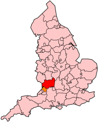
Gloucestershire is one of the most geologically and scenically diverse counties in England, with rocks from the Precambrian through to the Jurassic represented. These varying rock-types are responsible for the three major areas of the county, each with its own distinctive scenery and land-use - the Forest of Dean in the west, bordering Wales, the Cotswolds in the east, and in between, the Severn Vale.

The Inferior Oolite is a sequence of Jurassic age sedimentary rocks in Europe. It was deposited during the Middle Jurassic. The Inferior Oolite Group as more recently defined is a Jurassic lithostratigraphic group in southern and eastern England. It has been variously known in the past as the Under Oolite, the Inferior Oolite, the Inferior Oolite Series and the Redbourne Group.
The geology of Monmouthshire in southeast Wales largely consists of a thick series of sedimentary rocks of different types originating in the Silurian, Devonian, Carboniferous, Triassic and Jurassic periods.

The Sherwood Sandstone Group is a Triassic lithostratigraphic group which is widespread in Britain, especially in the English Midlands. The name is derived from Sherwood Forest in Nottinghamshire which is underlain by rocks of this age. It has economic importance as the reservoir of the Morecambe Bay gas field, the second largest gas field in the UK.
The geology of Lancashire in northwest England consists in the main of Carboniferous age rocks but with Triassic sandstones and mudstones at or near the surface of the lowlands bordering the Irish Sea though these are largely obscured by Quaternary deposits.
The geology of Suffolk in eastern England largely consists of a rolling chalk plain overlain in the east by Neogene clays, sands and gravels and isolated areas of Palaeocene sands. A variety of superficial deposits originating in the last couple of million years overlie this 'solid geology'.
The geology of Cambridgeshire in eastern England largely consists of unconsolidated Quaternary sediments such as marine and estuarine alluvium and peat overlying deeply buried Jurassic and Cretaceous age sedimentary rocks.
The geology of Essex in southeast England largely consists of Cenozoic marine sediments from the Palaeogene and Neogene periods overlain by a suite of superficial deposits of Quaternary age.
The geology of Kent in southeast England largely consists of a succession of northward dipping late Mesozoic and Cenozoic sedimentary rocks overlain by a suite of unconsolidated deposits of more recent origin.
The geology of Lincolnshire in eastern England largely consists of an easterly dipping succession of Mesozoic age sedimentary rocks, obscured across large parts of the county by unconsolidated deposits dating from the last few hundred thousand years of the present Quaternary Period.
The geology of Norfolk in eastern England largely consists of late Mesozoic and Cenozoic sedimentary rocks of marine origin covered by an extensive spread of unconsolidated recent deposits.
The geology of Merseyside in northwest England largely consists of a faulted sequence of Carboniferous Coal Measures rocks overlain in the west by younger Triassic and Permian age sandstones and mudstones. Glaciation during the present Quaternary Period has left widespread glacial till as well as erosional landforms. Other post-glacial superficial deposits such as river and estuarine alluvium, peat and blown sand are abundant.
The geology of County Durham in northeast England consists of a basement of Lower Palaeozoic rocks overlain by a varying thickness of Carboniferous and Permo-Triassic sedimentary rocks which dip generally eastwards towards the North Sea. These have been intruded by a pluton, sills and dykes at various times from the Devonian Period to the Palaeogene. The whole is overlain by a suite of unconsolidated deposits of Quaternary age arising from glaciation and from other processes operating during the post-glacial period to the present. The geological interest of the west of the county was recognised by the designation in 2003 of the North Pennines Area of Outstanding Natural Beauty as a European Geopark.
The geology of Tyne and Wear in northeast England largely consists of a suite of sedimentary rocks dating from the Carboniferous and Permian periods into which were intruded igneous dykes during the later Palaeogene Period.
The geology of West Sussex in southeast England comprises a succession of sedimentary rocks of Cretaceous age overlain in the south by sediments of Palaeogene age. The sequence of strata from both periods consists of a variety of sandstones, mudstones, siltstones and limestones. These sediments were deposited within the Hampshire and Weald basins. Erosion subsequent to large scale but gentle folding associated with the Alpine Orogeny has resulted in the present outcrop pattern across the county, dominated by the north facing chalk scarp of the South Downs. The bedrock is overlain by a suite of Quaternary deposits of varied origin. Parts of both the bedrock and these superficial deposits have been worked for a variety of minerals for use in construction, industry and agriculture.
The geology of Northumberland in northeast England includes a mix of sedimentary, intrusive and extrusive igneous rocks from the Palaeozoic and Cenozoic eras. Devonian age volcanic rocks and a granite pluton form the Cheviot massif. The geology of the rest of the county is characterised largely by a thick sequence of sedimentary rocks of Carboniferous age. These are intruded by both Permian and Palaeogene dykes and sills and the whole is overlain by unconsolidated sediments from the last ice age and the post-glacial period. The Whin Sill makes a significant impact on Northumberland's character and the former working of the Northumberland Coalfield significantly influenced the development of the county's economy. The county's geology contributes to a series of significant landscape features around which the Northumberland National Park was designated.

Finedon Top Lodge Quarry, also known as Finedon Gullet is a 0.9 hectare geological Site of Special Scientific Interest east of Wellingborough in Northamptonshire. It is a Geological Conservation Review site revealing a sequence of middle Jurassic limestones, sandstones and ironstones, and is the type section for a sequence of sedimentary rocks known as the 'Wellingborough Member'. It was created by quarrying for the underlying ironstone for use at Wellingborough and Corby Steelworks; the ore was transported by the 1,000 mm gauge Wellingborough Tramway.
The geology of Northumberland National Park in northeast England includes a mix of sedimentary, intrusive and extrusive igneous rocks from the Palaeozoic and Cenozoic eras. Devonian age volcanic rocks and a granite pluton form the Cheviot massif. The geology of the rest of the national park is characterised largely by a thick sequence of sedimentary rocks of Carboniferous age. These are intruded by Permian dykes and sills, of which the Whin Sill makes a significant impact in the south of the park. Further dykes were intruded during the Palaeogene period. The whole is overlain by unconsolidated sediments from the last ice age and the post-glacial period.
The geology of the Gower Peninsula in South Wales is central to its character and to its appeal to visitors. The peninsula is formed almost entirely from a faulted and folded sequence of Carboniferous rocks though both the earlier Old Red Sandstone and later New Red Sandstone are also present. Gower lay on the southern margin of the last ice sheet and has been a focus of interest for researchers and students in that respect too. Cave development and the use of some for early human occupation is a further significant aspect of the peninsula's scientific and cultural interest.