
The following is an alphabetical list of topics related to the Republic of Palau .
The following is an alphabetical list of topics related to the Republic of Palau .


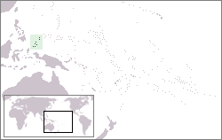
The Republic of Palau consists of eight principal islands and more than 250 smaller ones lying roughly 500 miles southeast of the Philippines, in Oceania. The islands of Palau constitute the westernmost part of the Caroline Islands chain. The country includes the World War II battleground of Peleliu and world-famous rock islands. The total land area is 459 km2 (177 sq mi). It has the 42nd largest Exclusive Economic Zone of 603,978 km2 (233,197 sq mi).

Airai, located on the southern coast of Babeldaob island, is the second-most populous state of Palau. It contains the country's chief airport, Roman Tmetuchl International Airport, and is connected by the Koror–Babeldaob Bridge to nearby Koror Island.
Angaur, or Ngeaur in Palauan, is an island and state in the island nation of Palau.

Babeldaob is the largest island in the island nation of the Republic of Palau. It is in the western Caroline Islands, and the second largest island in the Micronesia region of Oceania. Palau's capital, Ngerulmud, is located on Babeldaob, in Melekeok State.
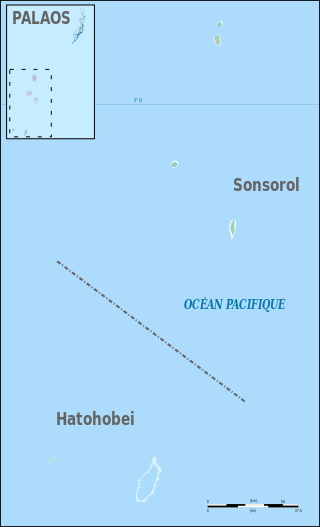
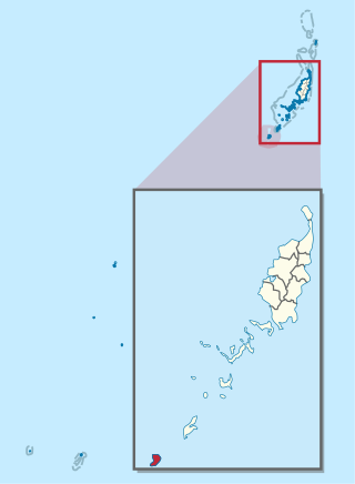
The Southwest Islands of Palau are several small islands spread across the Pacific Ocean about 600 km from the main island chain of Palau. They make up the Palauan states of Sonsorol and Hatohobei. The nearshore islands to the southwest of the main island of Palau (Babeldaob), which belong to the states of Koror, Peleliu and Angaur and the unincorporated Rock Islands, are not considered part of the Southwest Islands.

Aimeliik is an administrative division of the island country of Palau. It is one of the Republic of Palau's 16 states. It has an area of 52 km2 and a population of 334. The state capital is the village of Mongami. The four other villages are Medorm, Imul, Elechui and Ngmechiangel.

Ngchesar also known as Oldiais is one of the sixteen states of the nation of Palau in Oceania.

Ngaraard is the eighth state of the Republic of Palau, and was originally named Kerradel.
{{Infobox settlement | name = Ngiwal | native_name = | native_name_lang = | settlement_type = State | image_skyline = Cooooooooool - panoramio.jpg | image_alt = | image_caption = | image_flag = Flag of Ngiwal State.png | flag_alt = Flag of Ngiwal | image_seal = | seal_alt = | image_shield = | shield_alt = | nickname = | motto = | image_map = Ngiwal in Palau.svg | map_alt = | map_caption = Location of Ngiwal in Palau | pushpin_map = | pushpin_label_position = | pushpin_map_alt = | pushpin_map_caption = | coordinates = | coor_pinpoint = | coordinates_footnotes = | subdivision_type = Country | subdivision_name = Palau | subdivision_type1 = | subdivision_name1 = | subdivision_type2 = | subdivision_name2 = | subdivision_type3 = | subdivision_name3 = | established_title = | established_date = | founder = | seat_type = Capital | seat = [[Ngercheluuk] | government_footnotes = | leader_party = | leader_title = | leader_name = | unit_pref = Metric | area_footnotes = | area_urban_footnotes = | area_rural_footnotes = | area_metro_footnotes = | area_magnitude = | area_note = | area_water_percent = | area_rank = | area_blank1_title = | area_blank2_title = | area_total_km2 = 26 | area_land_km2 = | area_water_km2 = | area_urban_km2 = | area_rural_km2 = | area_metro_km2 = | area_blank1_km2 = | area_blank2_km2 = | area_total_ha = | area_land_ha = | area_water_ha = | area_urban_ha = | area_rural_ha = | area_metro_ha = | area_blank1_ha = | area_blank2_ha = | length_km = | width_km = | dimensions_footnotes = | elevation_footnotes = | elevation_m = | population_footnotes = | population_total = 282 | population_as_of = 2015 Census | population_density_km2 = auto | population_demonym = | population_note = | population_blank1_title = Official languages | population_blank1 = Palauan
English | timezone1 = | utc_offset1 = | timezone1_DST = | utc_offset1_DST = | postal_code_type = | postal_code = | area_code_type = | area_code = | iso_code = PW-228 | website = | footnotes = }} Ngiwal is one of the sixteen states of Palau. It has a population of 282 and an area of 26 km2

Ngardmau is one of Palau's sixteen states and is located on the west side of Babeldaob between the states of Ngaraard and Ngeremlengui.

Ngatpang is one of Palau's sixteen states. It comprises an area of around 47 square kilometers in the west of Palau's largest island, Babeldaob, facing onto Ngeremeduu Bay. It has a population of 282, making it Palau's 9th largest state in population.

Melekeok is a state of the Republic of Palau located on the central east coast of Babeldaob Island. The seat of government of the country, Ngerulmud, is located in the state. The state consists of long beaches, hills, steep ridges, rivers, and the largest and only natural freshwater lake in Palau and Micronesia, Lake Ngardok.
The following outline is provided as an overview of and topical guide to Palau:
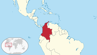
The following is an alphabetical list of topics related to the Republic of Colombia.

Sonsorol is one of the sixteen states of Palau. The inhabitants speak Sonsorolese, a local Chuukic language, and Palauan.
The sport of baseball is widely played in Palau, having been introduced by the Japanese during their occupation of the island nation. The highest level of league play in Palau in represented by Palau Major League (PML), which is overseen by the Belau Baseball Federation. The country is represented in international play by the Palau national baseball team.

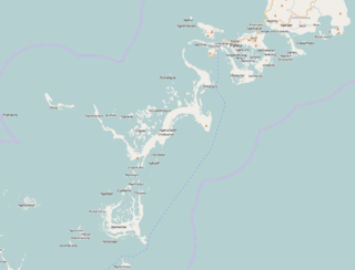
The effects of Typhoon Bopha in the Caroline Islands were significant, though limited in extent in comparison to the cyclone's intensity. Typhoon Bopha originated from a tropical depression south of Pohnpei on November 25, 2012, and tracked generally westward for more than a week. During this time, it threatened several islands across Micronesia, prompting the issuance of typhoon watches and warnings. The system skirted the Nomoi Islands on November 28 where it caused limited damage. Thereafter, it became a threat to Palau as an intense typhoon. Residents there boarded up their homes and some evacuated to public shelters while officials enacted a strict curfew during the typhoon's passage. Bopha passed 55 km (34 mi) south of Angaur island, or 100 km (62 mi) south of Babeldaob, on December 2 with winds of 185 km/h (115 mph).

This article is a gallery of the flags of the principal subdivisions of the countries and territories of Oceania. For purposes of this article, Oceania is taken to comprise Australasia, Melanesia, Micronesia and Polynesia.

The Ministry of Education is a government agency of Palau, headquartered in Koror City.

Palau has flags for its sixteen states.
